Early Evening Update: Tornado watch issued for all inland counties until midnight


Updated: Tuesday, May 21st, 7:25pm:
The Tornado Watch has been extended to include all of southeast Wisconsin.

Multiple Tornado Warnings have been issued within a line of storms that are racing northeast at 50 mph. Embedded areas of rotation will continue to be a concern as this line of storms moves into southeast Wisconsin over the next couple of hours.

Tune in to CBS 58 on air for coverage.
----------------------------------------------------------
Updated: Tuesday, May 21st 6:35pm:
Fond du Lac county has been added to the Tornado Watch that runs through Midnight.

Scattered severe thunderstorms are developing ahead of the main severe line of storms that's nearing the Mississippi River. Embedded areas of rotation within the squall line have prompted tornado warnings between La Crosse and Eau Claire.

Timing remains unchanged for our severe window in SE WI: 8-11pm.
-------------------------------------------------------------
Updated: 5:30pm, May 21, 2024

The SPC has issued a tornado watch until Midnight for most of our area. Right now, that doesn't include our lakeside counties with the uncertainty of the warm front.

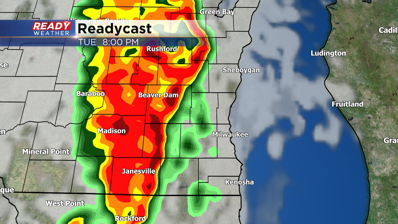
Showers and storms are expected to blow up late this afternoon and early evening across southwest Wisconsin. That line is forecast to move through our area between 8 pm and 11 pm.
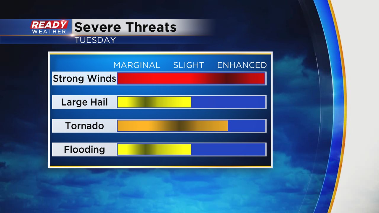
All modes of severe weather are expected. Damaging winds, large hail, and isolated tornadoes are possible.

Now is the time to charge up devices ahead of any power outages.
______________________________________________________________________________________________________________
Updated: 3:00pm, May 21, 2024
All eyes remain on the warm front which is draped across southern Wisconsin. North of the boundary the airmass is relatively stable and cool. Notice temperatures across northern Illinois are near 90.

There is plenty of instability south of the warm front. We call that area the warm sector. The warm front is forecast to move further north through the early evening; however, we will see how the lake modifies some of it.
Showers and storms are expected to blow up late this afternoon and early evening across southwest Wisconsin. That line is forecast to move through our area between 8 pm and 11 pm.
I would anticipate a watch for later this evening.
______________________________________________________________________________________________________________
Updated: 1:30pm, May 21, 2024
One severe cell quickly developed and collapsed.

Updated: Noon, May 21, 2024
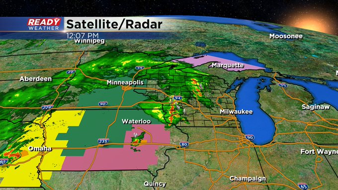
We remain quiet this noon hour. Fog persists over downtown Milwaukee. However, things are turning active to our west. Here's the latest radar image with current alerts:
Updated: 9:48 a.m. May 21, 2024
The dense fog from the morning has cleared across most of southeast Wisconsin. The dew points will stay elevated throughout the day so expect to feel some humidity. Our storms are still on track for Tuesday evening. A few storms may be possible in the afternoon but so far the morning round of rain has stayed just to our west with only a few showers reaching Dodge and Fond du lac Counties. Storms in central Iowa will need to be watched to see if they hold together as they move into SW Wisconsin.
Here's a radar image that will update with time:

While our storm chance remains isolated during the day, we still have a likely chance for rain from 7 PM to Midnight this evening. These will be fast moving storms that bring damaging wind and a few tornadoes along with hail and heavy rain.

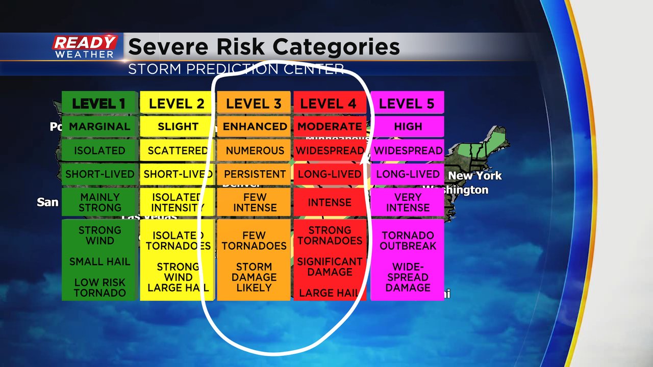
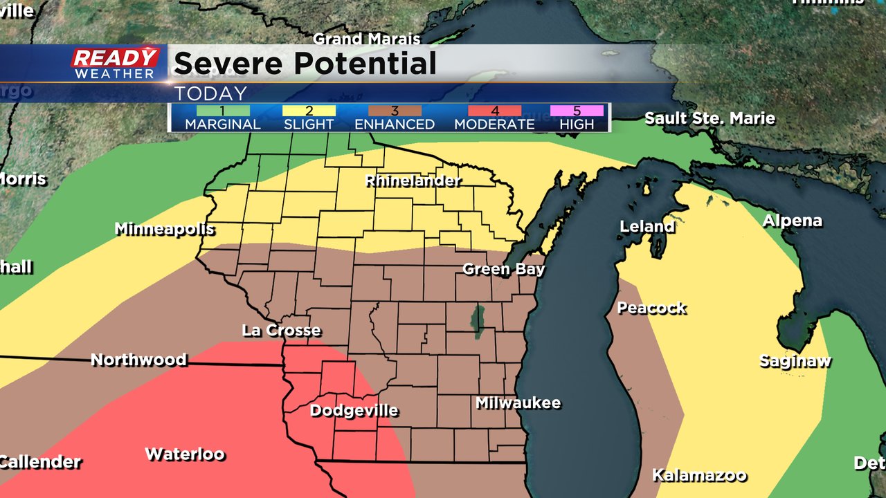
There's no change to the Level 3 Enhanced Risk for severe weather that is in place across all of southeast Wisconsin. The southwest part of the state has been added to a Level 4 Moderate Risk. We are used to our Level 1 and Level 2 events but Leel 3 and certainly Level 4 are more rare. That's when storm chances become more numerous and widespread with some intense storms and the possibility for more tornadoes and especially strong tornadoes in the Level 4 Moderate Risk.
The rest of the forecast outlined below including storm threats is on track.
------
Posted: 5:04 a.m. May 21, 2024
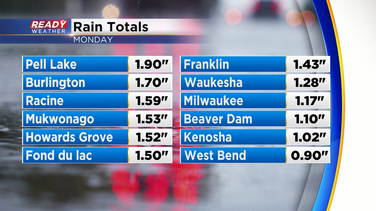
Monday saw plenty of scattered showers and storms with lots of stronger storms but few severe storms. One storm in Fond du Lac County Monday morning dropped some damaging but besides that it was relatively quiet on the severe front. But we did get plenty of rain. A good portion of southeast Wisconsin got between 1-2" of rainfall on Monday.
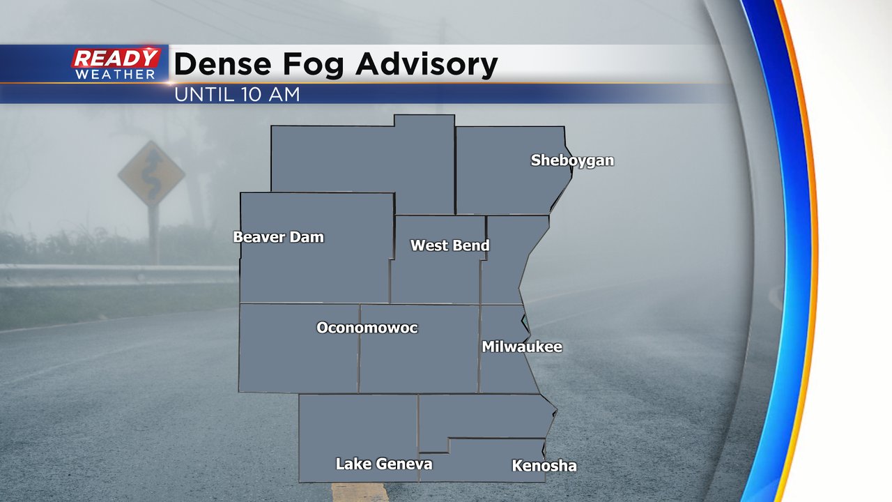
All of that rainfall combined with steady high dew points and calm wind has led fog to develop to start Tuesday. A dense fog advisory is in place for all of southeast Wisconsin until 10 AM Tuesday morning. Visibility is down to just a few hundred feet at times.
The morning fog should not have any big impacts on the expectation for storms Tuesday. Ongoing rain and storms are moving through a good portion of the Upper Midwest Tuesday morning and starting to reach Wisconsin. Whether or not these storms hang on as they move into southeast Wisconsin is in question but overall the rain chance during the day on Tuesday both in the morning and afternoon looks fairly isolated. However, any storms that do form during the day could still be strong with a hail and wind threat.
The best chance for severe weather in southeast Wisconsin is still Tuesday evening. Mainly after 7 PM a line of strong and possibly severe storms will roll through southeast Wisconsin ahead of a cold front. Storm chances will continue until midnight when the line of storms moves over Lake Michigan.
The severe risk for Tuesday is elevated, especially for southeast Wisconsin. A rare Level 4 Moderate Risk for severe weather has been expanded to include parts of southwest Wisconsin. The tornado potential is highest in these counties. Locally, all of southeast Wisconsin is under a Level 3 Enhanced Risk.
Damaging wind will be the main threat with any severe storms that do move through with the line of storms Tuesday evening. Wind gusts could be in the range of 75-90 mph leading to downed trees and widespread power outages. Many communities also sound their sirens for wind gusts over 80 mph which can do just as much damage as weak tornadoes so if you do hear tornado sirens or get loud alerts on your phones it could be damaging wind or a tornado. The tornado threat is also relatively high, especially for what we usually see in southeast Wisconsin. Some tornadoes in southwest Wisconsin could be strong and we will see if that threat hangs on into southeast Wisconsin. There is also a risk for large hail and some localized flooding.
Overall rain totals on Tuesday will hover around a full inch of rain. However some communities could see much more in big thunderstorms.
Download the CBS 58 Ready Weather app to track the storms and get alerts if tornado watches or severe thunderstorm warnings are issued.