Lingering light rain for Wednesday, mix possible Thursday
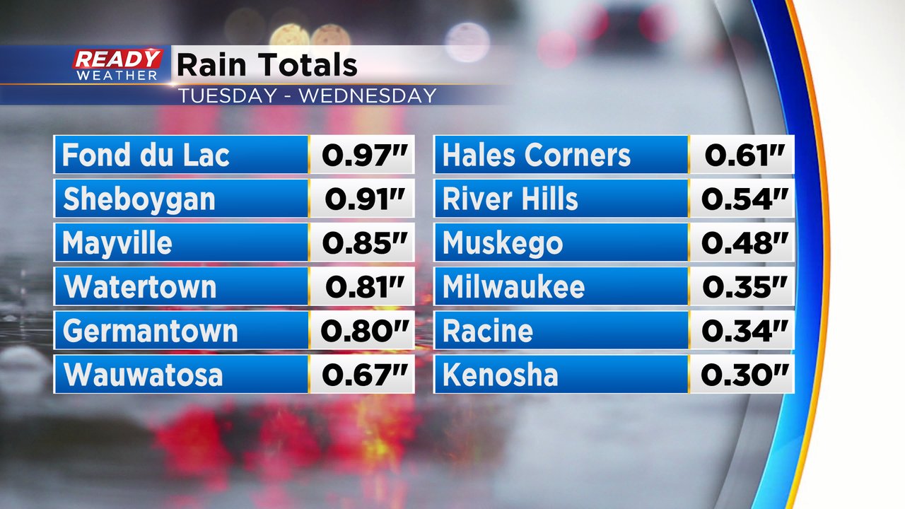
Our soggy week continues! We saw a good amount of steady and moderate rain roll through southeast Wisconsin Tuesday night into early Wednesday morning. A few viewers even reported hearing their first thunderstorm of the season! Rain totals ranged from just over a quarter inch in southern areas to around half inch around I-94 and just under 1" in our northern counties.
The large storm system that brought us the rain will slowly move eastward which will still give us the chance for some more light scattered rain showers for most of the day Wednesday. Any rain will wrap up around dinnertime with most spots seeing less than a tenth of new rainfall.

Another storm system will move in on Thursday. The morning starts dry but there's a chance for rain in the afternoon and rain looks like for Thursday evening. A little snow could mix in as well, especially Thursday night into early Friday morning. If we do see any accumulating snow it should be done before the Friday morning commute. Out of the four weather models we regularly look at, two of them are showing a little accumulating snow and two just have rain. While the chance for snow is there, anything that does fall will be fairly light. Stay tuned for updates on if we see any accumulation.

Download the CBS 58 Ready Weather app to track any lingering showers Wednesday and the rain/snow for Thursday.
