Rain quickly changing to snow. Slick travel for Tuesday morning
Rain will continue to switch over to snow overnight into tomorrow morning. No real changes to the forecast. Snow and falling temperatures will cause slick travel for Tuesday morning.

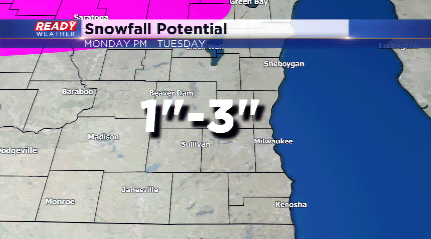
The winter weather advisory starts at 11 pm and goes until 10 am. 1" to 3" of snow is expected through the morning.
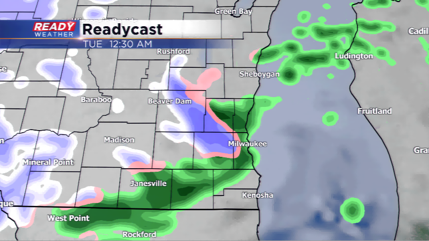
8 PM Update: It turned out to be a noisy evening with scattered showers and storms with heavy pea size hail. Some areas saw pea hail covering the entire ground.
The thunderstorms will diminish through midnight. The cold air on the back of the surface low will transition the rain to all snow overnight. Slick travel remains a possibility for the morning commute.
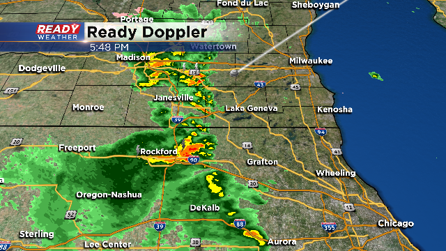
6 PM Update: Before any snow will develop overnight, we are expecting scattered showers and some embedded storms this evening. These storms have produced pea size hail which isn't very surprising given the cold air aloft.
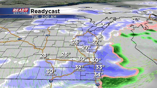
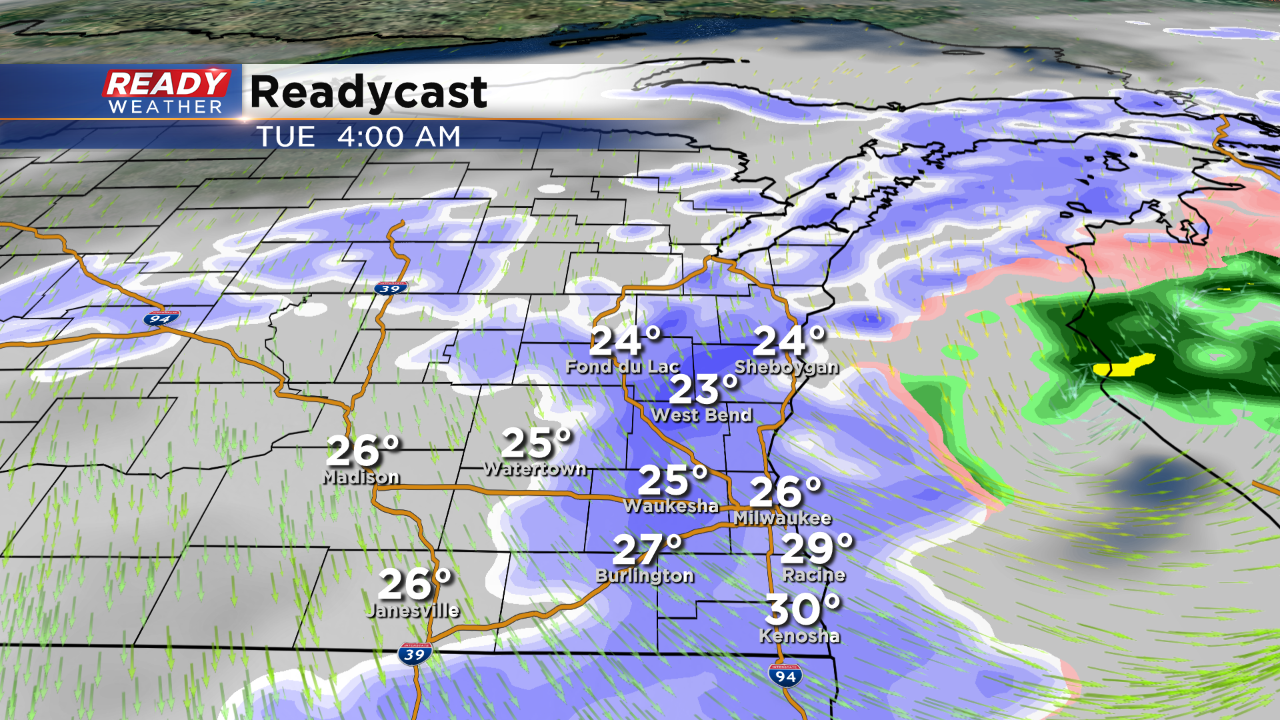
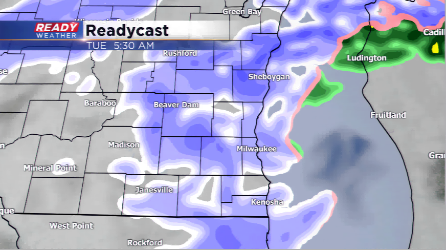
Storms will stay well below severe limits as they move in from the south. After midnight the cold air will start to change the rain over to snow; moreover, heavier snow is expected between 3 am and 6 am, just in time for the morning commute.
Models are fairly consistent with 1" to 3" of snow; however, there will likely be a swath of 3 to 4 inches somewhere within the winter weather advisory. Snow tomorrow morning will cause slick areas for the morning commute.
The snow will be out by 10 am.
4 PM Update: It's important to note that the winter weather won't occur until after midnight. Plan on rain and some embedded storms for this evening. A band of snow will produce 1" to 3" of snow overnight into tomorrow morning. The winter weather advisory was issued for slick travel for Tuesday morning.
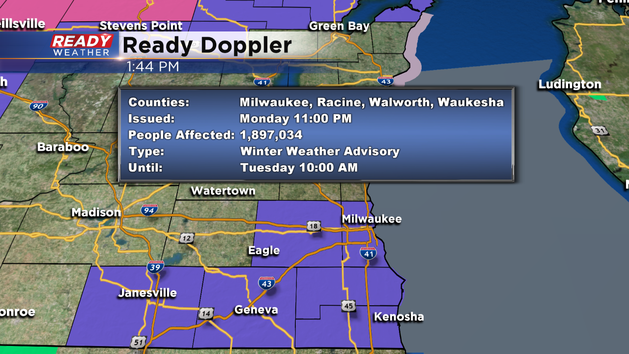
A new winter weather advisory goes into effect tonight through 10 am Tuesday for Milwaukee, Walworth, Racine, Kenosha, and Waukesha counties. We expect the rain to transition to snow after midnight and increase in coverage for the Tuesday morning commute.
A heavy band of snow could develop, and depending upon where the band sets up, a quick swath of 2" to 3" of snow could occur. Falling temperatures and snow will make the morning commute slick. The snow is expected to move out by the early afternoon.
Noon Update:
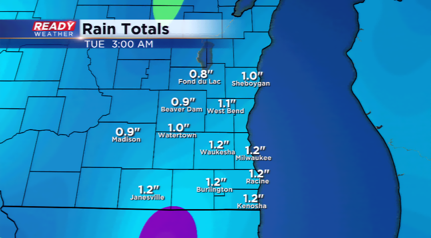
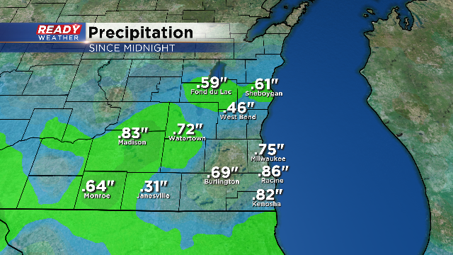
The rain is tallying up! Take a look at rainfall since midnight through 11:30am
We had one solid push of rain through the morning and it's currently a bit more scattered. But the fog is still around.
8 AM Update - Rain continues to fall over the area as the Dense Fog Advisory was allowed to cancel. The heaviest rain will likely fall this morning with a few rumbles of thunder. The rain becomes more scattered by this afternoon and evening before switching all to snow. Remember that there's a chance of 1"-3" of fresh snow and this could lead to slippery and snow-covered roads tomorrow.
A complex and dynamic storm system will drive in a plethora of moisture and enough fireworks to cause havoc around the Badger State the next 24-36 hours. A stream of moisture ahead of our next storm is kicking up dense fog. Another round of Dense Fog Advisories have been posted for all of southeastern Wisconsin for this morning.
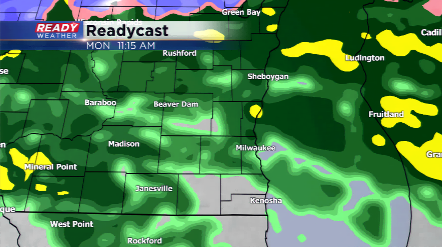
Rain, and even a few thunderstorms, will stream in along the warm front of the storm. Some pockets of heavy rainfall will be possible. As much as an inch or inch and a half of rainfall for totals could be had when all said and done with this storm. The monthly precipitation average for January is 1.76”, so this is a very healthy rain we are expecting.
Behind the storm system, colder air invades the region and the transition phase from rain to snow will take place. The snow could push in as early as tonight last until Tuesday. 1”-3” of fresh snow will be possible.
The arctic air will be held up north, but expect a cool down back down into the low 30s for highs by tomorrow and Wednesday.