More clouds roll in for the second half of the weekend


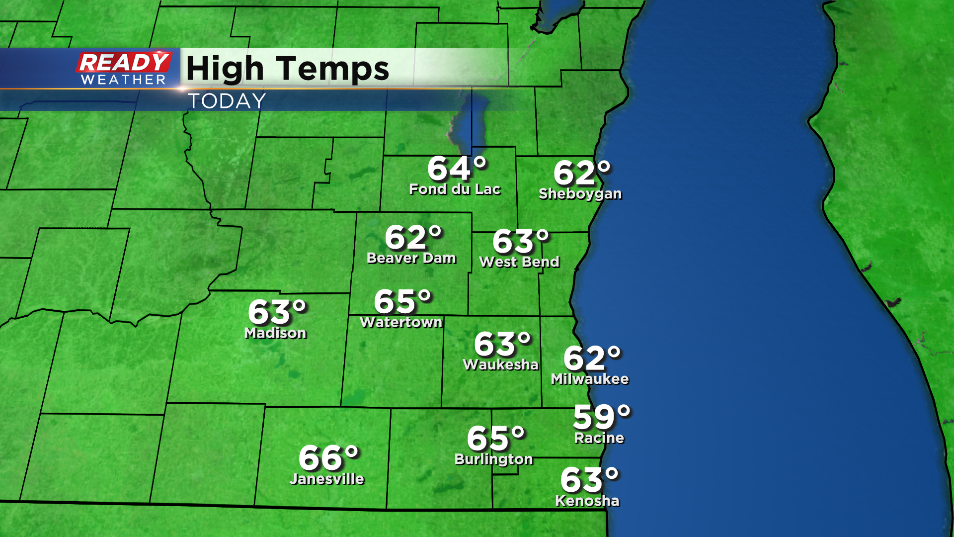
It's been a picture-perfect late October day today with abundant sunshine and temps in the low to mid 60s.
Unfortunately, Sunday won't be quite as bright, but should be just as warm. Clouds will increase late tonight with mostly cloudy skies expected throughout Sunday. Wind will eventually turn to the SE around 5 mph, capping highs in the low 60s.
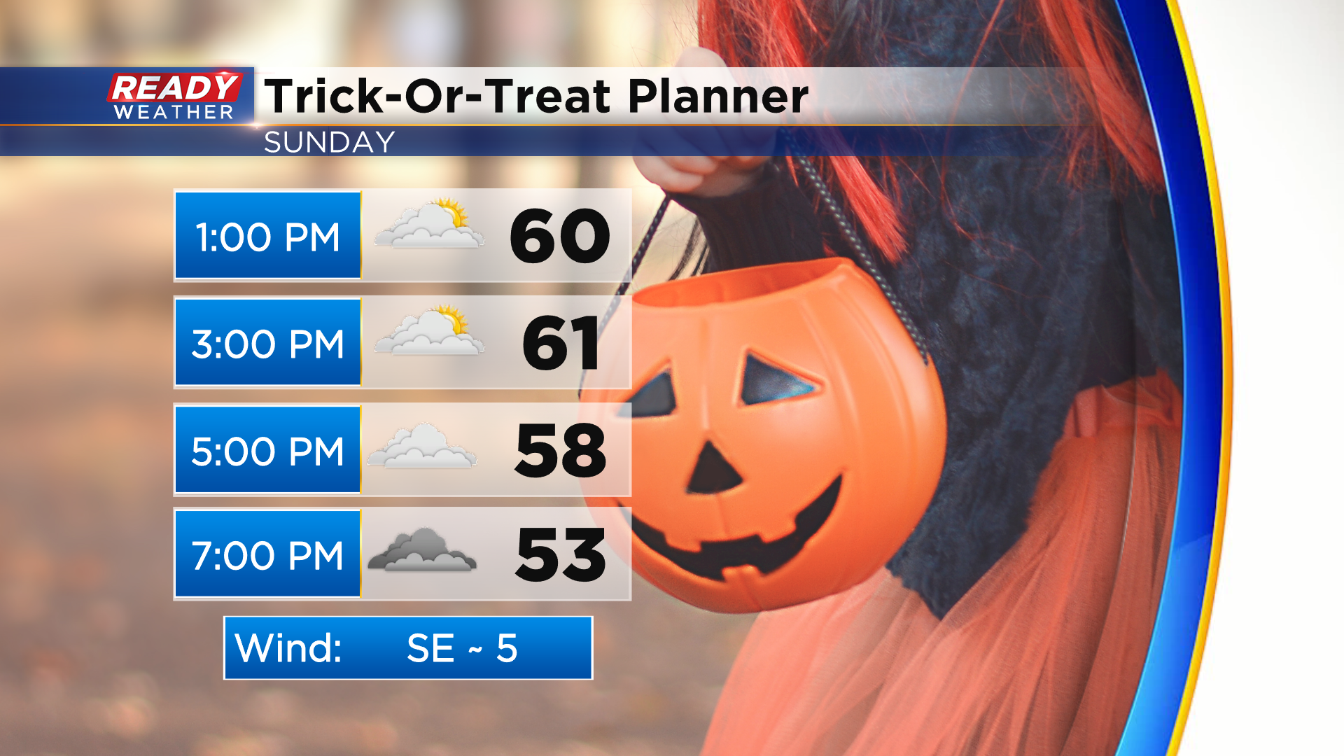
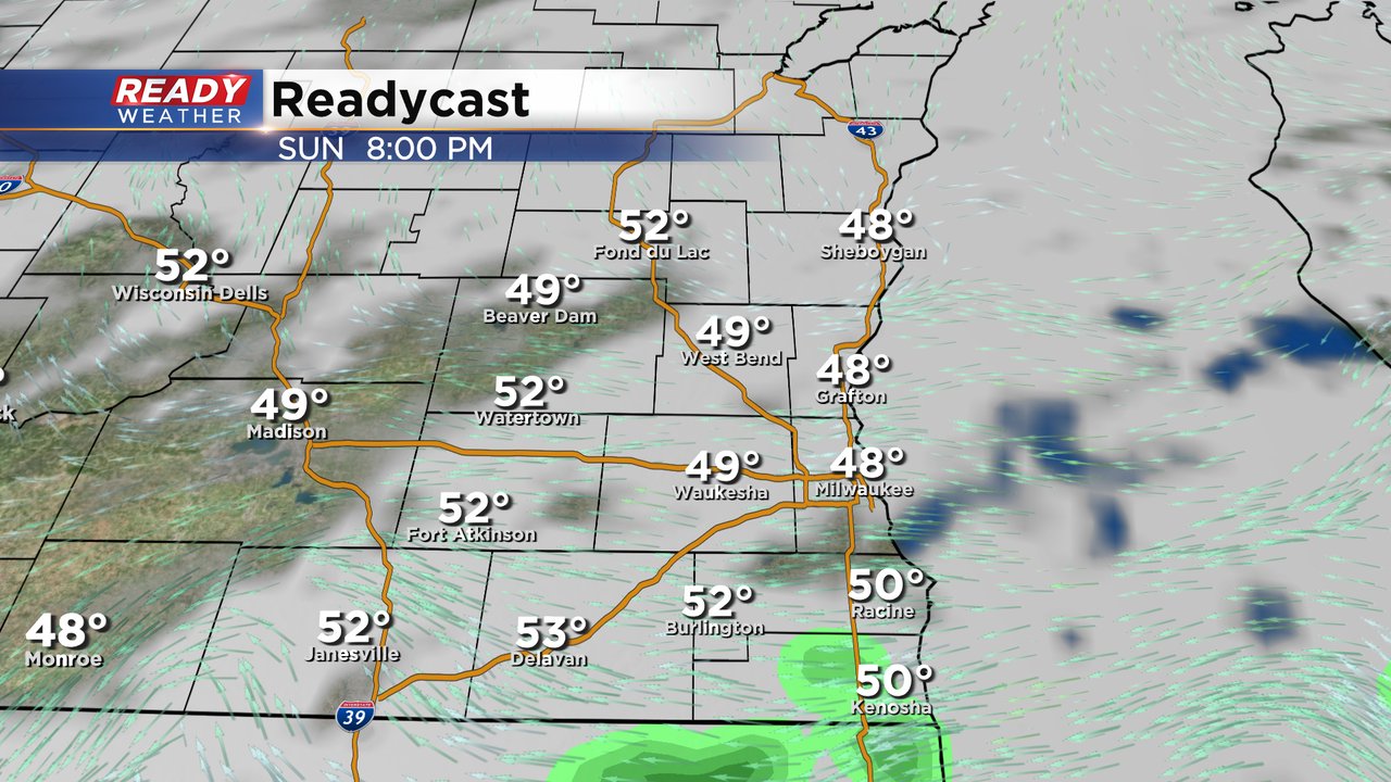
Despite the cloud cover, we're expecting dry conditions for Sunday trick-or-treat festivities. By mid evening, there's a small chance some light rain or drizzle clips far southeast WI, primarily Racine and Kenosha counties. This looks to move in between 7-8pm.
Some additional drizzle or fog may develop overnight but will dissipate by sunrise on Monday. Halloween will feature more clouds than sun during the day with skies clearing out during the evening. There's no threat of rain for Monday trick-or-treaters. More sunshine is expected Tuesday through Thursday with temps remining mild in the mid to upper 60s.
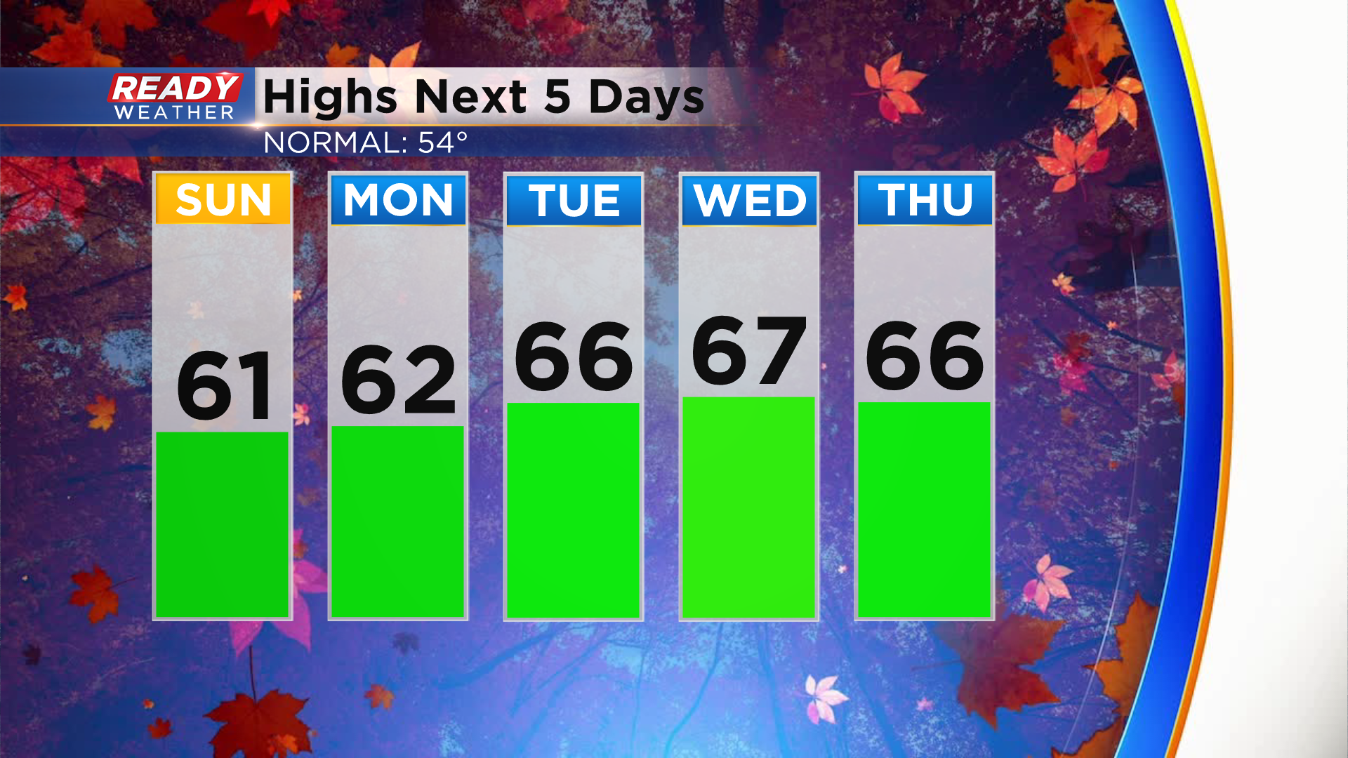
Rain chances begin to increase by the end of the week. Download the CBS 58 Ready Weather App for the full forecast.