More snow and arctic air arrive Thursday into Friday

-
2:53

Natalie’s Everyday Heroes: Woman creates mobile family closet...
-
2:20

‘She was all I had’: Sister remembers woman killed with best...
-
2:25

Rodriguez campaign under fire after campaign finance report discrepancies
-
2:15

Fate of I-794 continues to spark controversy and mixed reviews
-
1:12

Rally held for police pursuit safety as Milwaukee leaders set...
-
2:00

West Allis officer suspended after felony misconduct charge
-
2:15

2 women killed by hit-and-run driver near 20th and Teutonia
-
2:49

Lincoln Avenue School families learn about plans for upcoming...
-
1:56

West Bend Labyrinth Garden offers a peaceful, colorful escape...
-
4:32

Toy expert shares summer picks, from World Cup gear to indoor...
-
2:29

Another July heat wave starts Monday
-
0:50

Guests evacuated after fire response at Brookfield hotel

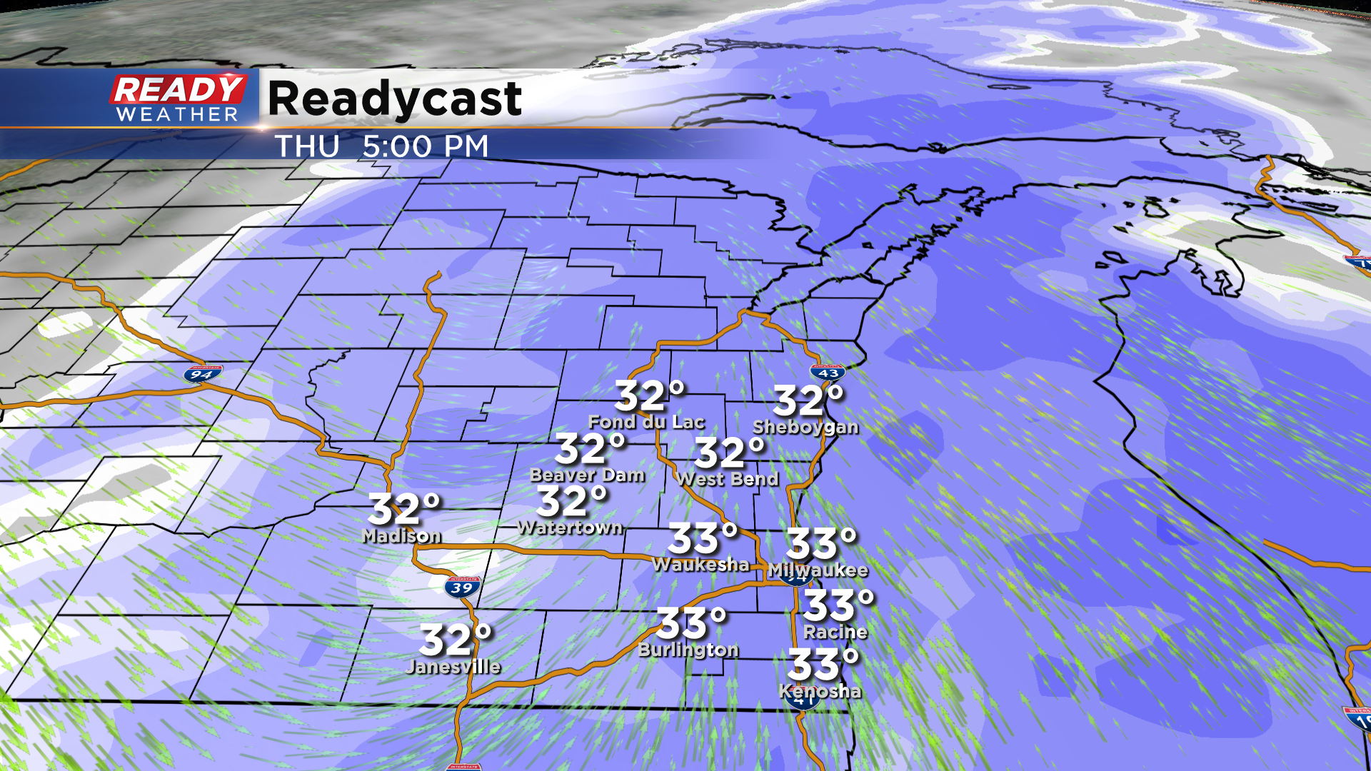
Another round of snow is set to arrive across southeastern Wisconsin on Thursday. Between 6 am and Noon expect a wintry mix before it turns over to all snow by lunchtime.
The Thursday evening commute looks very snowy across the entire metro. The snow will linger overnight into early Friday morning. Snow should be done by the morning commute on Friday. Roads Thursday evening will be slick and snowy.
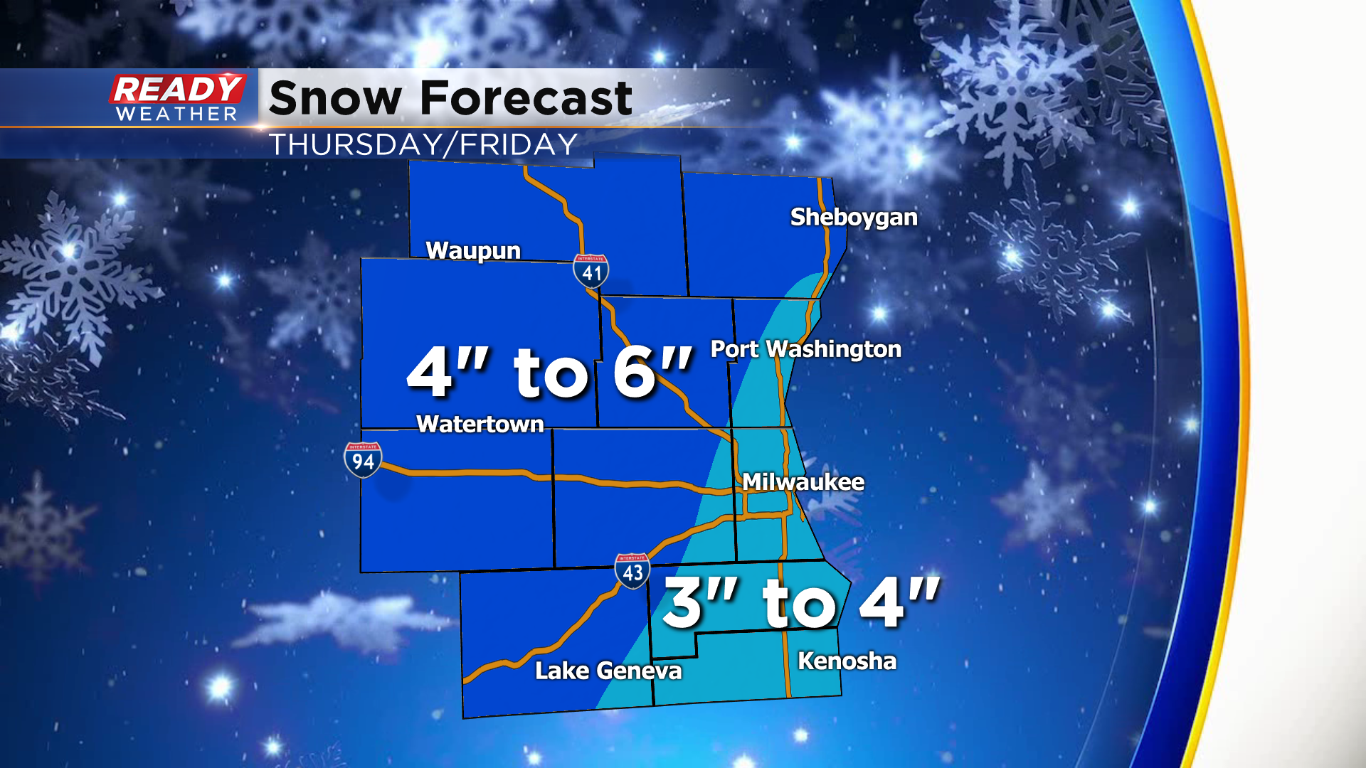
Most of the area will receive 3" to 6" of snow. The highest totals will be across our northern and northwestern areas. Some spots there could be over 6".
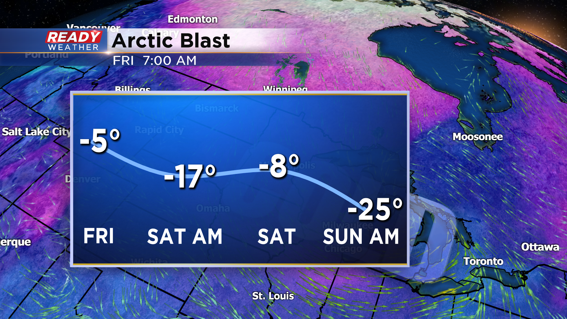
The coldest air of the season is set to arrive on Friday into the weekend as arctic air invades the Midwest. Take a look at the forecasted wind chill graphic above. Wind chills will be subzero for several days creating very dangerous conditions!