Precipitation check after Sunday's wet weather with more wind Monday


Sunday was another wet day in southeast Wisconsin with scattered showers, including areas of heavy rain, and some sleet, graupel and slushy snow mixing in at times. After the wet weather we had our precipitation for the year in Milwaukee is now up to 4". That is basically half of what we had at this point last year which was very wet at over 8" but it's only about an inch behind the average.

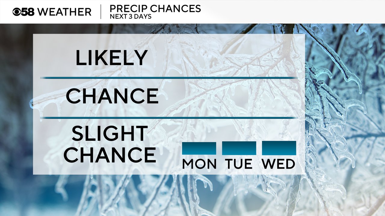
After some lingering snow flurries Monday morning the next few days look mostly dry. We will have to watch a storm system to our west Tuesday and to our south Wednesday, but right now those all look to stay away from us locally. The next precipitation chance won't be until the weekend.
As the storm system that brought us the rain and mix Sunday into Monday morning leaves us we will have a lot of wind Monday with gusts to 40 mph at times out of the west. That wind dies down Monday night then Tuesday and Wednesday the wind will stay light.
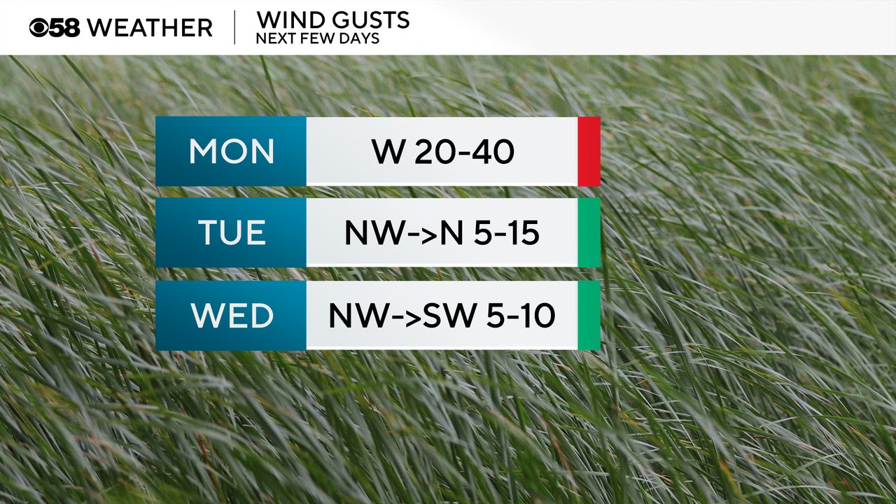
Here is a look at wind gusts in southeast Wisconsin that will update with time:

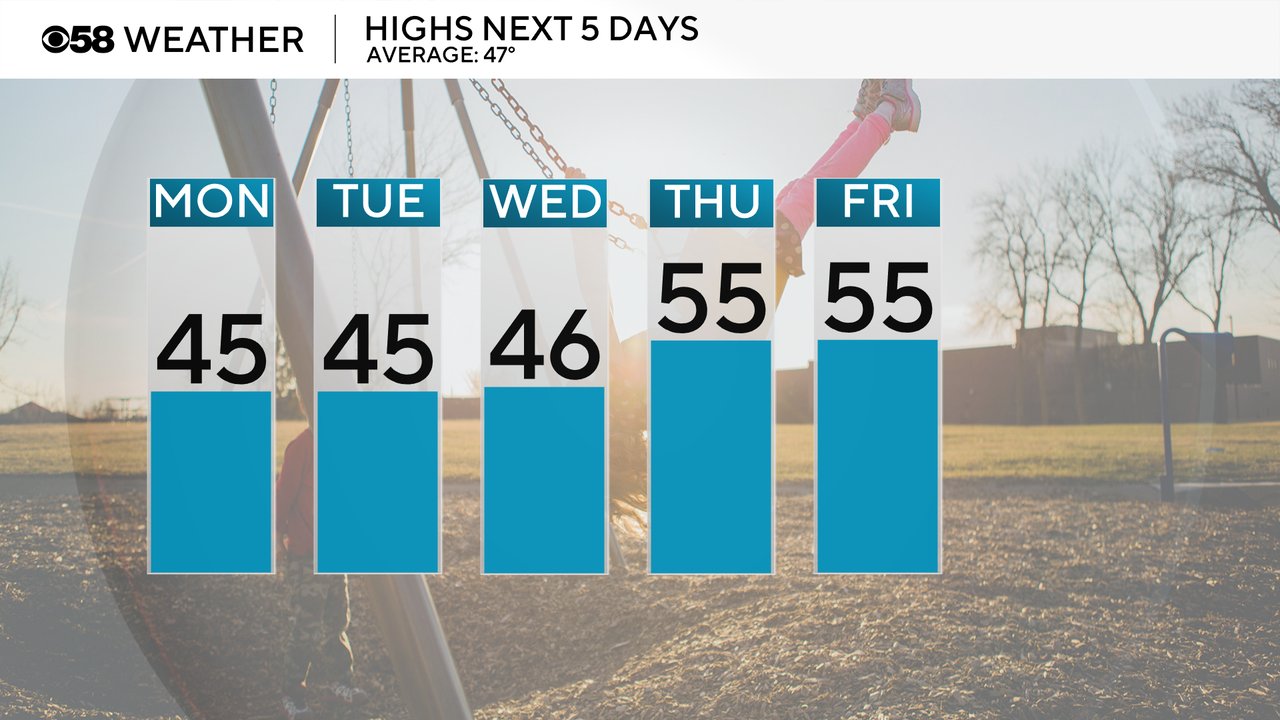
Temperatures won't be too bad to start the new work week with highs in the mid 40s Monday through Wednesday which is just below the average high of 47 degrees. Then we see a nice warm up into the middle 50s for the end of the week.
Download the CBS 58 Weather app to track the temperatures and wind gusts for your locations.