Evening Update: Rain Tapers as Winds Ramp Up


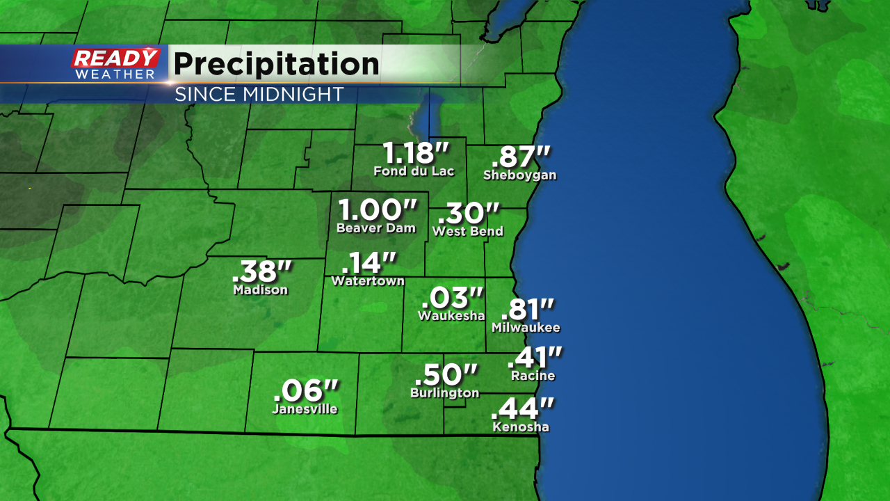
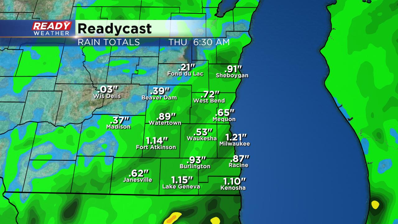
It's been a gloomy and rainy day across the area. Here's a look at rainfall totals as of 10pm.
After a gentle rain Wednesday morning a drying trend is starting in our southwest spots. The drying trend won't continue forever with scattered showers returning by late morning for most.
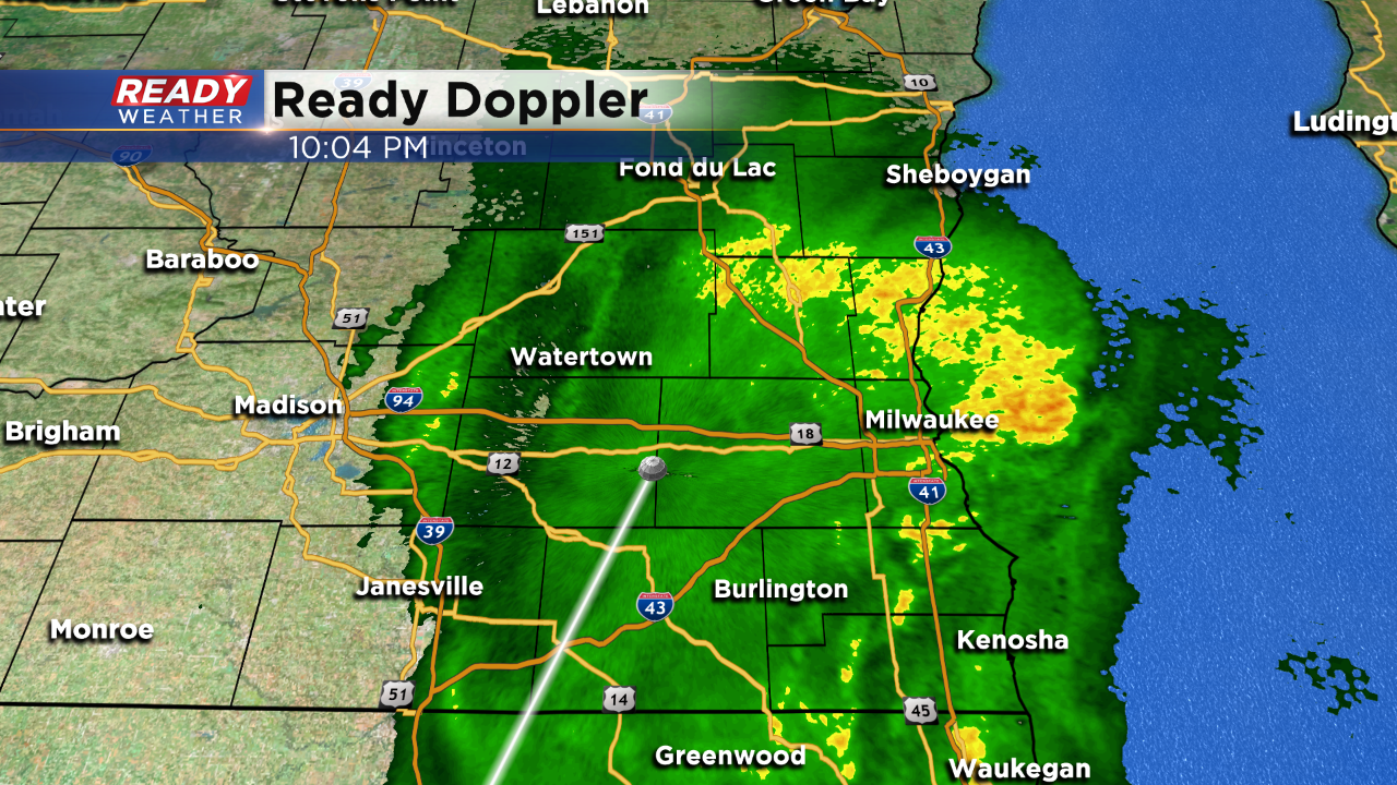
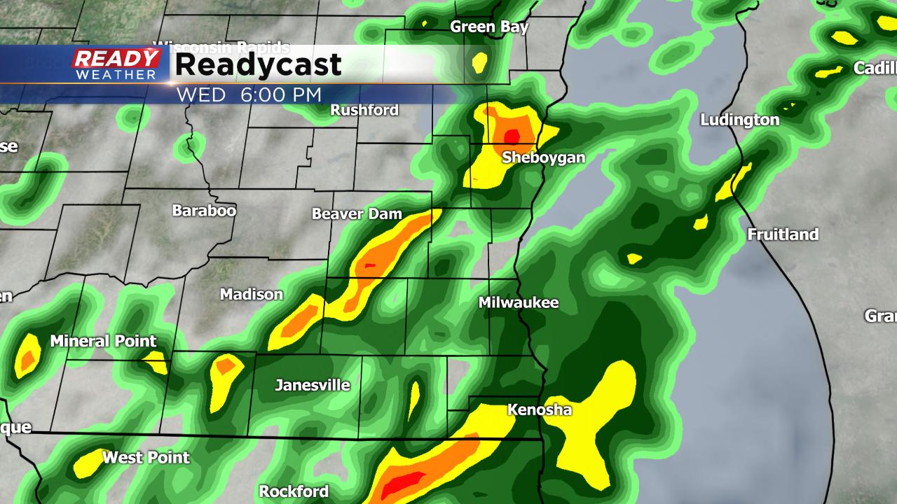
The best chance for some heavier downpours and a few embedded thunderstorms rolls in this afternoon and evening.
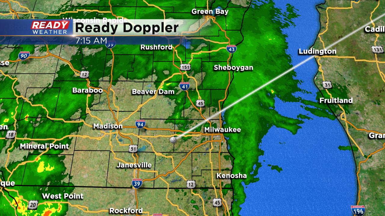
A soaking rain is still expected by the Thursday morning. Our southern half of the viewing area has the best chance to see rain totals around 1" with northern spots only seeing about a quarter inch of rain.
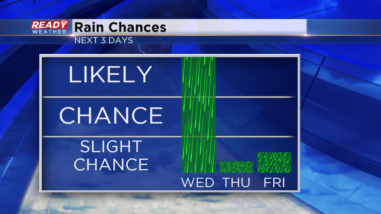
After Wednesday's likely rain, there is a slight chance for a few lingering showers Thursday morning. An isolated storm Friday afternoon and evening is possible, but otherwise the first day of summer break for MPS students should remain dry. Saturday brings a better chance for rain.
Download the CBS 58 Ready Weather App to track the dry breaks and see where the heavy rain sets up.