Dreary and damp weather continues for today


Updated: 1:30 pm Wednesday September 9th:
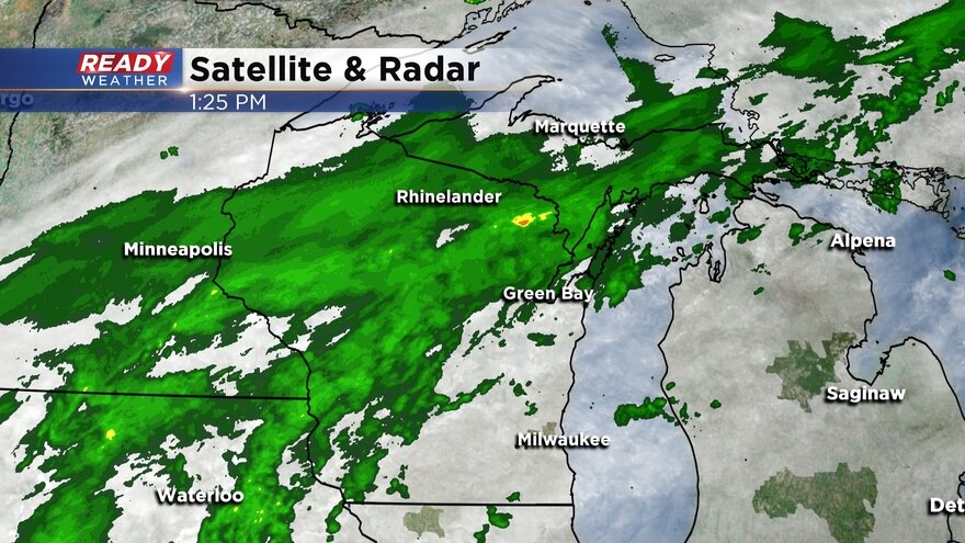
A majority of the steady, light rain has stayed north of southeast Wisconsin this afternoon, but areas of drizzle and isolated light showers have moved through from time to time.
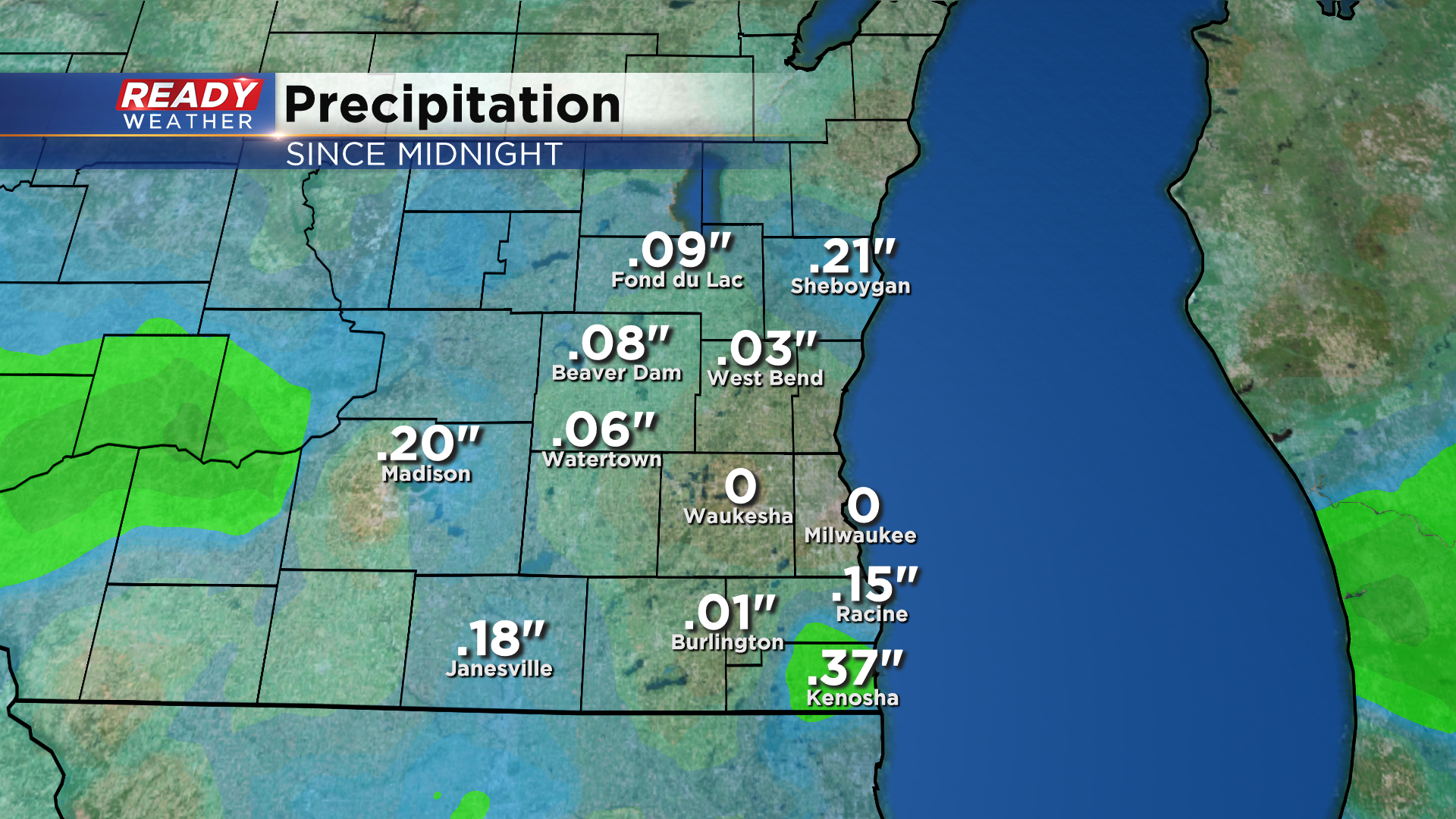
Most of southeast Wisconsin has picked up .10" of rain since midnight, with an additional .10" or so expected through tonight.
Thankfully the gusty winds have died down a bit this afternoon after gusting up to 25 mph this morning.
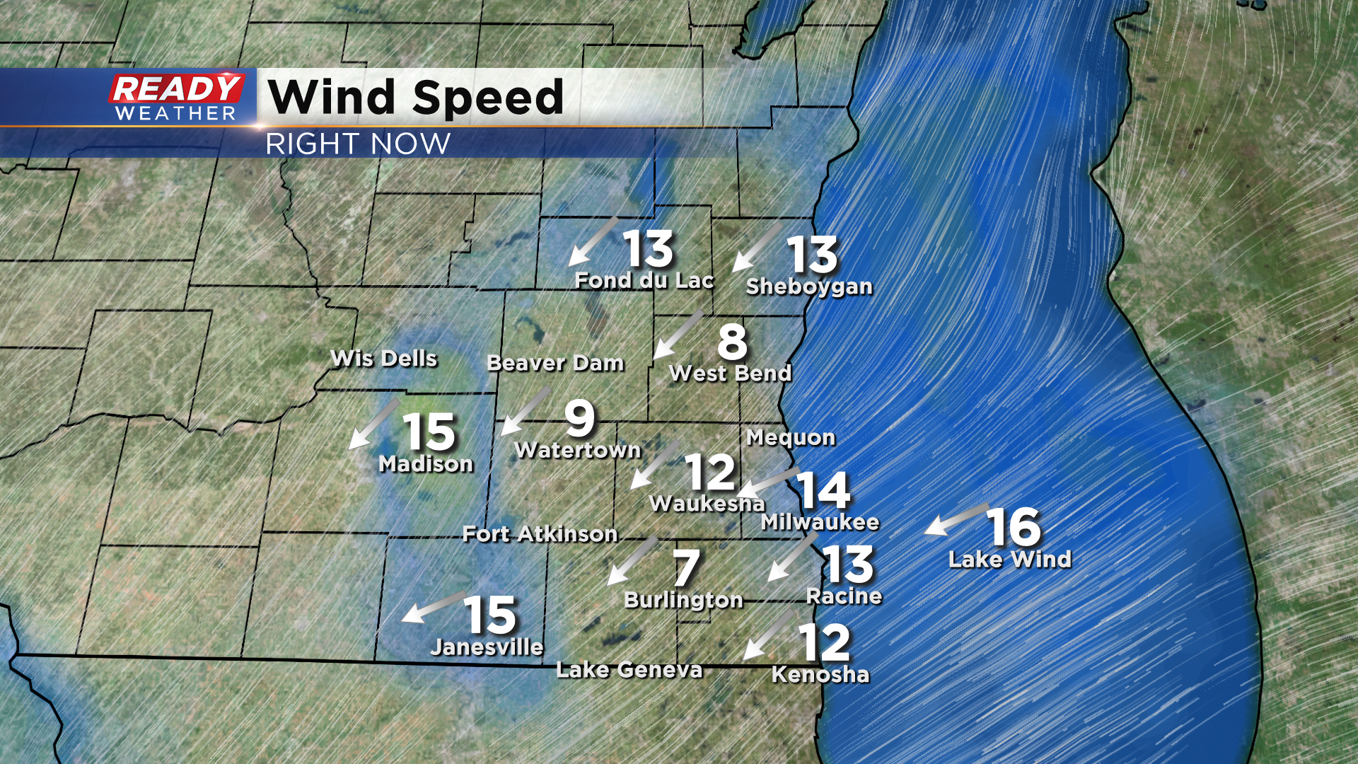
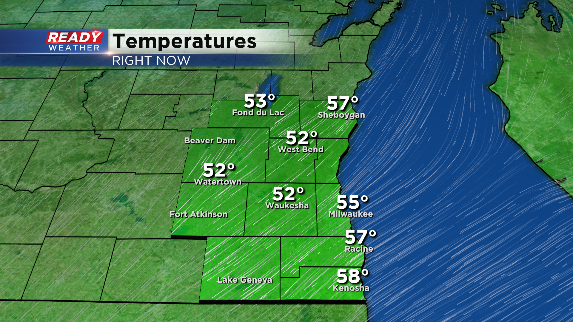
The lighter winds are keeping the lakeshore flooding threat in check, but combine that with the drizzle and cloud cover and it's still a cool, dreary day. Temps have been stuck in the 50s all day, and they'll remain in the 50s through tonight.
Download the CBS 58 Ready Weather App to see when dry weather will return.
-----------------------------------------------------------------------------------
More of the same weather-wise on Wednesday with scattered showers persisting through most of the day. Rainfall totals as of 8 AM Wednesday morning since Monday night have most of southeast Wisconsin the 0.50"-1.50" range with Kenosha closing in on 2". It's a good soaking rain that is falling over enough time where there isn't any flooding concerns.

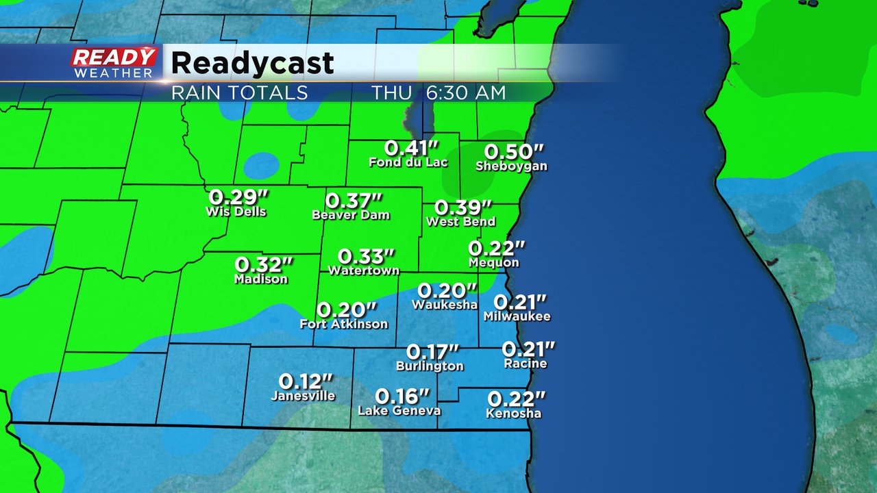
Light and scattered, but persistent, showers will continue for most of Wednesday. Even when it isn't raining expect there to be some mist and drizzle. Light showers will continue into Thursday morning as well. Additional rain totals on top of what's already been picked up will be in the quarter to half inch range.
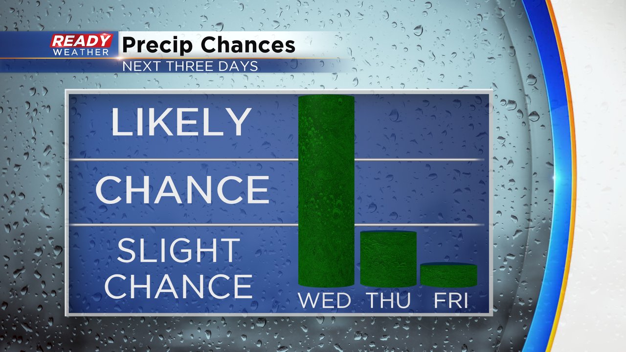
After a 100% chance for rain on Wednesday, we could see a few lingering showers Thursday morning or a pop up Thursday afternoon so just a slight chance there. Friday looks mostly dry and mostly cloudy. If we do see any rain on Friday it would be at night ahead of a more than likely chance for Saturday.
The wind on Wednesday won't be as bad as what it was on Tuesday but expect it to stay breezy with wind gusts above 20 mph at times. Temperatures will struggle with the NE wind, clouds and rain with highs in most spots on Wednesday in the upper 50s. The stiff NE wind combined with a Lake Michigan that has been running near record levels all year long will cause some high waves up to 9 feet and lakeshore flooding. A Lakeshore Flood Advisory has been issued for all lakeside areas for all for all of Wednesday and most of Thursday.

Download the CBS 58 Ready Weather app to continue tracking the ongoing rain.