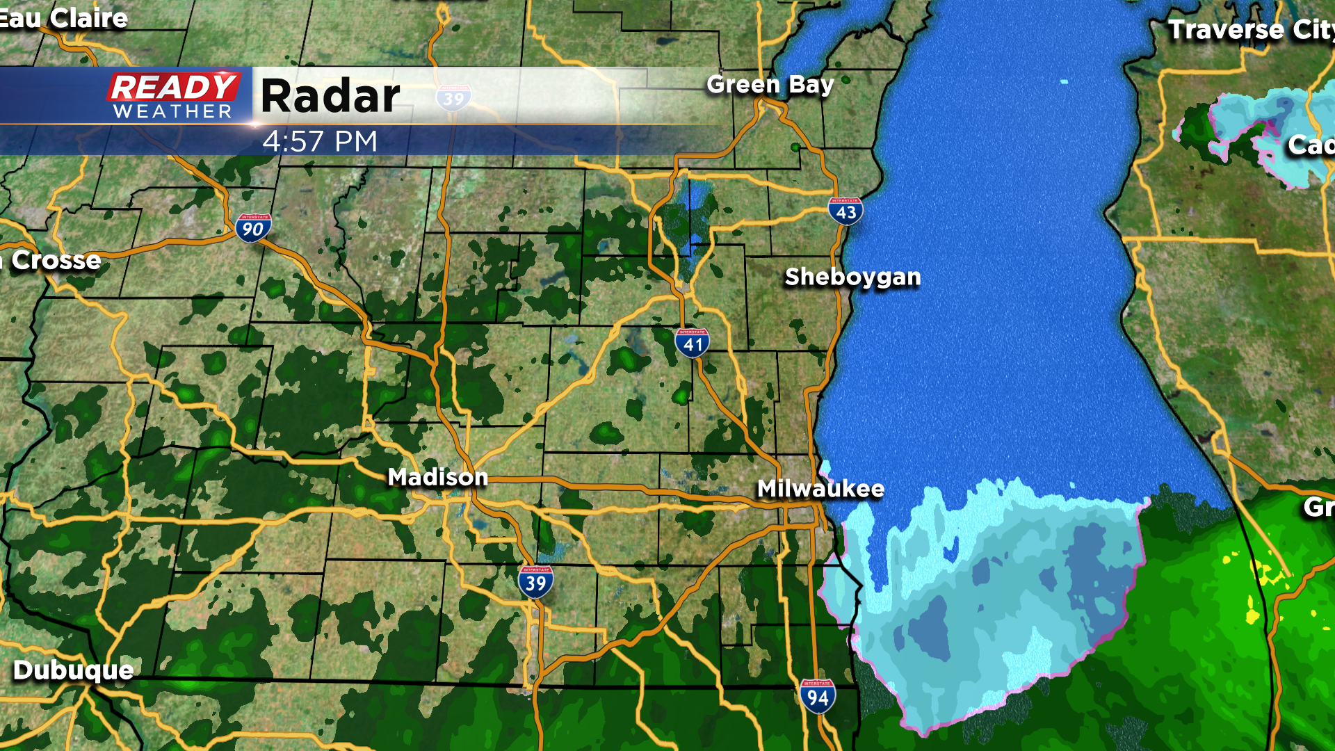
Rain & snow showers end this evening with some frost possible overnight
After a rather gloomy, damp day, the main area of rain and wet snow has finally moved out of the area. Spotty rain/snow showers will be possible before midnight, but most should fizzle out after sunset.
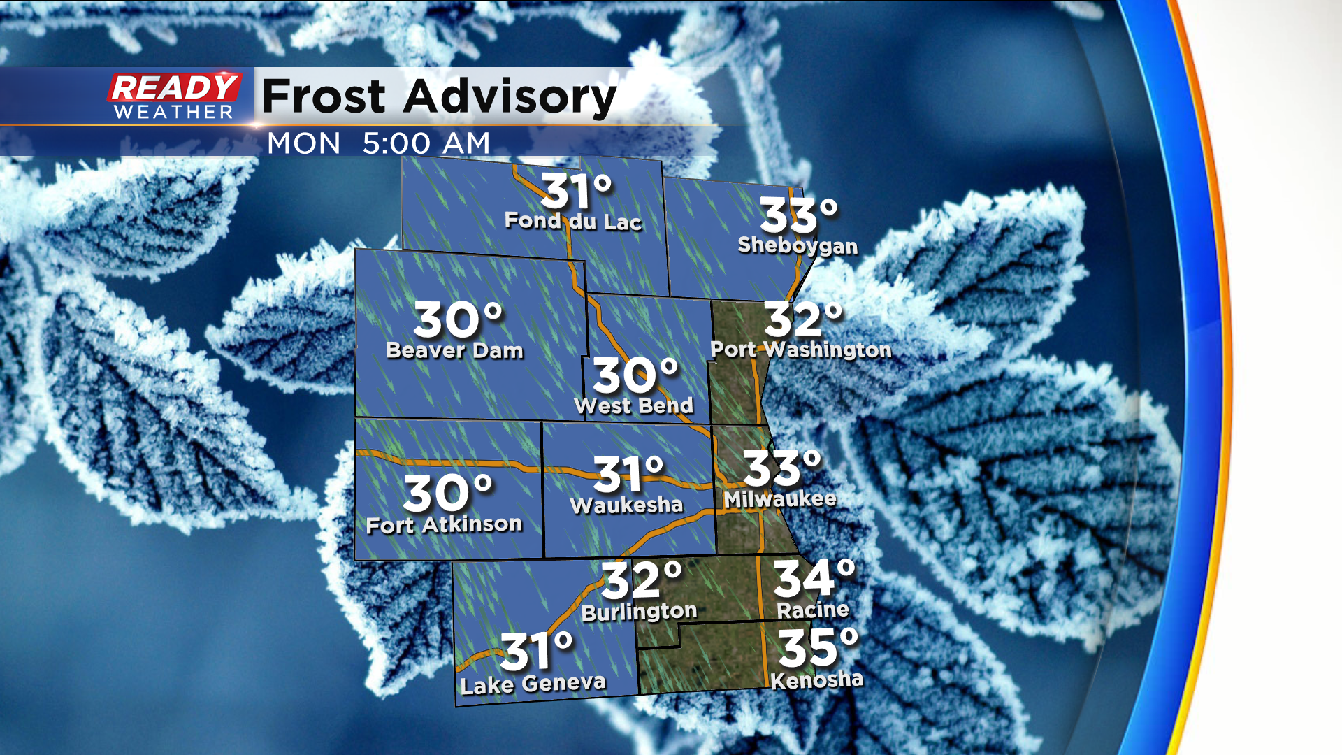
Clouds will be slow to decrease tonight, but where they do clear out frost will be possible as temps will drop into the low 30s. The best chance of this happening is well north and west of Milwaukee. A Frost Advisory has been issued for all inland counties and Sheboygan county through 8 am Monday. Winds should be strong enough and there should be enough leftover cloud cover to prevent frost near the lakeshore.
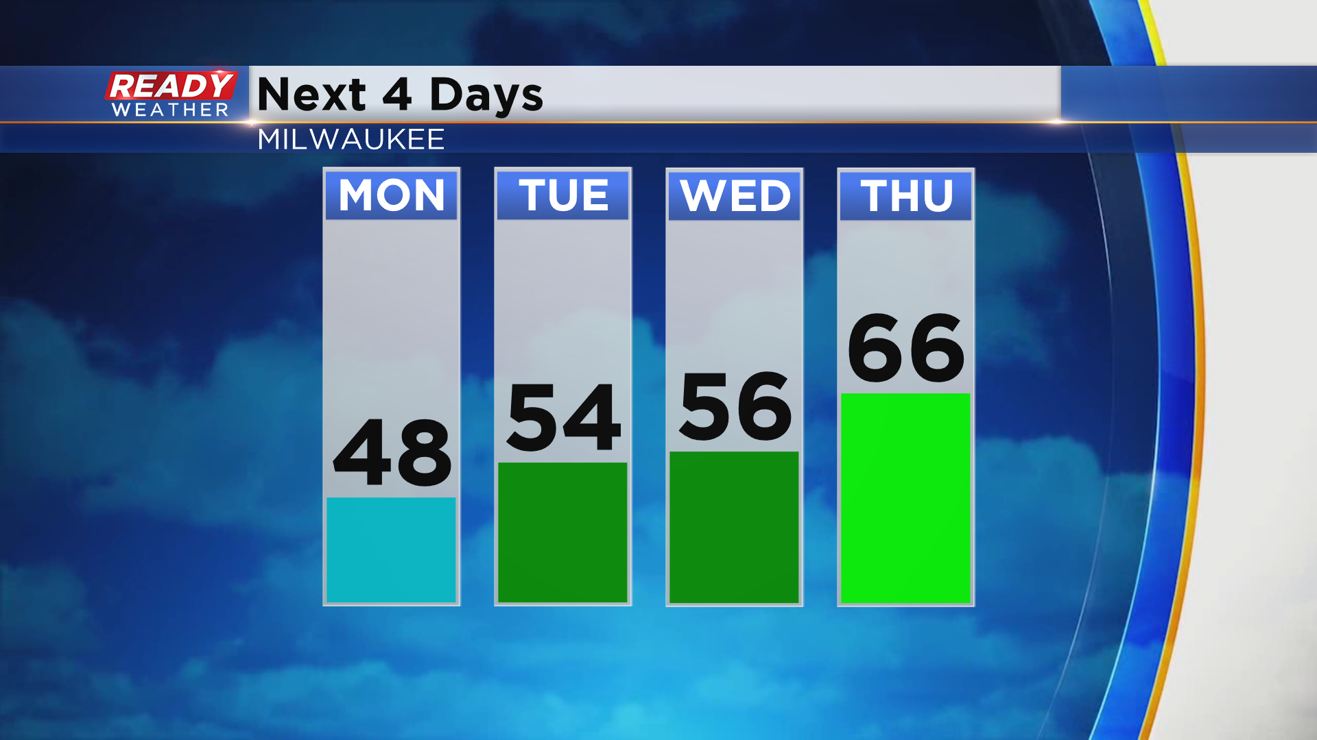
Temps will be cool to start the week with highs around 50 on Monday, with another round of frost possible Monday night away from the lake. Temperatures will be on a warming trend this week with highs getting back into the 60s area wide on Thursday.
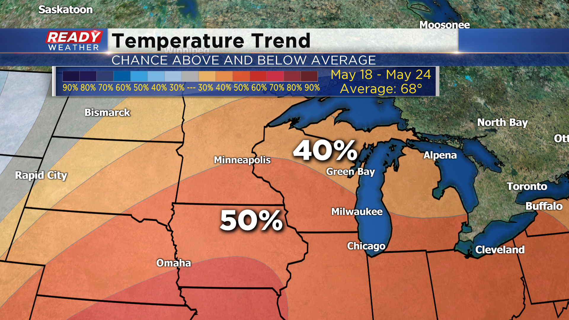
There’s a good chance we remain in the 60s through the second half of the week, and the warmest weather may not get here until next week. The Climate Prediction Center’s temperature outlook for May 18-24 has a 50% chance for above normal temperatures. Normal highs by the third week of May are in the upper 60s.
Download the CBS 58 Ready Weather App to see when we could have a few storms this week.
