Remnants of Hurricane Beryl set to impact southeast Wisconsin


Hurricane Beryl made landfall as a Category 1 storm Monday morning in Texas. As of Tuesday morning, the storm has weakened to a Tropical Depression as it's moving through Arkansas but rain is reaching as far north as central Illinois and Indiana.
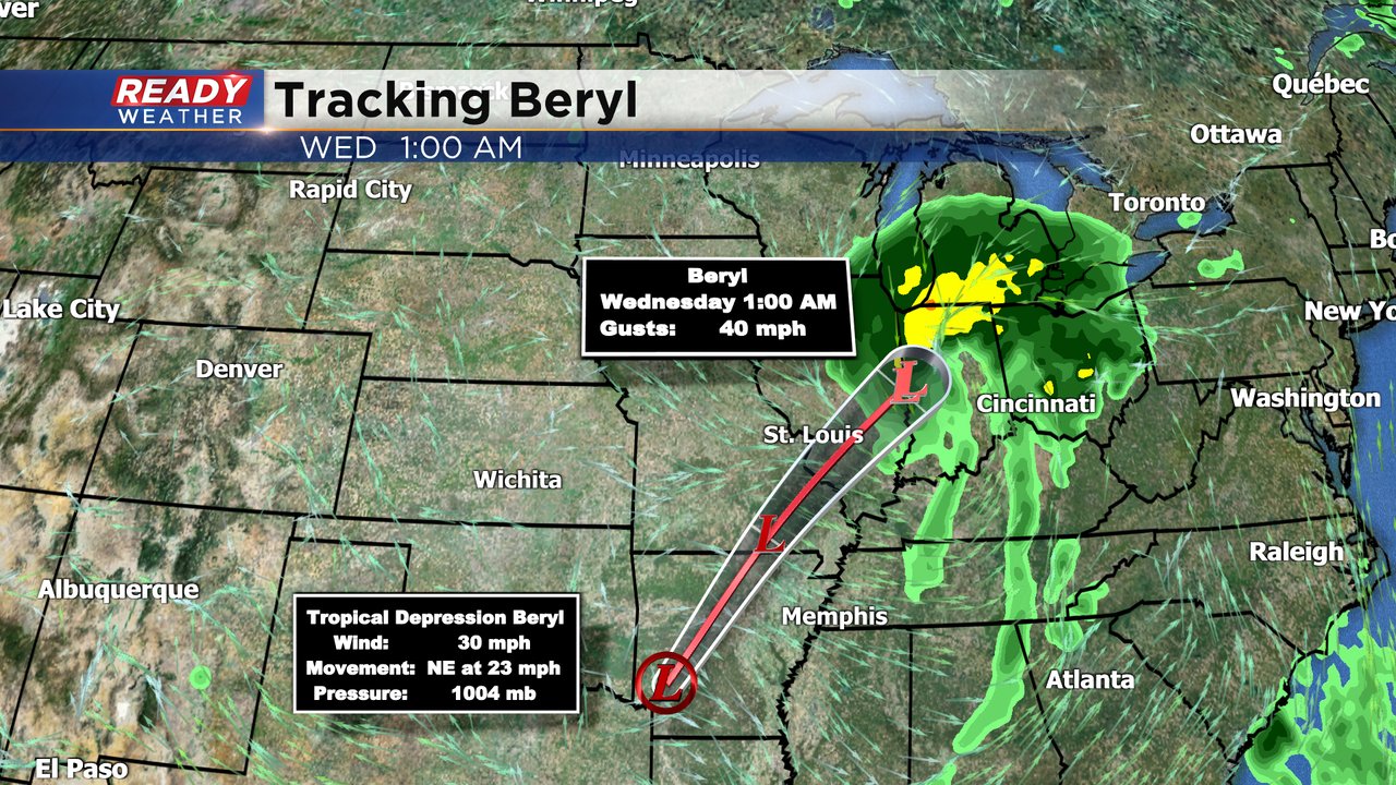
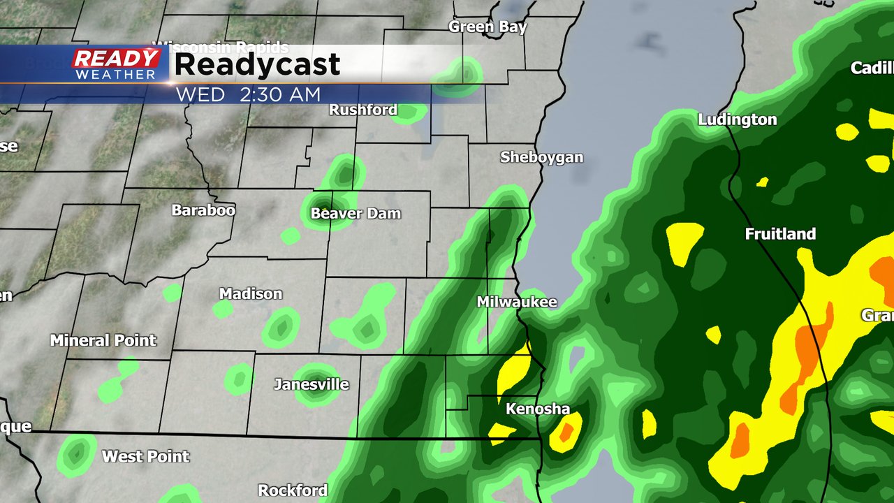
The latest track for Beryl brings the storm into Illinois and Indiana Tuesday night into Wednesday morning. As it gets closer to Wisconsin some of the outer rain bands with the storm could reach parts of southeast Wisconsin. Racine and Kenosha Counties have the best chance to see some rain but as far north as Washington and Ozaukee Counties could see some rain as well.
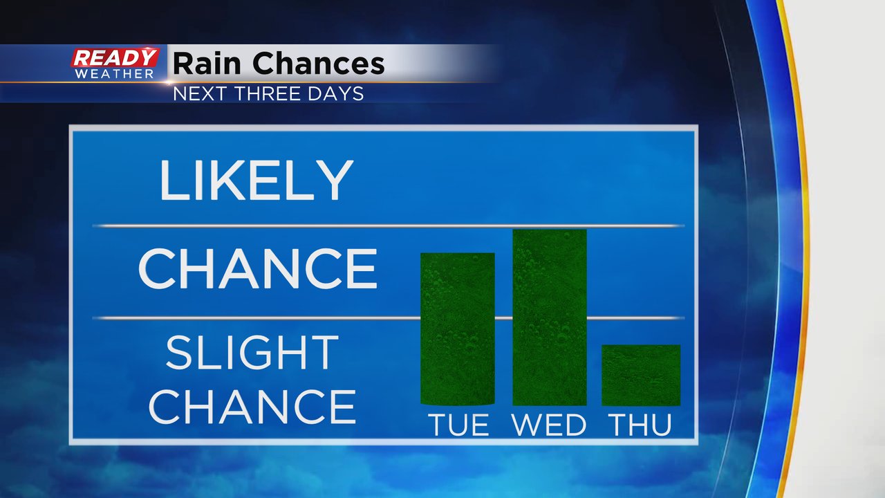
The rain chances for Tuesday and Wednesday continue to go up with Beryl's rains now tracking a bit farther north. Right now Thursday looks mostly dry but an isolated shower or storm can't be ruled out.
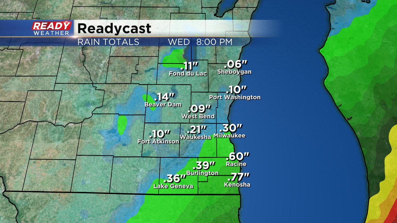
Rainfall totals the next 36 hours will be highest in our southeast counties where over a half inch to an inch is possible. Parts of Milwaukee and Walworth Counties could get a decent soaking rain with less than a quarter inch in other locations.
Download the CBS 58 Ready Weather app to zoom out on the interactive radar to see where Beryl is now and how far north the rain will get.