3 PM Update: Severe thunderstorm watch canceled for some counties.


Updated: 3:00 p.m. May 20, 2024

The severe thunderstorm watch has been dropped for some of our western counties. The ingredients for severe weather are slowly diminishing.
There remains a chance for a strong to severe storm for the lakefront areas; however, widespread severe weather is not expected. Showers and storms should come to an end by the early evening.
Several rounds of storms are expected for Tuesday!
______________________________________________________________________________________________________________
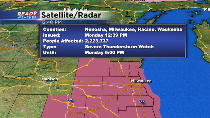
Updated: 12:15 p.m. May 20, 2024
We have a Severe Thunderstorm Watch issued for the area until 5pm today.
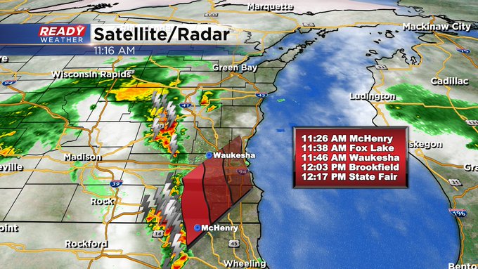
Updated: 11:15 a.m. May 20, 2024
We continue to closely monitor strong storms. Here's the latest radar image:

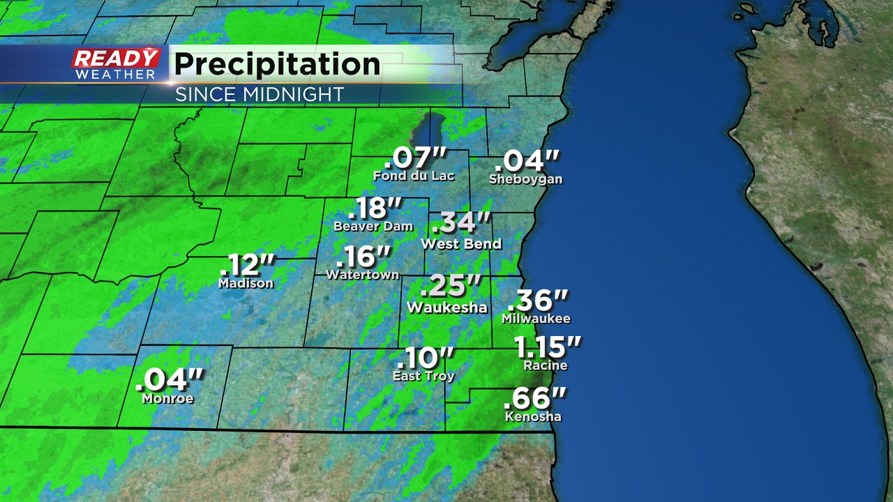
Updated: 9:26 a.m. May 20, 2024
Our first round of rain is done. The storms that rolled through this morning were non-severe but dropped some good rainfall along with a lot of thunder and lightning. Parts of Racine and Kenosha Counties got a half to full inch of rain.
A few more storms are now starting to form around the Madison area and moving into southeast Wisconsin. The lull in action between the first and second rounds has allowed a bit more fuel to settle into the atmosphere so these storms are a little beefier with some hail already reported in a few spots.
The best chance for some strong to severe storms will linger through the afternoon and into the early evening. By 8 PM the storm risk will go away. But more storms are possible on Tuesday especially in the evening.
------
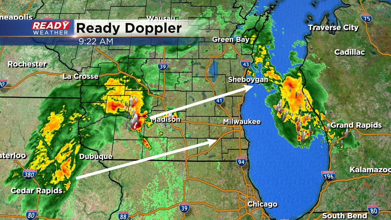
Posted: 4:57 a.m. May 20, 2024
The weekend was gorgeous but as we turn the page into a new work week the storms have returns. Scattered showers and storms are already rolling in from the west Monday morning and likely continue off and on throughout the rest of the day.
Here's a current radar image that will update with time:

Any of the storms on Monday could be strong, including the morning, but the best chance for storms to become severe will be from midday through the early evening.

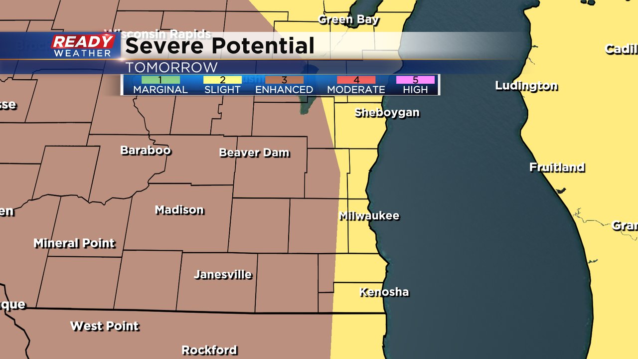
Throughout Monday we need to watch the location of a warm front moving in from Illinois. Communities that see the warm front will have best chance to see strong to severe storms. The Severe Potential for Monday highlights this risk. Areas along/south of I-94 are in the Level 2 Slight Risk since they are more likely to see impacts from the warm front. Everyone else in southeast Wisconsin is under a Level 1 Marginal Risk.

With any strong to severe storms that develop on Monday strong winds and large hail will be the main threats but an isolated tornado and brief street flooding could also be possible.

Monday isn't our only chance for storms or severe weather this week. Another chance for storms is likely on Tuesday. Strong to severe storms are likely Tuesday evening. Western parts of our local viewing area are already under a Level 3 Enhanced Risk for severe storms.
Download the CBS 58 Ready Weather app to track the storms as they develop Monday and Tuesday.