


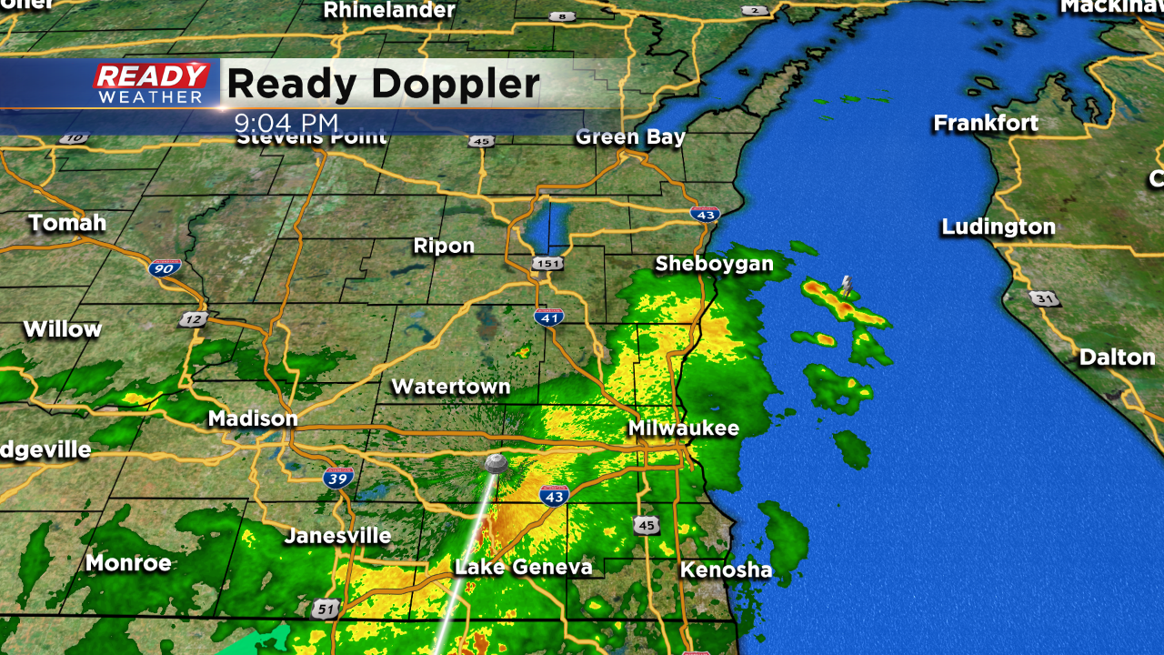
9:00 PM:
Thankfully the showers and storms continue to weaken as they move across southeastern Wisconsin. We expect them to fall apart over the next couple of hours.
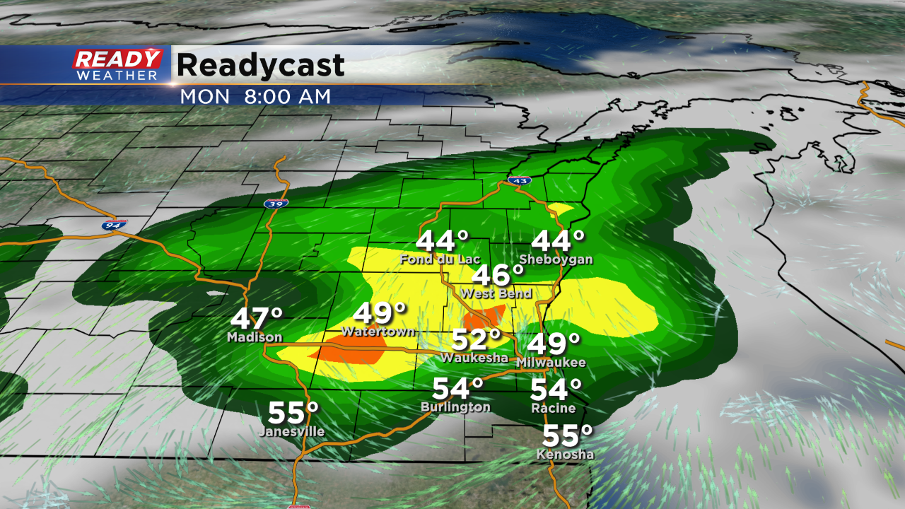
More rain will develop tomorrow morning into the afternoon, so have your umbrella for the first half of the day. The winds will turn out of the northeast keeping temperatures in the lower 50s; that's about 25 degrees cooler than Sunday!
______________________________________________________________________________________________________________
6:30 PM:
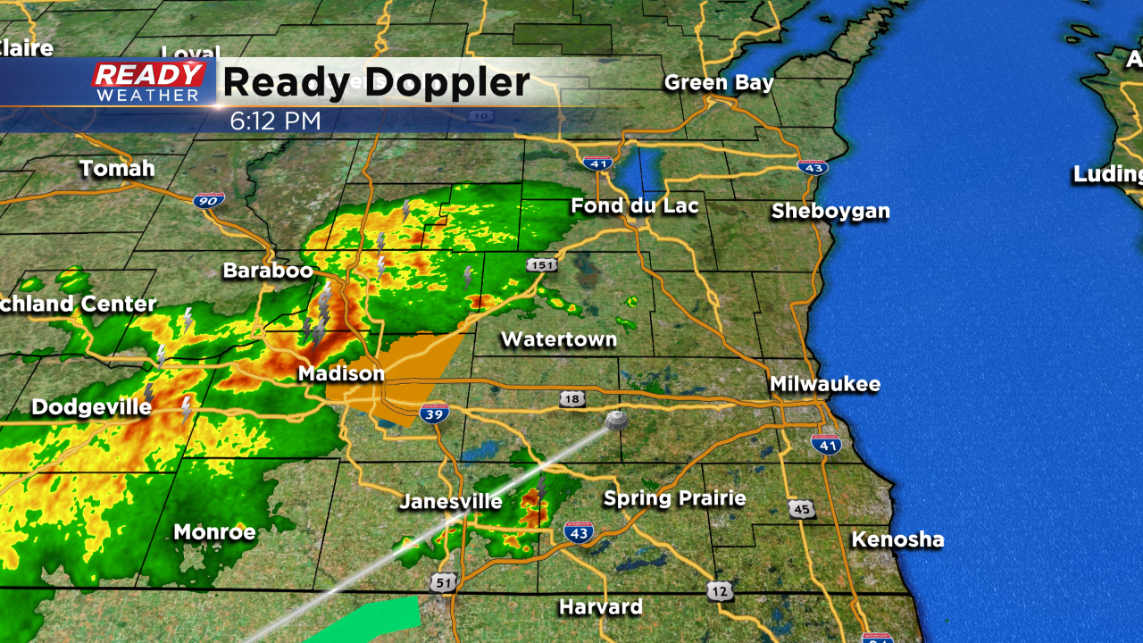
Scattered showers and storms continue to fire ahead of a cold front this evening. The greatest instability remains west of our area. The general trend has been for storms to weaken as they move east. A few warnings have been noted outside of our viewing area.
The best chance for the rain and storms will be closer to 8 pm. More rain is expected for Monday morning into the afternoon with a high close to 50.
_____________________________________________________________________________________________________________
3:30 PM
It's been a beautiful afternoon with highs in the 70s and relatively lower humidity. That low humidity will help keep any storms below severe limits later this evening. Scattered showers are starting to develop west of our area. We do expect an uptick in coverage across southeastern WI this evening and overnight.
Winds will shift northeast tomorrow and that will drop highs back into the 50s!
________________________________________________________________________________________________________________
The first part of Sunday looks wonderful thanks to sunshine and a southwest wind. Temperatures are expected to climb into the 70s by the early afternoon ahead of a cold front. Get your outdoor plans done early as storms chances increase late in the day.
The front will act as a focus for showers and storms this afternoon and evening. The storm chances look to be between 3 PM and 10 PM. Overall the moisture is rather low today with dewpoints in the 40s. In order to get stronger storms you really need dewpoints in the lower 60s.
The scattered showers and storms could produce small hail and some brief gusty winds; however, the overall severe risk will likely stay to the west of our area.