Showers return tonight leading to a soggy start to the work week


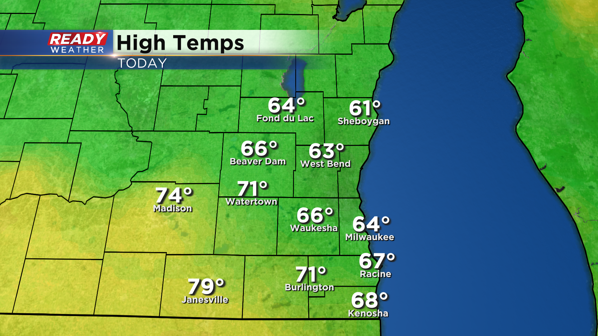
The morning band of rain lifting north out of southeast Wisconsin by midday, leaving us with a rather nice afternoon! Some sunshine south of I-94 even helped temps warm into the 70s in a few spots!
While we've had a good chunk of dry time today, a few isolated showers have already moved into SW WI and will start to stream into SE WI this evening.
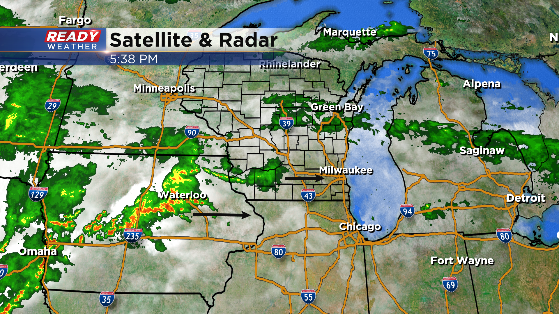
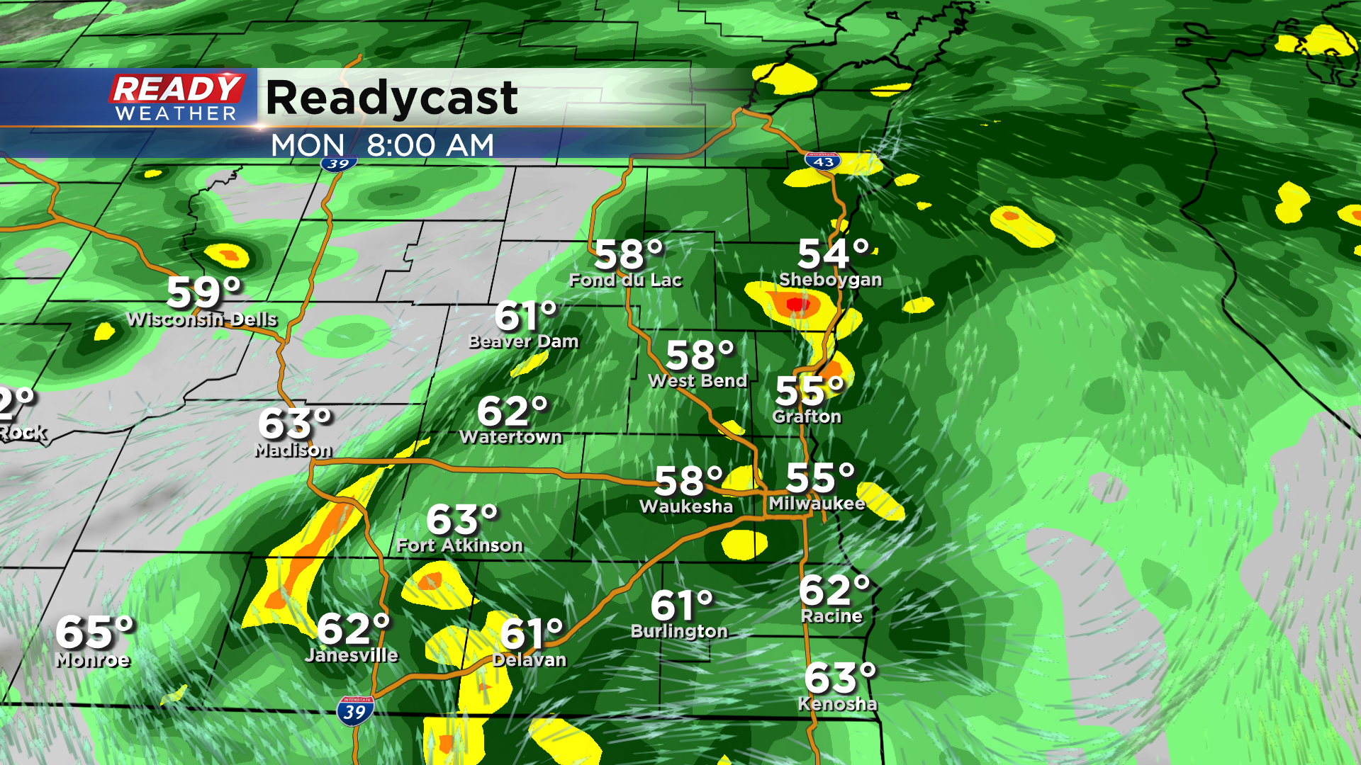
The scattered rain and embedded storms will become more widespread overnight into Monday morning with the window of most widespread rain expected between 1am and 9am Monday.
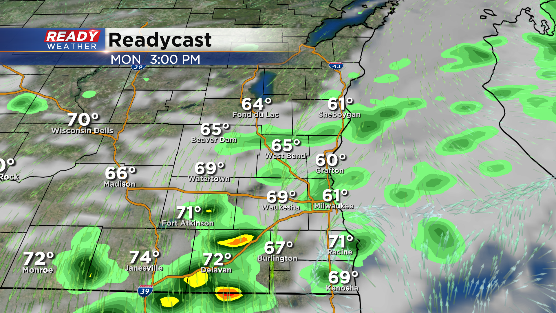
The cold front will gradually work through southeast Wisconsin from NW to SE through the course of the afternoon. Additional scattered showers and isolated storms are possible ahead of the front, especially south of a line from Grafton to Janesville.
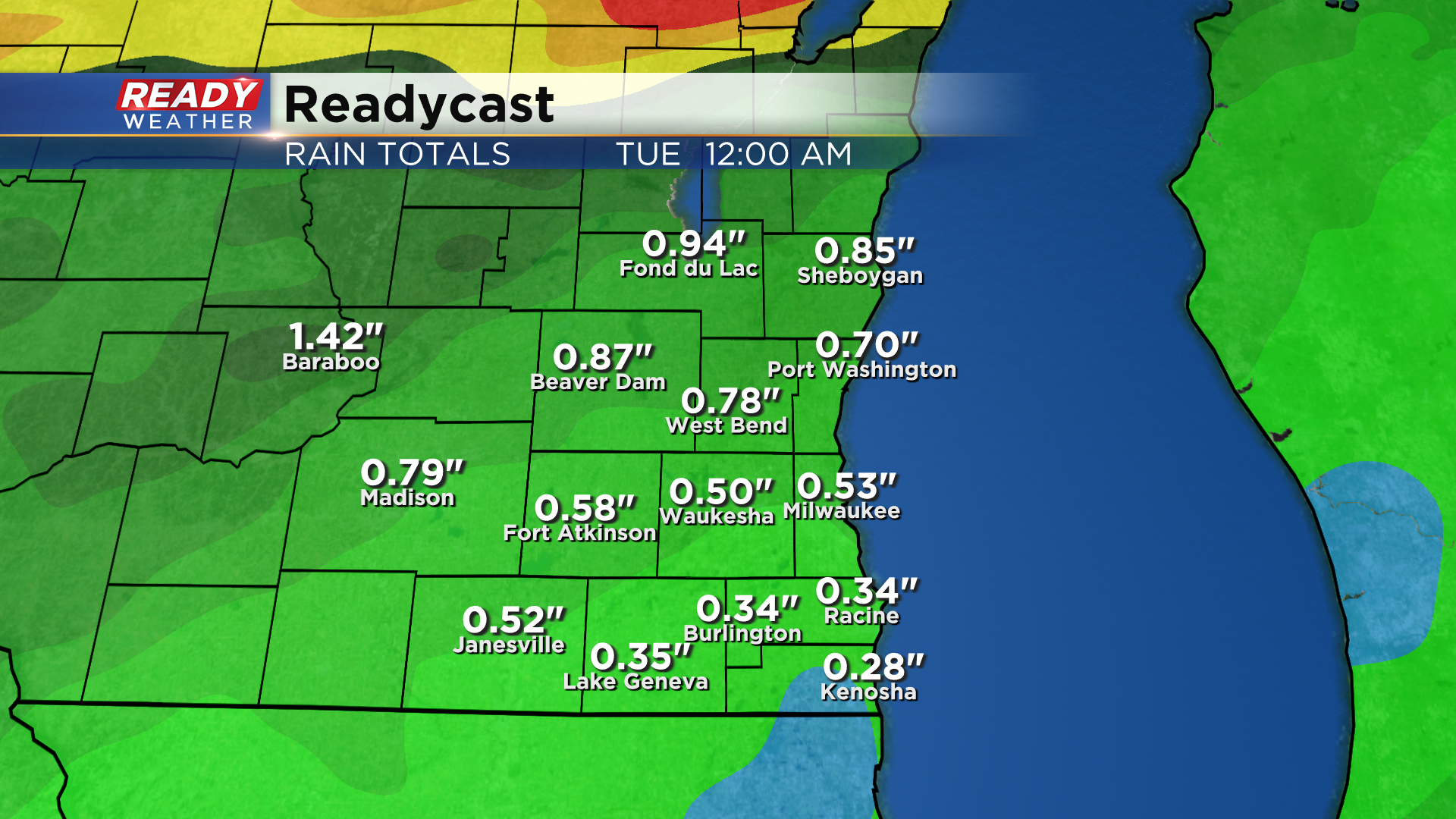
Most of the area will pick up an additional .25-.75" of rain tonight through Monday. Localized spots may pick up an inch of rain with the best chance of that occurring NW of the Milwaukee metro.
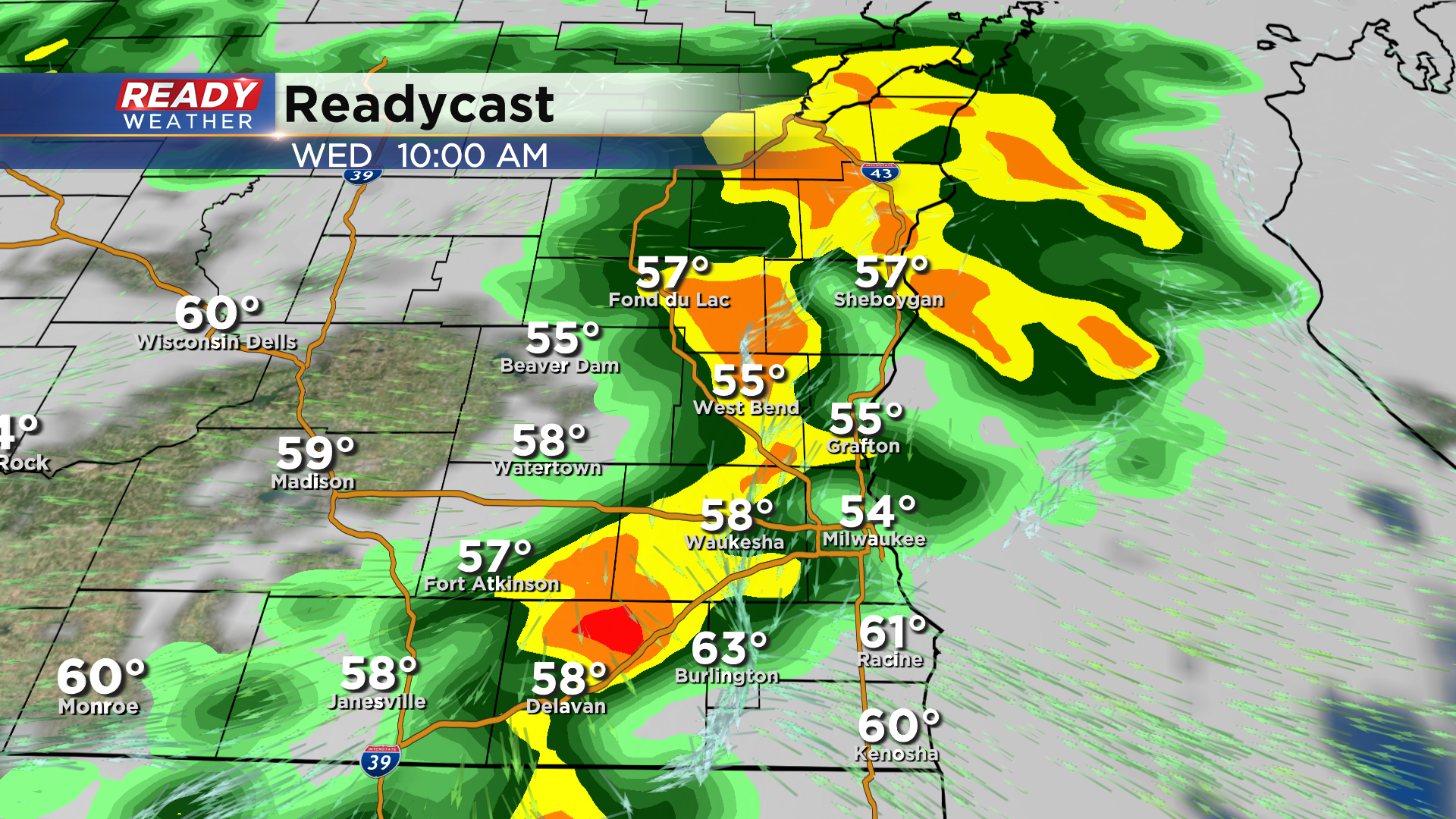
We'll dry out on Tuesday, but another round of showers and isolated storms is expected Wednesday. This will generally keep temps in the upper 60s to around 70 degrees through the middle of the week.
The second half of the week into next weekend looks primarily dry. Download the CBS 58 Ready Weather App to see the full 7 day forecast.