


I hope you were able to get outside and enjoy the much needed sunshine around the area today! Today marked our third dry day in a row, the longest such streak this month.
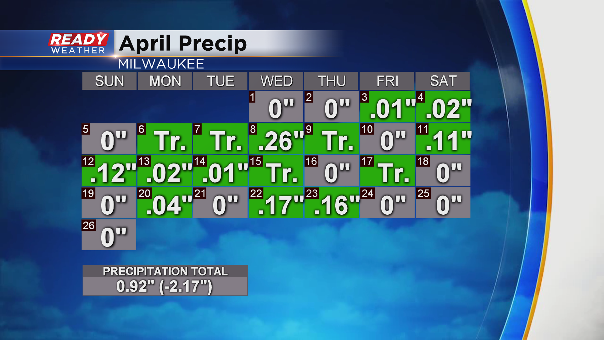
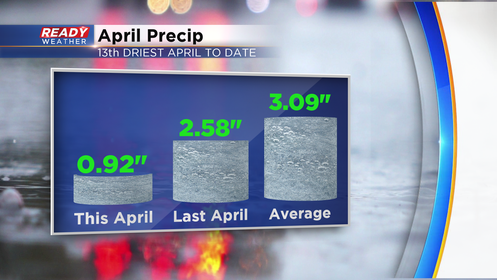
Even though we’ve had more wet days than dry day this month, we’re well below normal for rainfall this month. In fact, local farmers are saying it’s drier now than it was at any point last year!
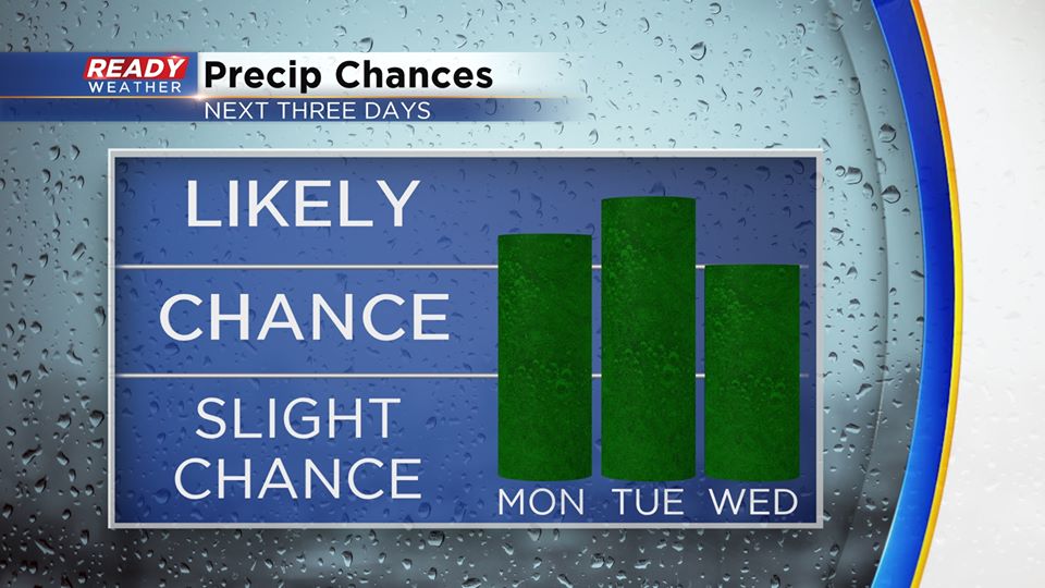
After a mainly dry weekend for most of the area, we have a good chance for multiple rounds of rain to start the new work week.
Conditions will be dry through Monday morning, but rain starts to work into the northwest portion of the area around midday.
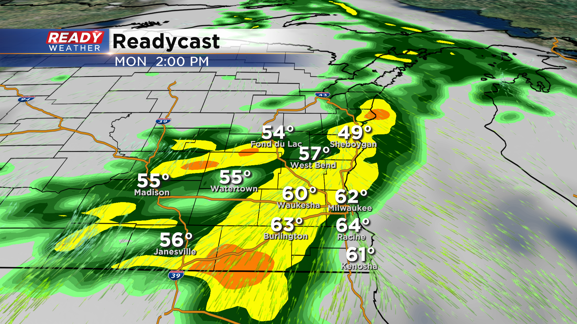
Showers will overspread the area throughout the afternoon, tapering off during the evening.
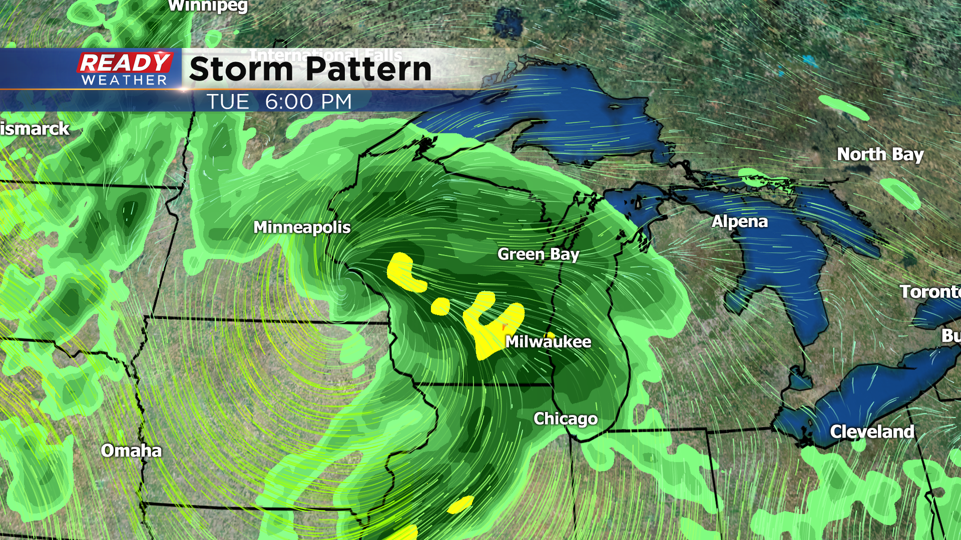
We’ll remain dry Monday night through at least early Tuesday afternoon before the next low pressure system tracks into southern Wisconsin. Rain and a few storms look most likely late Tuesday afternoon through evening.
Spotty wrap around showers and blustery conditions will linger throughout Wednesday.
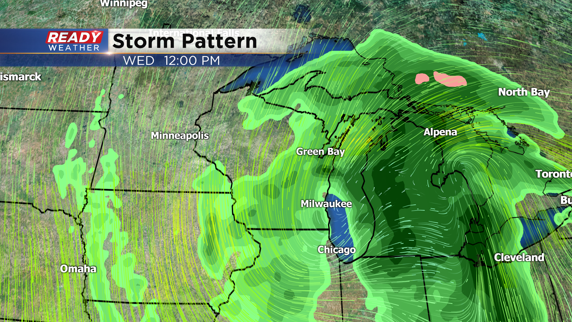
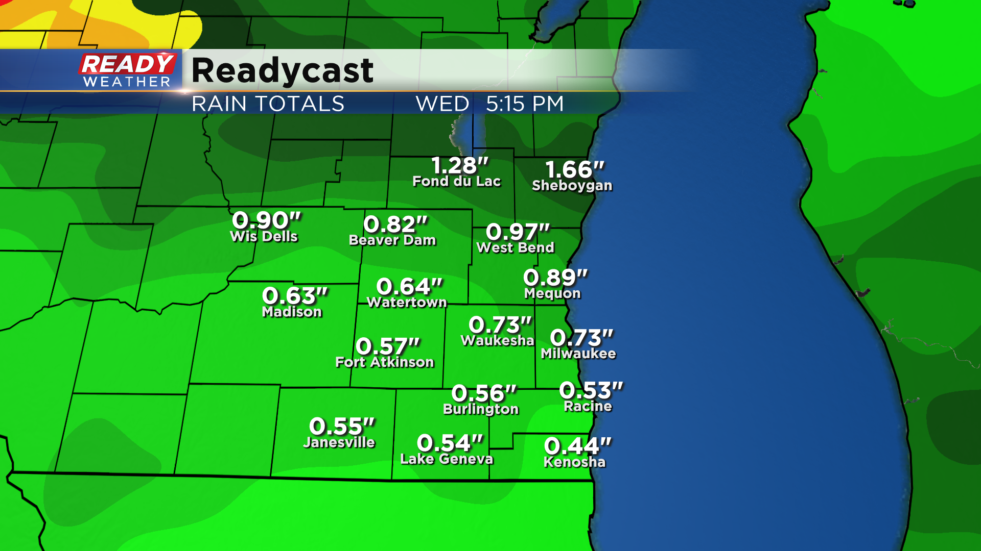
There are still small differences in the details with these systems, but overall most of the area should pick up .50 – 1” of rain through Wednesday, with isolated higher amounts possible.
Mainly dry weather will move in for the second half of the week with temperatures on a warming trend to start May. Temps could be in the mid to upper 60s by Saturday!