


It was a chilly start this morning with the coldest low temperatures of the season hitting! Milwaukee began this Thursday at 45 degrees with most areas inland into the 30s, and many spots northwest of the city below the freezing mark bringing in patchy frost. We do have a southeast wind return today, bringing our afternoon temps back into the mid-60s, and as a southwest wind develops for tomorrow, highs should stay consistent near average.
Overnight, we should stay warmer as we head into the weekend, not only thanks to the southwest wind, but also as more clouds develop. Our next rainy system is building in but shouldn't impact us until early Friday morning. A few fair weather clouds are expected today, but more clouds will move in overnight.
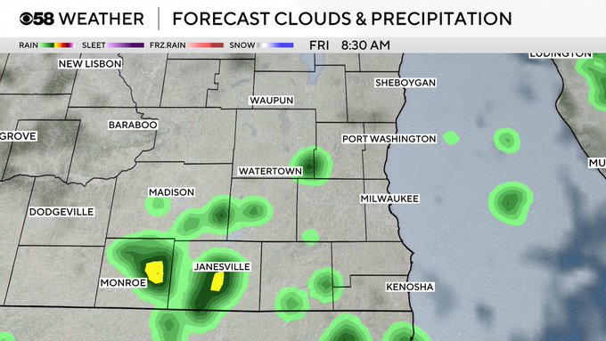
Scattered showers are possible tomorrow, with the best timing for this to be early to mid-morning. Into the afternoon, the rain chance will turn more isolated and spottier, with many areas staying dry to finish the work week. A few clouds will linger into the weekend, but we will turn drier, so a nice weekend is in store.
A shower chance is possible again by Monday, and ahead that system we do warm back up with highs into the low 70s. However, behind that little system, we will then cool right back off with a more northerly wind putting temps back into the low 60s for the remainder of next week.