Steady temps with slowly rising humidity and a low storm chance this weekend


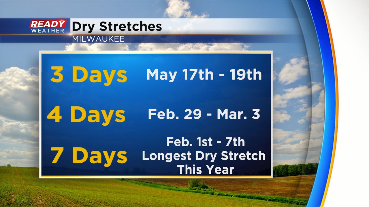
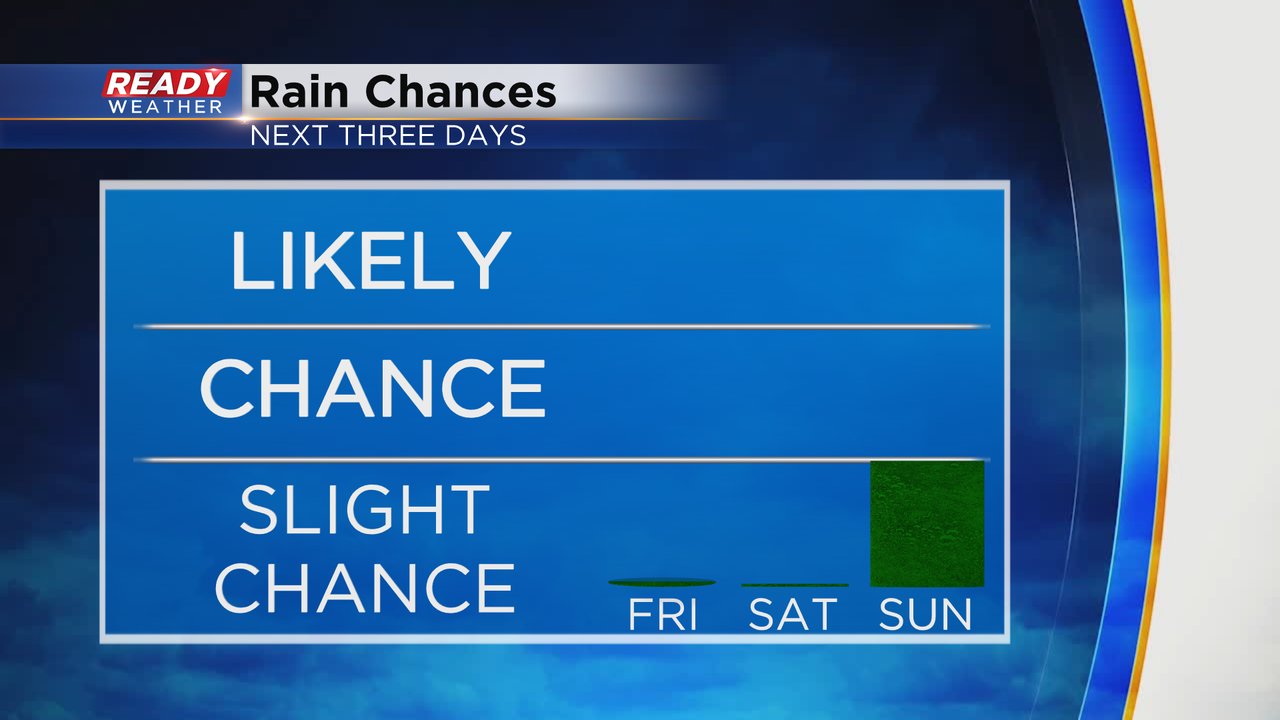
The last time we had three straight completely dry days in southeast Wisconsin without even a raindrop was the middle of May! That streak likely changes on Friday which could be the third dry day in a stretch that started on Wednesday. In fact, Saturday still looks dry making it four days in a row which is the longest stretch since winter at the end of February and beginning of March.
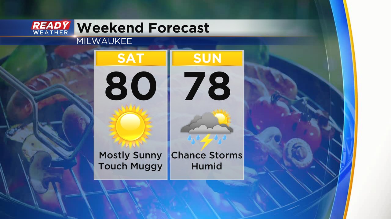
By Sunday our next rain chance does return with a few light showers or even a rumble of thunder possible.
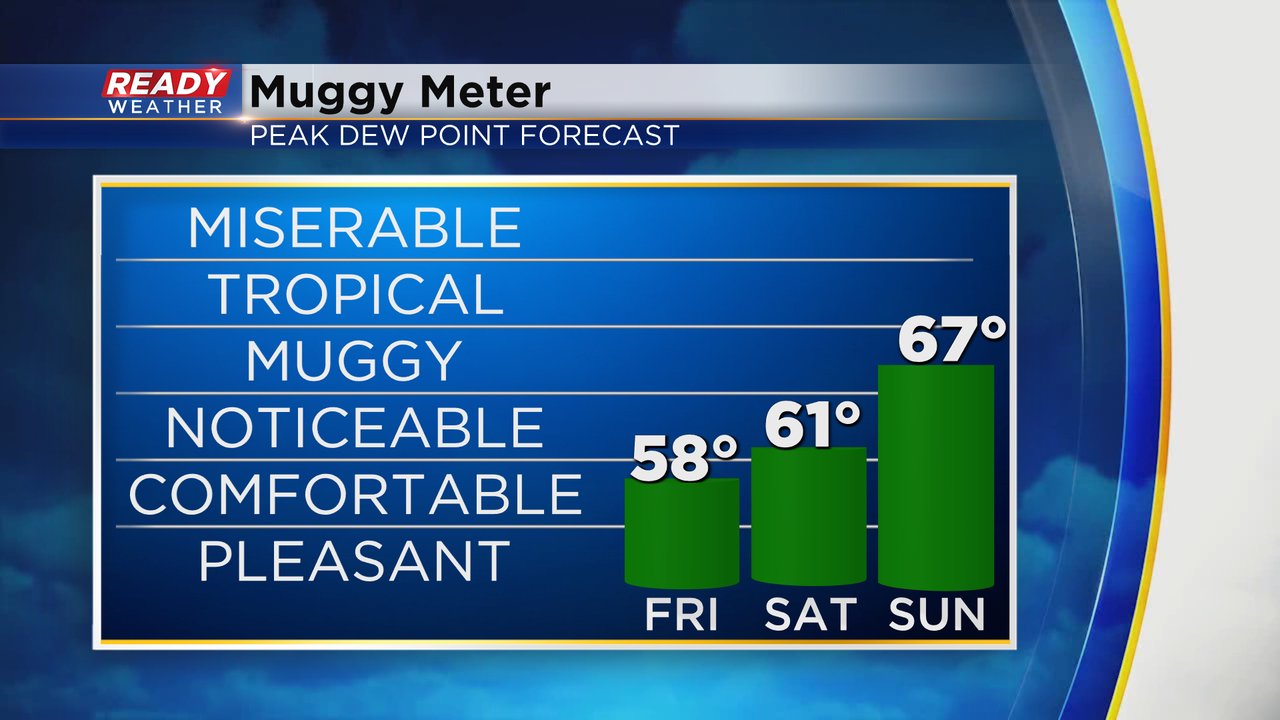
Dew points continue to stay low for Friday in the comfy category in the upper 50s. Just a touch of humidity may be possible on Saturday with dew points around 60 but the mugginess and humidity will definitely return on Sunday as the dew points rise into the middle and upper 60s.
There are no big storm systems over the next week so that means temperatures will stay fairly steady with no strong warm or cold fronts moving in and out of the area. Highs will stay in the upper 70s to around 80 and just below average for the entire next week.
Download the CBS 58 Ready Weather app to stay updated on any changes to rain chances the next week.