Sunny start to the week before remnants of Cristobal impact the area


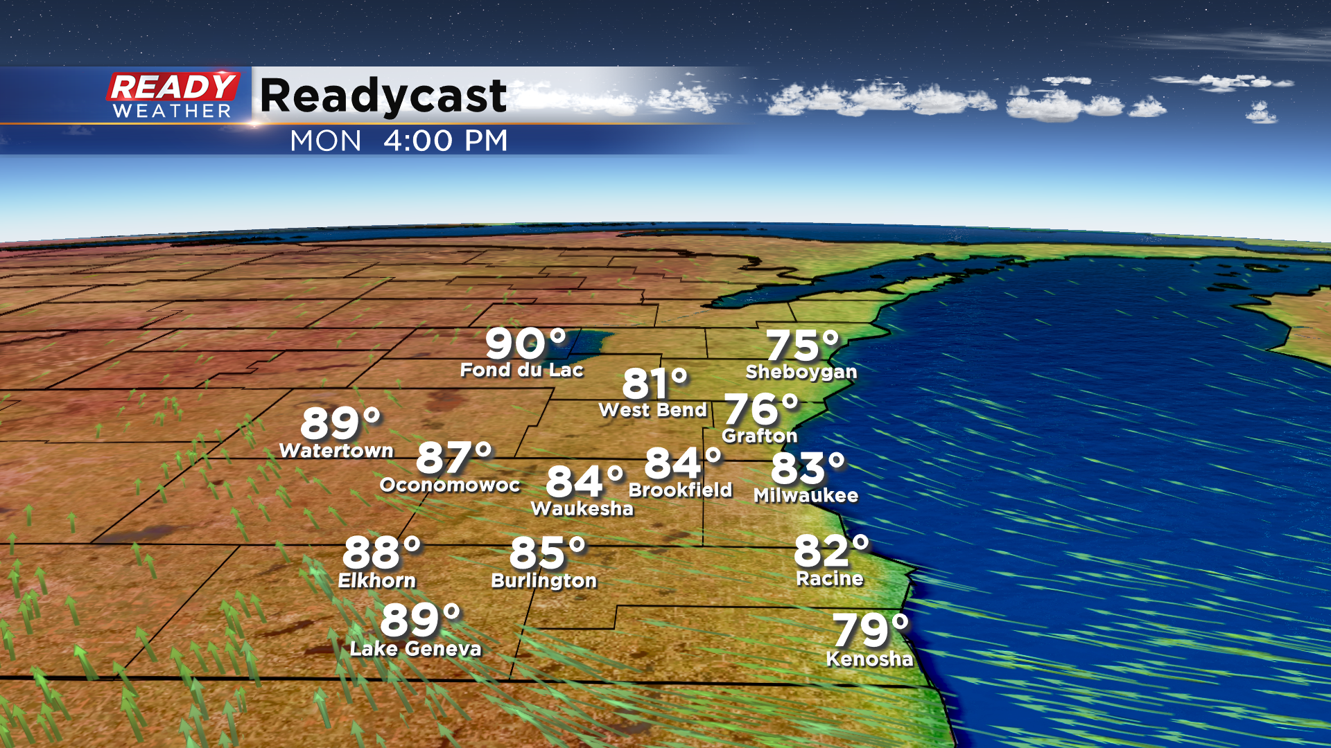
After a pleasant weekend with plenty of sunshine and comfortable temperatures, warmer and a bit more humid air returns on Monday. Sunny skies are expected with highs in the low 80s lakeside, and around 90 well inland with a southeast breeze at 10-15 mph.
Our attention then turns to the remnants of Tropical Storm Cristobal, which made landfall in Louisiana this evening. Cristobal's remnants are expected to track through Wisconsin Tuesday afternoon and night, bringing heavy rainfall to the state.
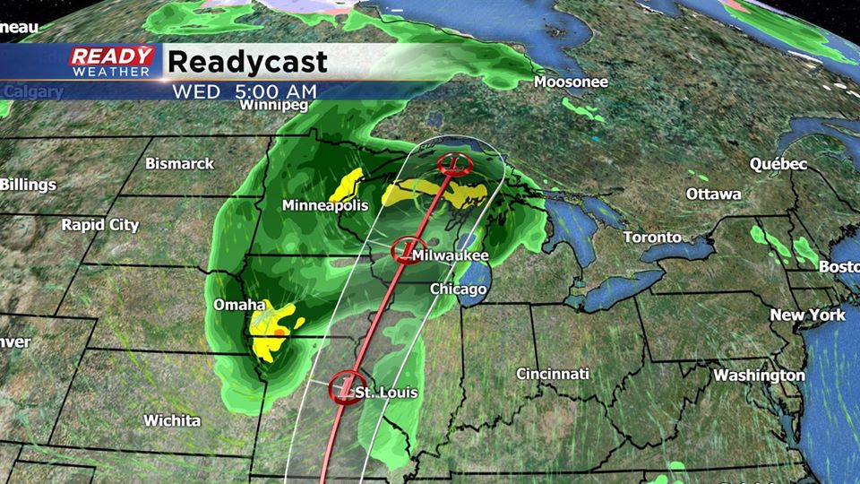
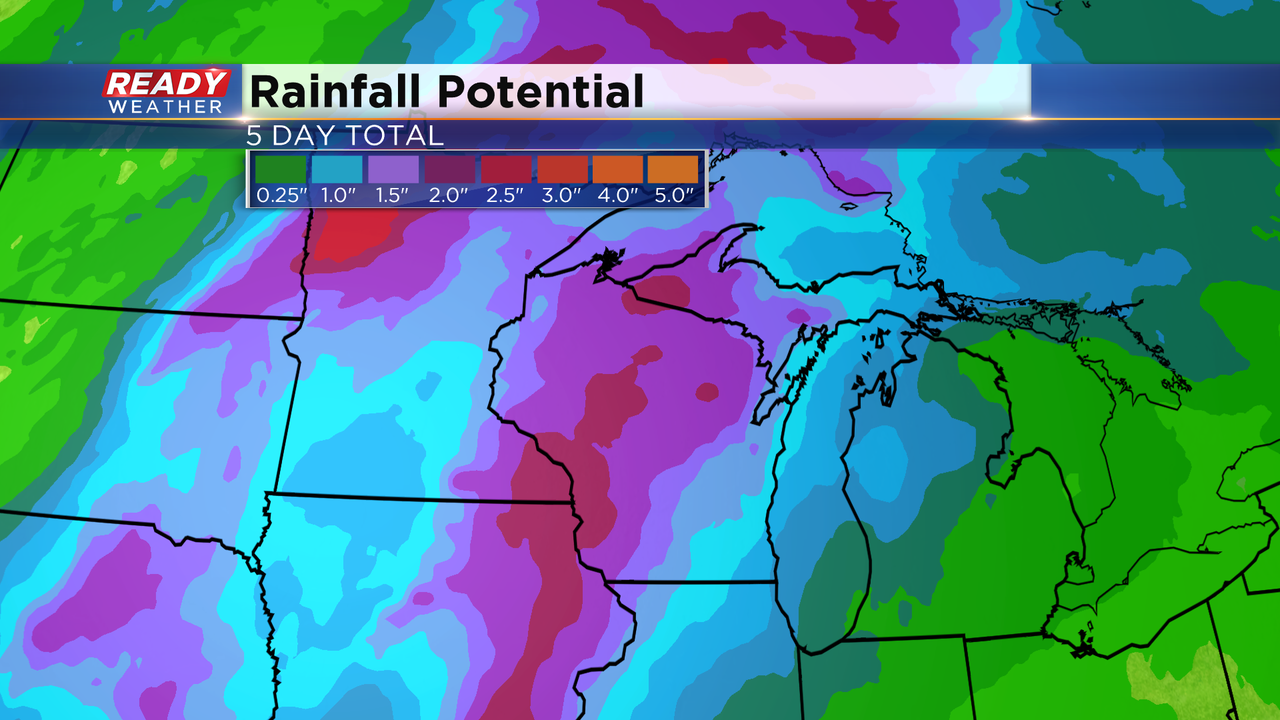
The projected track of Cristobal from southwest Wisconsin to northeast Wisconsin would keep the heaviest rain of 2-3" across western and northern parts of the state, with .50-1.50" more common in southeast Wisconsin. There is still uncertainty in the track, so if the track shifts east, the heavier rain totals and flooding threat would shift east as well.
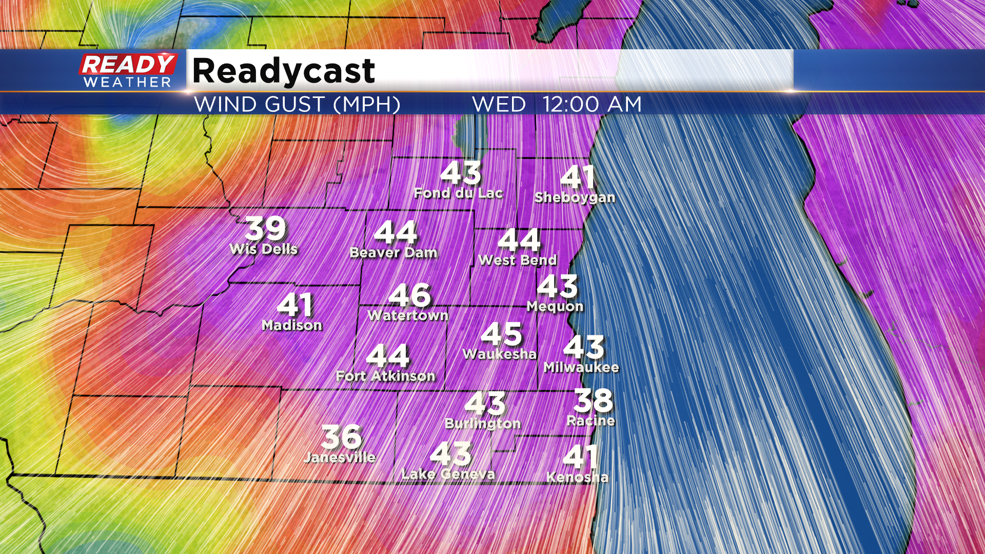
If this track pans out, the strong winds associated with this system could make more of an impact for southeast Wisconsin than the heavy rain. By Tuesday evening, wind could be gusting between 35-45 mph, and if we're on the east side of the system that would also put us under an isolated tornado threat. 35-50 mph winds will be possible Wednesday afternoon as well as a second system develops right behind Cristobal.
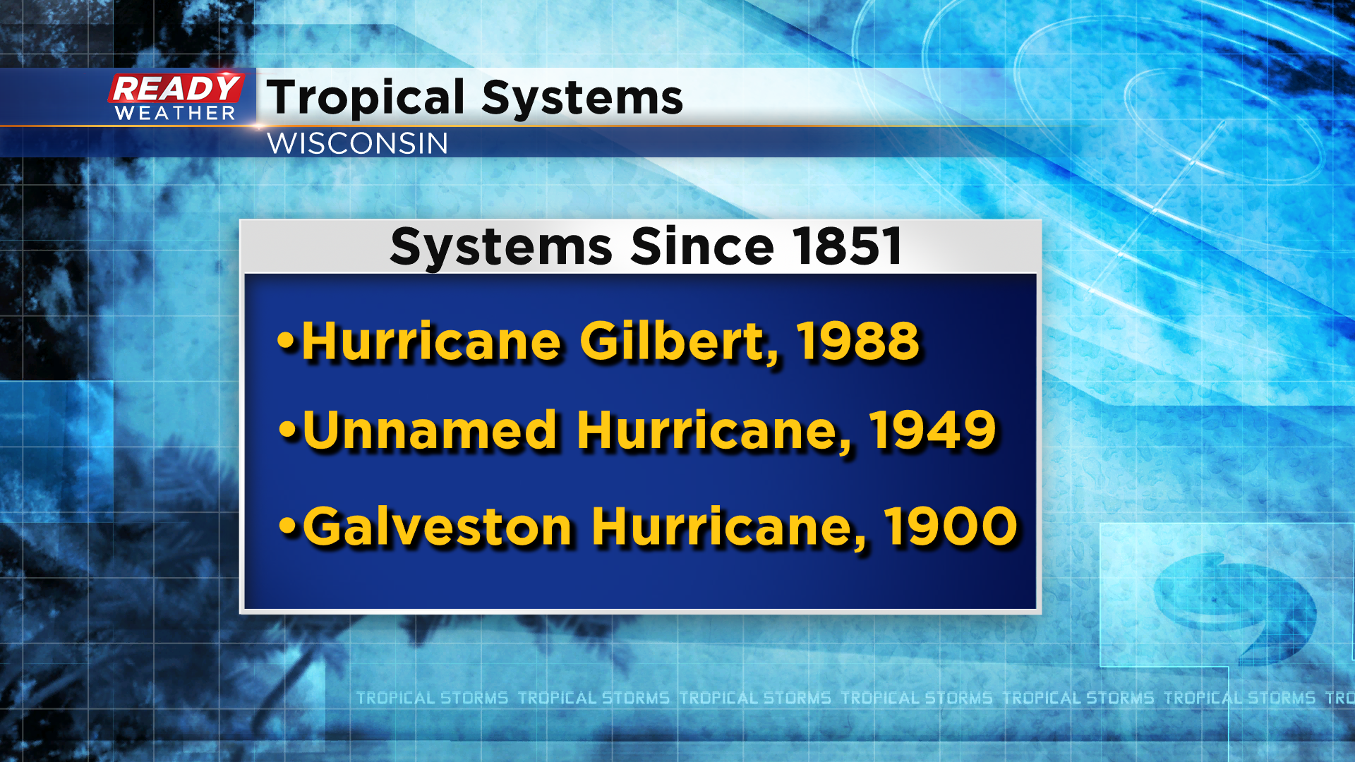
It's rare to have a tropical system track through Wisconsin. Dating back to 1851 (when record keeping began), there have only been three tropical systems that have tracked through Wisconsin. The most recent being Hurricane Gilbert in 1988.
Keep up with the forecast over the next two days since there is still uncertainty in Cristobal's exact track.