Warm and windy with very high fire danger to start the weekend


Updated: Saturday, May 1st 11:00 am:
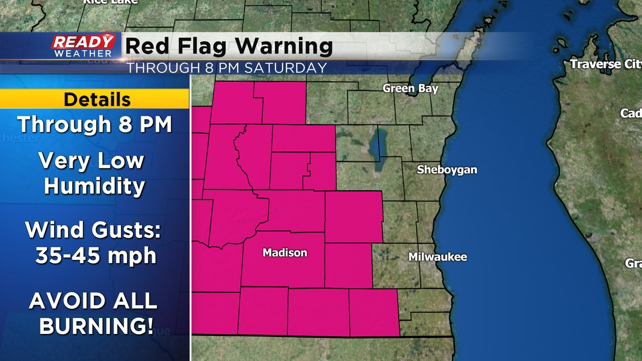
A Red Flag Warning has been issued for Dodge, Jefferson, and Walworth counties due to critical fire danger. Avoid all burning and any activities that create sparks. Any fires that start will spread quickly due to the strong winds, low relative humidity, and warm temperatures.
---------------------------------------------------------------------------------------
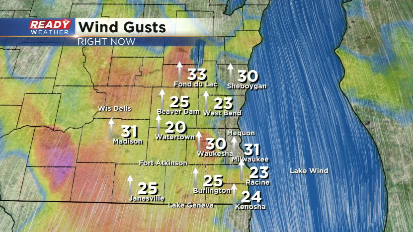
Winds are ramping up this morning with gusts already over 30 mph in many locations.
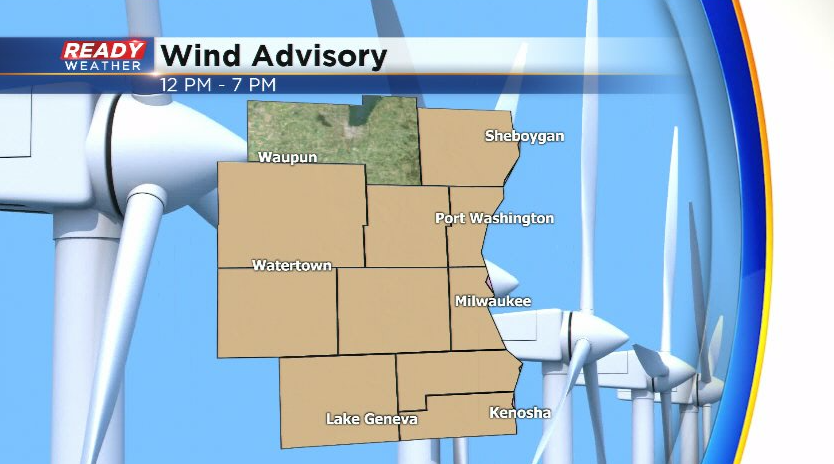
Winds will frequently gust between 30-40 mph today with gusts approaching or exceeding 45 mph this afternoon. A Wind Advisory has been issued from Noon through 7 pm for all counties in the area besides Fond du lac.
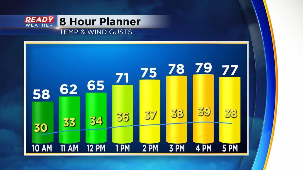
Temps are currently sitting in the low 50s, but once that wind turns to the southwest this afternoon temperatures will quickly warm through the 70s with most spots topping out near 80°.
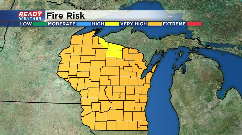
The combination of warm, dry, and windy conditions will lead to very high fire danger across the state today. Avoid all outdoor burning!
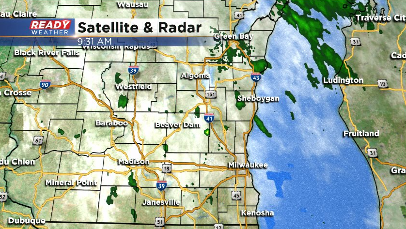
There are a few sprinkles falling from the deck of clouds passing through this morning, but most of these are evaporating.
We still can't rule out a stray pop up shower near Fond du Lac later today, but once this deck of clouds moves through we should have more sunshine and dry weather through the afternoon. Download the CBS 58 Ready Weather App to see the full 7 day forecast.