Warm weekend with an isolated storm chance


Update as of 7:15 a.m. Saturday, May 18th...
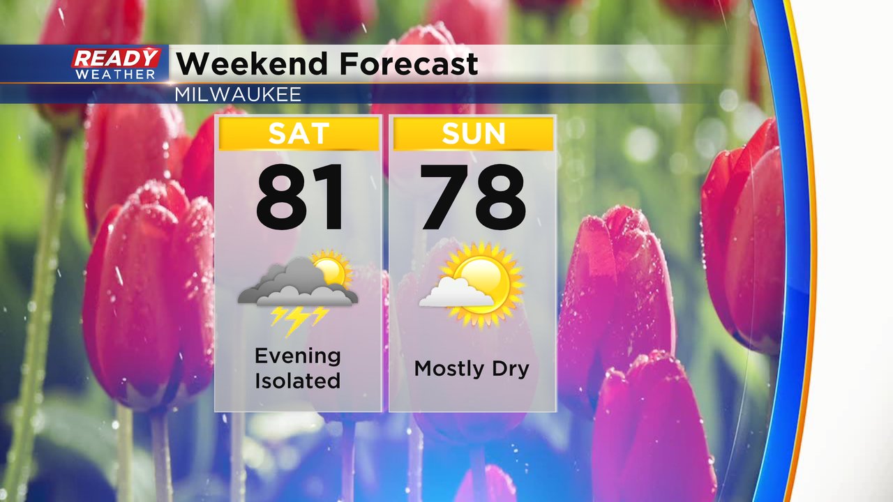
A few updates as we head into the weekend. An Air Quality Alert holds for the second part of Saturday for a good chuck on the viewing area. If you have breathing sensitivity issues, try and limit your time outside. Ozone, not smoke, is the real culprit this particular time. Look for warm temperatures to continue through the weekend with highs either side of 80 on Saturday and a bit cooler on Sunday with an onshore wind flow. So only in the 70s. Expect rain and storms Monday and Tuesday, some could be strong.


_____________________________________________________________________________________________________________
A few stronger thunderstorms rolled through southeast Wisconsin Thursday. They dropped some heavy rain in a few communities with rain totals nearing 1" in isolated locations.

The soaker on Friday pushes the May rain total to 2.81" in Milwaukee which is one inch above average for this point of the month and well above the rainfall we had last year in May.

Most of the upcoming weekend looks dry with a mix of sun and clouds. An isolated storm chance is possible Saturday evening as a thin line of broken showers and storms rolls across the state. A few of those could linger into southeast Wisconsin.

It will be a warm weekend as well with highs hovering around 80 both Saturday and Sunday. The wind stays light and just a touch warmer inland with some lake influence. While the rain chance Sunday isn't enough to put it on the forecast we could see a shower in the morning or evening.
Download the CBS 58 Ready Weather app to track the hour-by-hour forecast and plan out your weekend.