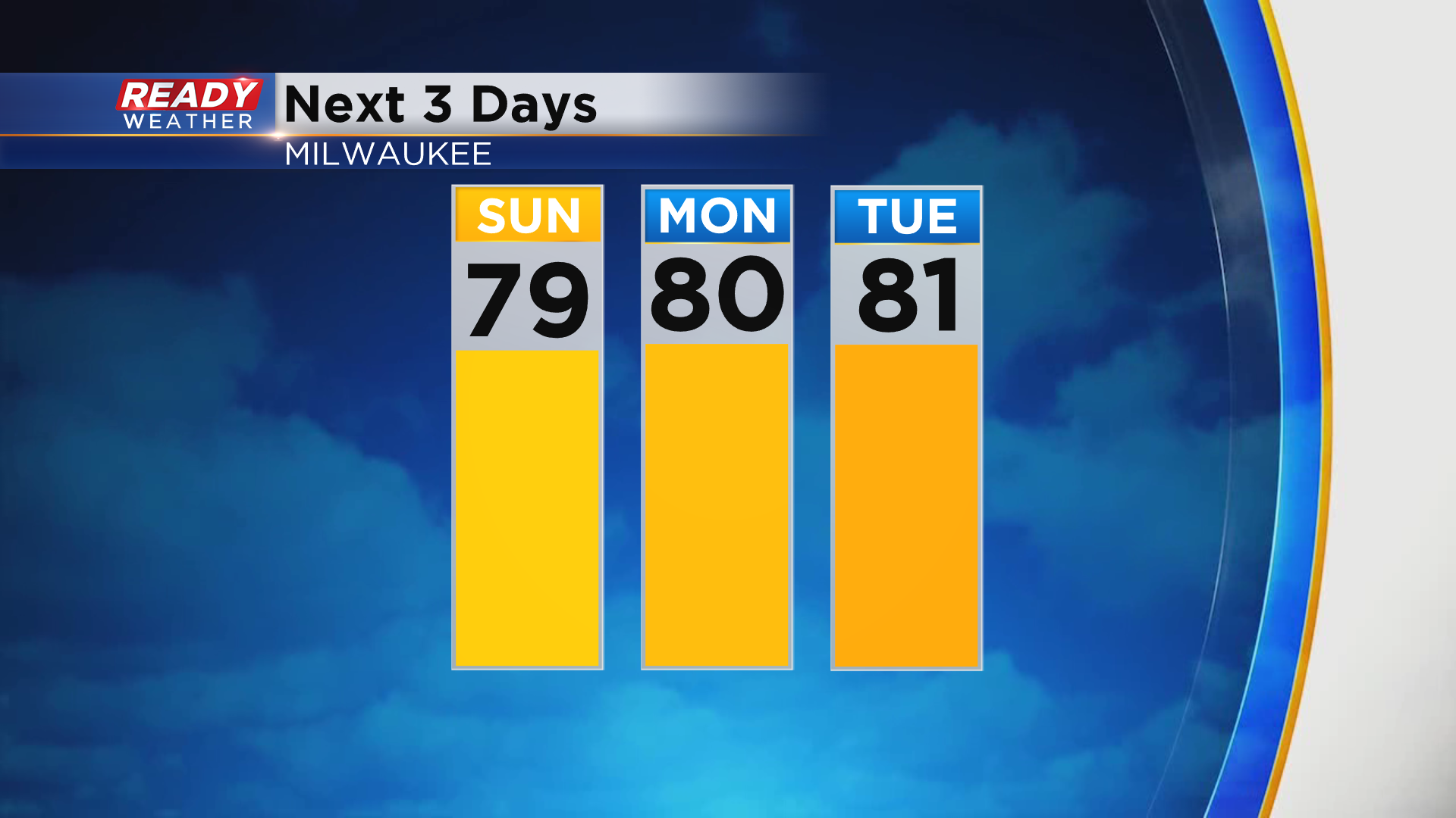
Warmth continues before a large temperature drop Sunday afternoon


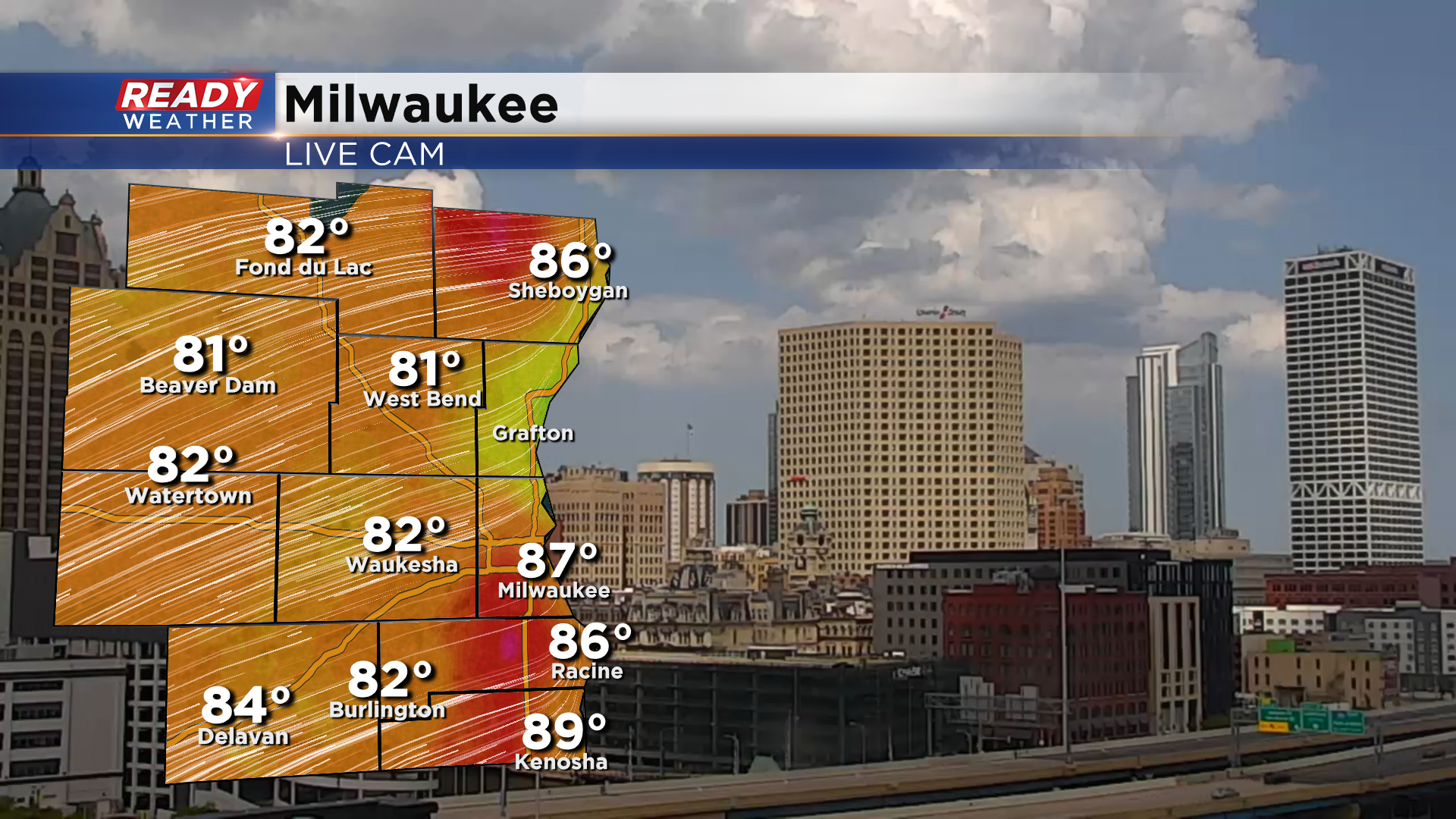
It feels like summer across southeast Wisconsin with temperatures in the 80s under sunny to partly cloudy skies as of 2 pm.
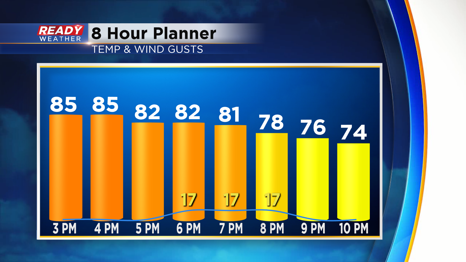
Temperatures will remain mild in the 70s and 80s this evening with a pleasant WSW breeze.
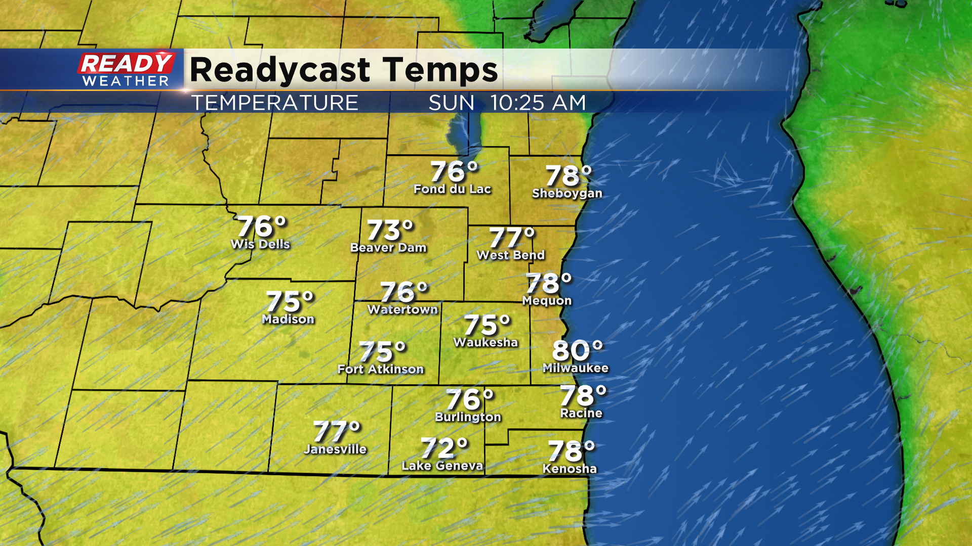
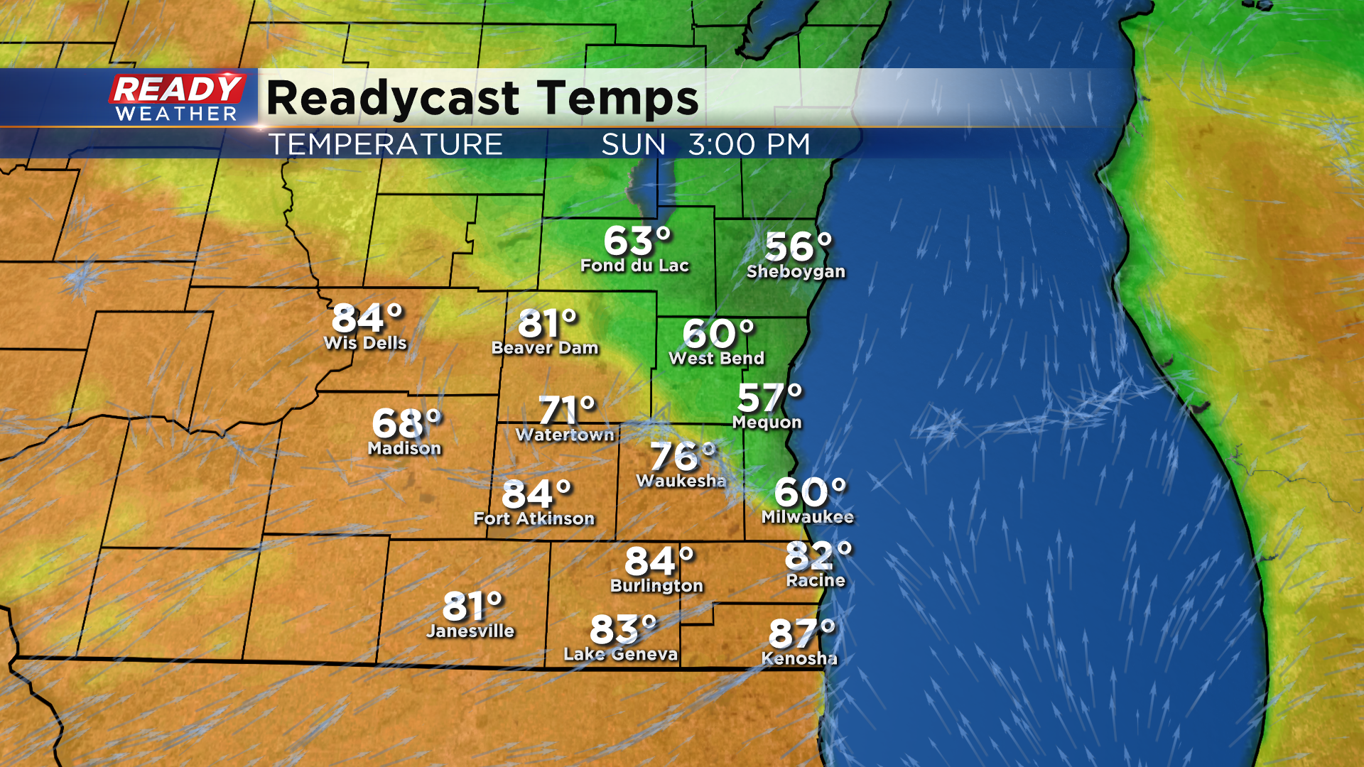
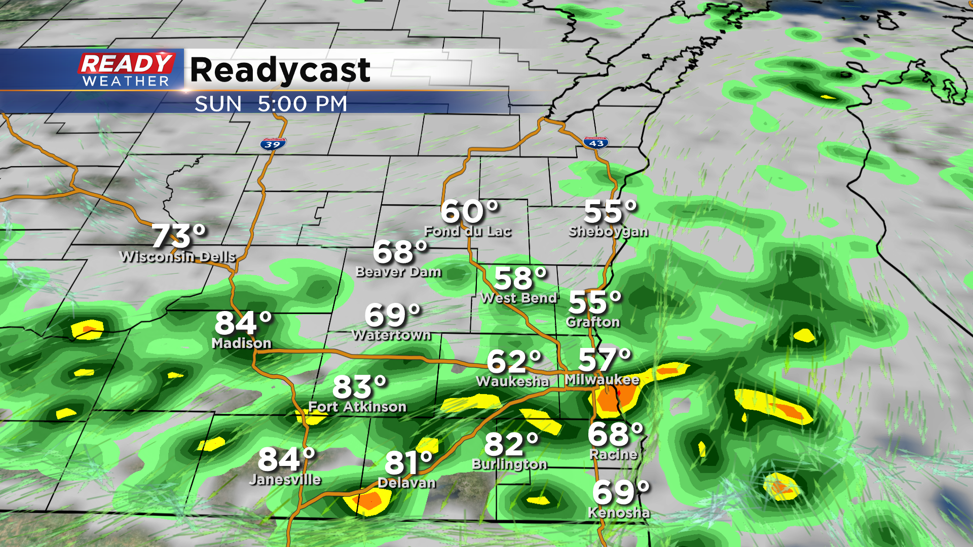
Clouds will be on the increase tonight into Sunday morning, which keep temps in the upper 60s to around 70 to start the day on Sunday. Temperatures will climb through the 70s, with a few spots possibly getting into the low 80s (depending on cloud cover), but a backdoor cold front will race down the lake in the afternoon, dropping temperatures from the 70s and 80s into the 50s and 60s.
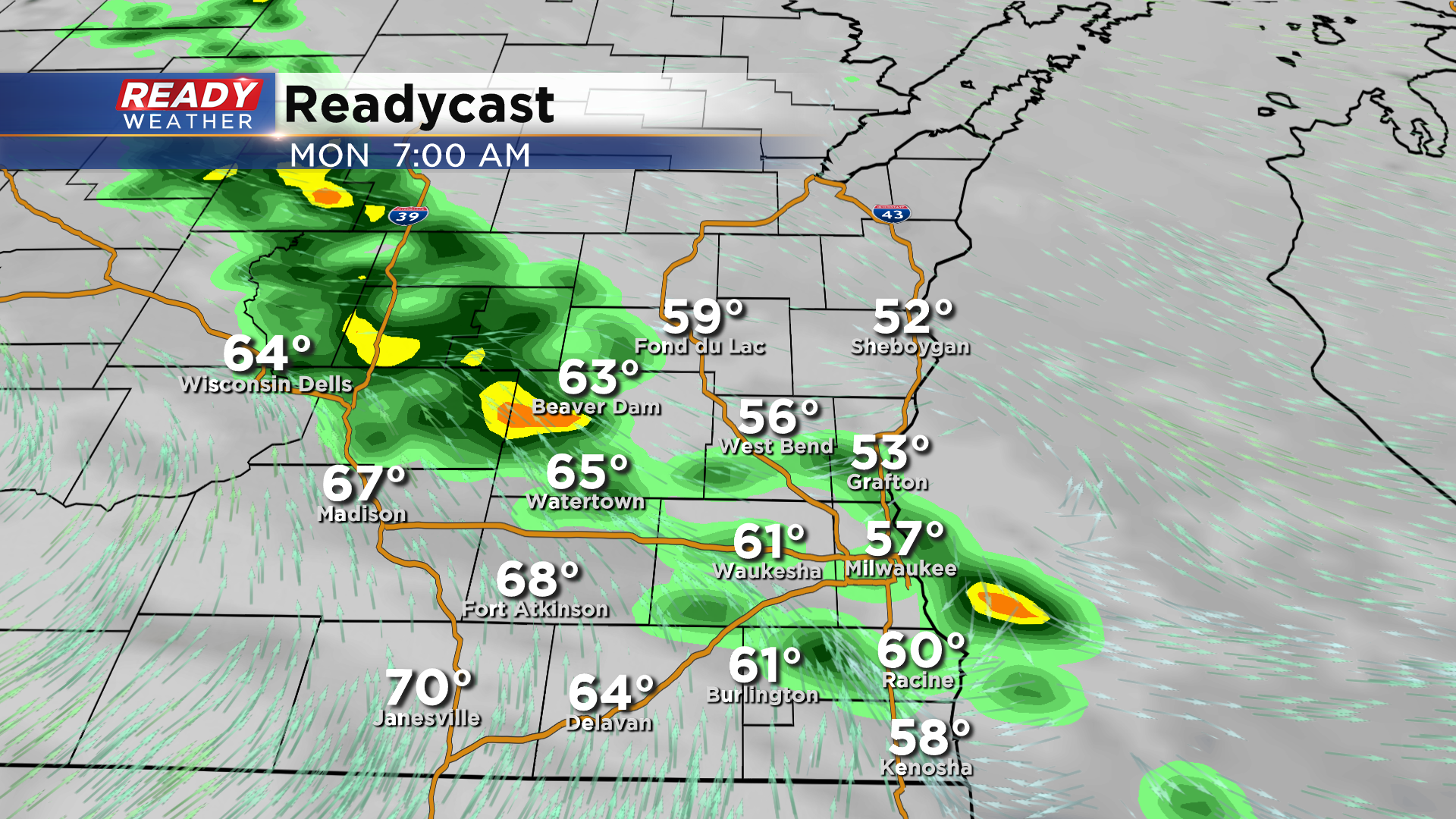
However, we won't be staying in the 50s and 60s for long. That front will lift back northward as a warm front on Monday, with temperatures returning to the 70s and low 80s during the first half of the week.
Not only will this front bring a fluctuation in temperatures, it will also bring shower and storm chances back into the forecast. A few showers may sneak into southern Wisconsin Sunday morning as a weak wave approaches, but a better chance for scattered showers and storms will come in the afternoon as the front slides in.
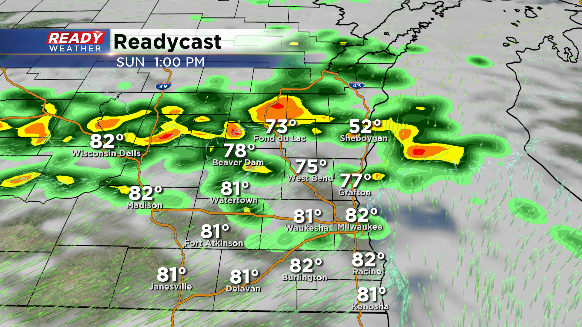
These showers and storms will sag southward through the afternoon and into the evening.
A few showers may linger into the start of the day Monday as the front lifts back northward, but showers or storms will be a bit more isolated in the afternoon with peeks of sun.
More showers and storms are expected Tuesday into Tuesday night as the cold front moves through with high pressure drying us out on Wednesday. Download the CBS 58 Ready Weather App to track the showers and storms.