Entering a stormy period this July 4th holiday week


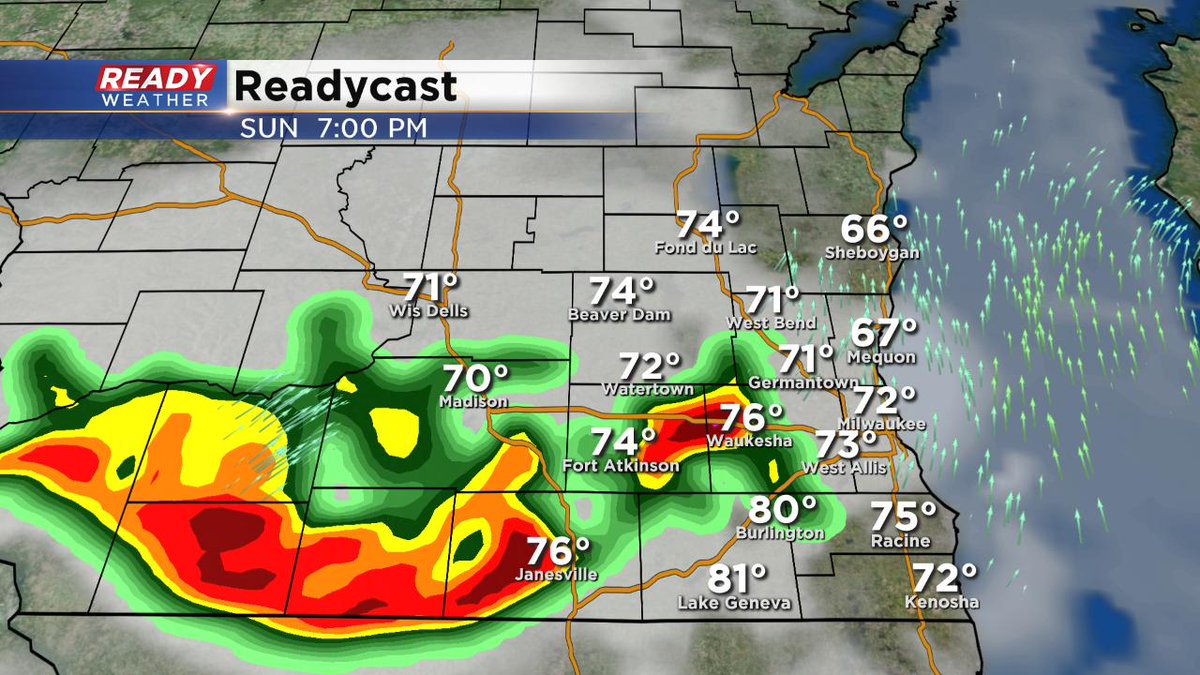
8:30 pm Sunday:
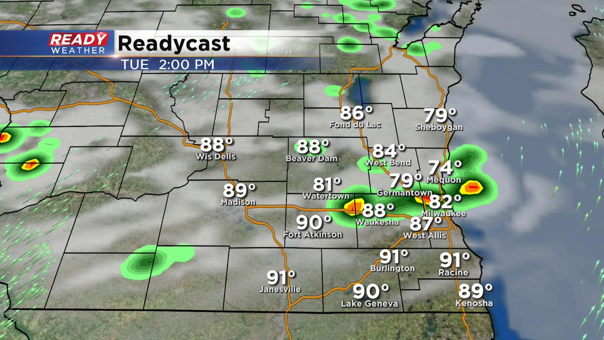
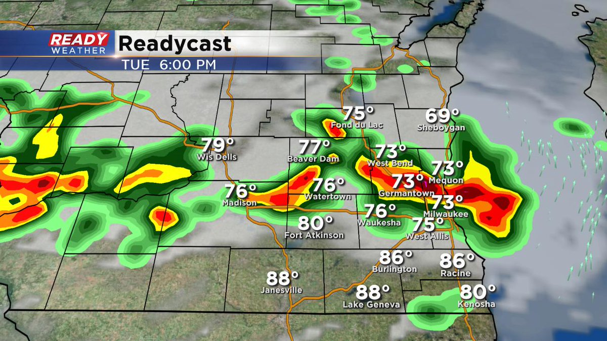
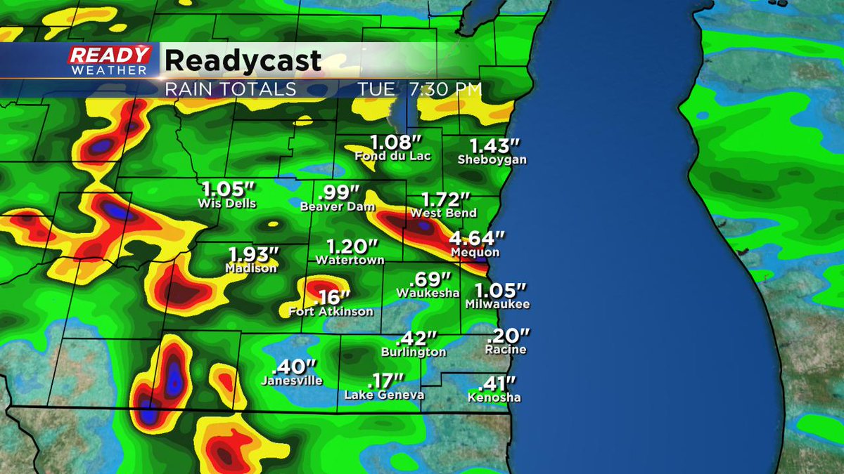
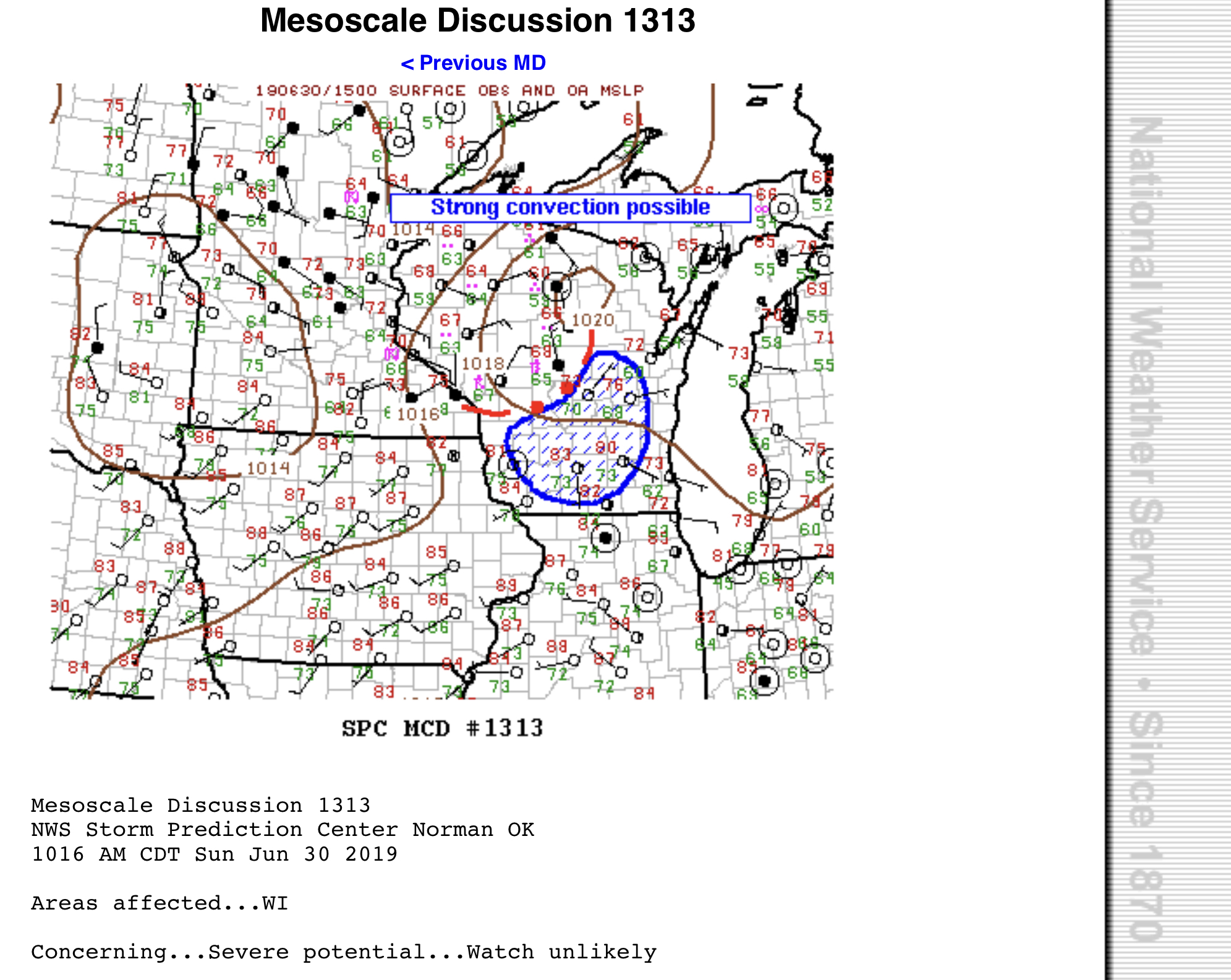
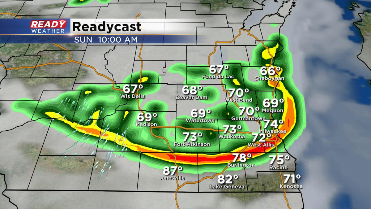
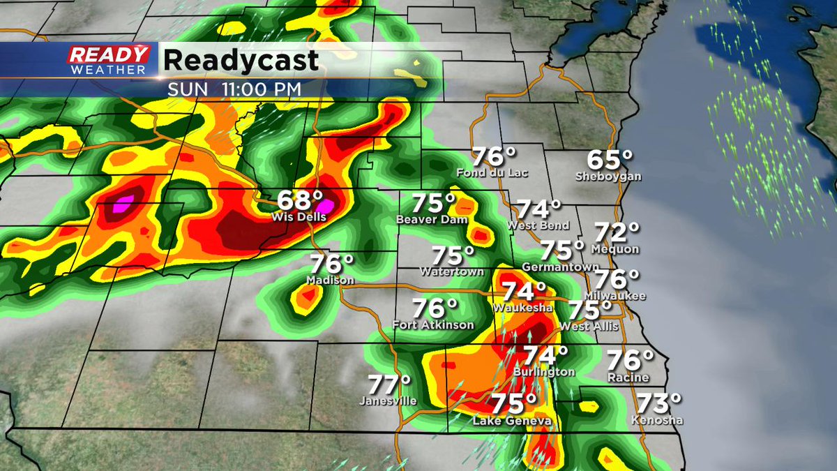
We should stay quiet this evening and overnight. And then things will fire up again, on and off, much of this coming week, especially with the intense heat and humidity expected the next few days. Any storm could be strong with heavy rain, hail, and damaging wind. I don't really see a pattern change until the weekend. Keep in mind we'll have plenty of dry times through the 4th of July. But you'll have to dodge the rain and storms periodically.
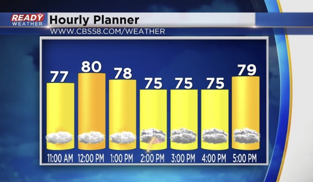
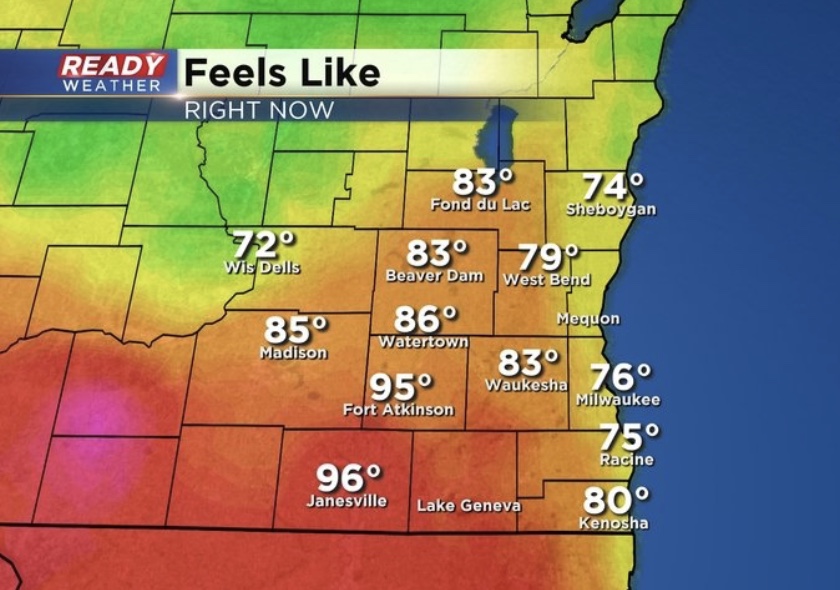
Pace yourself this week too. At times, with the humidity, it'll feel well in the 90s, especially the first part of the week.
_____________________________________________________________________________________________________________
2:30 pm Sunday:
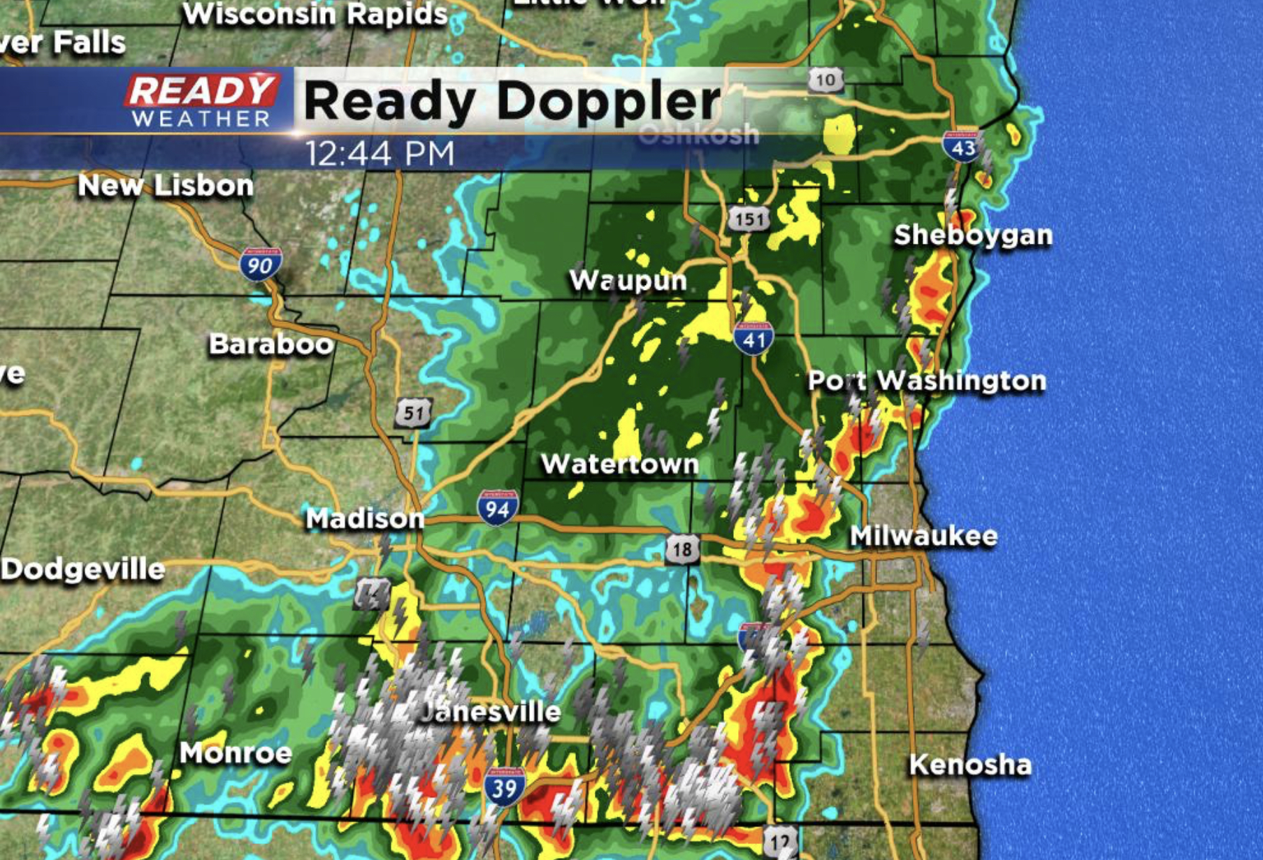
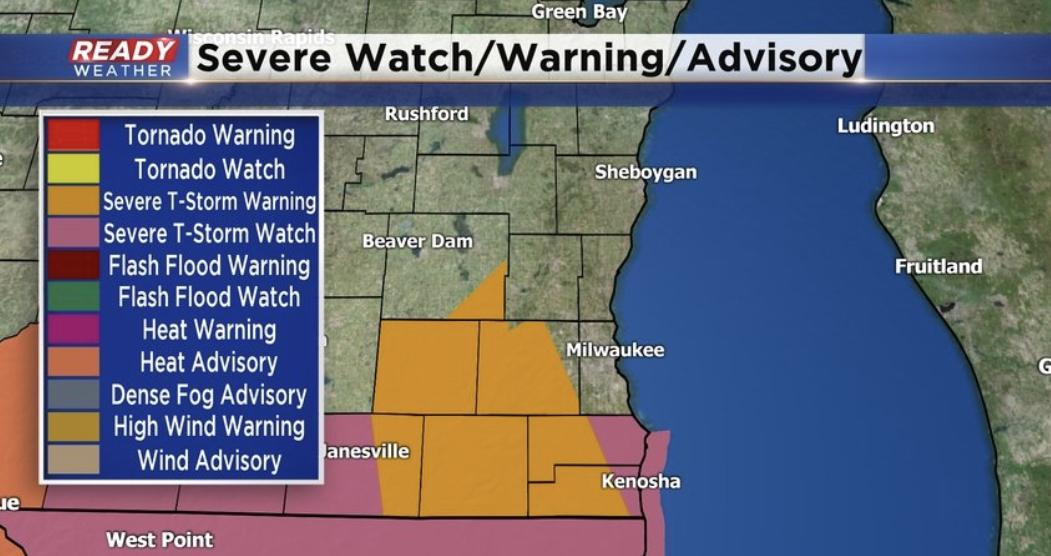
We've quieted down for a time now. All the warnings and watches have been dropped. However, a lot of cleanup is underway, especially across Walworth and Waukesha Counties. Winds more than 60 mph were clocked in certain areas as the storms roll through between 11 am and 1 pm. Oconomowoc and Ixonia are two places hit hard. Some of this same general area was affected on Thursday by storms. More storms are possible into this evening, especially west of Milwaukee. And then we stay in the active pattern much of this week right through the 4th of July.
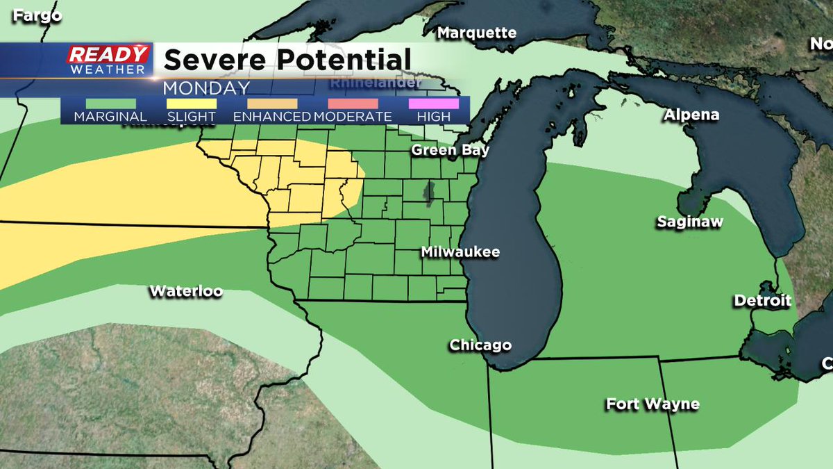
Another issue will be the warm, muggy conditions. Look for highs in the 80s for the week with heat indices in the 90s for many of us too.
______________________________________________________________________________________________________________
1pm Update: Storms with lightning, heavy rain and gusty wind close in on Milwaukee county. There is no warning for Milwaukee county, but we continue to see reports of trees and branches down on gusts around 50-60mph. Please take cover now as the storm passes through.
————————————————-
Storms could contain strong wind gusts to 60mph along with some hail. At this point most locations under this line have reported some branches down with gusty wind.
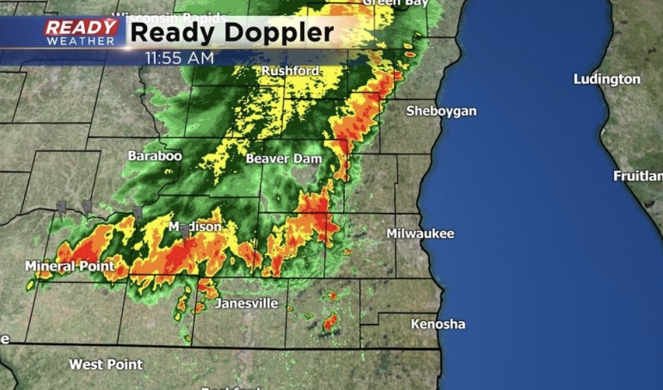
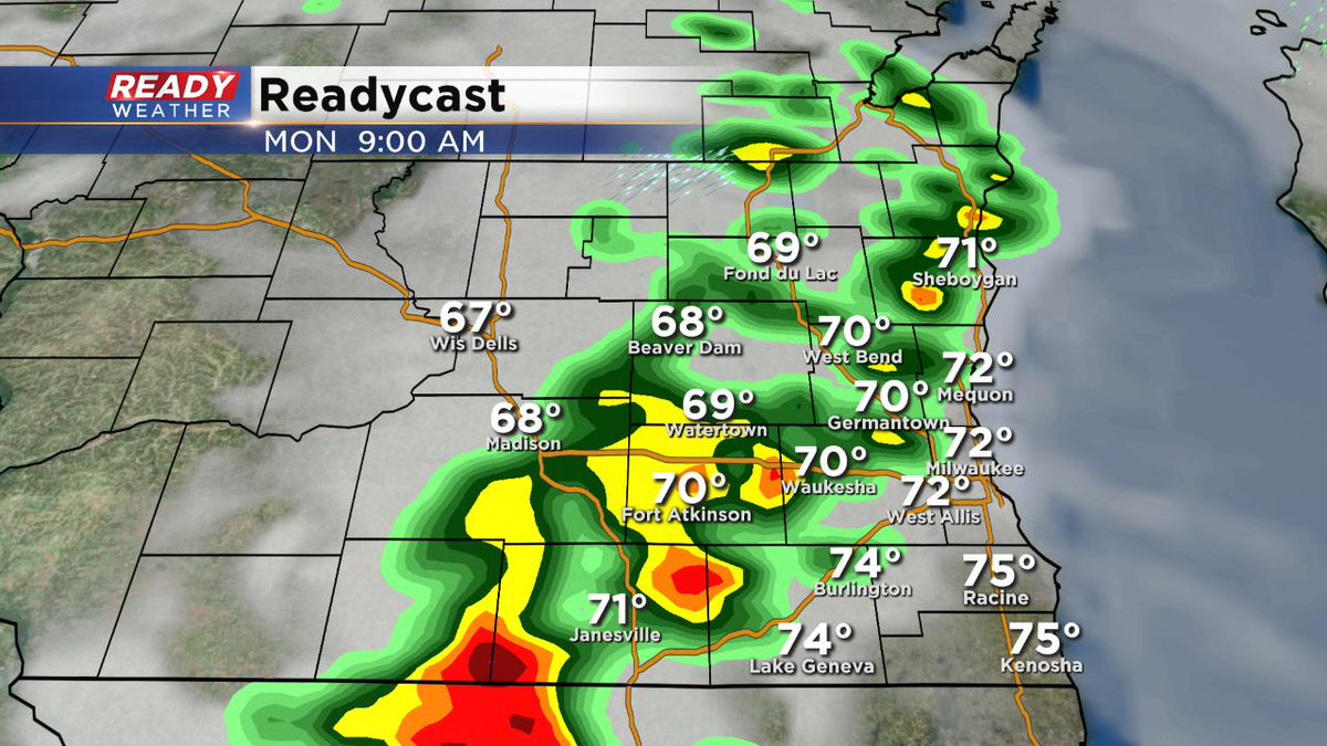
Sunday 10 am update...
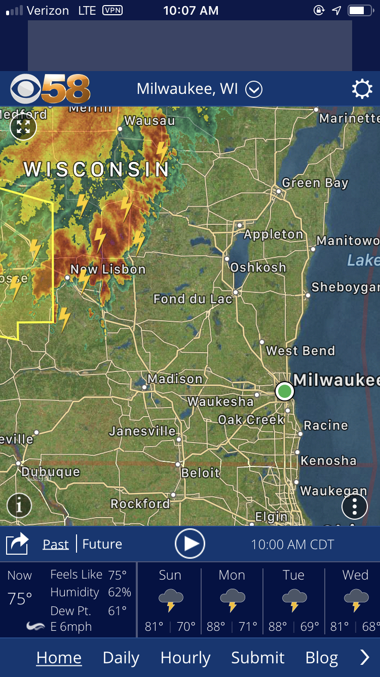
Still on track for having storms roll through between lunchtime and the middle of the afternoon across southeast Wisconsin. It looks like the overall band has weakened. But the threat is still there for gusty winds, large hail, and heavy rain. Again, make sure to seek shelter if these thunderstorms fire up where you are. Today is a good day to download the CBS58 weather app if you haven't already. It's free to use and very functional on a day like this! There are many more chances of storms through much of this week, including July 4th itself. Stay tuned to CBS58 for the latest weather information and of course right here on cbs58.com.
_____________________________________________________________________________________________________________
Sunday 6 am update…
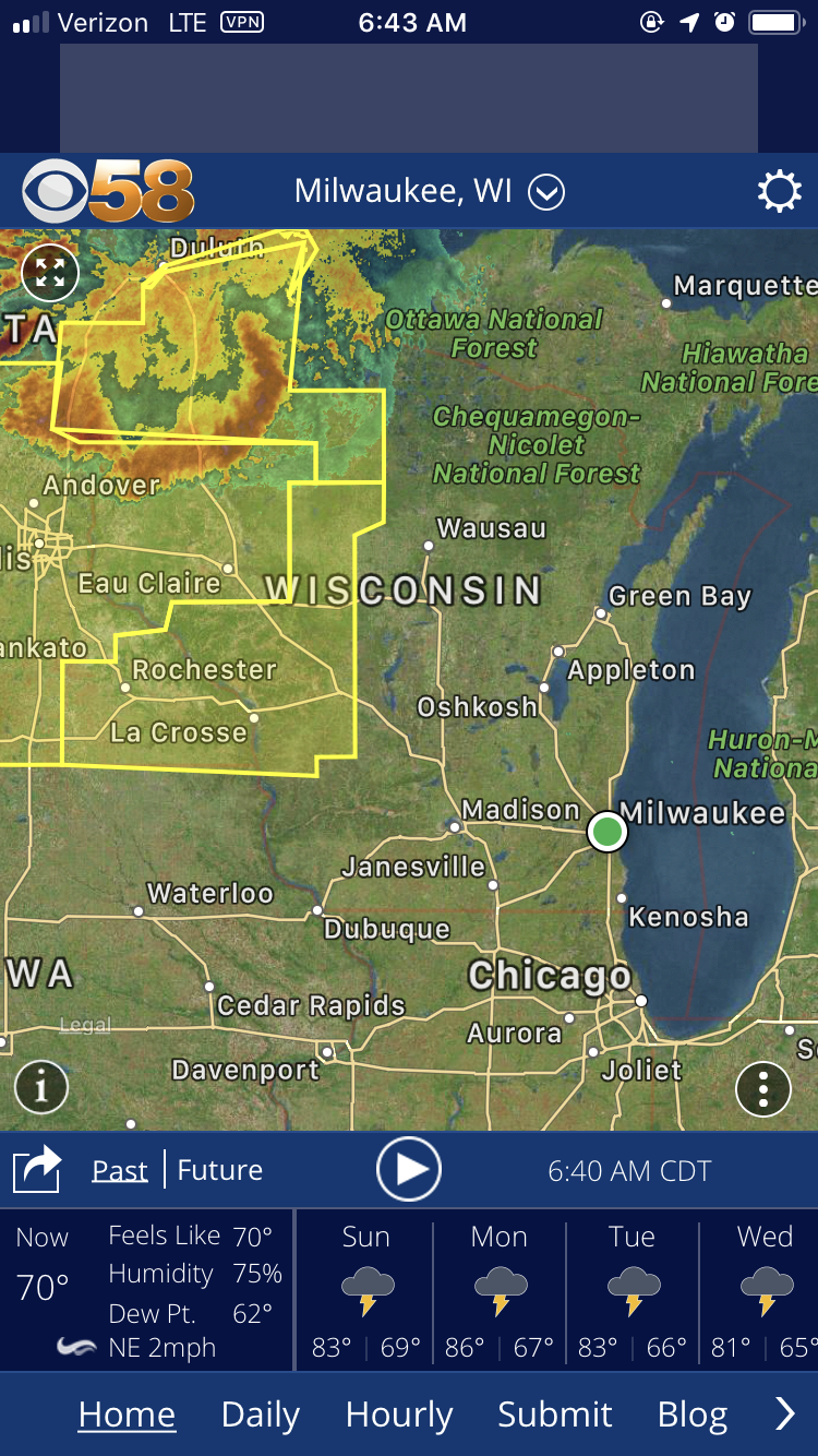
A “bowed” area of severe storms is pushing through the northwestern part of Wisconsin and is expected to be here after 11 AM. Winds more than 60 miles an hour, large hail, and very heavy rains are all possible. If you see the storms fire up, head indoors or seek shelter. Keep
____________________________________________________________________________________________________________
Saturday Updates..,
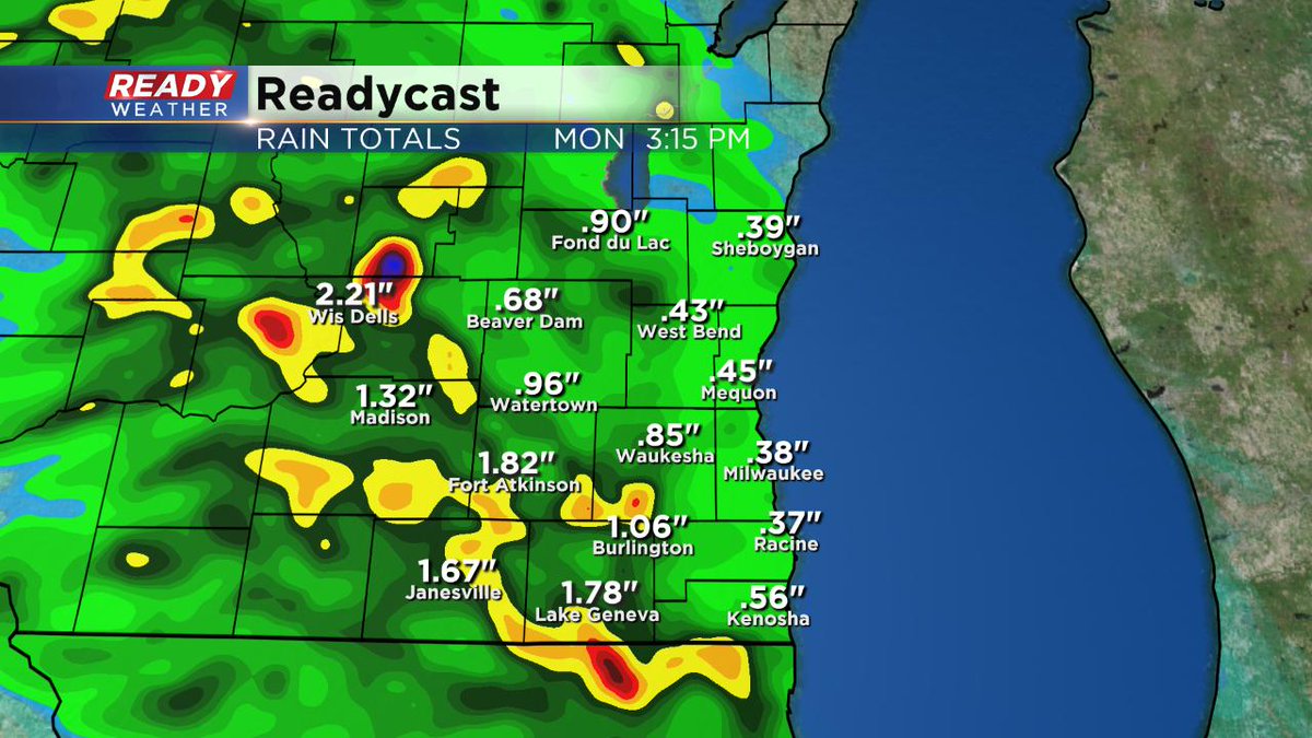
Milwaukee (CBS 58)--Enjoy what we have now because it's getting stormier, in waves, on Sunday. Look for showers and storms to breakout by 8 or 9 o'clock in the morning and linger to around lunch. Then another chance of storms is possible later Sunday evening, say after 9 pm. A warm front is lifting north that will help trigger the storminess. Heavy rain, gusty winds, and large hail are all possible with these storms. One to two inches of rain could fall. Don't cancel the plans but please keep an eye to the sky and the free CBS58 weather app.
I should mention there's a slight risk for severe weather as well.
Meantime, the pattern stays stormy through the July 4th holiday. However, the upcoming weekend is trending drier at least according to the reliable Euro computer model.