Overnight Update: Scattered rain and a few storms possible overnight. Wind gusts to 60 mph possible Saturday along with an isolated tornado.


Updated: Friday, November 4th 11:00 pm:
A round of showers and storms produced several reports of hail across southeastern Wisconsin this afternoon. Hail up to golf ball size was reported in Dodge county. Additional rain and storms are possible tonight; however, we don't expect additional severe weather.

Through tomorrow afternoon areas west of Milwaukee will pick up an additional 1" of rainfall. Lower totals are expected for the southeastern part of our area near Racine and Kenosha counties.
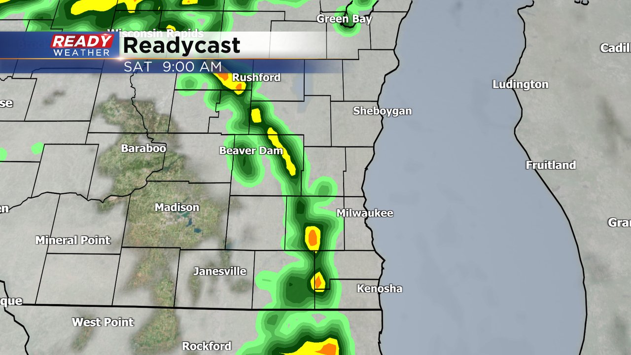
A line of showers and possible storms are possible for Saturday morning between 7 am and Noon. There's a chance that a few isolated tornadoes could develop. They would be very short lived and would move very fast.
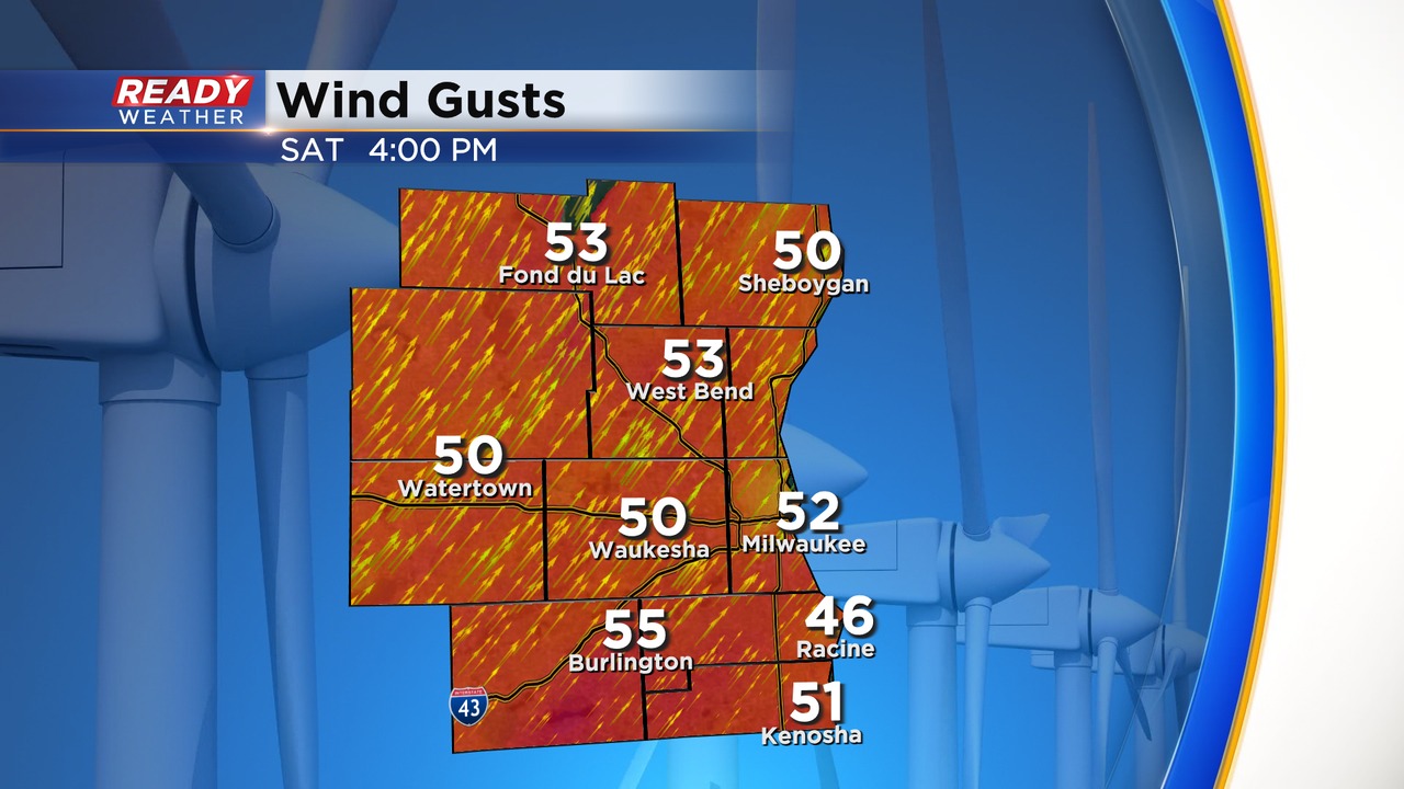
After that line passes very strong winds will gust Saturday afternoon. Gusts approaching 60 mph can't be ruled out. A wind advisory is in effect for all the area on Saturday.
_____________________________________________________________________________________________________________
Updated: Friday, November 4th 11:30am:
A couple of strong thunderstorms have developed this morning and have been racing northeast at 55 mph. A few more storms are developing northern Illinois and will continue on this trajectory into the afternoon.
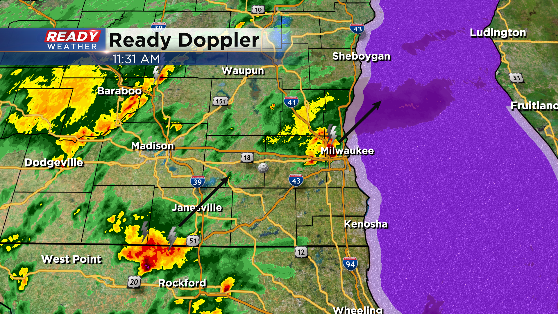
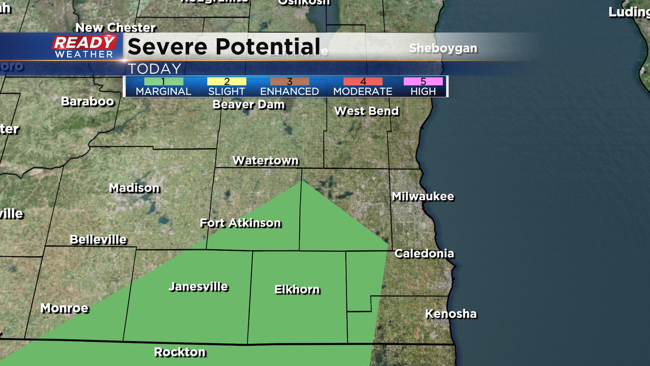
These storms have the potential for gusty winds and small hail. Given that the storms have been borderline severe at times, the Storm Prediction Center has placed a small portion of southern WI in a Marginal Risk (level 1 of 5) for this afternoon.
Areas northwest of the Marginal Risk will experience more widespread, steady rainfall as opposed to scattered storms. This widespread rainfall will overspread all of SE WI tonight.
--------------------------------------------------------------------
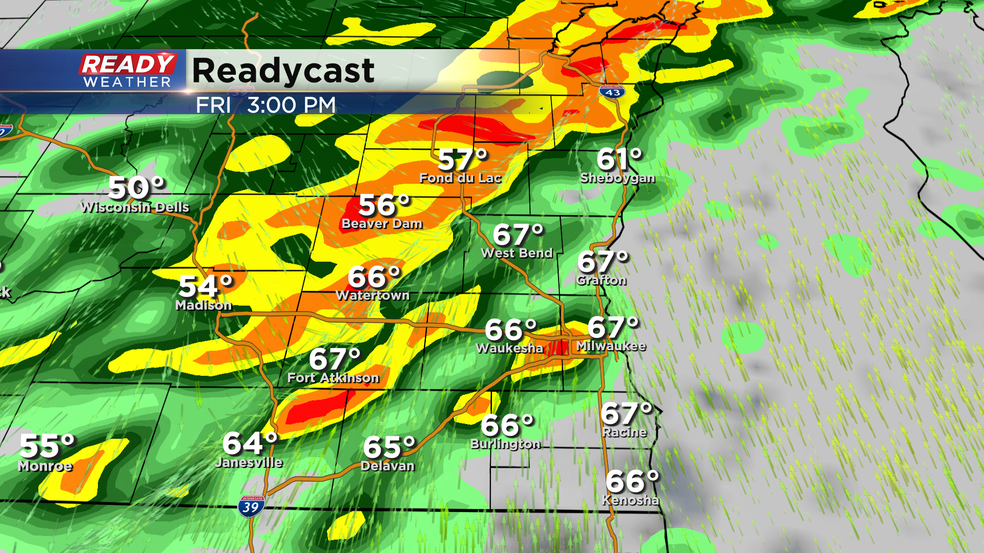
After a week of quiet and warm weather with plenty of sunshine, our atmosphere is changing in a big way. A round of rain, heavy at times, will start rolling into southeast Wisconsin Friday afternoon and last in some areas for 24 hours.
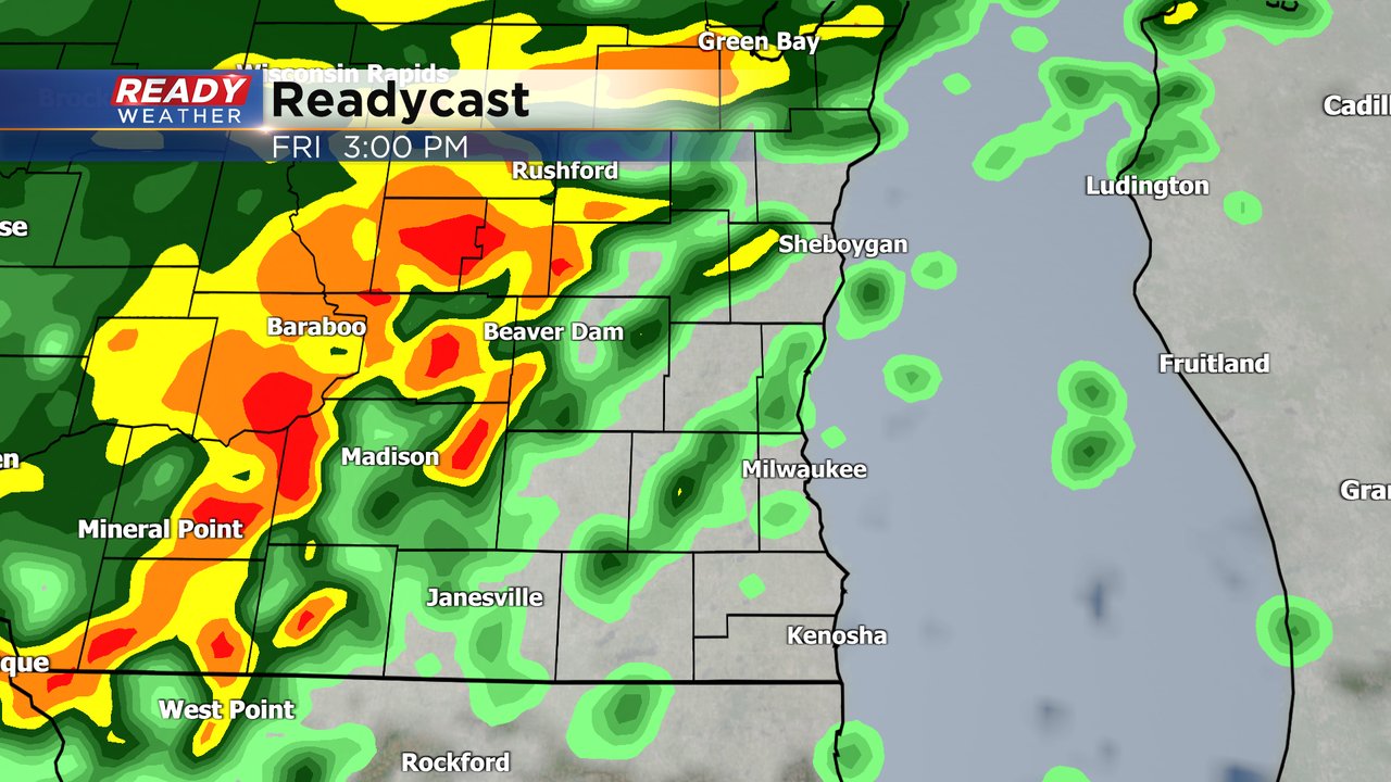
The amount of rain you pick up will heavily depend on where you live. Northwest counties like Fond du Lac and Dodge with see the steadiest and heaviest rain with around 2" there. Southeast counties like Racine and Kenosha may not even see a half inch with only light scattered showers Friday and Saturday.

A line of showers Saturday morning may not look like much on radar but could actually cause the most problems. The set up is very similar to a few weeks ago where a few brief spin up tornadoes are possible. The showers that could form the tornadoes will form along a cold front pushing through southeast Wisconsin between 8-11 AM. Stay weather aware and have a way to get warnings Saturday morning.
We've been on record watch most of this week and all three days to start the month have reached the 70s which has never happened before in November in recorded history. Despite reaching the 70s, we've stayed short of any record highs. Friday will be our last chance with expected highs in the upper 60s and records in the low 70s.

The wind that started to gust higher Thursday will stay high on Friday with gusts to 30 mph. Saturday is the extremely windy day with gusts to 50 mph with more wind lingering on Sunday.

The extreme wind expected on Saturday has led to a wind advisory being issued for all of southeast Wisconsin. The advisory runs from 4 AM Saturday through 10 PM (basically all day). Some brief power outages will be possible with the strong wind as well as blowing debris from construction sites and semi trucks should take extra precautions.

Download the CBS 58 Ready Weather app to track the wind, rain and possible tornadoes.