Wintry Mix Ends
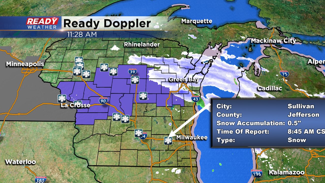
11:30 am update: All the advisories in our area have been canceled. Temperatures stayed a touch warmer and that really made all the difference.
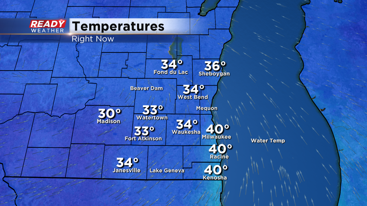
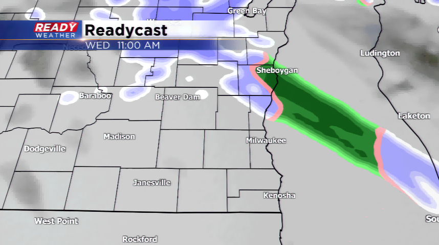
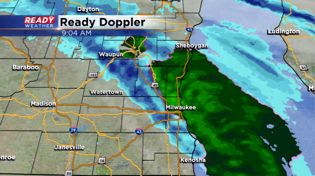
9:00 am update: The snow/rain is tracking northeast into the eastern sections of southeastern Wisconsin. We are still expecting the precipitation to end by noon today.
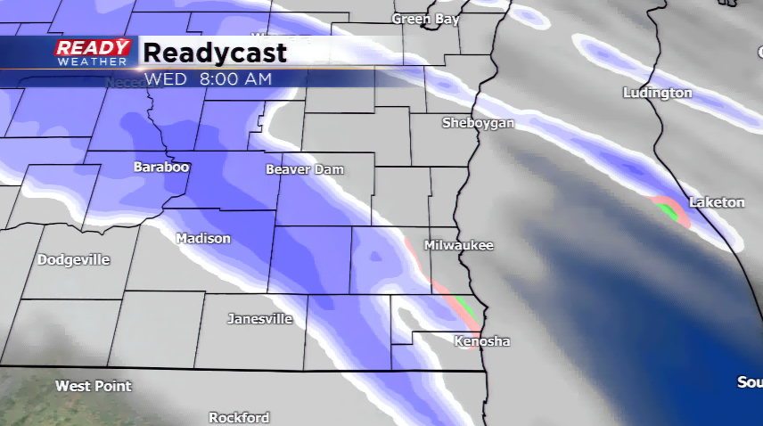
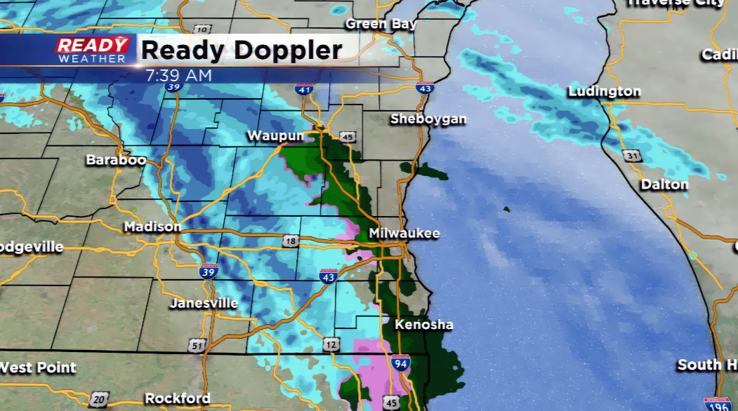
7:30 am update: snow and freezing precipitation is overtaking parts of southeastern Wisconsin. The radar is even showing green which means liquid, but with surface temps around freezing, expect a slow drive in to where you need to go this morning!
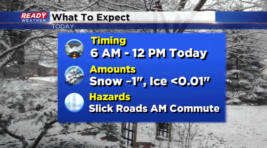
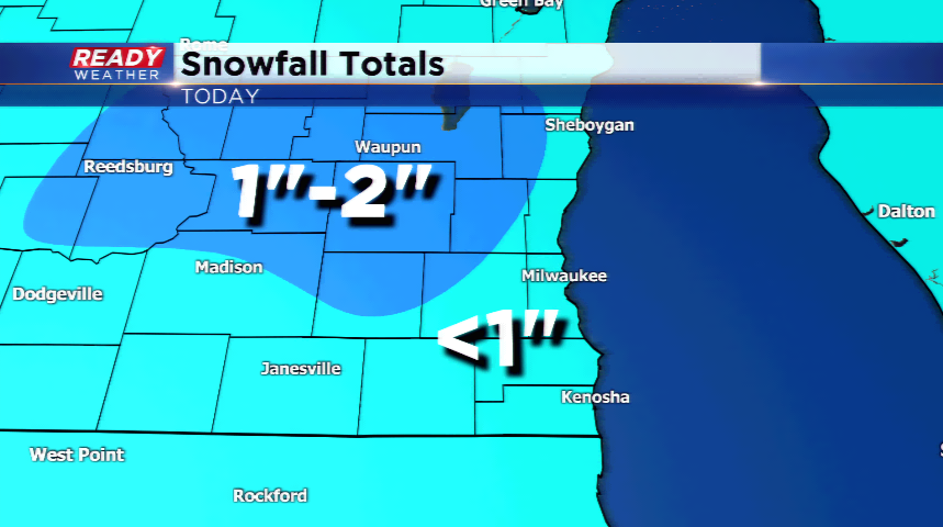
A Winter Weather Advisory has been posted for all of southeast Wisconsin for this morning. The threat of a wintry mix, specifically freezing drizzle and/or light snow, will be present with a fast-moving area of low pressure. Snowfall amounts will not exceed 2”, and that will be the highest possible northwest of Milwaukee. Most of the metro will see less than an inch with the warm temperatures and the thin line of precipitation tracking into the region.
The activity will drive in after 6 am, and the leading edge could be the light drizzle that will freeze on impact. Slippery roads will be possible. Expect the precipitation to end early this afternoon as it lifts north and east of the region.