11AM Update: Snow is done, main roads are improving


Updated: 11:00 a.m. December 30, 2020
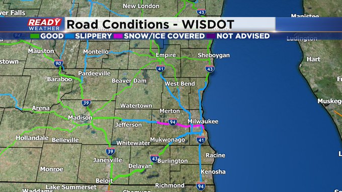
The winter storm has passed! But we still have plenty of snow and slush around area roads. Here's the latest from the Wisconsin DOT:

Updated: 9:26 a.m. December 30, 2020
The snow has wrapped up in southeast Wisconsin and any lingering winter weather advisories have been canceled. Snow reports haven't changed much from the graphic shown below with much of the area seeing 4-8" except for our far nothern and southern spots. Road conditions have also improved with most of SE Wisconsin now listed as slippery or good instead of snow covered. Enjoy the snow! Our next round arrives Friday.

------
Posted: 6:06 a.m. December 30, 2020
The heaviest of the snow fell Tuesday night into early Wednesday morning. By 3 a.m. only some areas of light snow were remaining. At points that snow was mixing with some light sleet or freezing drizzle. The winter storm warning has been canceled but a winter weather advisory remains for most of southeast Wisconsin. Some of the freezing drizzle could remain for the next few hours causing a glaze of ice to form.

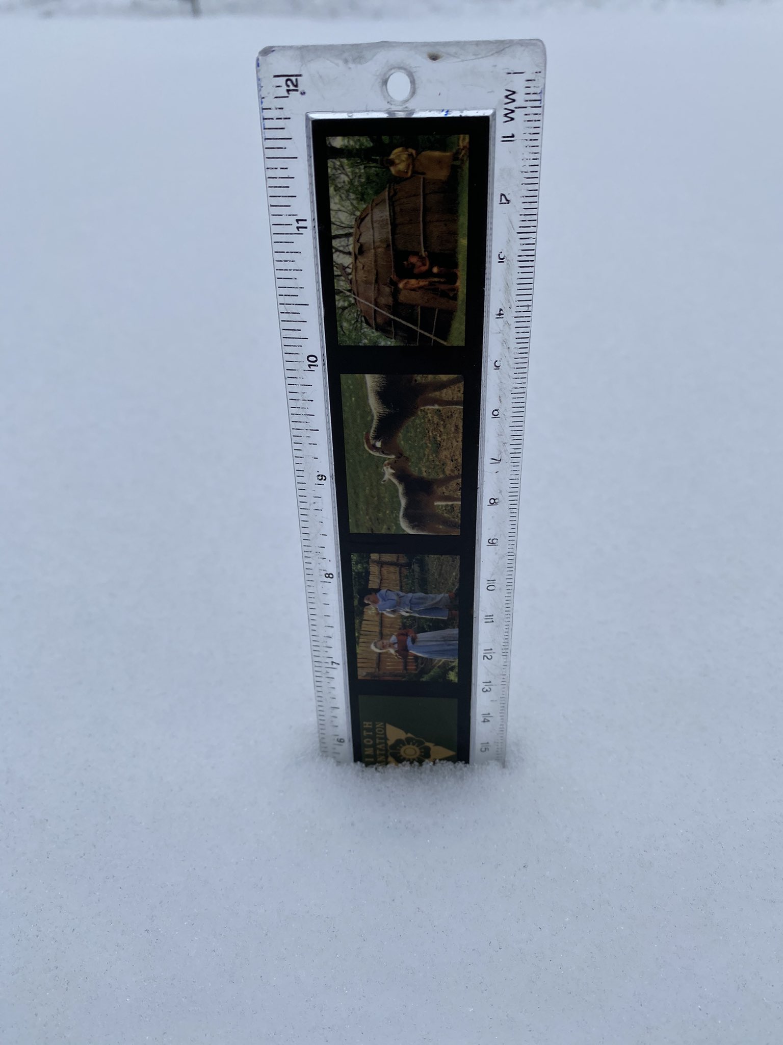
Snow reports are still coming in with a bulk of southeast Wisconsin picking up 6-9" of snowfall. Milwaukee officially picked up 4.8" at the airport. Northern counties like Fond du Lac didn't get as much with 2.2" reported there.

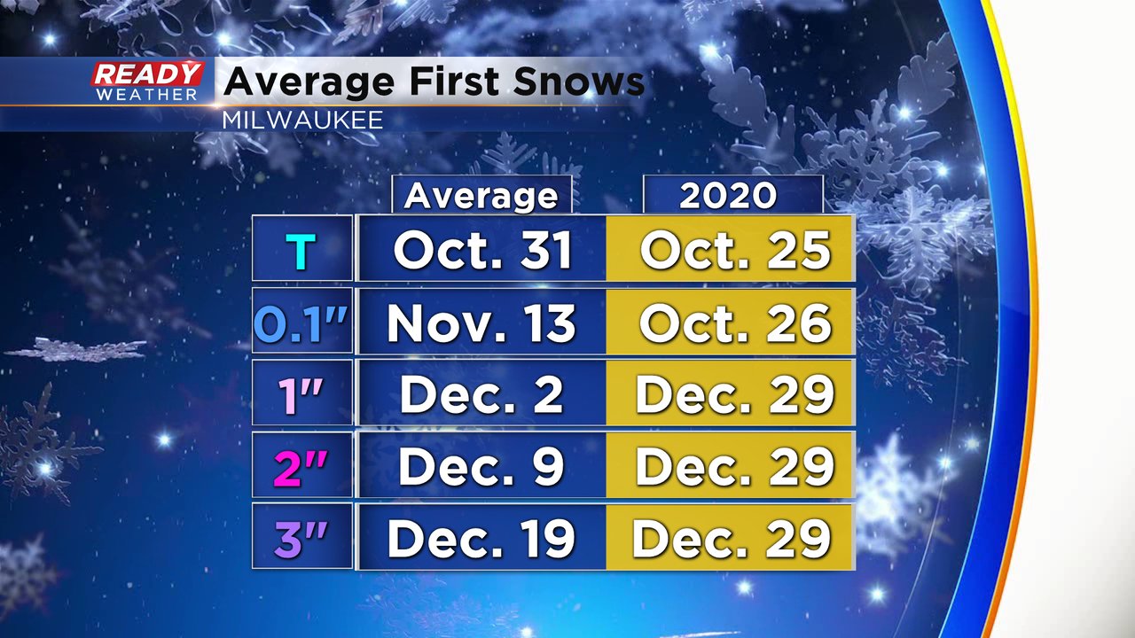
Before this snowfall Milwaukee was about four weeks behind average for it's first inch snowstorm. Milwaukee picked up 3.7" before midnight meaning it's first 1", 2" and 3" snowfalls will go down as December 29th.
The lingering freezing drizzle and light mix is expected to wrap up by mid-morning with some sunshine returning in the afternoon. Any sunshine will help to improve the highways in southeast Wisconsin which have already started to improve. As of 6 AM most of the roads are being reported as slipper or snow covered and continue to improve.

Download the CBS 58 Ready Weather app to track the next round of snow that arrives Friday.