Cold air continues with dangerous wind chills through the middle of the week


Afternoon Update:
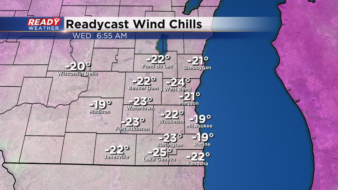
The coldest of the cold arrived this morning. Check out these wind chills:

The cold isn't going anywhere. All day Tuesday will be another day of dangerous cold. The wind chill advisory has not changed at all and is still scheduled to end Wednesday morning at 9 AM. We may potentially see more wind chill advisories at night through the weekend.

By Wednesday morning wind chills are starting to improve a bit but still very cold in the 20s below-zero with frost bite developing in 15-30 minutes.
Wind chills will slowly get better through the rest of the week with feels like temperatures reaching around 0 Wednesday afternoon. Thursday morning wind chills are back to a normal Wisconsin winter cold in the teens below-zero in the morning and above-zero during the afternoon.

The winds are higher on Tuesday with gusts to 30 mph and they stay elevated through Tuesday night. Wednesday the breeze remains but a nice lighter wind will arrive by Thursday.

Check out the morning low temps through the weekend. Away from the lakefront air temps hang out in the single digits below-zero most mornings. Lakeside we are a little warmer around zero or just above. It's not until Sunday afternoon that we really start to warm.

Download the CBS 58 Ready Weather to track all the temps and wind chills the rest of the week.