Scattered storms moving out


The scattered showers and storms will continue to move out by 11 pm. No further rain or storms are expected overnight.
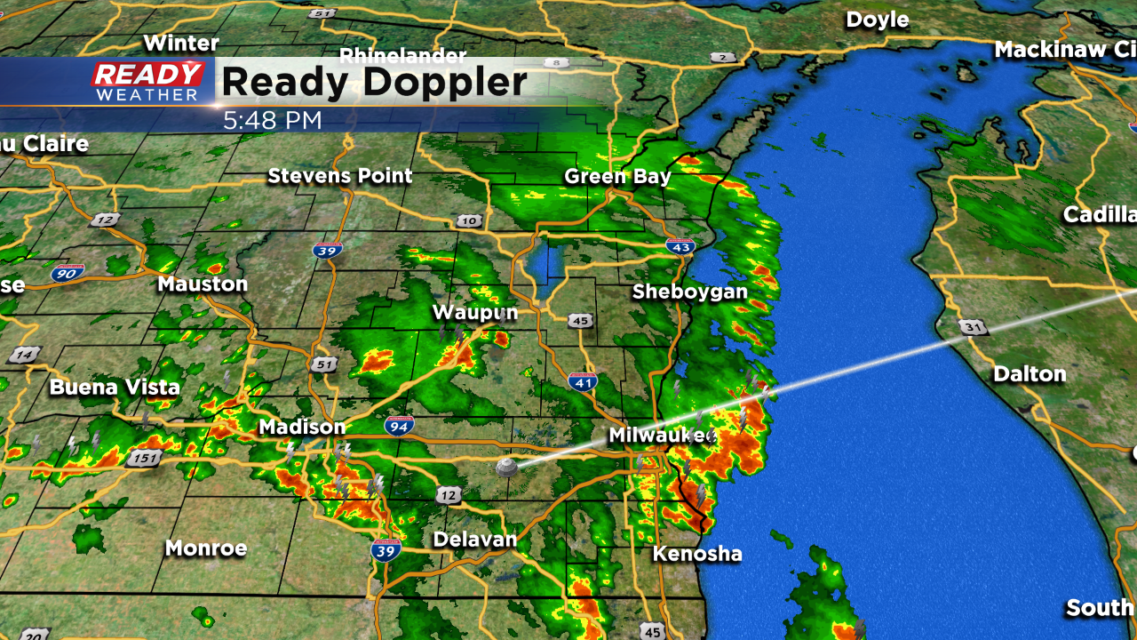
6 PM Update:
Heavy rain and embedded thunder continues across southeastern Wisconsin this evening. No severe weather has been reported. Some pea size hail was reported; however, nothing close to quarter size.
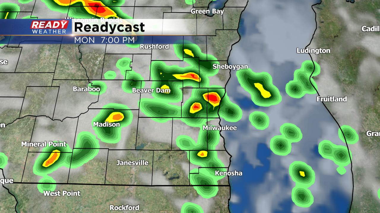
Models continue to move the rain and storms out after 8 pm.
______________________________________________________________________________________________________________

4 PM Update:
Scattered showers and storms are now moving into the area. Thankfully storms have weakened some as they move east. No watch is expected and these storms will likely stick around through 8 pm.
Some cells may produce very small hail and some gusty winds; however, overall severe weather is not anticipated at this time.
______________________________________________________________________________________________________________
2 PM Update:
The first batch of showers and storms has pushed through the area. That rain has temporarily reduced the overall instability.
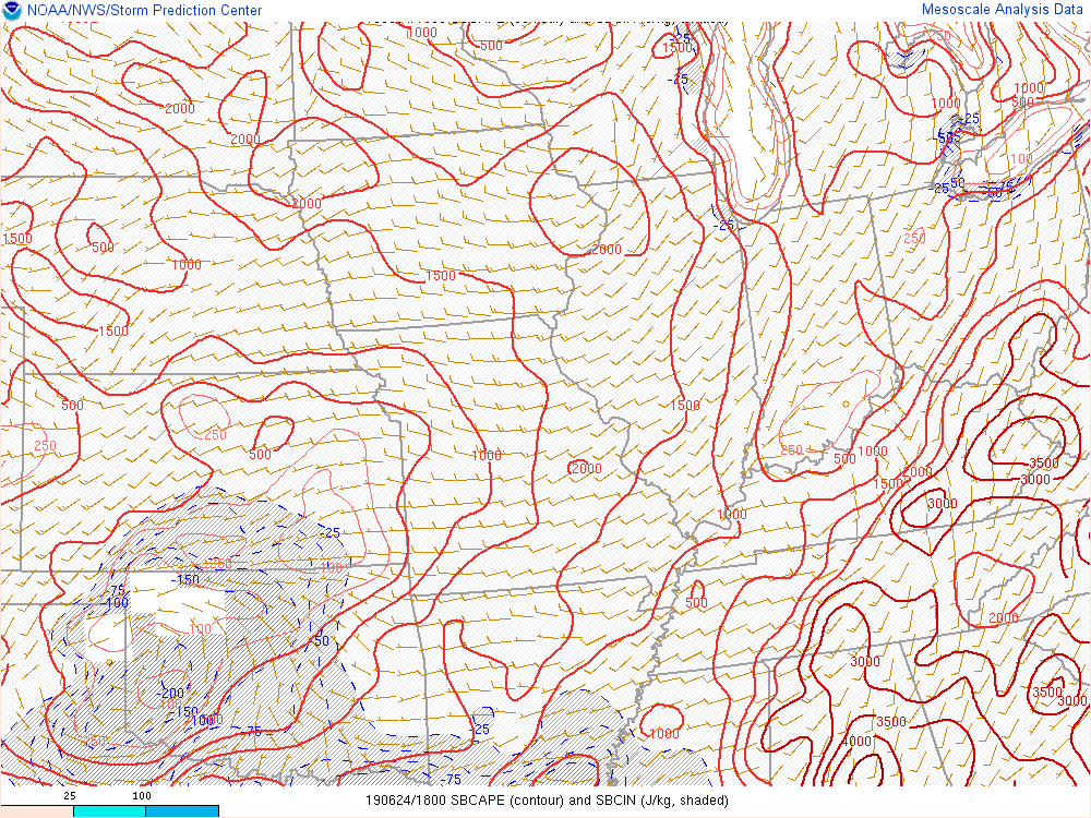
We feel that over the next several hours some sunshine and cold air aloft will fuel additional showers and storms. Take a look at the graphic above. You can see a nice pocket of CAPE across southwestern Wisconsin. This should grow with more surface heating.
Showers and storms this afternoon will have the chance to produce hail and gusty winds. Storms are expected to decrease after dark.
Some storms could become strong to severe!
______________________________________________________________________________________________________________
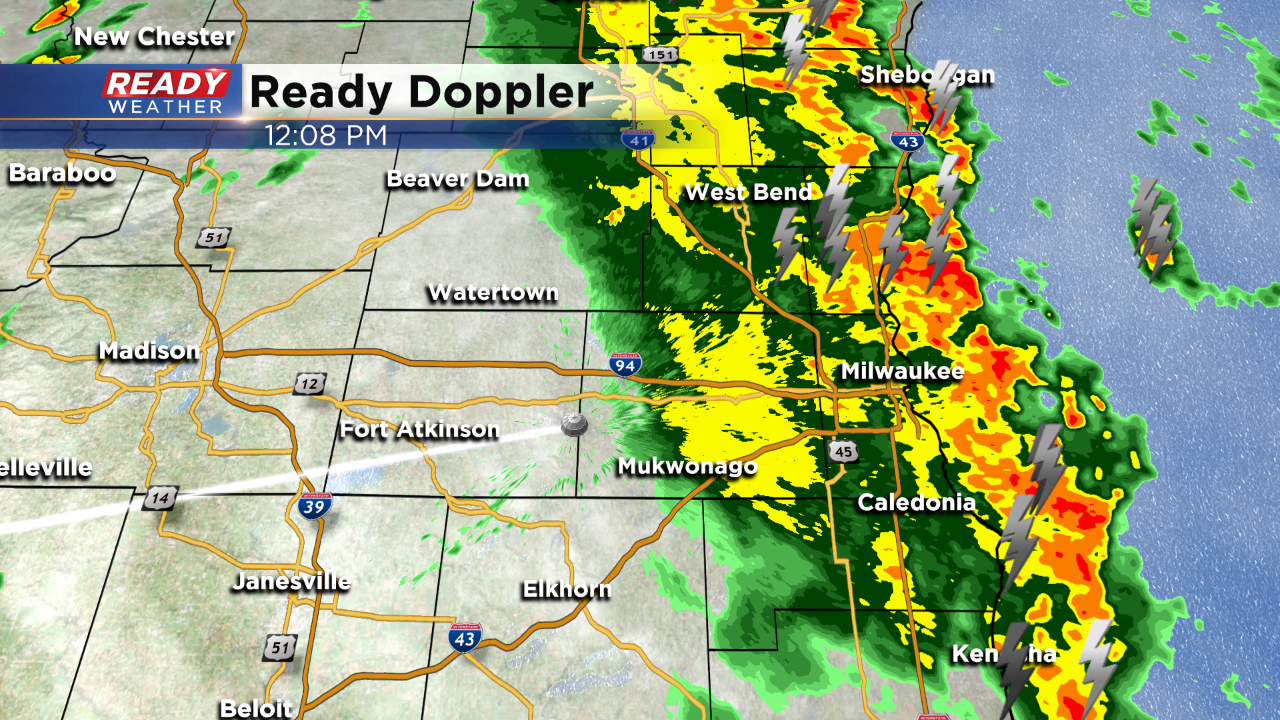
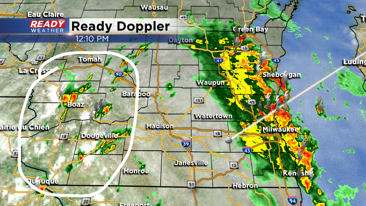
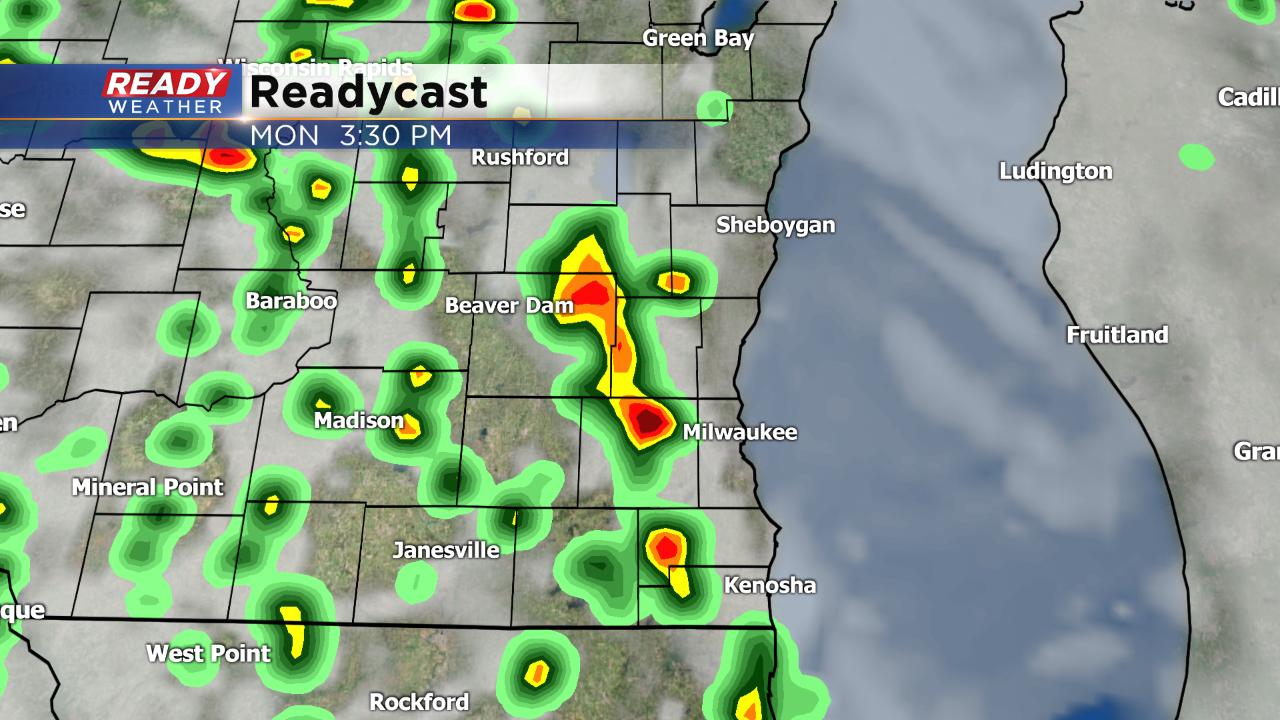
Noon Update: Non-Severe showers and storms with downpours and lightning are headed to the lakefront this noon hour:
Updated: 9:04 a.m. June 24, 2019
A few light sprinkles and showers have popped up Monday morning but thunderstorms are still on track for this afternoon. Instead of two separate rounds of storms, weather models are now showing scattered activity for most of the afternoon and early evening. The best chance for a strong to severe storm will be from 3 p.m. to 8 p.m.
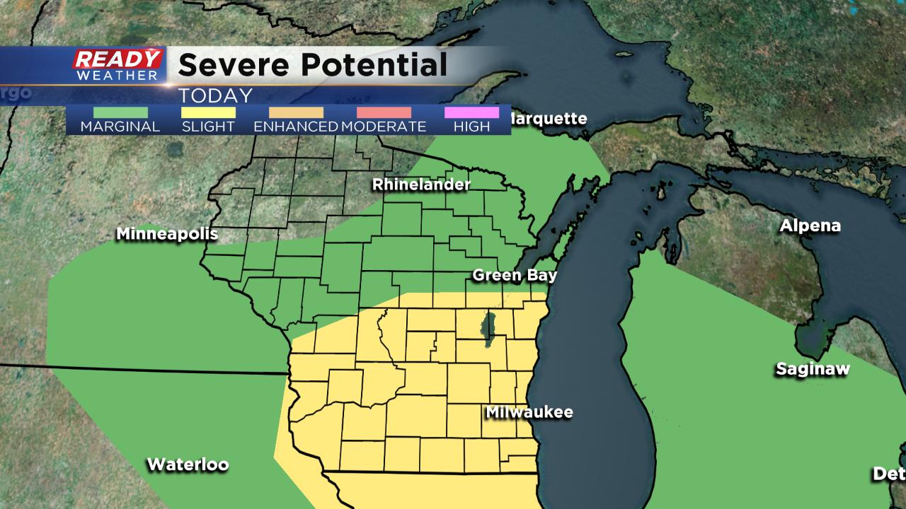
The morning update for severe potential has no major changes in southern Wisconsin but it did push the "slight" risk a little farther north towards Green Bay.
------
Posted: 5:50 a.m. June 24, 2019
After a few scattered showers and storms on Sunday, the chance for more wet weather increases Monday. Most of southeast Wisconsin is waking up to clouds and a touch of humidity with dew points in the muggy category. After a predominately dry start to the day, showers and storms will roll through Monday afternoon and evening. It looks likely that two rounds of scattered storms will move in. The first arrives between noon and 3 p.m.
The second round will push through between 5 p.m. to 7 p.m.
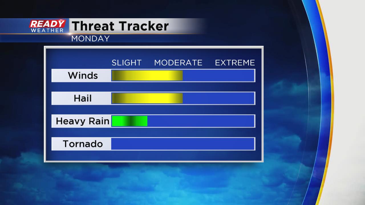
Both rounds of storms today could be strong to severe. Almost the entire CBS 58 viewing area is in the "slight" risk for severe weather with a "marginal" risk stretching into the northwoods. Widespread severe weather is not anticipated, but some isolated severe storms are possible.
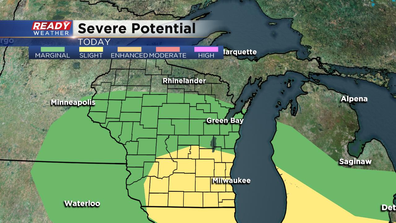
If strong to severe storms do develop the main threats will be damaging wind and large hail. Some heavier downpours are possible, but the flooding risk is low. There is no tornado threat.
Download the CBS 58 Ready Weather App to track the rain and storms as they develop. If watches or warnings are issued, the weather app will alert you.