Sunday Update: Wind chill advisory issued for all of southeast Wisconsin Sunday night


Updated: 9:49 a.m. March 3, 2019
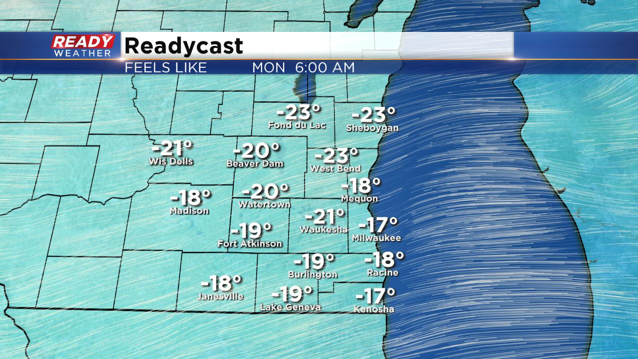
A wind chill advisory has been posted for all of southeast Wisconsin starting Sunday night at 10 p.m. and lasting for 12 hours until 10 a.m. Monday morning. Wind chill values during this time period could get as cold as -25, especially for inland spots.
Another wind chill advisory may be needed for at least part of southeast Wisconsin Tuesday morning.
------
Posted: 6:30 p.m. March 2, 2019
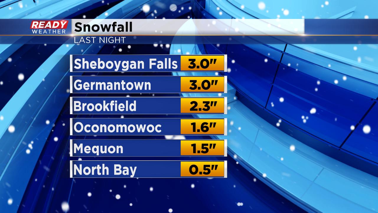
Most of southeast Wisconsin woke up to a fresh blanket of snow Saturday morning. Anywhere from a few tenths of snow in southern spots to a few inches in northern spots fell. Milwaukee officially picked up 1.2" of snow bringing the snow total since November to 48.2" which is almost 10" above-average.
Now that the snow is over the cold is moving in. Temperatures will get chilly Saturday night and stay that way through most of the work week. Wind chill advisories and warnings have already been issued to our west and north for most of the Upper Midwest. A wind chill advisory will likely be needed for Wisconsin for Monday morning and possibly again Tuesday morning.

Wind chills will be at their most dangerous levels Monday morning hitting -25° in some spots. At those conditions frost bite can settle in in under 30 minutes.
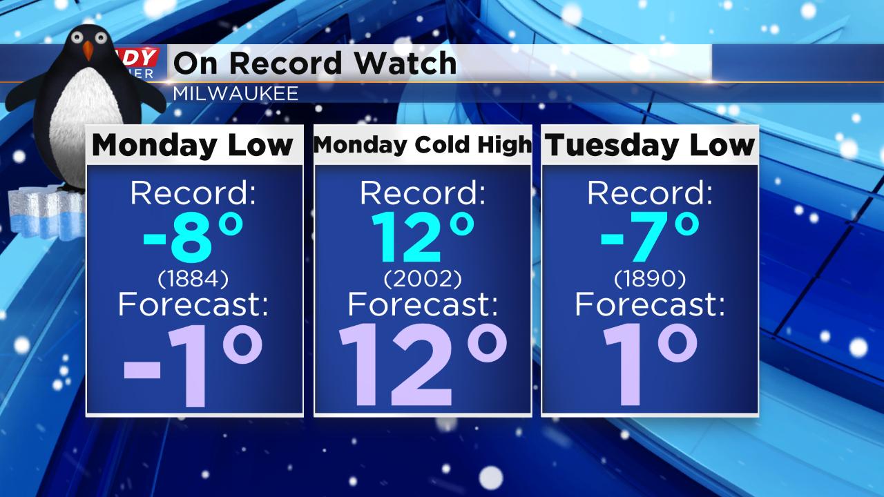
Temperatures do look a little warmer for Sunday night through Tuesday but are still bitterly cold and close to records. The best chance for a broken record looks to be Monday's high temperature. The record for the coldest high temperature on Monday, March 4, is 12° which is also the current forecast high temperature. Low temperatures could be in jeopardy Monday and Tuesday mornings but right now Milwaukee looks to stay away from records.
Download the CBS 58 Ready Weather app to track the temperature and wind chill where you live and see when snow returns to the forecast.