Few stronger cells possible tonight; more rain again tomorrow


Looks much nicer outside this evening after the heavy rain and thunderstorms from earlier cleared out! Low pressure, however, does still remain right over us here in Wisconsin, meaning the chance for precip still lingers on.
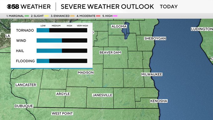
Out ahead of this system, a warm front lifted pushing in a light breeze out of the south helping us not only warm back up into the mid-80s today but also brought in plenty of humidity! Hot and humid conditions will continue on for this evening, which could help fuel some possible stronger cells. Main impacts to watch out for include small hail and gusty winds but cannot rule out and isolated tornado at this point.
This system will clear as we get closer to bed time tonight, but that clearing is short lived, as by the time we get to mid-morning Sunday, another round of scattered storms are possible. These storms are not expected to be severe, but a few heavy downpours and rumbles of thunder are possible. We should stay non-severe, as behind this stormy system a cold front is dropping through, we which help ease the heat and humidity.
Expect highs to remain only into the 70s over the next couple days but will not last for long as our next stormy system builds in pushing in another warm front bringing in extreme heat and humidity. This will yet again help fuel some stronger storms possible for many days of our next work week.