11:15 PM Update: Storms lifting north tonight, but another chance comes Sunday with the cold front


Updated: 11:45 pm Saturday, August 28th:
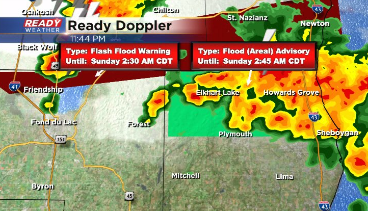
A Flash Flood Warning has been issued for extreme northern Fond du Lac county until 2:30 am due to 2-3" of rain falling over 2 hours. Some flooding has been reported in Marytown, which is on the Fond du Lac/Calumet county line. An Areal Flood Advisory has also been issued for northern Sheboygan county due to the heavy rain from the slow moving storms. Remember to NEVER drive through flooded roadways, especially at night since you can't tell how deep the water is and whether or not a road is crumbling.
---------------------------------------------------------------------------------------------------------
Updated: 11:00 pm Saturday, August 28th:
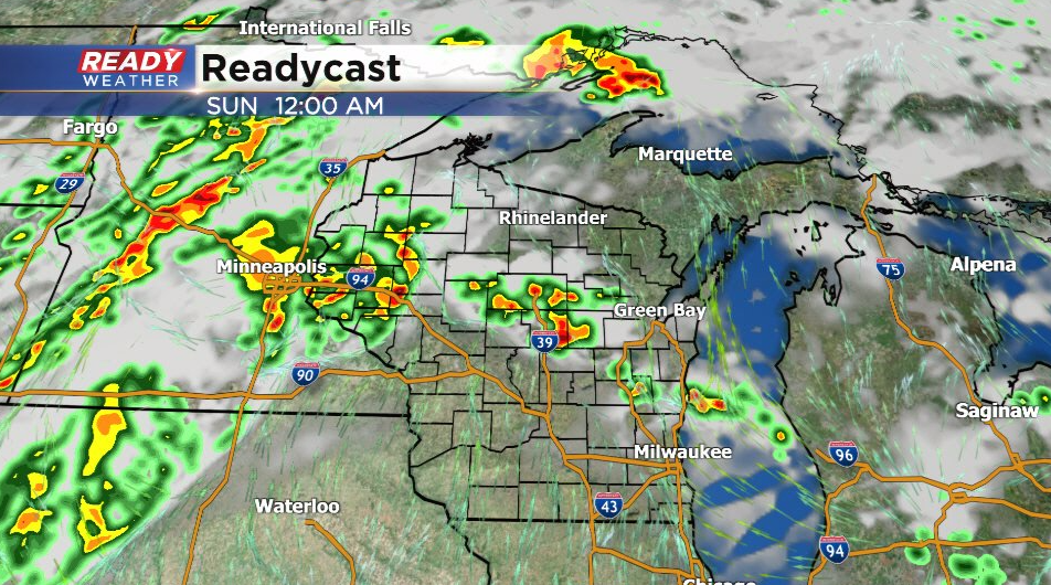
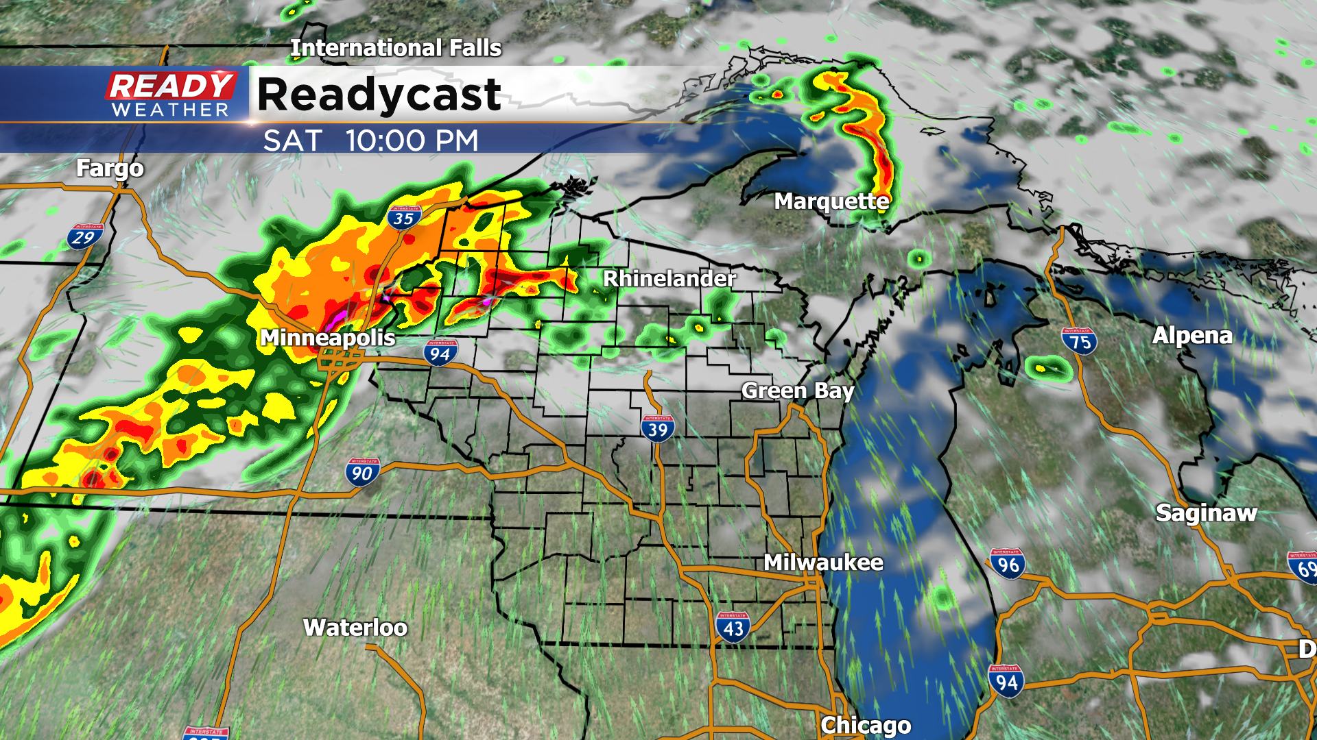
Storms with lightning and heavy downpours continue to lift northeast through Fond du Lac and Sheboygan counties.
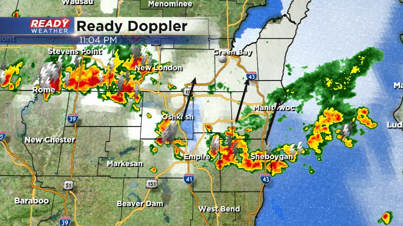
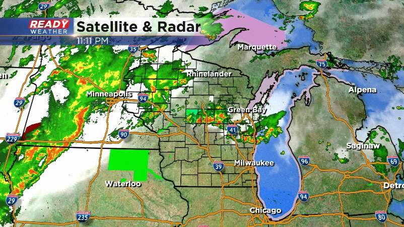
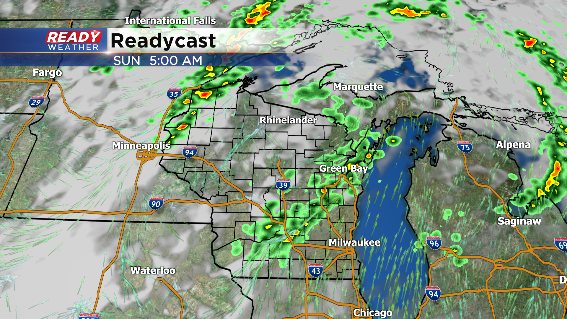
These storms are still on track to lift out of the area by midnight. Once these lift north, southeast Wisconsin should see a break from the storms for the rest of the night. There's a line of storms tracking through southern Minnesota and Iowa, but they are currently sub-severe and are expected to weaken after crossing the Mississippi River early Sunday morning.
That being said, we can't rule out an isolated shower sneaking into western spots early Sunday morning as this line dissipates.
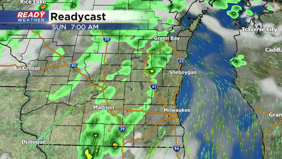
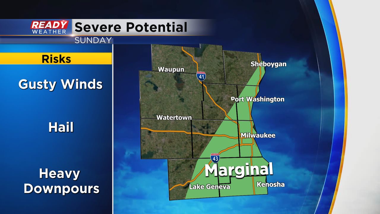
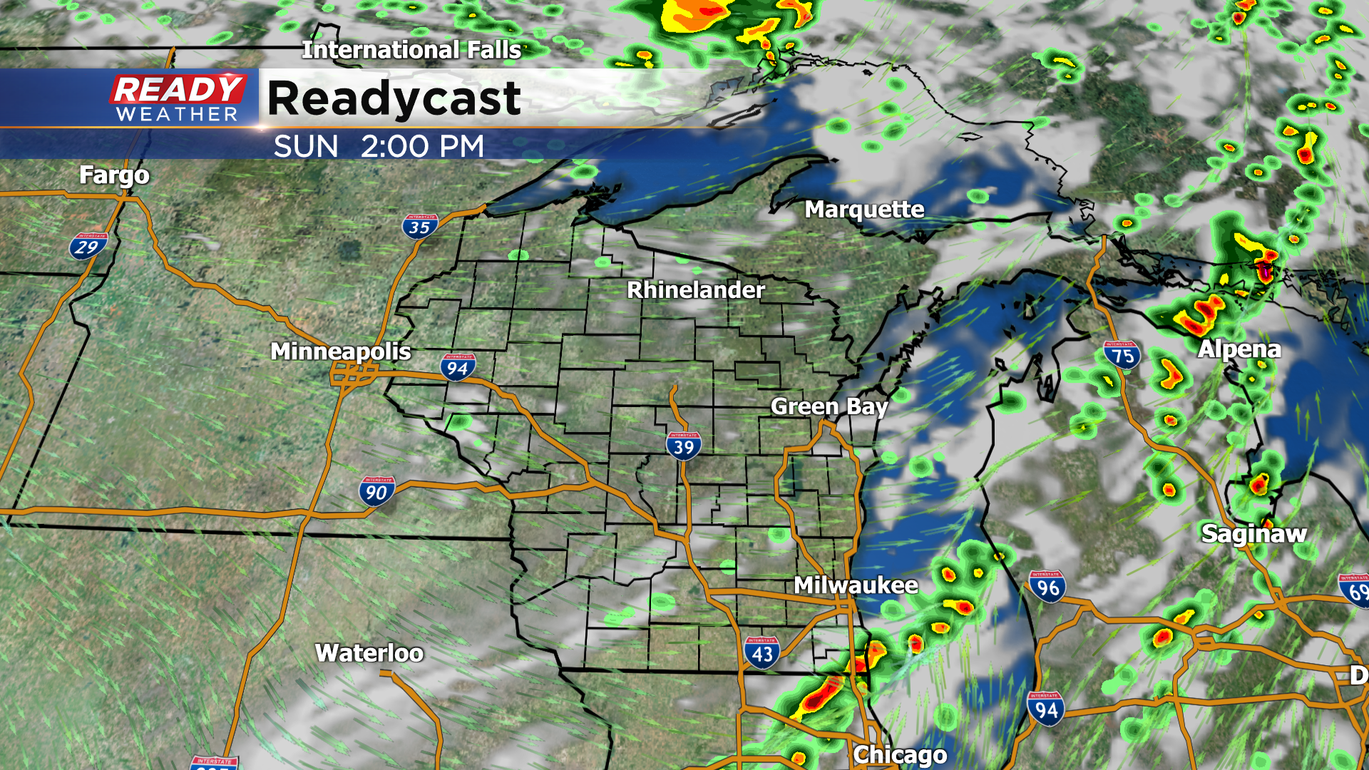
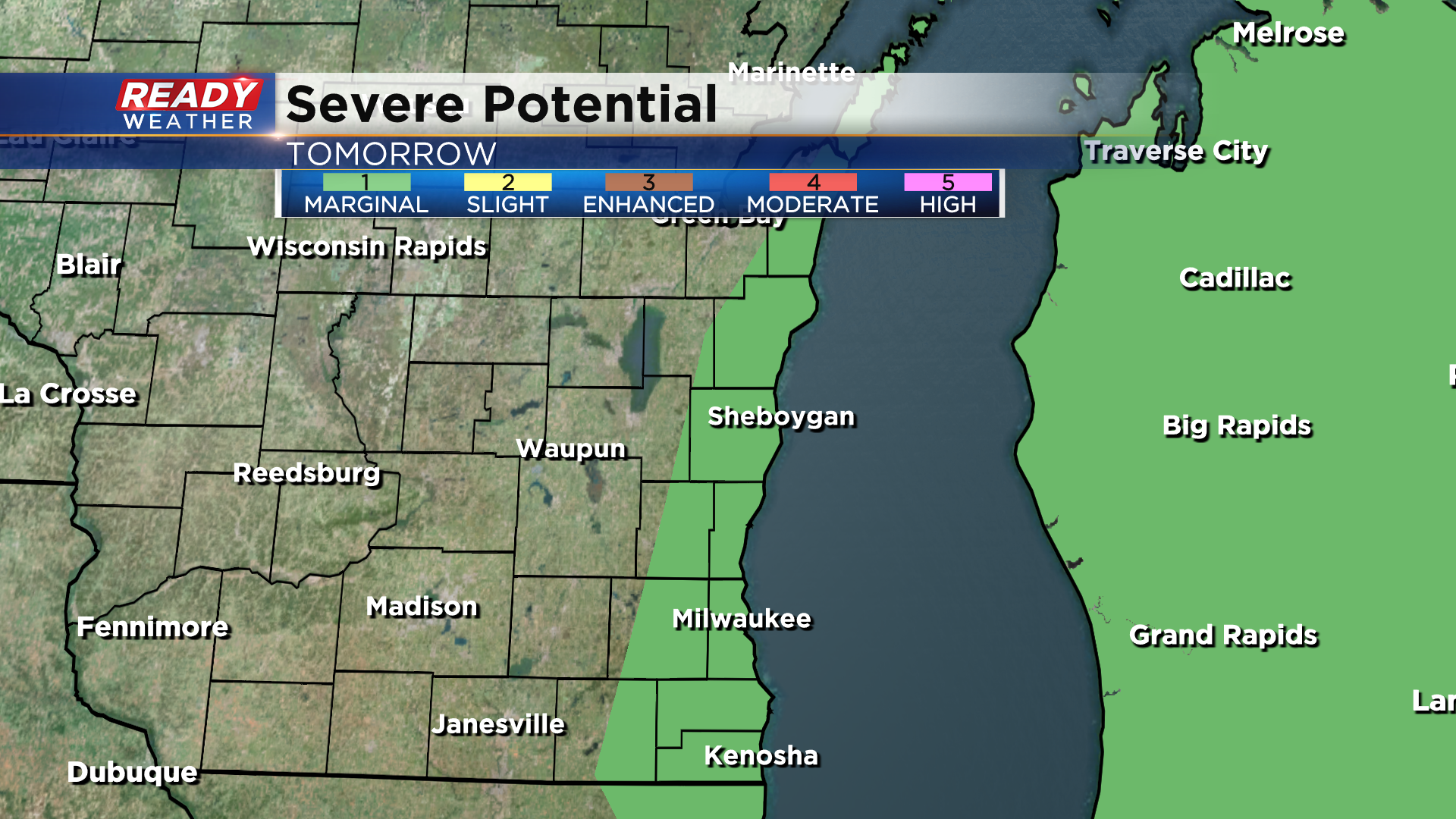
The cold front will be trailing this dissipating line of storms and is currently expected to push through southeast Wisconsin around early afternoon. This could spark a few isolated storms, with the best chance being in Milwaukee, Racine, and Kenosha.
*If* storms are able to fire along the front, they could be strong to severe with gusty winds and hail. There's a level 1, Marginal Risk in place for this isolated threat.
Once these storms exit by mid or late afternoon, we'll be in the clear with dropping humidity into the work week.
--------------------------------------------------------------------------------------------------
Updated: 8:45 pm Saturday, August 28th:
The storms driven by daytime heating have dissipated, but additional cells are now popping up in Fond du Lac and Dodge counties as the low level jet kicks in.
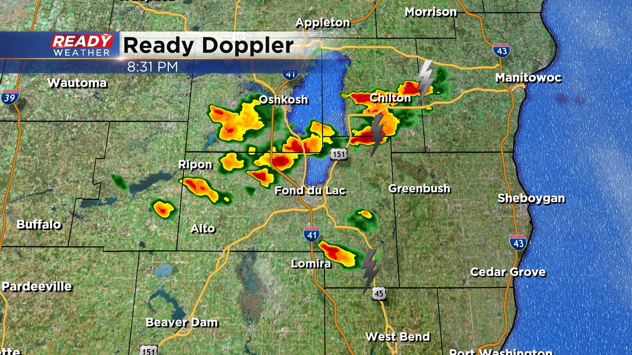
These storms will be possible for another few hours until the complex lifts into northeast Wisconsin after midnight.
--------------------------------------------------------------------------------
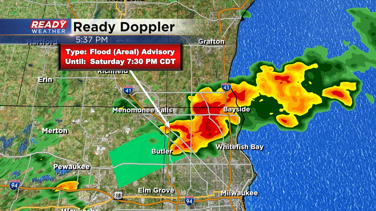
Updated: 5:45 pm Saturday, August 28th:
Nearly stationary thunderstorms from Butler to Mequon have dropped 1-2" of rain over the last couple of hours, which has prompted an Areal Flood Advisory through 7:30 pm. An additional .5-1" of rain is possible before the storms exit, which could lead to localized flooding or ponding on roadways.
----------------------------------------------------------------------------------------
Updated: 3 pm Saturday August 28th:
A few spotty storms are popping up this afternoon with the heat of the day. Some of these are getting a little extra boost from a lake breeze as well.
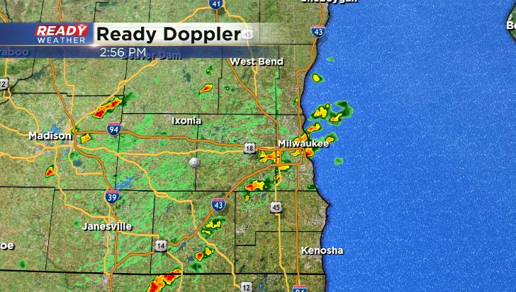
Expect a brief downpour and some lightning in these cells. The strongest cells may produce pea sized hail or brief gusty winds before falling apart. The spotty storm chance will wind down this evening as the sun sets.
-------------------------------------------------------------------------------
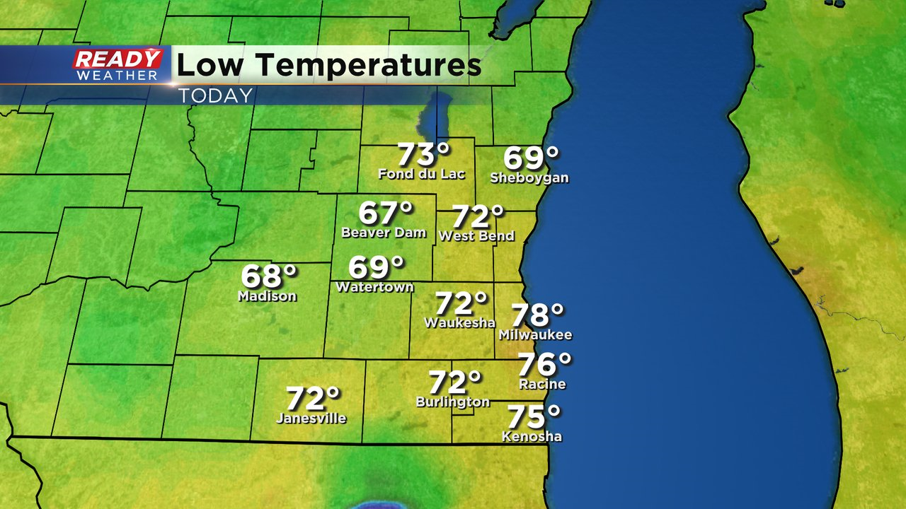
It's been quite the warm start to the day across southeast Wisconsin! Temperatures only dropped to 78° in Milwaukee last night, which would shatter the record hottest minimum temperature for today of 75° set in 1948 unless a very isolated downpour can cool us down later this afternoon (very unlikely).
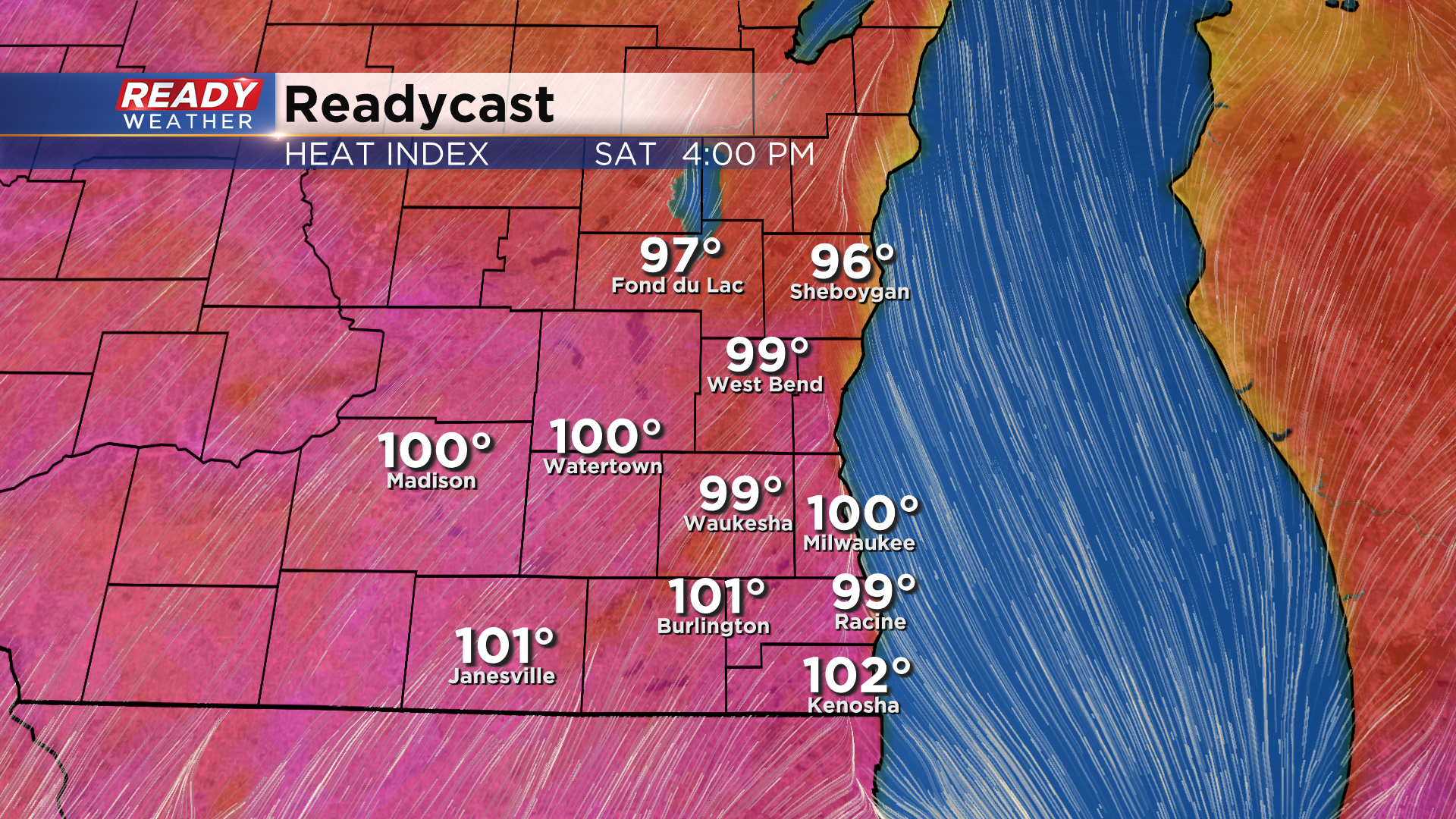
The warm start is setting the stage for a very hot day across the area as temps rise into the upper 80s to low 90s. Factor in dew points in the low 70s and it'll feel closer to 100° this afternoon.
The hot temps will likely prevent any storms from popping up this afternoon along and south of I-94, but we can't rule out a stray storm well north of Milwaukee (only a 20% chance). If these storms can fire, they could be strong and produce gusty winds or hail. A level 1 of 5, Marginal Risk, is in place in Fond du Lac and Sheboygan counties for this small risk. Meanwhile, a much higher risk for severe weather will be across Minnesota and into northern Wisconsin closer to the warm and cold fronts.
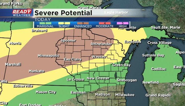
Multiple rounds of strong to severe storms are expected in these areas today into tonight.
Storms are expected to merge into a line, or multiple lines, heading into this evening but the line will fall apart as it pushes into southeast Wisconsin overnight as it out races the cold front. Best chance for a few showers will be NW of Milwaukee.
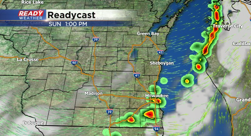
The cold front itself won't reach southeast Wisconsin until Sunday afternoon or early evening. There are some timing differences on when the front will pass. If it passes through early in the afternoon, our storm chances would be very low. If the front moves in late afternoon or evening, we'll have to watch for a few isolated strong to severe with the best chance being in Milwaukee, Racine, and Kenosha.
A level 1 risk is in place along the lakeshore on Sunday.
Humidity will drop Sunday night with cooler and less humid conditions expected to start the work week. Download the CBS 58 Ready Weather App to track the storms and see the full 7 day forecast.