Mid Afternoon Update: Rain and wet snow pushing across the area


Updated: Thursday, January 19th, 2023 3:00pm:
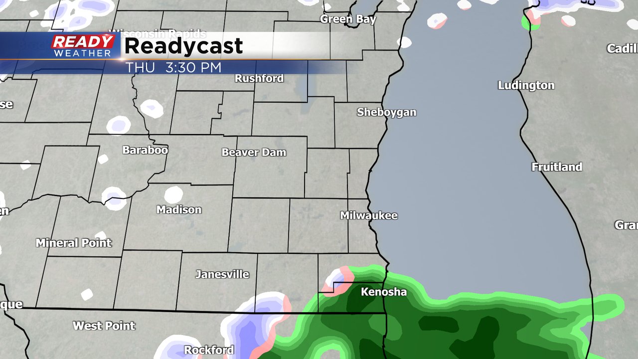
Another batch of rain and wet snow is slowly pivoting across southern Wisconsin this afternoon. Temps are several degrees above freezing for most of the area, so not much in the way of impacts are expected with this mix.
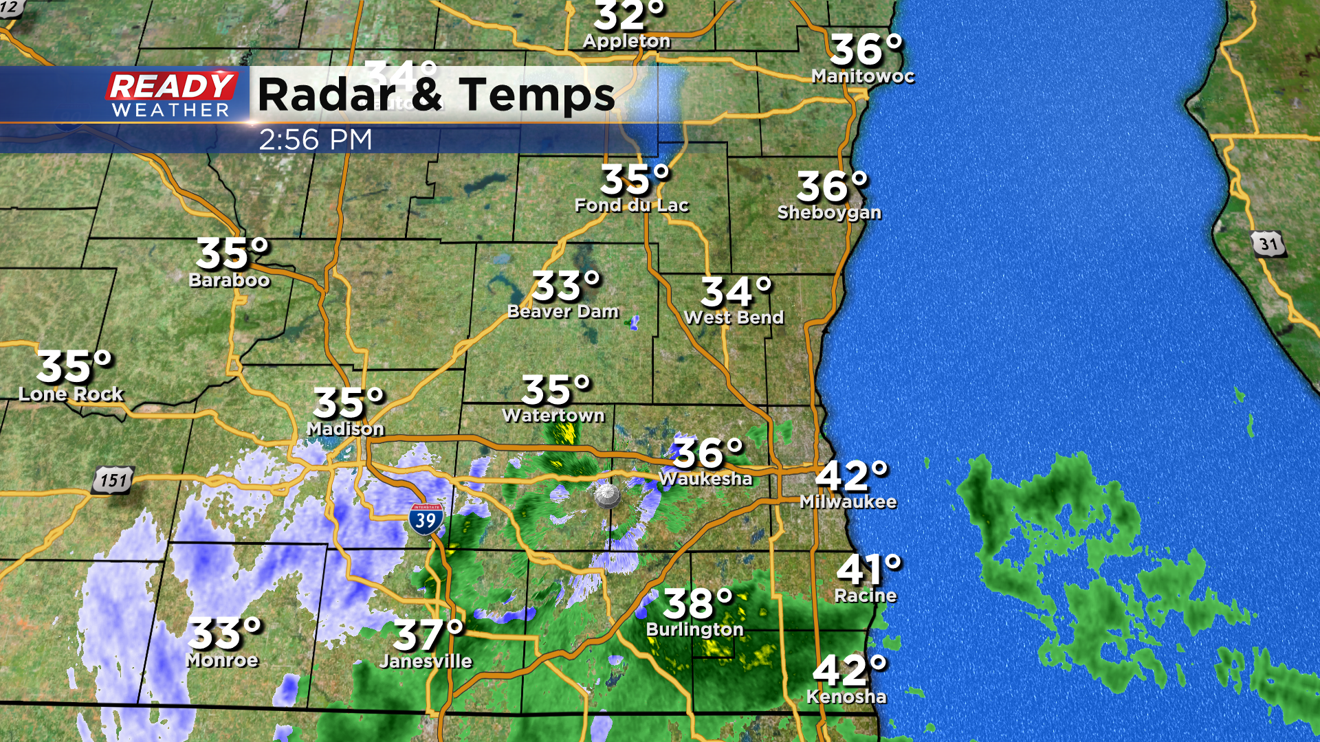
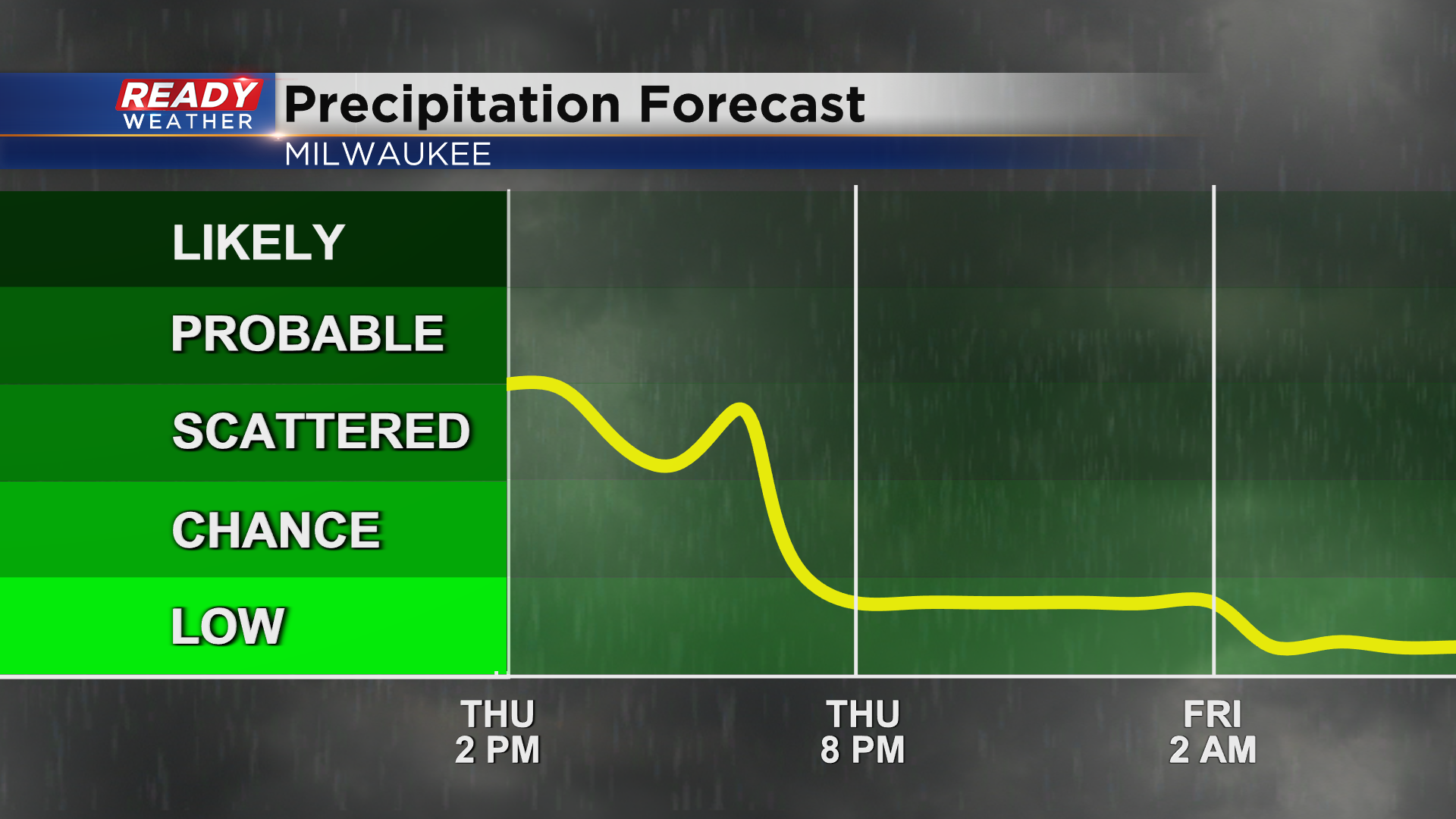
Precipitation will largely wind down mid to late evening with dry weather returning Friday.
----------------------------------------------
Updated: 12:15 p.m. Jan. 19, 2023
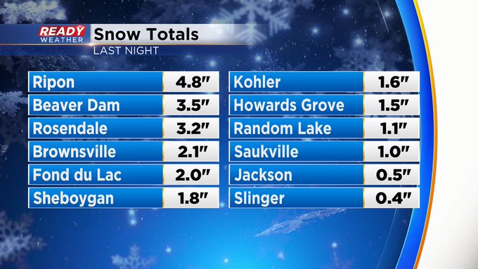
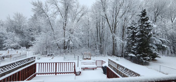
Accumulating wet weather was over before daybreak. Here's a look at some of the reports:
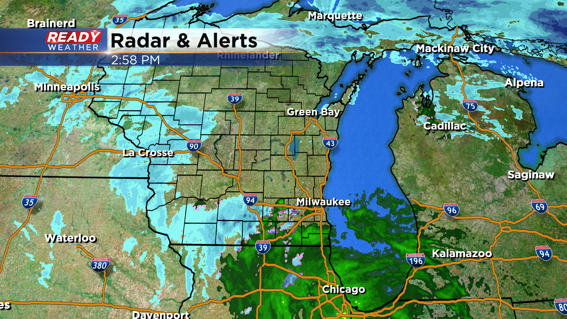
Updated: 9:10 a.m. Jan. 19, 2023
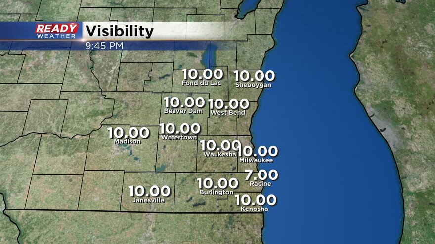
The accumulating rain and snow is done across southeast Wisconsin. A few lingering rain and snow showers may be possible the rest of Thursday morning into the afternoon. In addition to some lingering rain/snow, we've also seen a lot of fog develop along with mist and drizzle.
Here's a look at visibility conditions that will updated with time:
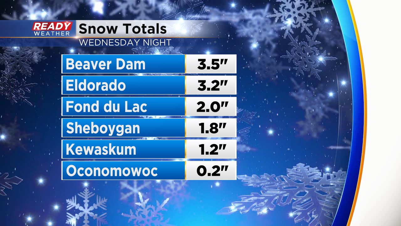
A few snow totals are starting to roll in with the highest numbers in Dodge and Fond du Lac Counties where they picked up 2-4" of snow. The rest of our northern counties saw 1-2" with nothing measurable reported south of I-94.
------
Posted: 4:47 a.m. Jan. 19, 2023
The accumulating snow and rain from Wednesday night has pretty much wrapped up. Areas south of I-94 stayed mostly all mix and rain with little to no accumulation. Northern counties that were under a winter weather advisory did some accumulating snow. Although the accumulating snow and rain has mostly ended, a few light rain and snow showers will be possible throughout the rest of Thursday.
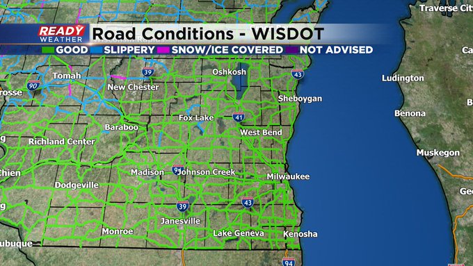
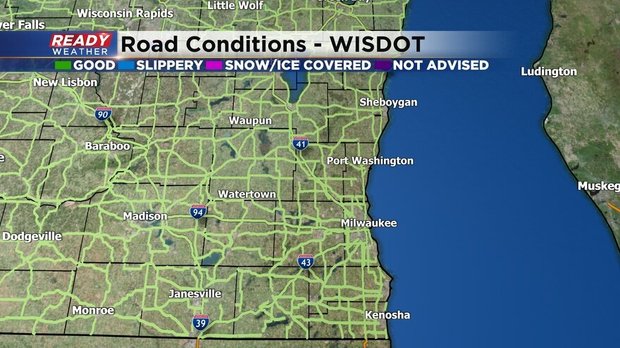
The winter road conditions map from the DOT shows snow covered roads in northern counties, some slipper roads west and north of the Milwaukee metro and mostly wet roads to the south. These road conditions will improve as the Thursday morning commute goes on.
Here's a look at those roads conditions that will update with time:
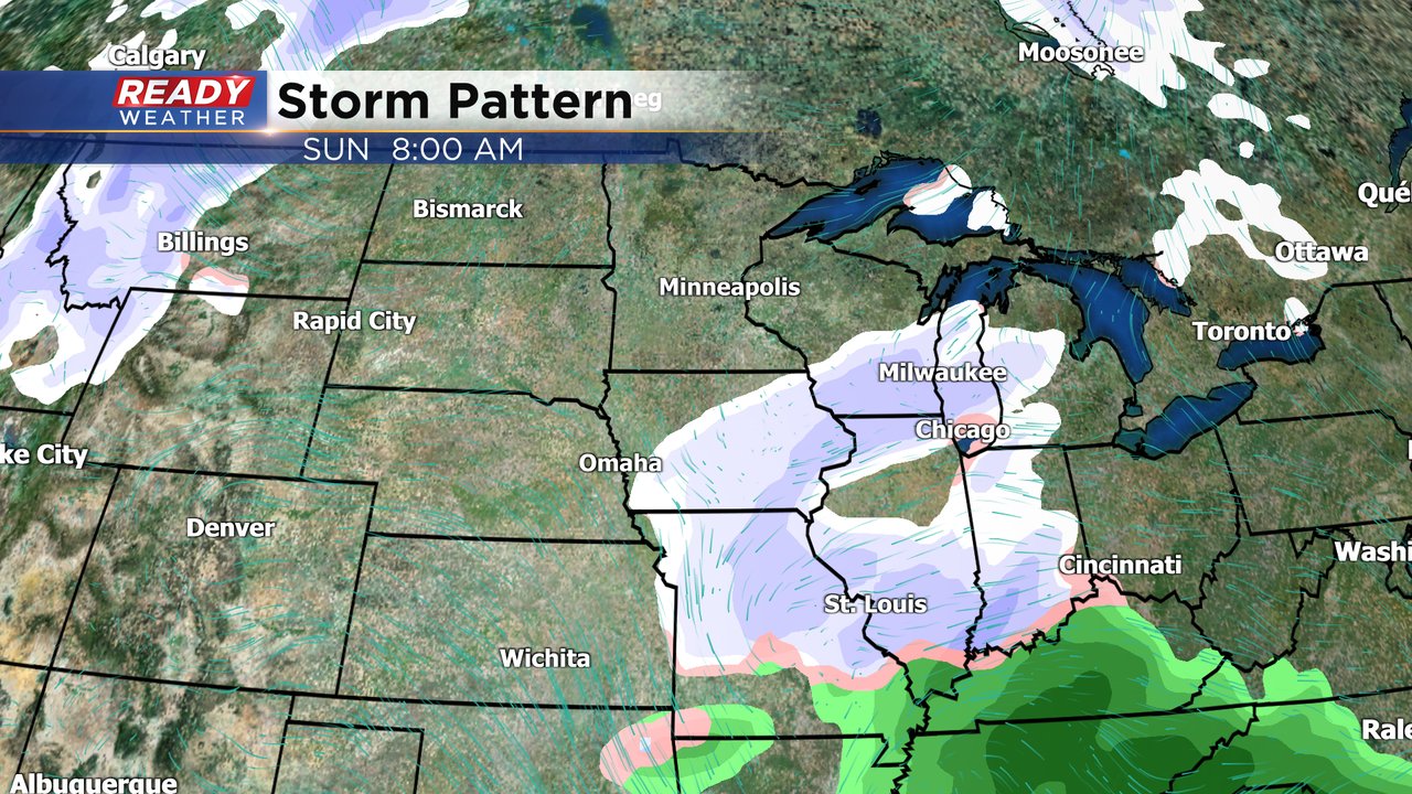
If you didn't get any or enough snow Wednesday night the next chance to see some snow will be Saturday night into Sunday. This time it looks like we stay on the colder side of the storm so little chance for mix ruining snow totals. Some light snow accumulation is possible
Download the CBS 58 Ready Weather app to track the lingering mix today and see when our next chances for snow are.