Quiet end to the weekend, but turning blustery to start the new work week


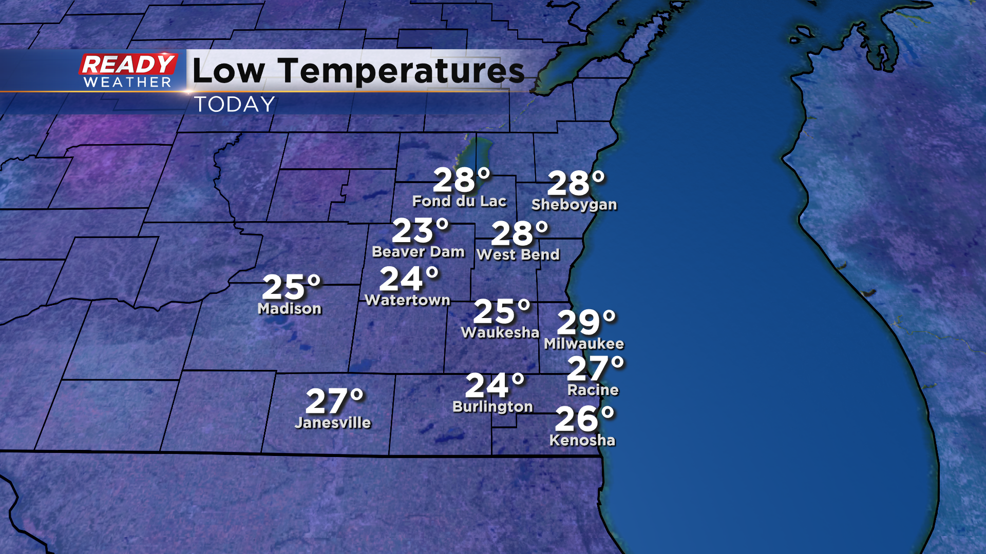
It was a cold and frosty start to the day across southeast Wisconsin as temps dropped into the mid to upper 20s under clear skies.
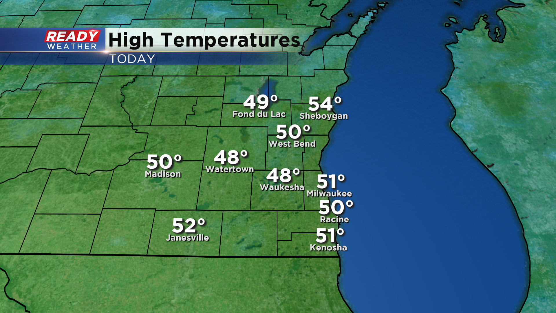
Temperatures were able to rebound nicely into the upper 40s to low 50s this afternoon thanks to abundant sunshine and a southwesterly breeze.
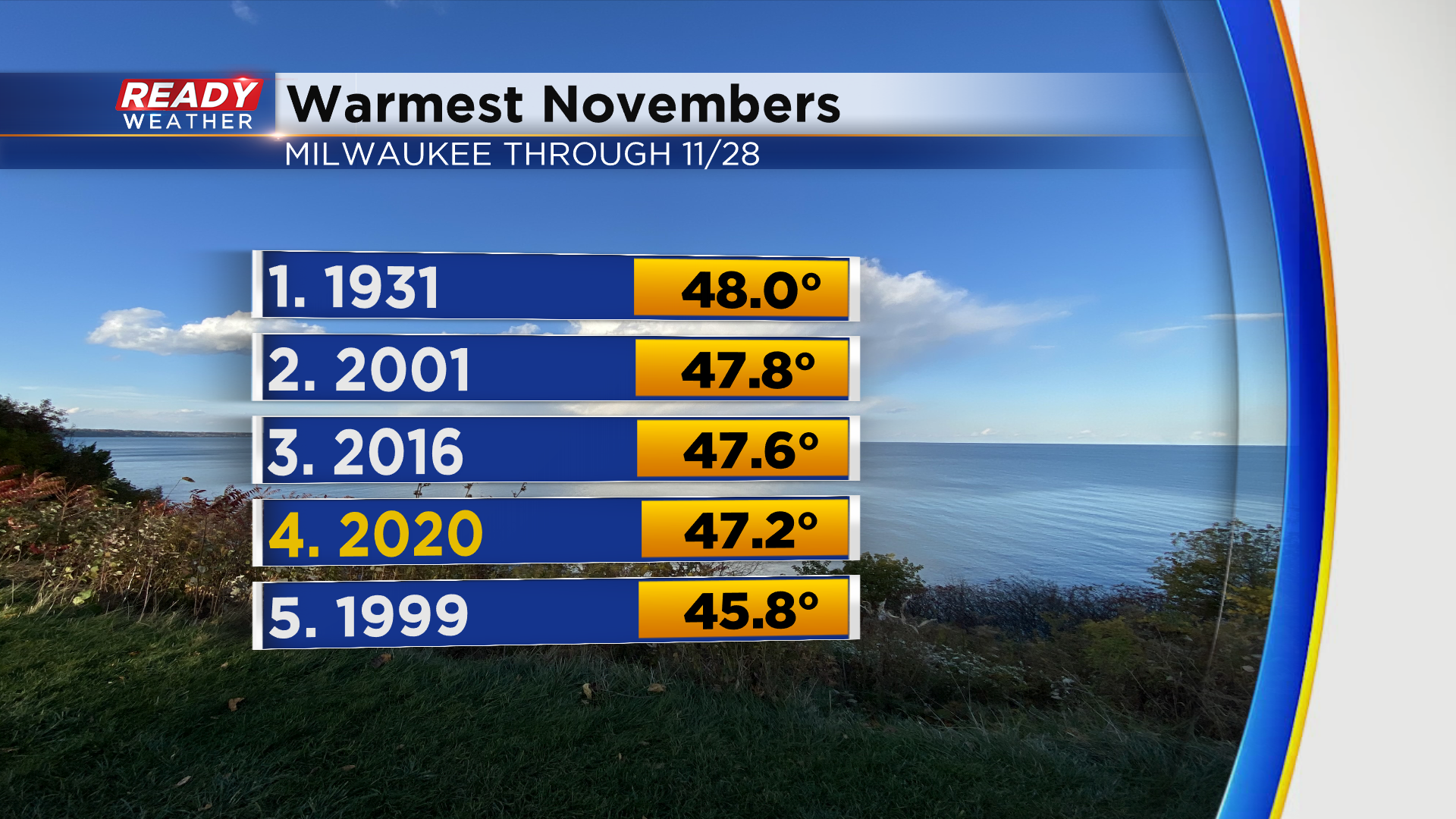
Today marks Milwaukee's 22nd day with above normal temps this month. With only 2 days left in the month, November 2020 currently ranks 4th warmest on record.
Temperatures will be above normal again on Sunday, reaching the mid 40s around midday before a cold front moves through the area and drops temps back into the 30s by late afternoon. Highs will remain in the 30s to start next week with Monday being the coldest day of the next week.
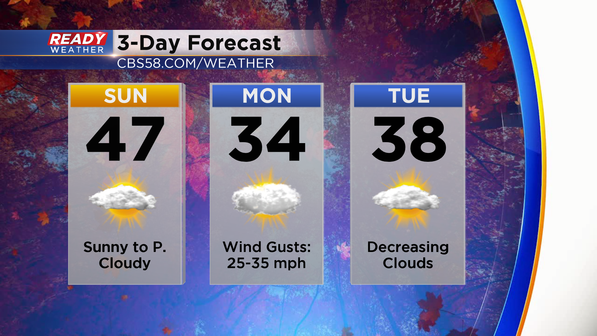
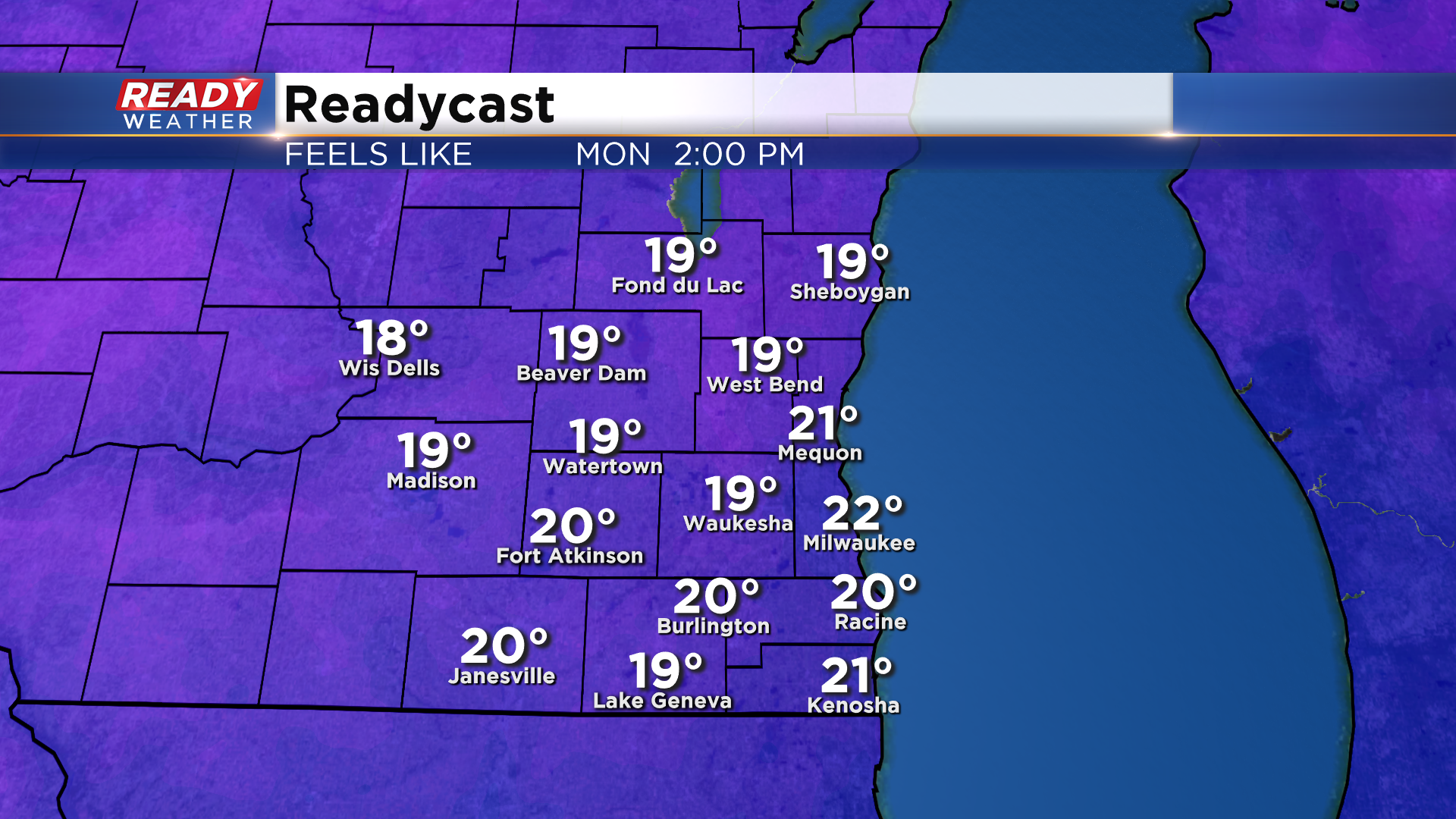
While we'll have a few wind gusts up to 20 mph during the day on Sunday, winds will start to crank up behind the cold front Sunday evening into Monday with gusts between 25-35 mph. The strongest gusts are expected Monday morning and will subside a bit Monday night. With temps only reaching the low to mid 30s on Monday under mostly cloudy skies, feels like temps will be in the 20s all day.
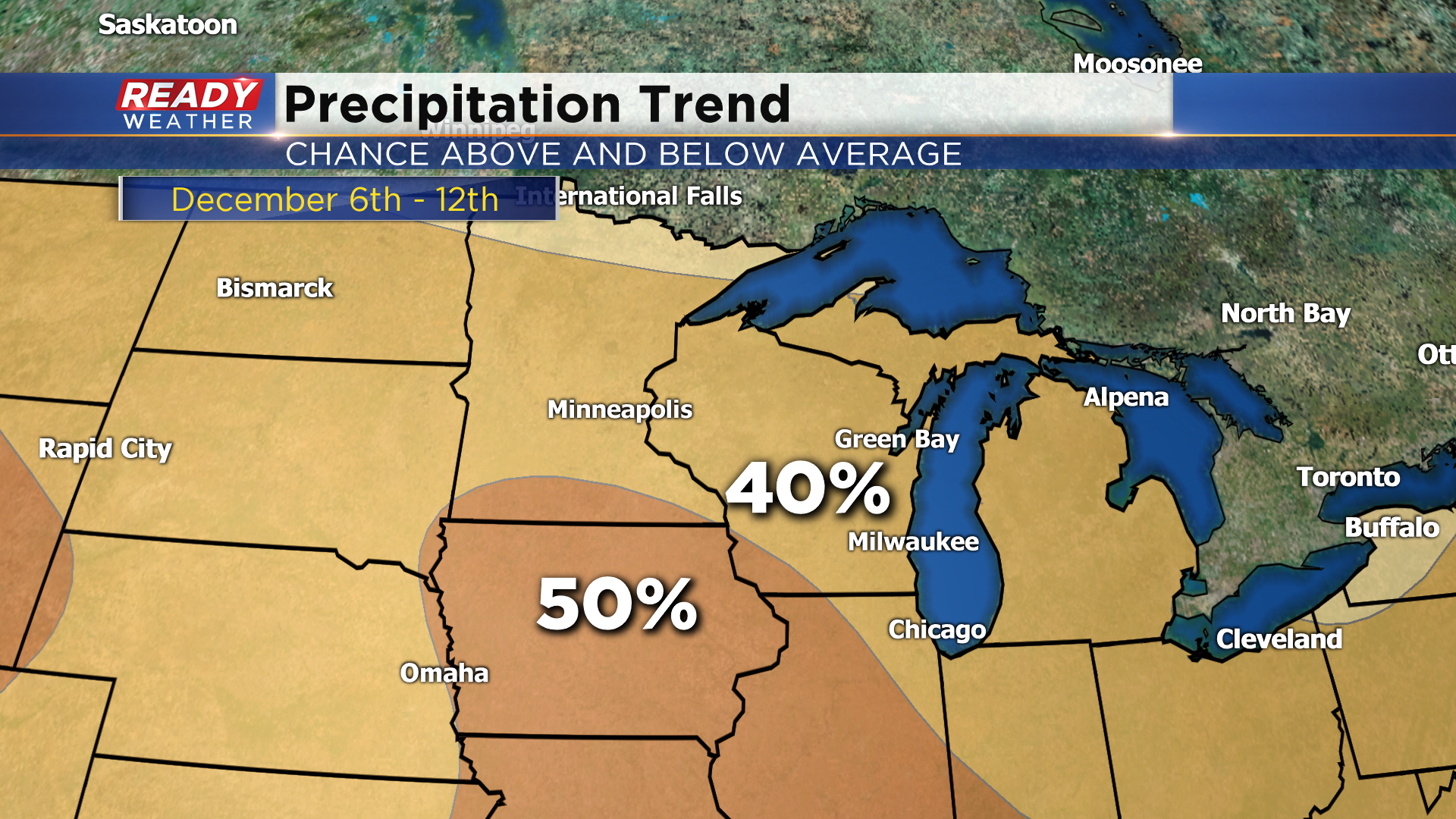
Temps will warm back into the upper 30s to low 40s for the second half of the week into next weekend with dry and quiet weather expected. Dry weather is also favored through the first half of December as well as slightly above normal temps. So if you were hoping for some cold and snowy weather, you'll have to keep waiting a little while longer.
Download the CBS 58 Ready Weather app to track Sunday's cold front.