Afternoon Update: Clouds will likely limit strong storm potential this evening


Updated: Saturday, August 13th 2:55pm:
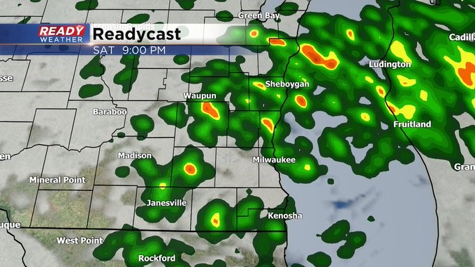
It's been a quiet and cloudy day so far today across most of southeast Wisconsin. The exception being Sheboygan county which has seen multiple downpours and rumbles of thunder.
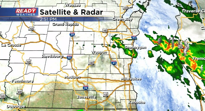
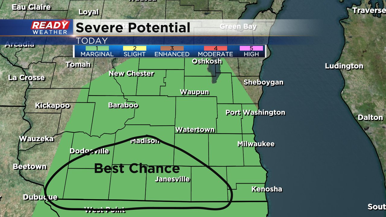
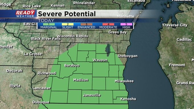
The widespread low cloud cover will help limit strong to severe storms later this evening. The best chance for any stronger storms with gusty winds and hail will be across far southern/south central WI where there has been some sunshine today.
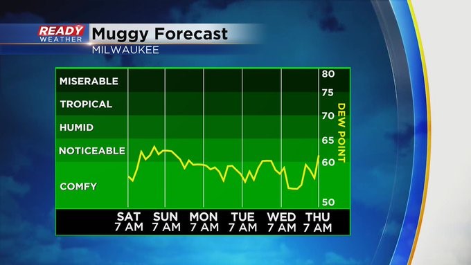
The air also a bit more humid in this part of the state, while it isn't quite as sticky in SE WI.

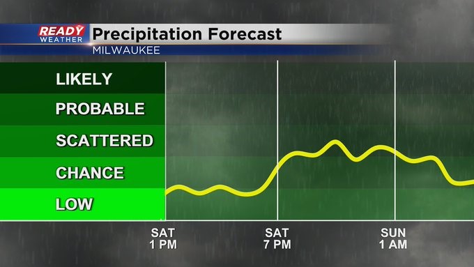
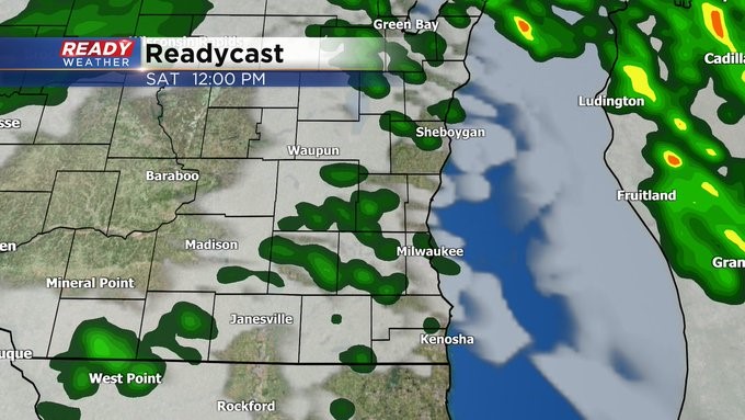
All of that being said, we're still expected at least spotty showers to develop after 6pm with a few isolated storms possible as well. Some small hail will be possible in storms.
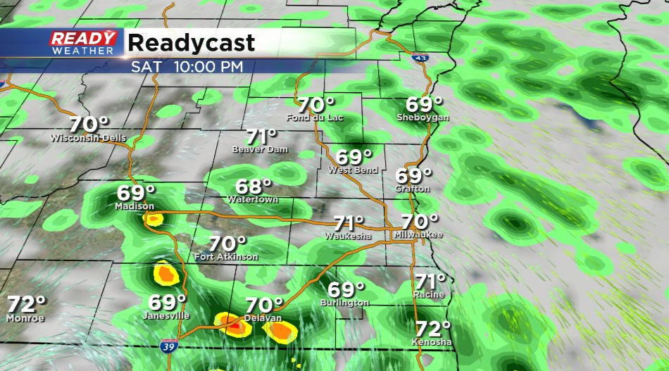
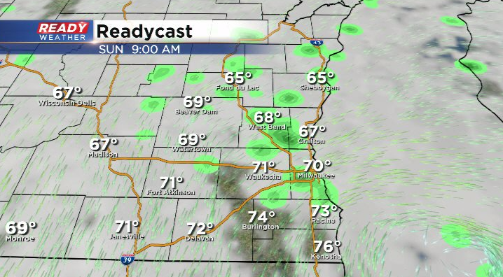
Showers will turn less numerous overnight as the cold front passes through the area. This will shift our winds to the northeast, likely keep areas of drizzle and sprinkles around through at least Sunday morning.
Download the CBS 58 Ready Weather app to track the wet weather.
----------------------------------------------------
MILWAUKEE (CBS 58)--Not the prettiest weekend but not the ugliest either. Look for scattered showers and thunder showers throughout the day on Saturday and through the evening hours as well. One or two could pulse up a bit as well as low pressure to the west of us sinks to the south of the region. There's a marginal risk of severe weather. Hail and damaging winds are two threats. Frequent lightning too. Also keep in mind, from late morning Saturday into early Sunday, there's a Small Craft Advisory north of Milwaukee County. Higher waves and rip currents are possible.
The weather quiets down into the start of the coming week. Of course the next best chance of rain and storms will be going into next weekend as well.