11:00pm Update: Training storms could lead to flooding overnight


11:15 pm Update: Line of sub-severe storms is tracking through southeast Wisconsin with additional spotty storms popping up near the Milwaukee metro.
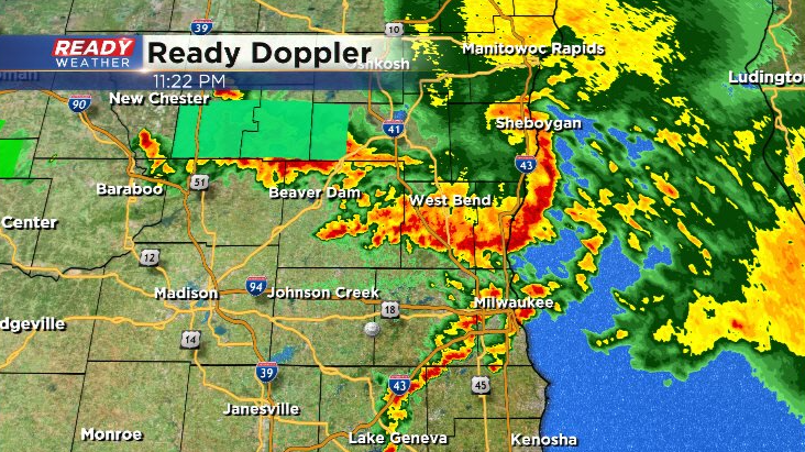
Very heavy rain and frequent lightning are the main threats in these storms, and with storms back building and training over the same locations we could have some flooding issues overnight. An Areal Flood Advisory is already in effect for western Fond du Lac county due to 2"+ of rain in a short amount of time.
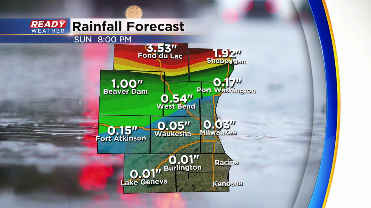
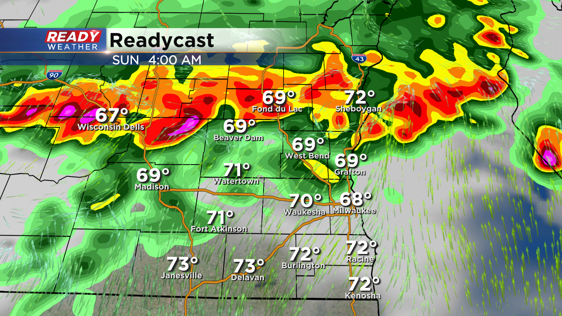
These training storms will eventually start to lift northward overnight as the warm front pushes northward, but 2-4" of rain is easily possible in any locations that see training storms. Areas north of I-94 have the best chance at overnight flooding due to training storms. Storms exit by Sunday morning.
---------------------------------------------------------------------------------------
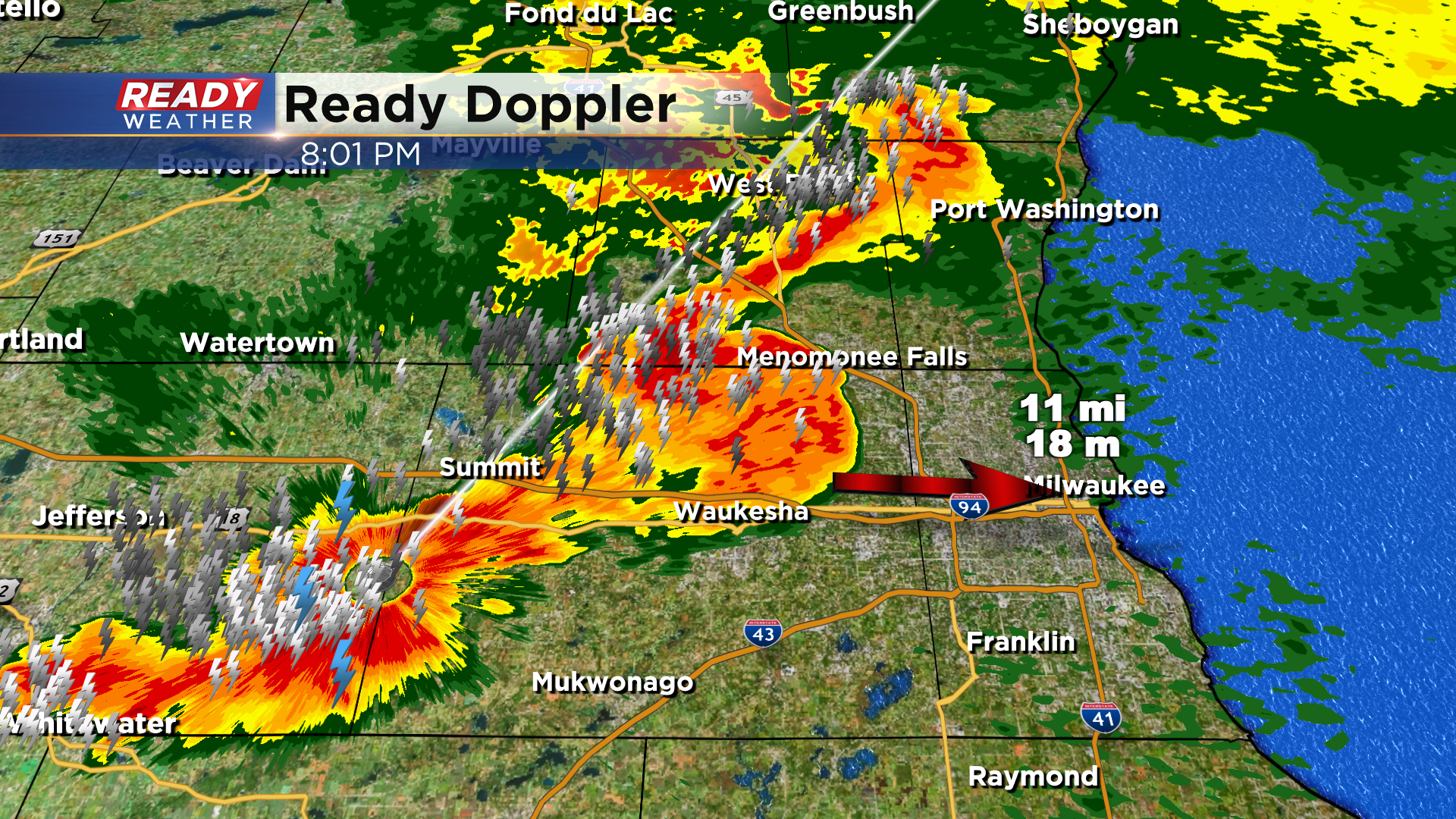
8:00 pm Update:
Non severe storms continue to rumble eastward across the area. This will impact fair goes within the next 20 minutes. Here's the estimated arrival time:
5:00 pm Update:
A Severe Thunderstorm Watch has been issued for Dodge, Jefferson, Walworth, and Waukesha counties until 9 pm.
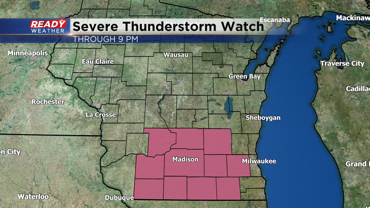
A severe cluster of storms is producing both straight-line winds and a a confirmed tornado east of Boscobel. Damaging winds and isolated spin ups are expected with this area of storms as it tracks southeast across southern Wisconsin.
-----------------------------------------------------------
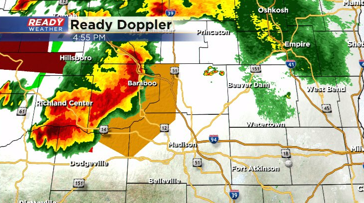
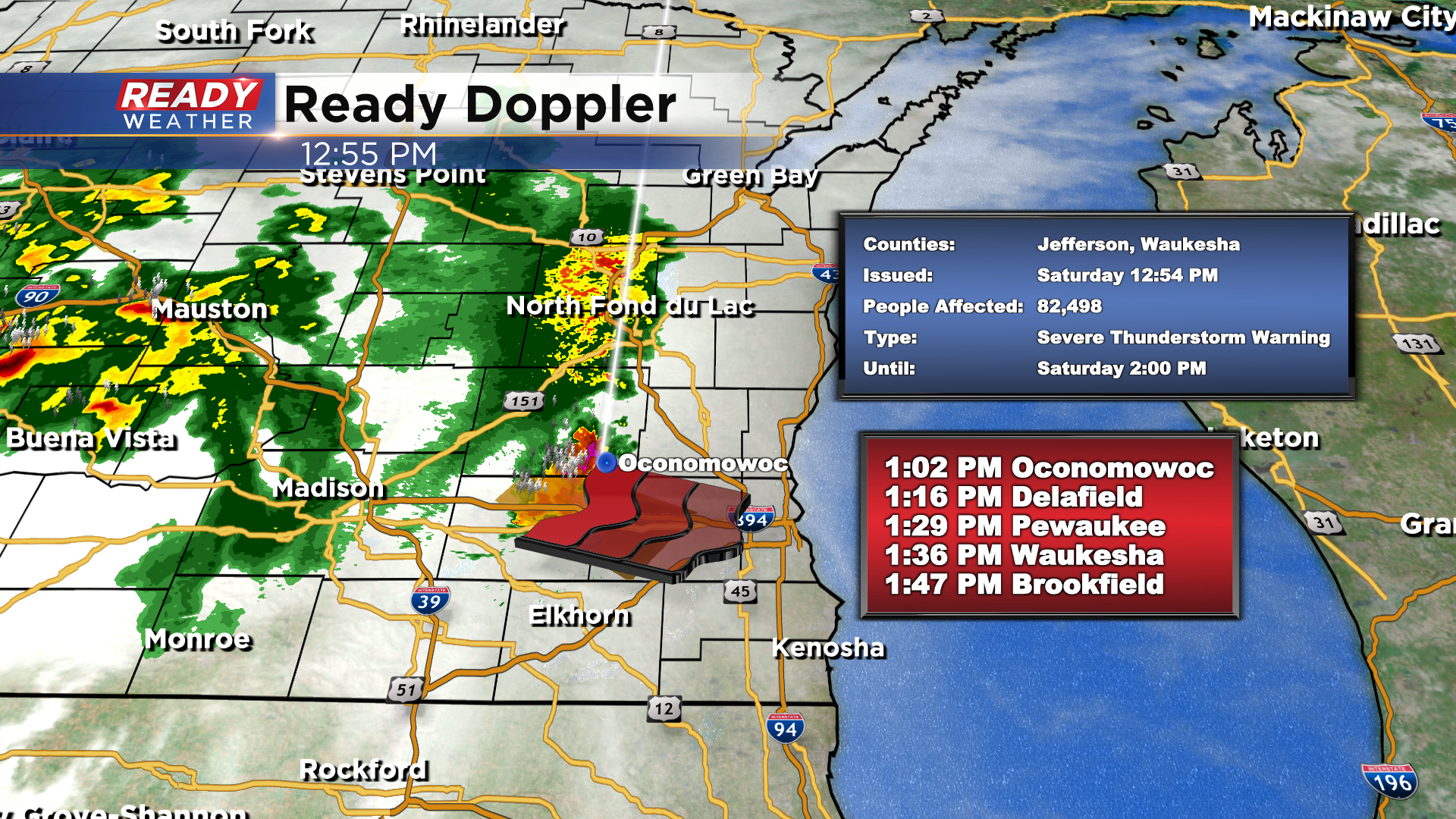
2:00 Update: As of now, there are no longer any severe thunderstorm warnings in progress in our viewing area. The warned on cell in Waukesha county has weakened. Here's what's left of it:
1:30pm Update: We continue to monitor a severe storm pushing through Waukesha county.
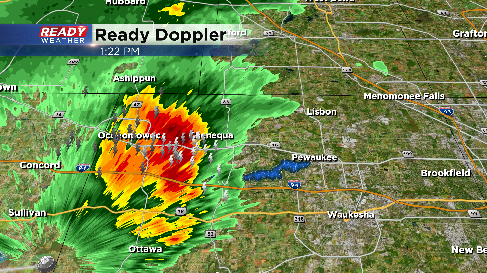
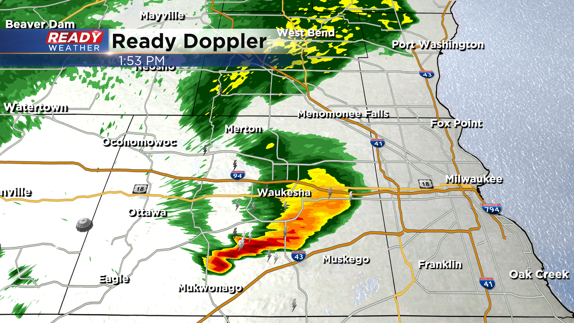
12:50pm Update:
Severe weather is in progress again today across our area. Currently a Severe Thunderstorm Warning is underway for Jefferson, and Waukesha county until 2:00 pm. We've had two verified reports of 60 mph wind gust around Watertown.
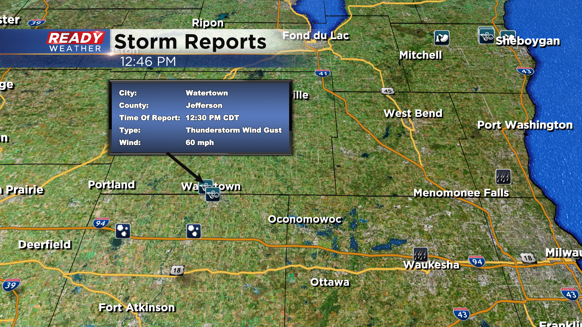
Also getting reports of large trees down in that area along West Street with pea size hail. This storm will impact larger communities like Waukesha which that county has now been warned on too, so be prepared to head indoors soon!
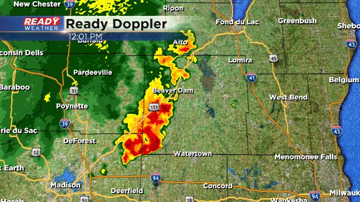
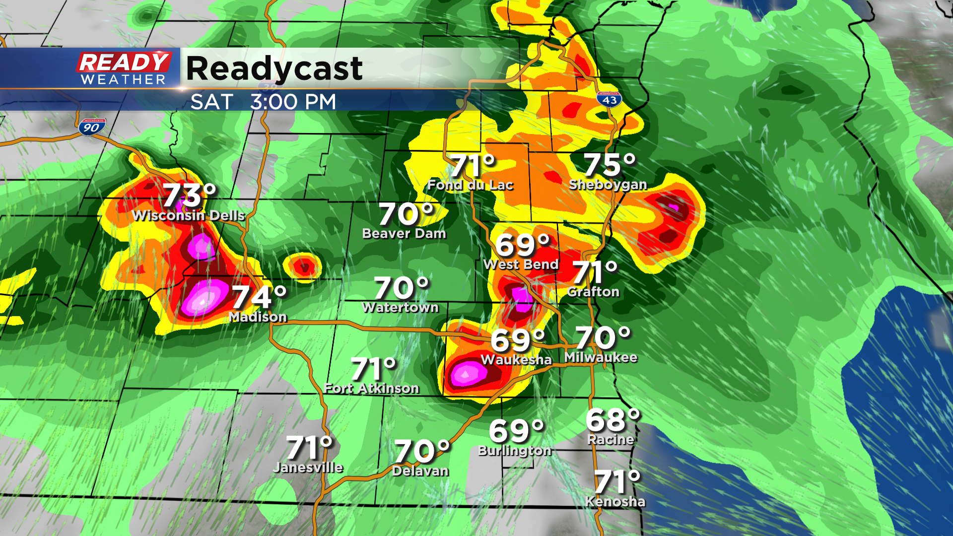
It's going to be quite an active 48 hours across southeast Wisconsin as multiple rounds of rain and storms are expected as a low pressure system and warm front hang out in the area. Exact timing and details of each round of storms will depend on the previous round, so expect some changes. Showers and storms are already developing this morning, including a stronger storm tracking southeast into Dodge county.
Additional strong to severe storms are developing back in western Wisconsin and southeast Minnesota closer to the low pressure system and warm front.
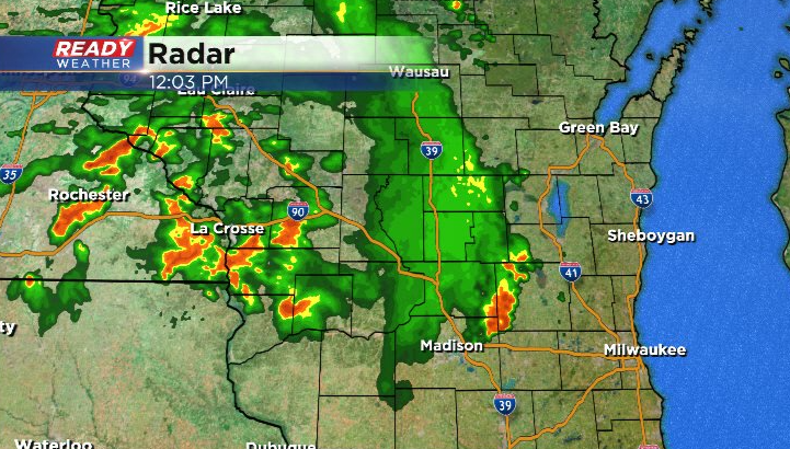
Currently those storms are moving northeast, but may become more organized and take a turn towards southeast Wisconsin this afternoon.
After a potential break in the action for a brief period of time, we're expecting additional storms to develop along the warm front late this evening into the overnight hours. Where this front will be located will depend on this afternoon's storms. Training storms with very heavy rain are expected along the front that will slowly lift northward heading into Sunday morning.
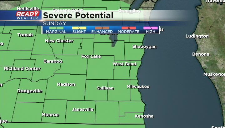
There's a risk for severe weather with any rounds of storms today and tonight. A level 2 of 5, Slight Risk has been extended into Dodge, Jefferson, Walworth, and western Waukesha county, while a level 1 of 5 Marginal Risk is in place everywhere else.
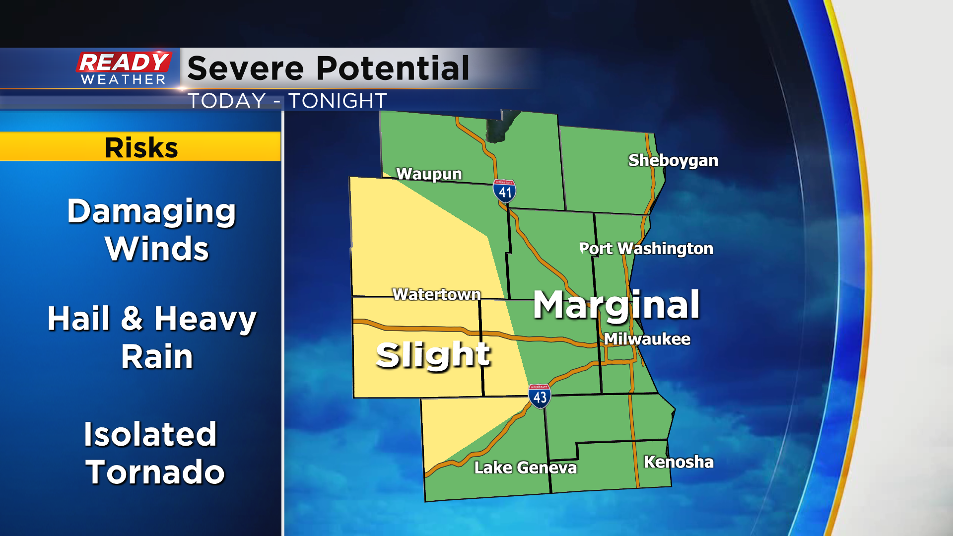
Damaging winds will be the primary threat, but we can't rule out a couple of isolated tornadoes. Repeated storms dropping heavy rain in the same locations could also lead to flooding overnight.
After a break in the action Sunday morning, we'll be watching for another round of potentially strong to severe storms late afternoon into the evening. Currently there's a level 1, Marginal Risk, in place for severe weather Sunday evening.