Late Morning Update: Snow totals come in high as snow wraps up
Updated: 11:30am
Snow is finally coming to an end.
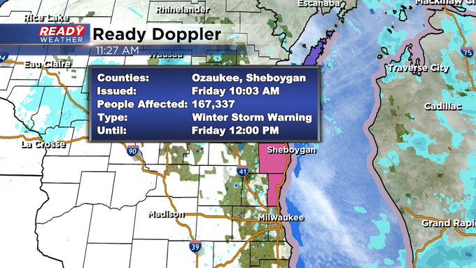
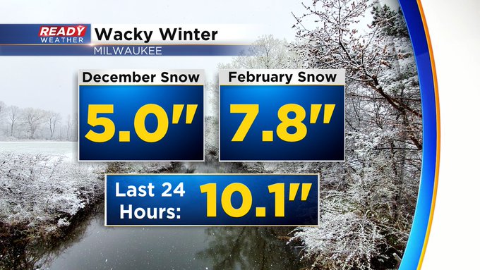
Officially the warning is still in effect until noon for Sheboygan and Ozaukee counties. At least with temps in the 30s any additional light snow falling this morning over already cleared pavement should be melting. What an event though, we've had more snow with this one than two other winter months.Updated: 8:46 a.m. March 10, 2023
The accumulating snow has just about wrapped up. A few more snow showers will be possible here and there through the rest of Friday morning and the afternoon but not much else will accumulate. Snow reports are rolling in this morning with most of southeast Wisconsin picking up between 5-10" of snow.
The 10.1" of snowfall officially in Milwaukee is current as of 6 AM and is the biggest 2-day snowfall the airport has picked up since 2017!
This is an extremely heavy snow that is leading to numerous downed trees and branches all across the viewing area. Over 100,000 people are currently without power as of 9 AM Friday morning with all of the snow.
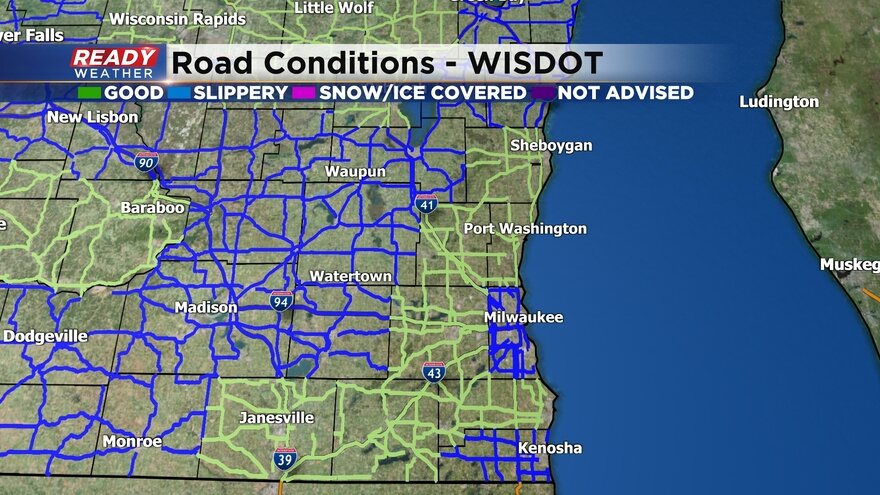
Road conditions are improving with some locations now reported as good driving conditions.
Here is a road conditions map that will update with time:
Unfortunately this is not our only upcoming snow. Another round of snow rolls in Saturday even through Sunday and even potentially lingering into Monday. Another 1-3" or 2-4" of snow will be possible there.
Download the CBS 58 Ready Weather app to track the end of today's snow and the next round over the weekend.
------
Updated: 6:07 a.m. March 10, 2023
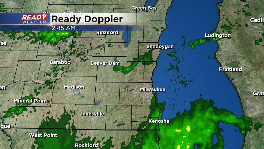
Steady snow is still falling Friday morning especially north of I-94. The snow is becoming a bit more showery in southern counties. The chance for accumulating snow will remain until 10 AM with a few light snow showers lingering through the early afternoon.
Here's a current radar image that will update with time:
We are starting to see more and more snow reports come in. Most of southeast Wisconsin has picked up between 5-9" of snow. This snow is super heavy and wet almost like concrete so take your time shoveling.
------
Posted: 4:47 a.m. March 10, 2023
The snow has been coming down wet and heavy all night long and continues Friday morning. This snow is extremely heavy and is leading to lots of power outages all across southeast Wisconsin with over 75,000 customers currently reported without power. Snow is still expected to fall for a few more hours with the steady, accumulating snow done by 10 AM then a few lingering light snow showers are possible.
Roads are in very rough shape and are completely snow covered across most of southeast Wisconsin. A lot of the snow is extremely slushy. When you pass a car on the highway you will get covered with a wall of slush. Take it slow and drive safe.
Here's a look at the road conditions just before 5 AM:
Even though this round of snow is beginning to wrap up, there's more snow on the way this weekend. Another storm system will take aim at southeast Wisconsin from Saturday evening through most of Sunday and even lingering into Monday. Another 1-3" of new snow is possible Saturday night into Sunday then maybe another inch on Monday.
Download the CBS 58 Ready Weather app to track the end of the snow.


