3 PM Update: Mixed Showers Transitioning to Rain


3 PM Update:
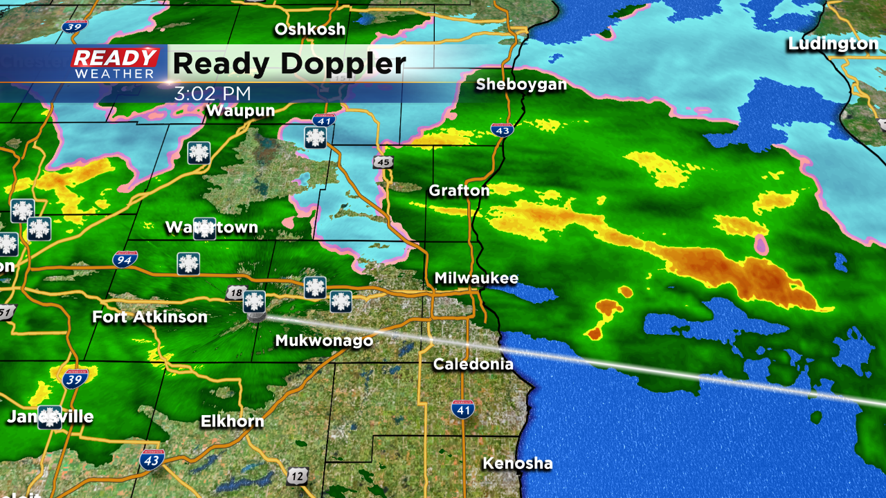
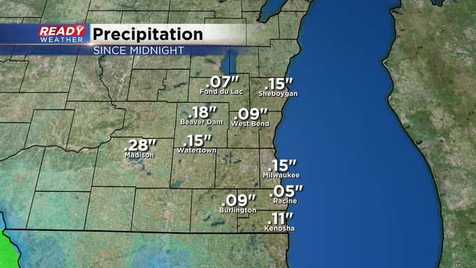
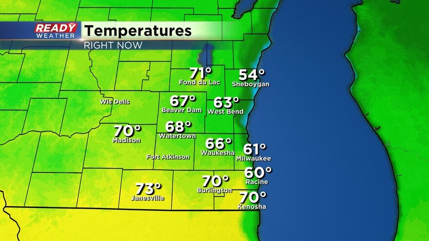
Most of the snow and sleet has transitioned to all rain across southeastern Wisconsin. Over the next couple of hours there will be some rain mixing with some sleet; however, nothing is expected to accumulate or cause issues on the roads. Temperatures later tonight will warm into the lower 40s as the winds shift south.
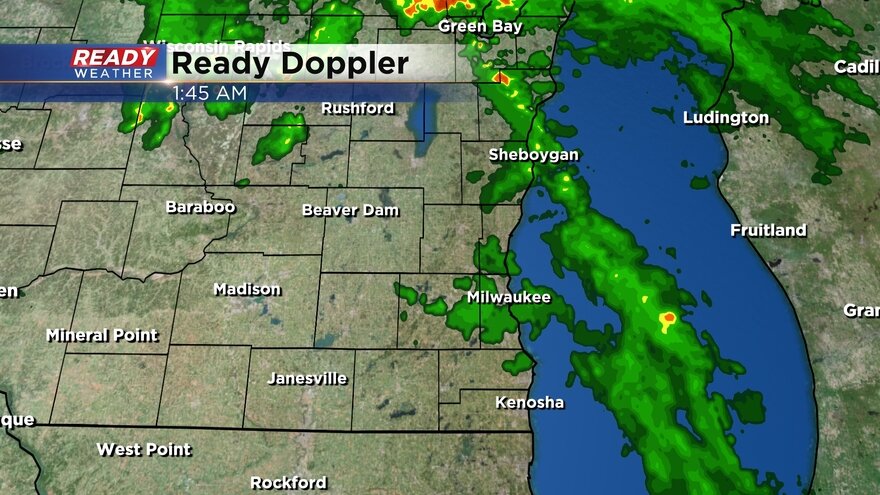
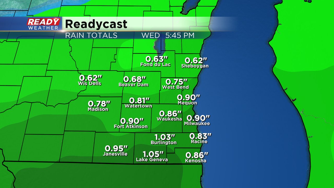
Light rain is possible overnight. Another wave of rain is expected for Wednesday afternoon.

Last November was rather snowy for Milwaukee. Milwaukee averages 2.4" of snow for the entire month. Areas west of the lake picked up a wet 1" to 2" before it transitioned to rain. Milwaukee sits at just a trace.
______________________________________________________________________________________________________________
Updated: 1:30 p.m. November 24, 2020
Team coverage tracking our wintry weather maker continues this afternoon.
Updated: 11:04 a.m. November 24, 2020
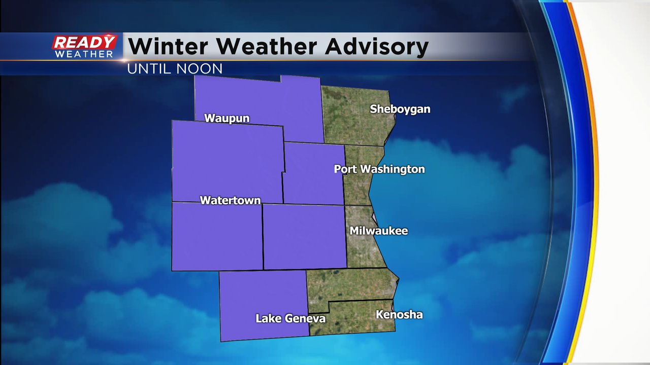
Our central and western counties have been added to the Winter Weather Advisory until noon today for a slushy 2-4" of snow. 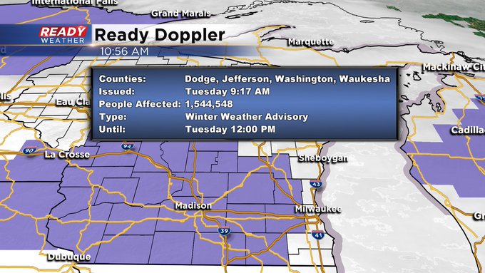
Updated: 9:07 a.m. November 24, 2020
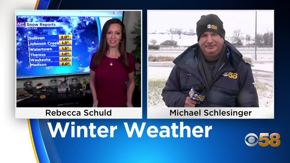
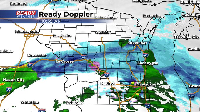
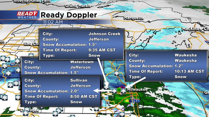
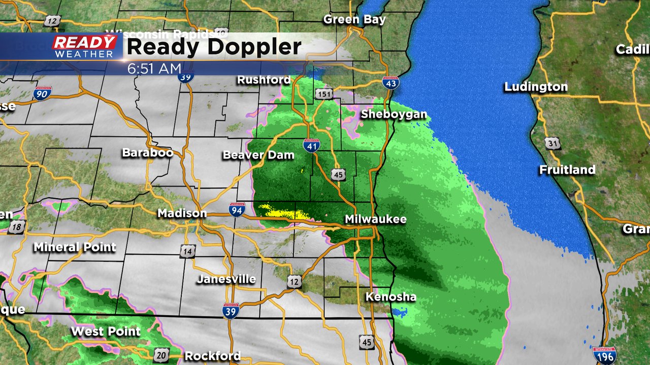
Rain, snow and mix is still falling across southeast Wisconsin and some snow totals are starting to come in. Most of the totals are from just to our west with 1-2" reported but we've had a few reports in that range from southeast Wisconsin too. I would not expect much, if any, accumulating snow in lakeside areas. A break is starting in some southern spots which will be the likely end of the snow and switchover to rain. Here's the latest radar image that will updated with time:
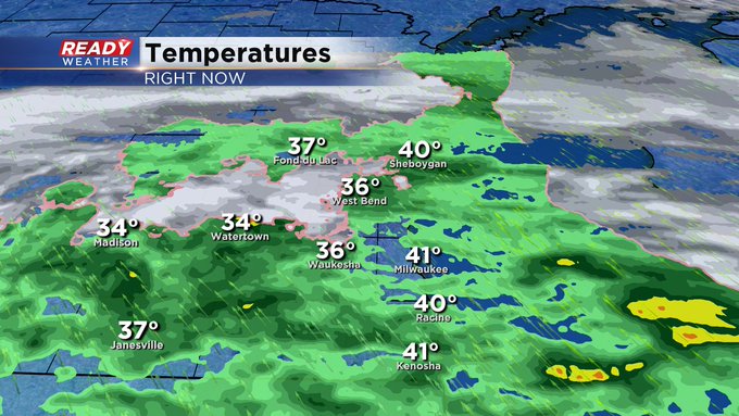
Temperatures have dropped to freezing in many western and inland areas so expect the snow to accumulate a little more there and roads could get a little slick. Temps are still mild in the middle to upper 30s lakeside and north. This temperature map will update with time:
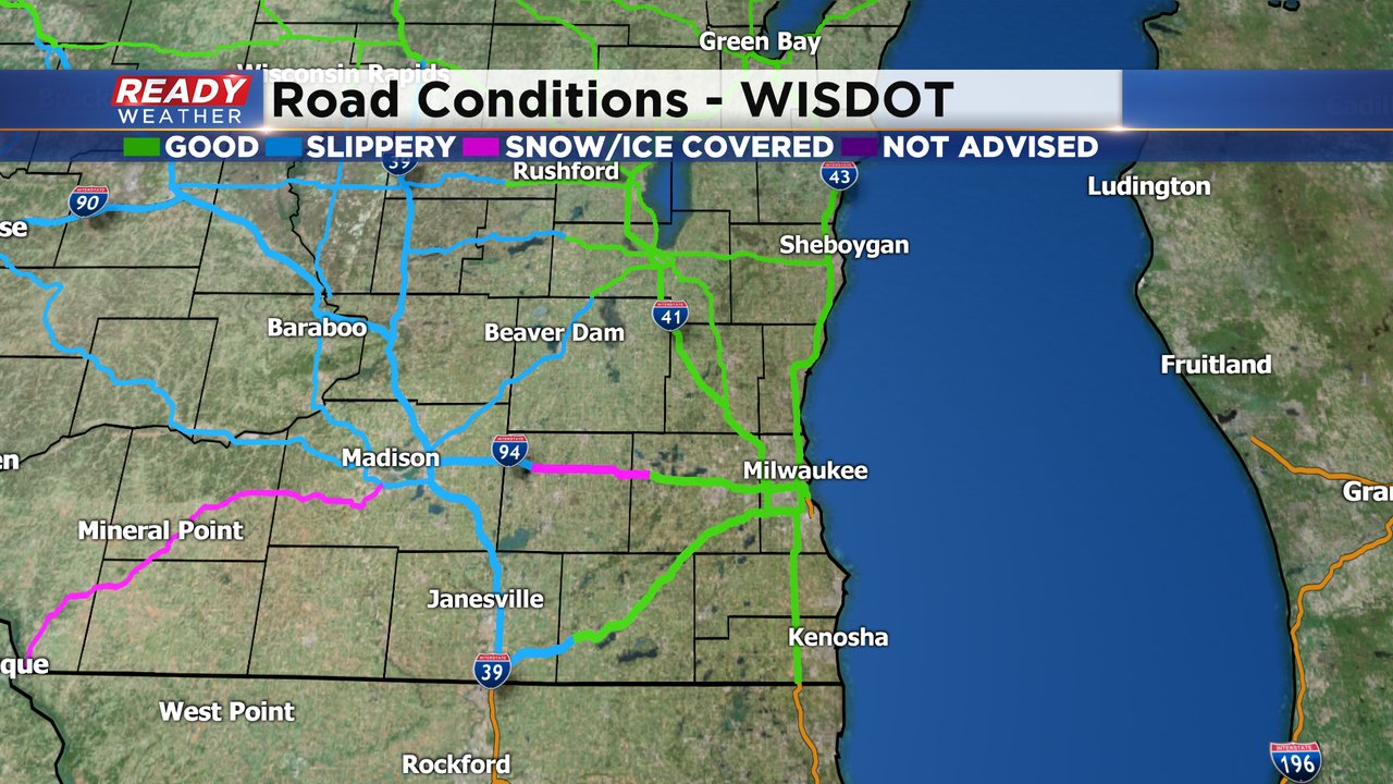
Road conditions are still reported as good for most of southeast Wisconsin and mainly just wet. Some freeways closer to Madison are reporting slick spots or even snow covered patches so keep that in mind if your travels take you west today.
------
Updated: 6:59 a.m. November 24, 2020
All of southeast Wisconsin is seeing some sort of precipitation right now but whether that is all rain, all snow or a rain/snow mix depends on where you live. Our far western counties like Dodge, Jeffersona and Walworth are seeing mainly just snow. Lakeside areas like the city of Racine and Kenosha and most of Milwaukee and Ozaukee Counties are just seeing rain with a few snowflakes mixed in.
Expect the precipitation to continue in this mixed fashion through the rest of the morning. We still expect all of the precip to switch over to just rain by the early afternoon.
Temperatures are very important on a morning like this and the majority of southeast Wisconsin is seeing temperatures above freezing which will allow roads to stay mainly just wet. Here's a temperature map that will update with time:
Driving conditions are reported as good or just wet for most of southeast Wisconsin. Roads around Beaver Dam are reported as slippery in stretches and conditions worsen as you approach Madison.

------
Posted: 4:52 a.m. November 24, 2020
Our first impactful snow event of the season is knocking on our doorstep. Just before 5 AM on Tuesday the snow has just entered our western and southern counties like western Jefferson County and southern Walworth County. Here's the latest radar image that will update with time:
Temperatures so far this morning are fairly mild with most of southeast Wisconsin above freezing and lakeside spots like Milwaukee, Racine and Kenosha very warm around 40. Any precip that falls this morning lakeside will likely stay rain or a rain snow mix with roads mainly staying wet there or slightly slushy. Inland communities with temps just above freezing can expect slushy road conditions. Here are the latest temperatures that will update with time:
Snow will move in from the west the next few hours and by 9 AM all of southeast Wisconsin should be seeing it. Because of the rate of snow expected this morning as well as the impact on the roads all of our inland and western counties have been added to the winter weather advisory. This includes Fond du Lac, Dodge, Washington, Jefferson, Waukesha, and Walworth Counties. The advisory lasts until noon on Tuesday.
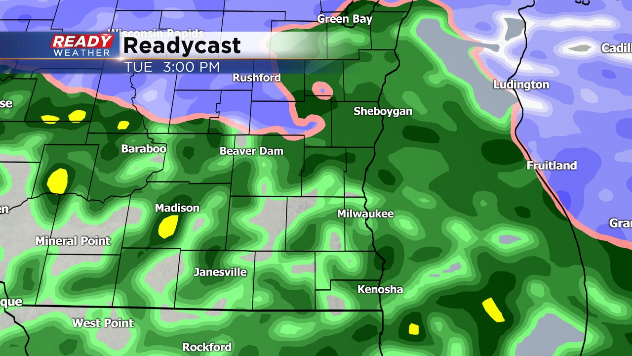
We are still expecting the rain and rain/snow mix to switch over to just rain during the early afternoon of Tuesday. By 3 PM the majority of southeast Wisconsin will just see rain falling.
Snow totals in southeast Wisconsin haven't really changed much with up to 2" expected locally and highest totals away from the lake. Beaver Dam and Fond du Lac have the potentially to see the most in our area. Just to our west some areas of south central Wisconsin could get up to 4" of snow.

Rain will be a big part of this storm system as well with up to one inch of just rain expected. The rain will be moderate and steady at times Tuesday afternoon and evening. A few lighter showers are expected Tuesday night with some scattered rain continuing through Wednesday afternoon and wrapping up in the evening.
Download the CBS 58 Ready Weather app to track the falling snow and switchover to rain with the Interactive Radar.