It's been a very dry year so far. Thanks to the snowy February, we're at least up to 1.14" of precipitation. That still leaves us as 5th driest start to the year for Milwaukee, as of today. But we're about to put a nice dent in the deficit. Strong low pressure is approaching the area starting after midnight. We'll see a period of light rain from about midnight to 4-5am.
 Image
Image
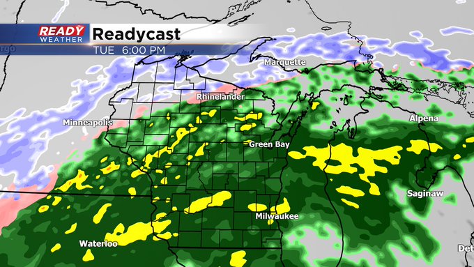
This will only be light rain. With perhaps a tenth of an inch of rainfall accumulating. Then, after a morning break the solid and soaking rain moves in for the afternoon.
 Image
Image
That will be in progress for the evening commute and continue into the night. We may even have some rumbles of thunder. Take a look at these projected rain totals:
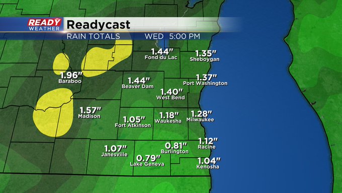 Image
Image
While we have the rain here, the northwest part of the state is under a Winter Storm Watch. More snow is expected there and some spots could pick up a half foot of snow. And we won't be able to escape the snow either. As the storm begins to depart the state, we'll see the rain switch to snow here. Although we could get an inch or two for our far western communities, the rest of us likely sees less than an inch. Temperatures will start in the 40s and drop to the 30s later in the day so this remains primarily liquid for us. Here's when the switch takes place.
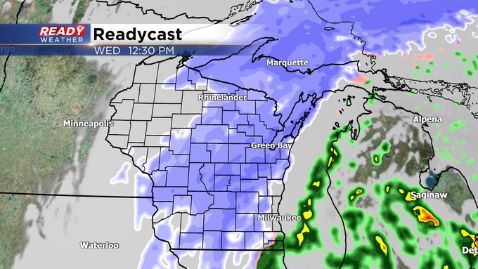 Image
Image
One last thing to keep in mind is winds will really ramp up into Wednesday. Gusts could reach 40 mph as they turn northerly. As temps drop to around the freezing mark by sunset, wind chills will drop to the teens, so be ready for a chilly end to your Wednesday.
I'm meteorologist Rebecca Schuld


