Tracking heat and humidity along with storm chances this weekend


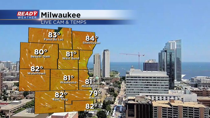
A beautiful start to the day as temperatures are rapidly heating across Milwaukee. Clear skies are allowing us to warm up to the 80s already this afternoon.
Enjoy the pleasant weather while you can! Dewpoints are only expected to rise from here with heat building up through the weekend. Tomorrow, humid conditions are likely with dewpoints in the mid 60s, although humidity on Sunday and Monday looks to reach the miserable category on the Muggy Forecast as dewpoints in the 70s are expected.

So far this month we haven’t seen many hot days, with our last 90-degree day being a little over two weeks ago. On June 25th, we reached a high of 92 degrees, and those temperatures look to return to end our weekend and begin the work week.
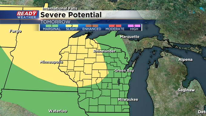
With temperatures in the 90s and dewpoints far more humid than we’d enjoy, severe thunderstorms are likely this weekend as chances of storms are likely Saturday through Monday.

During the daytime hours Sunday, we look to stay dry until late afternoon as a line of spotty storms develops, bringing brief and heavy downpours, then clearing by the late evening.

Tied with the expected storms this weekend, some of these have the potential to turn severe as both Sunday and Monday have the main risk of strong winds and heavy downpours.
Following the heat and storms, temps finally begin to cool for the rest of the week after the last bit of rain exits early Tuesday.
CBS58 Weather Intern - Natalie Chudzik