Warm end to September with gusts returning to start October


The end of September is already here! The month will end on a warmer month with highs reaching the mid 70s lakeside and even some upper 70s away from the lakefront. A cold front that moves through Monday night drops highs into the 60s for Tuesday then rebounds a bit in the 70s the rest of the work week.

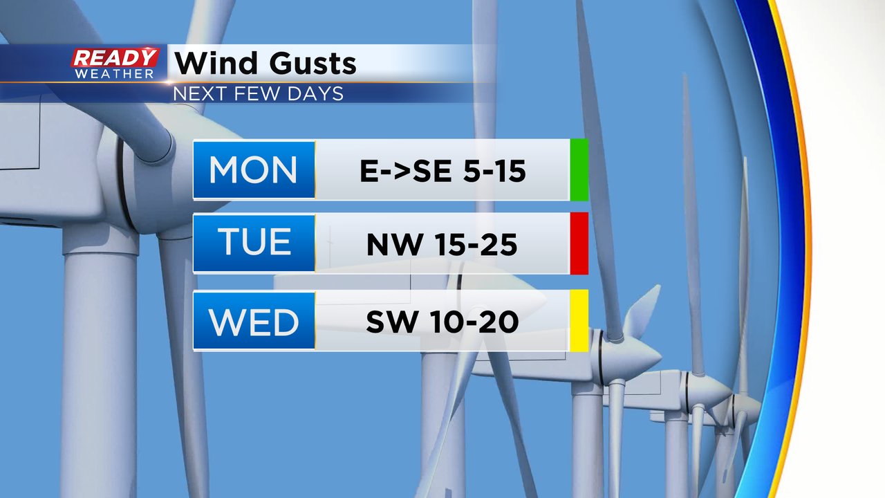
This past weekend was fairly windy, especially Saturday. That wind takes a break Monday with a light lake breeze but after the cold front Monday night a windy NW breeze returns for Tuesday then some breeziness remains on Wednesday.
The last day of September might also be our last day with any humidity for the season with dew points hanging out in the low 60s making it feel a touch muggy at times. Then the cold front Monday night drops the dew points into the 40s and even 30s for the middle of the week.

The cold front that rolls through Monday night into early Tuesday looks mostly dry but a few sprinkles can't be completely ruled out during the early morning hours of Tuesday. Most should be dry by sunrise.

Download the CBS 58 ready weather app to see when the next better rain chance arrives.