Warming up to start the week with the chance for strong to severe storms


We made it into the 50s over the weekend on Sunday but as we go into a new work week temperatures will soar into the 60s. Low 60s for highs are expected both Monday and Tuesday and Wednesday could reach the upper 60s to near 70! For the end of the week we cool down a bit back down below-average around 50.

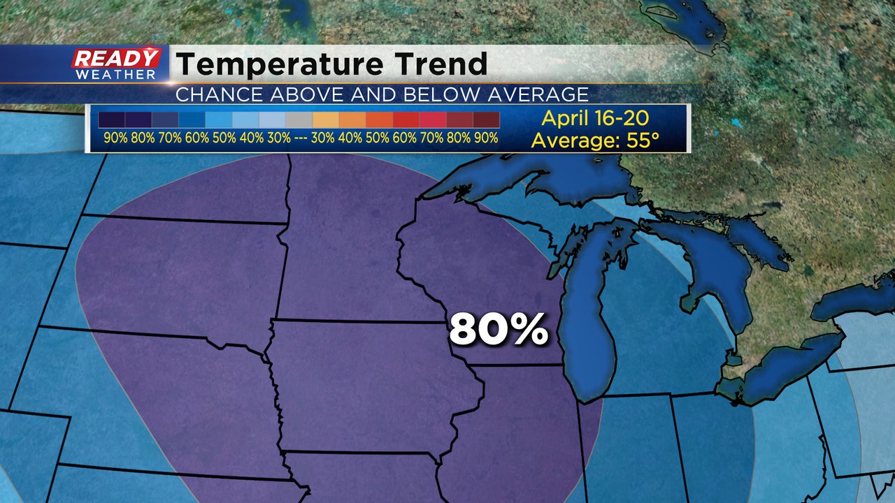
Enjoy some of the warmth while we have it because the arrival of Easter weekend into next week will drop temperatures into the upper 40s. The temperature trend for April 16-20 has almost the entire country seeing below-average temperatures with an 80% chance for that in Wisconsin.
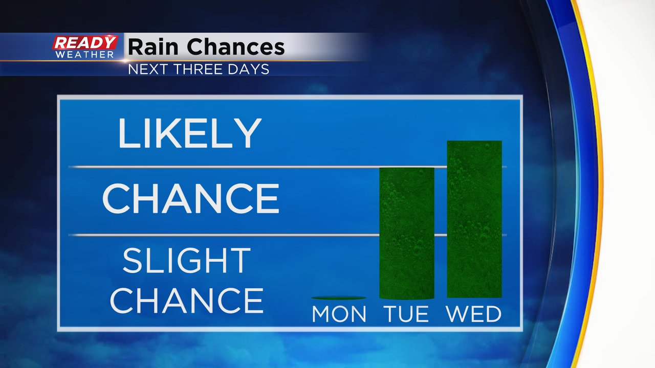
After a completely dry day on Monday our rain chance returns Tuesday evening with a few showers and storms possible. Wednesday is the best chance for showers and storms this week before a mostly dry holiday weekend arrives.
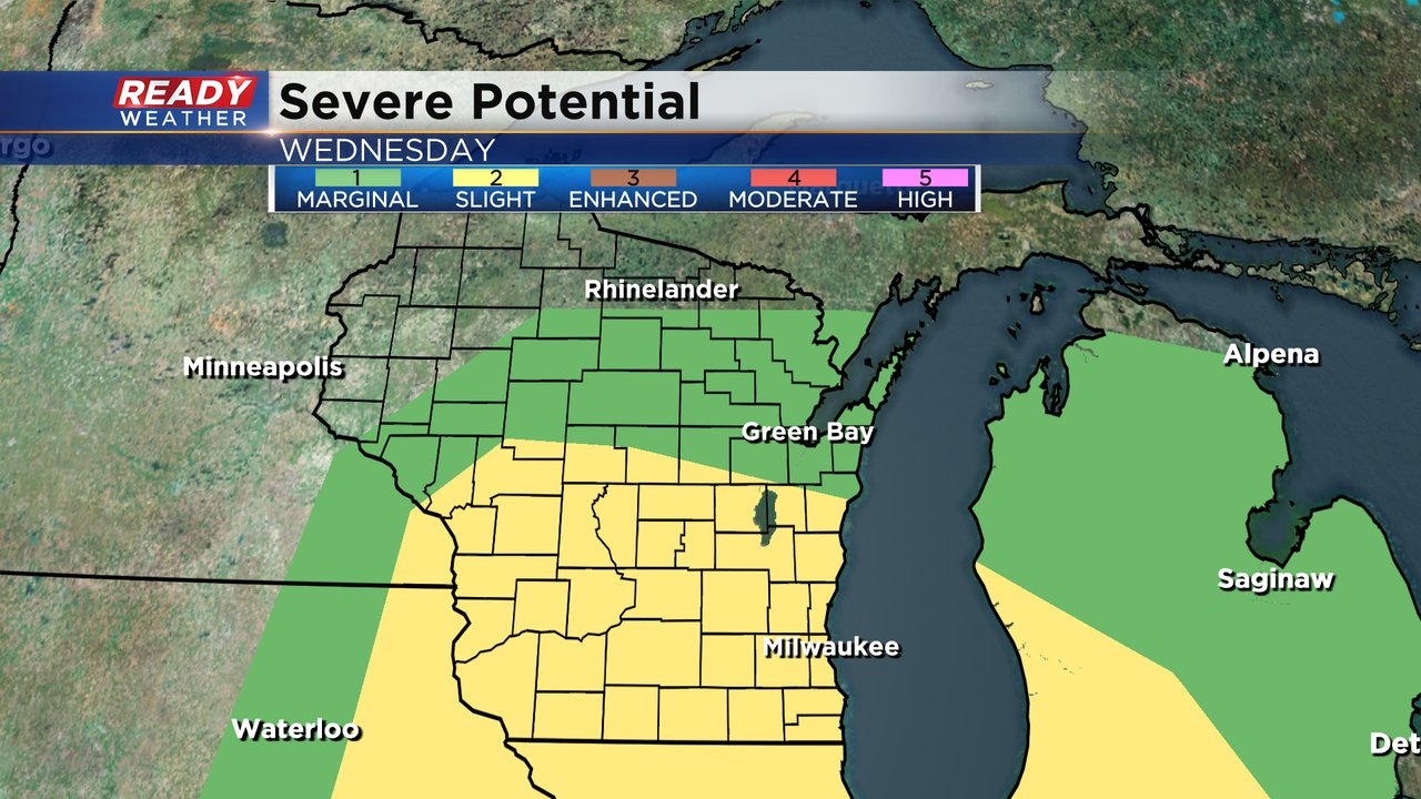
With the warmth the next few days a few stronger storms may be possible on Tuesday evening. Wednesday is the main day we are watching for the possibility of severe weather. This will all depend on the timing of a cold front but hail, strong wind and even isolated tornadoes are possible Wednesday afternoon and evening. All of southern Wisconsin is currently in the slight risk (level 2) for severe weather.
Download the CBS 58 Ready Weather app to track the warm temps and the chance for strong to severe storms.