Wet snow and mix arrive Wednesday night through Thursday


Another potent winter storm will move across the Midwest Wednesday and Thursday bringing southeast Wisconsin the chance for both wet snow and rain. The precipitation looks to start just after the evening commute on Wednesday with steady and heavy wet snow and mix Wednesday night into early Thursday morning then lingering snow and mix showers throughout the rest of the Thursday.

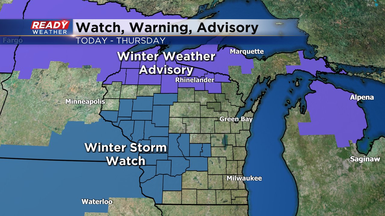
A winter storm watch has been posted just off to our west where they have the better chance for just snow and no mix and higher snow totals of 6"+ of snow may be possible out in these areas. The winter weather advisory in northern Wisconsin is for some light snow and mix Tuesday morning. Parts of southeast Wisconsin will likely be under a winter weather advisory as we approach this storm. As of this afternoon nothing has been issued.
The track of the storm will heavily determine what type of precipitation we see and how much of it. A shift to the north would mean more rain for more of us and a shift to the south would mean more snow. As of Tuesday morning, southern counties likely see wet snow and rain with some not getting any snow accumulation and others seeing a slush inch or two. Northern counties have a better chance to see mostly wet snow with 3-5" of snow possible.

Download the CBS 58 Ready Weather app to keep tabs on how the forecast changes.