Winter returns with snow showers, a wind advisory and a blast of cold air
We spent 120 hours below freezing from the morning hours of Thanksgiving through mid-morning on Tuesday. Temperatures finally got into the mid 30s Tuesday afternoon and while Wednesday might be even warmer, the wind will be stronger. Wind gusts during the day on Wednesday get as high as 35 mph then hit their peak Wednesday night to 45 mph before staying strong with gusts to 30 mph most of Thursday.
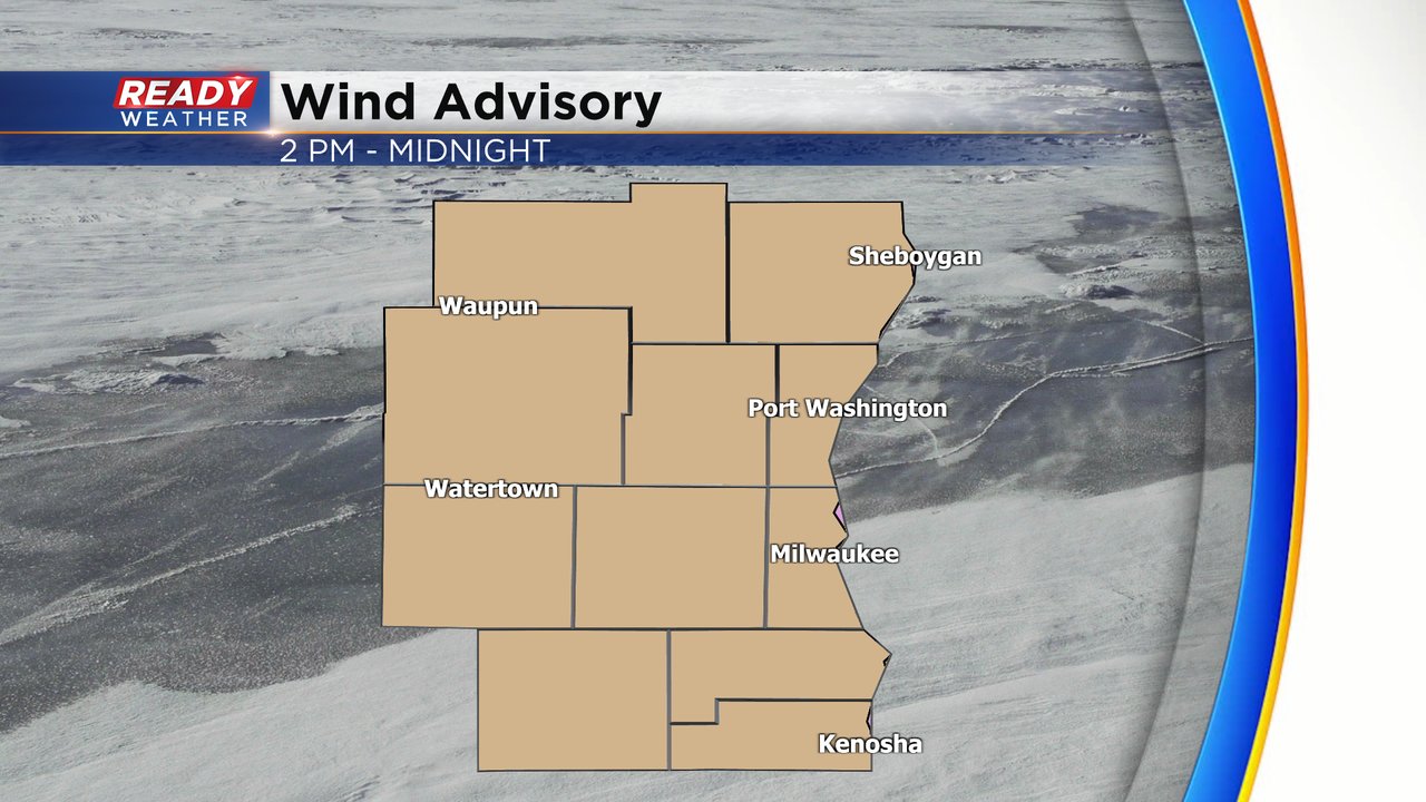
The strong wind especially Wednesday night has prompted a wind advisory from 2 PM Wednesday through midnight Wednesday night for the possibility of wind gusts up to 45 mph.
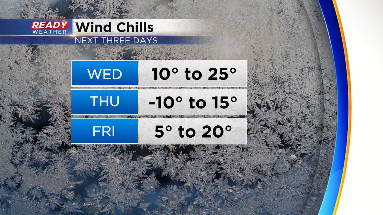
The wind will finally lighten up to 5-15 mph on Friday but wind chills are going to stay cold the rest of the week. Wednesday morning wind chills are in the teens and don't warm much more than the 20s in the afternoon.
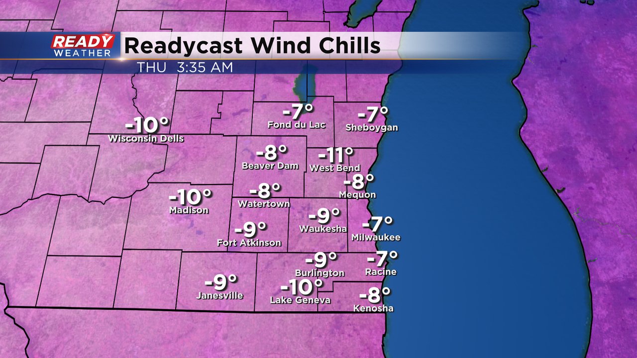
Thursday morning wind chills will be the coldest, and even colder than this past weekend. Thursday morning could feel more like the single digits to around -10 degrees and only warm to around 10 above zero in the afternoon. Friday morning will remain cold with single digit wind chills above-zero then around 20 by Friday afternoon with a lighter wind.
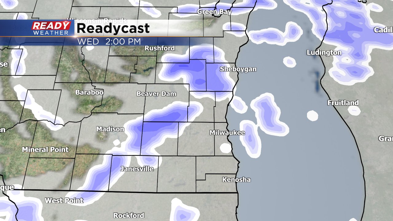
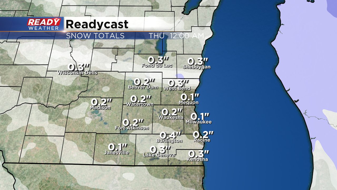
The wind is picking up as a cold front approaches Wednesday. That cold front could also bring some snow showers to southeast Wisconsin Wednesday afternoon and evening. Some of the bursts of snow, combined with the wind and blowing snow, could result in reduced visibility around a mile. The best timing for snow showers is from Noon to 9 PM.
While accumulating snow isn't likely for everyone, some locations could get at least a dusting if not a few tenths of an inch of snow up to a half inch Wednesday afternoon and evening. Roads could be slick for the Wednesday evening commute.
Download the CBS 58 Ready Weather app to track the snow with the interactive radar and the wind chills for your location with the hour-by-hour forecast.


