


Some residents in southeast Wisconsin are waking up to some light snow and light wintry mix Wednesday morning. That mix will linger through the morning and by late morning and noon at the latest it switches over into all rain showers.
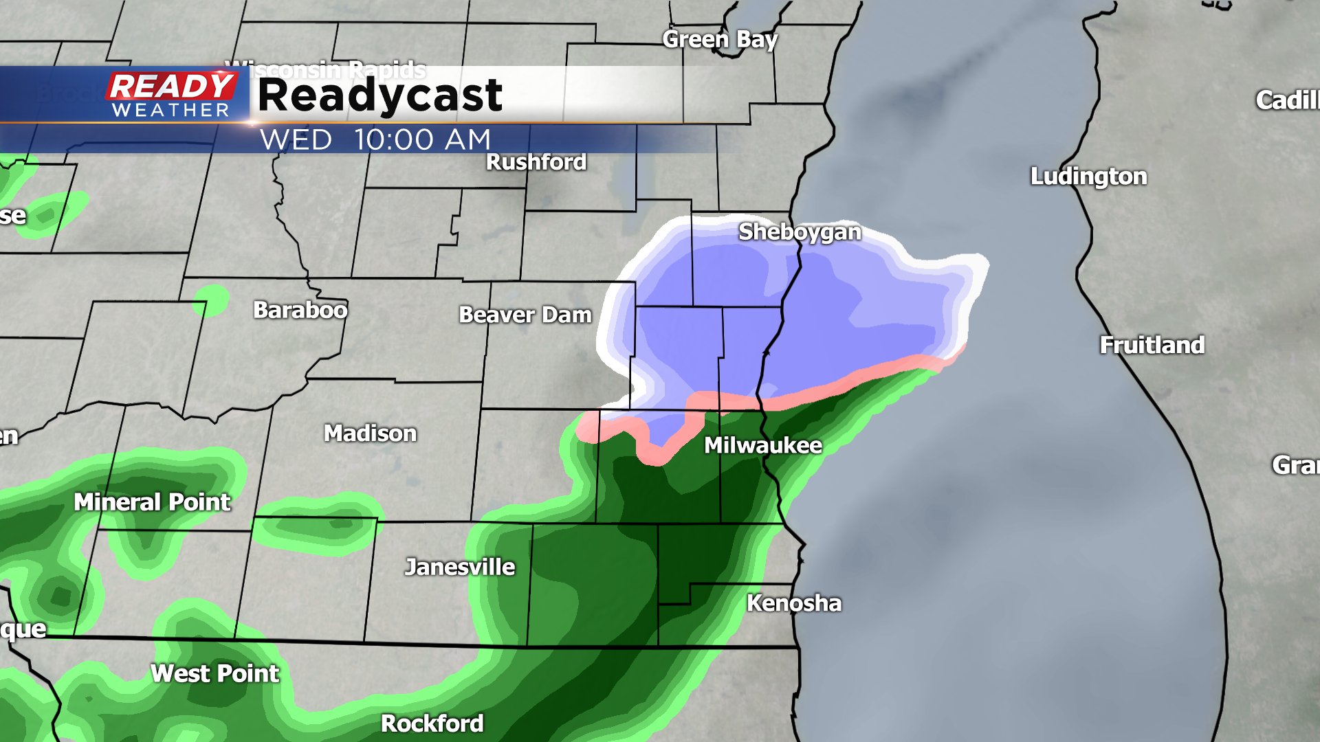
Rain showers will linger through the afternoon and stay mostly light. Rain on Wednesday will wrap up by 4 p.m. with most spots getting anywhere from 0.10"-0.30" of rain.

Wednesday is storm #1 with storm #2 arriving on Thursday. We stay dry Wednesday night into Thursday morning but by late Thursday morning and definitely the afternoon and evening scattered showers will develop. A few isolated thunderstorms are possible especially Thursday evening with best chances near the WI/IL border.

Thursday's rain will be more soaking than Wednesday's with up to a full inch possible meaning by the time our two storms wrap up 1.50" of rain is possible in some communities.

Any storms that do form on Thursday could be strong. Temperatures Thursday will be mild in the 50s bringing enough instability to the atmosphere to form a stronger thunderstorm. All of southern Wisconsin is in the marginal risk for severe weather for the first time this year.
Download the CBS 58 Ready Weather app to track the mix for today and chance for storms tomorrow.