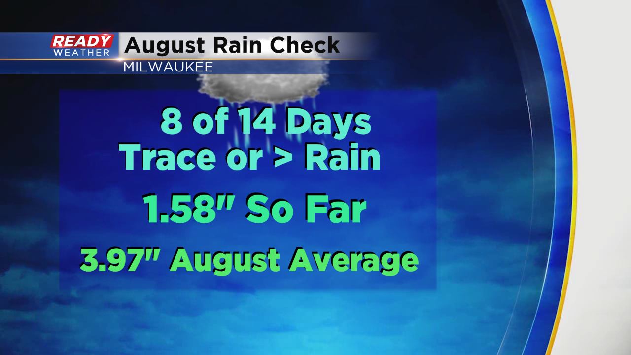
The last couple have days have been a bit on the gloomy side. In fact, we've had 75% cloud cover overhead in the Milwaukee area since the weekend. And almost half the month so far has had at least a trace or more of rain. Check it out:
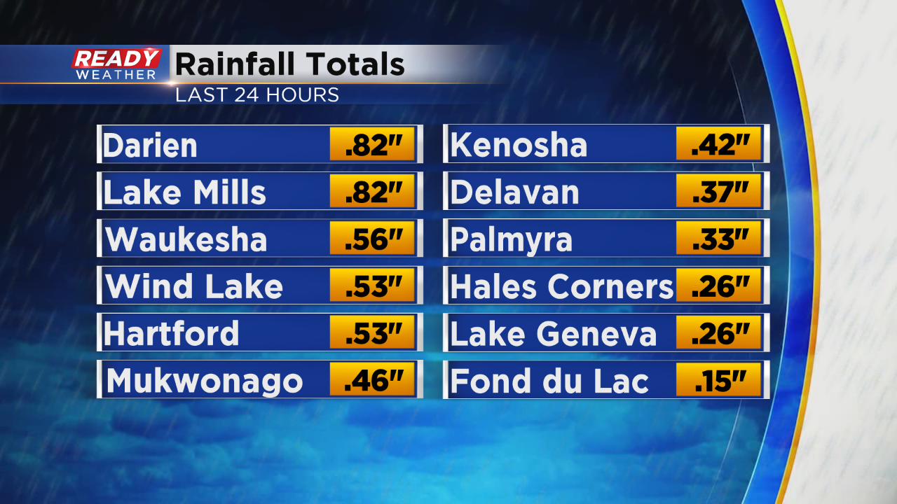
On the current track we are still about a quarter inch behind to date on rainfall. Our early morning rain in the city tallied up just over three tenths of an inch of rainfall. Other areas got more, some less.
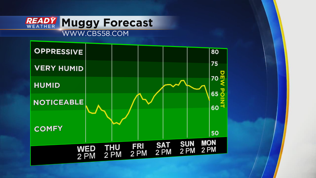
If you are a fan of the rain and somewhat muggy weather, there's more in store!
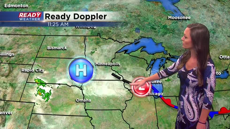
Currently we have an area of low pressure nearby. It's keeping clouds and a few isolated showers around.
Thursday high pressure tries to nudge in. As you'll see from the Muggy Forecast it does provide a slight decrease in humidity, although an isolated shower still cannot be ruled out.
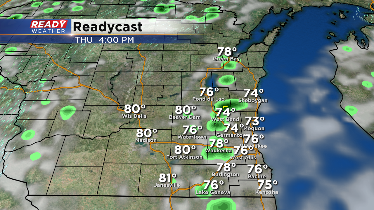
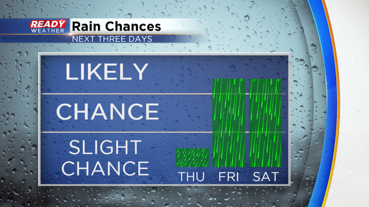
This is what Readycast paints in for rain chances Thursday afternoon. It won't add up to much. Better accumulating chances will come the following two days.
A few storms will also be possible Friday and again this weekend. The upcoming weekend appears humid and warmer with temps back in the 80s.
As always the CBS58 Ready Weather Team has you covered with everything you need to know to stay one step ahead of the storms. You can find plenty of tools to track the weather with our Ready Weather App. It's free for Apple and Android products.
I'm meteorologist Rebecca Schuld