Coldest air in nearly a month returns to southeast Wisconsin
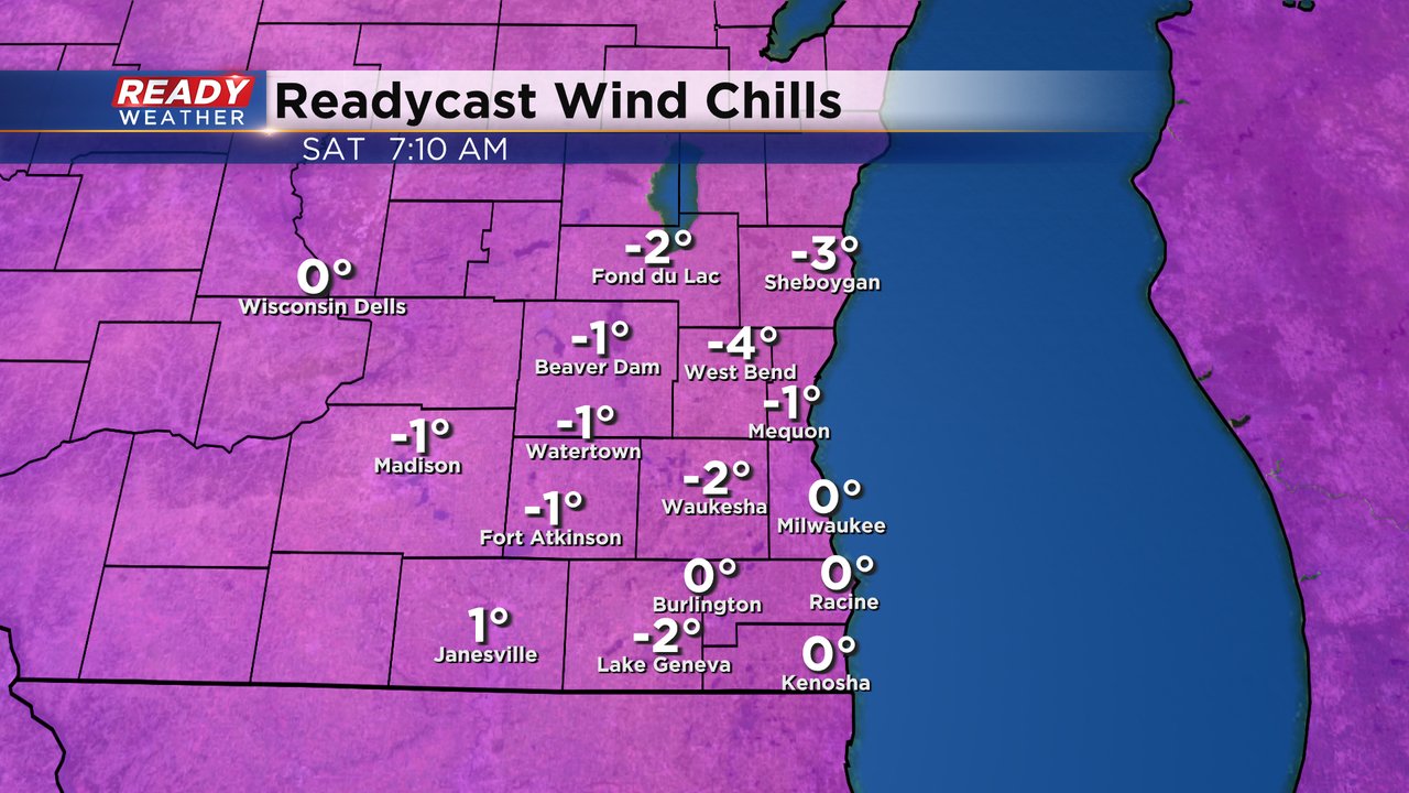
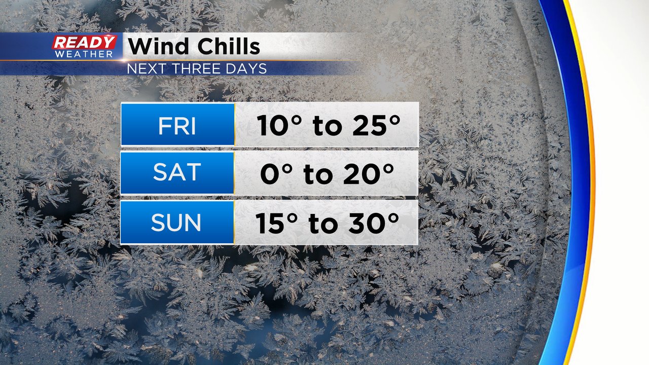
The snow from Thursday morning is long gone and even melted in a lot of communities, but the cold air is now rolling in. Wind chills Friday morning reached the teens for everyone and even barely into the single digits in Sheboygan. Those wind chills will stay in the teens to the low 20s most of the day Friday. Saturday morning will be the coldest daypart of this latest cold stretch. Wind chills when you wake up Saturday morning will hover around or just below-zero.
By Saturday afternoon wind chills stay chilly in the teens but then they stay steady through Sunday morning and finally get back to more normal levels by Sunday afternoon.
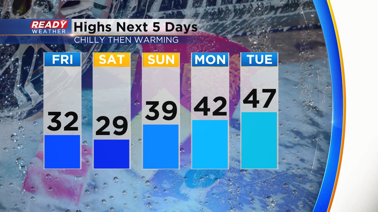
Along with the cold wind chills, highs for Friday and Saturday will stay around 30* which is the coldest temperatures since January 22nd. It will likely end a streak of 25 straight days above average highs. But look at how fast we warm back up! Back above average Sunday afternoon then 40s for Monday and Tuesday!
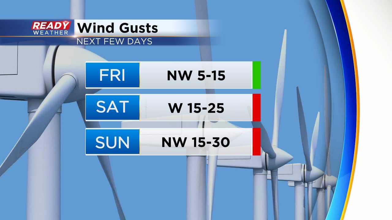
Part of the reason the wind chills will be so cold the next few days is an increase in wind speed. The wind isn't too bad Friday morning through the afternoon out of the NW 5-15 mph, but by Friday evening it gets breezy and that breeze gets a little stiffer on Saturday. Sunday is a windy day with gusts to 30 mph out of the northwest.
Download the CBS 58 Ready Weather app to track the wind chills for the weekend.
