Flood warning continues Monday morning after historic weekend flooding and more on the way


The flooding over the weekend in the Milwaukee Metro area was historic. Based on thresholds this was at least a 500-year flood meaning there is a 0.2% of rain of this magnitude happening in Milwaukee or a 1 in 500-year chance of it happening. Some areas reached levels that would constitute a 0.1% chance of this happening or a 1 in 1,000-year flood.

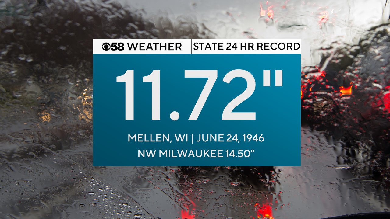
The 14.50" of rain on that list above on the northwest side of Milwaukee was an official and well-maintained station by MMSD. It will likely go down as a new statewide record for 24 hour rainfall shattering a very old record set in Mellen, Wisconsin on June 24, 1946. The total has to be verified by the state climatology office before it becomes official.
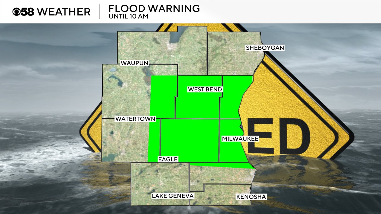
Flood warnings continue for the four county area that was hit the hardest: Waukesha, Milwaukee, Washington and Ozaukee Counties. Those counties, and a few surrounding areas, are under a flood warning until 10 AM Monday for continued standing water.
River flood warnings also continue in some areas. A few river gauge sites saw record high levels over the weekend including the Milwaukee River at Estabrook, Fox River at Waukesha and Root River at Franklin. The Milwaukee River at Estabrook is no longer at flood levels but the Fox River and Root River are still flooding. The Menomonee River in Tosa and the Oak Creek in South Milwaukee are no longer flooding but the Milwaukee River at Cedarburg is in minor flood stage.

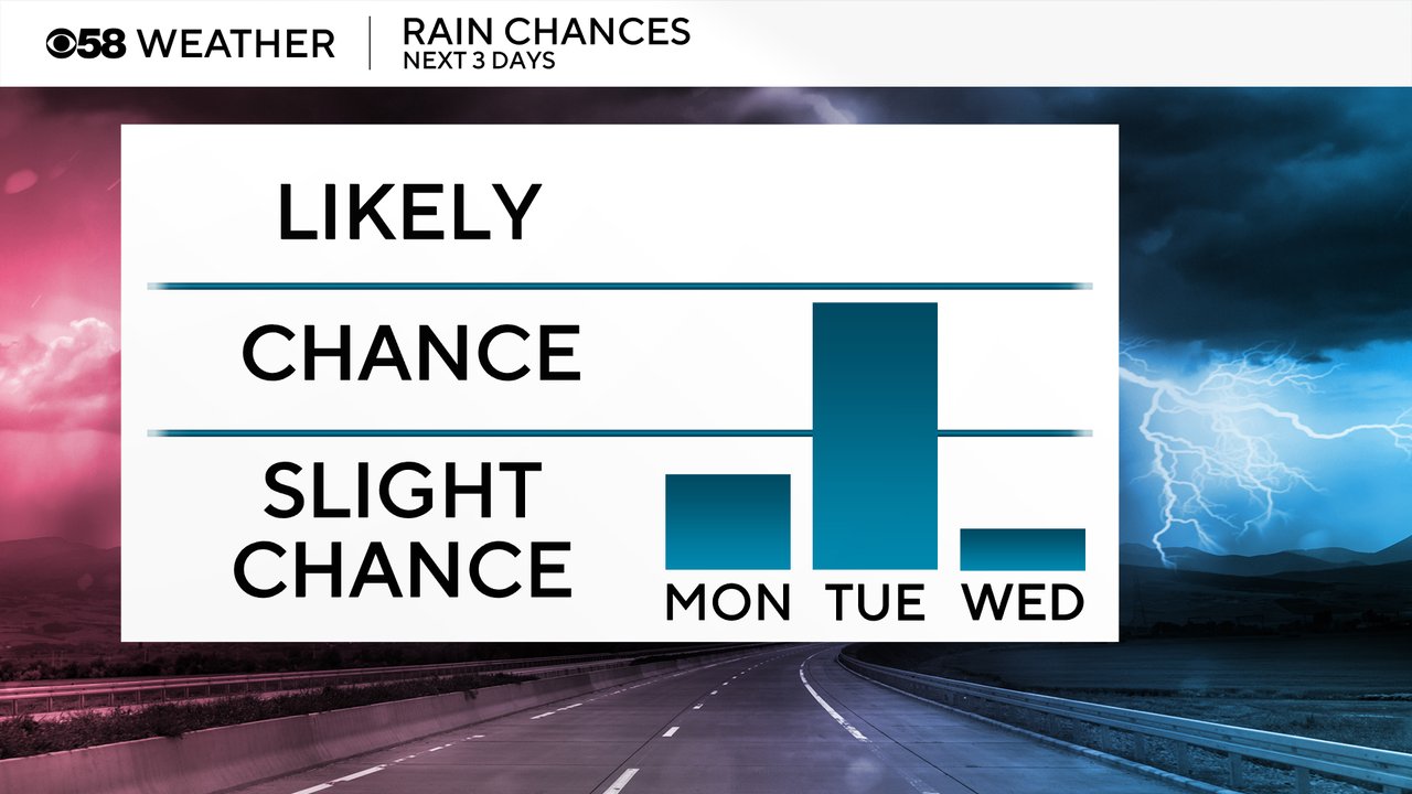
Unfortunately we are not completely done with the rain. A few isolated showers were out there Monday morning and a few more could be possible Monday evening. Better chances for rain move back in for Monday night through Tuesday. A round of storms and some heavy rain is possible Tuesday morning and a few strong storms could happen Tuesday evening. Wednesday starts a multi-day dry stretch.
Download the CBS 58 Weather app to track the continued showers and storms.