


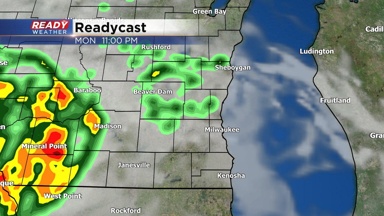
Hopefully you enjoyed Sunday, because it was our one day in this two week stretch where we didn't have any humidity, little rain chances and cooler temps in the 70s. Now as we start the new work week the temps are rising, the humidity level is increasing and rain is moving in. A few rain showers are possible Monday morning. For the most part rain has been falling apart as it moves into southeast Wisconsin but a few showers have made their way into our viewing area. The chance for morning rain lasts through about 10 AM with most of the rest of the day dry. A few more isolated showers and storms will be possible after 9 PM and overnight. A few of those storms could be strong.
Temperatures on Monday will be about 10* warmer than Sunday in the middle 80s. The temps continue to warm with 90* possible on Wednesday. Thursday and Friday look slightly cooler in the low 80s before middle to upper 80s return for the weekend.

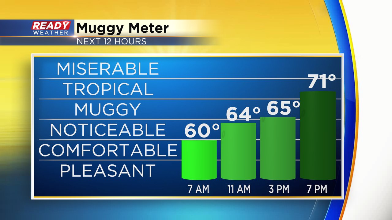
The dew point Monday goes from not so bad in the morning to sticky in the afternoon. By evening it will feel fairly tropical with dew points getting close to 70*.
And the humidity will get worse from there with middle 70s for dew points expected Tuesday and Wednesday. Thursday and Friday could be a little better with the slight drop in temps but expect the stickiness to return for the weekend.

Rain chances will stay persistent this week with at least a slight chance every single day. No day looks like a complete washout and it's a little tough to pinpoint when the wettest times of each day will be. Over the next 72 hours Tuesday looks to be our best chance for some scattered showers and storms throughout the day. Wednesday's rain looks best in the morning but there are more storm chances going into the weekend.

Download the CBS 58 Ready Weather app to track the rain.