Mild for the first day of spring before another chill and the chance for snow


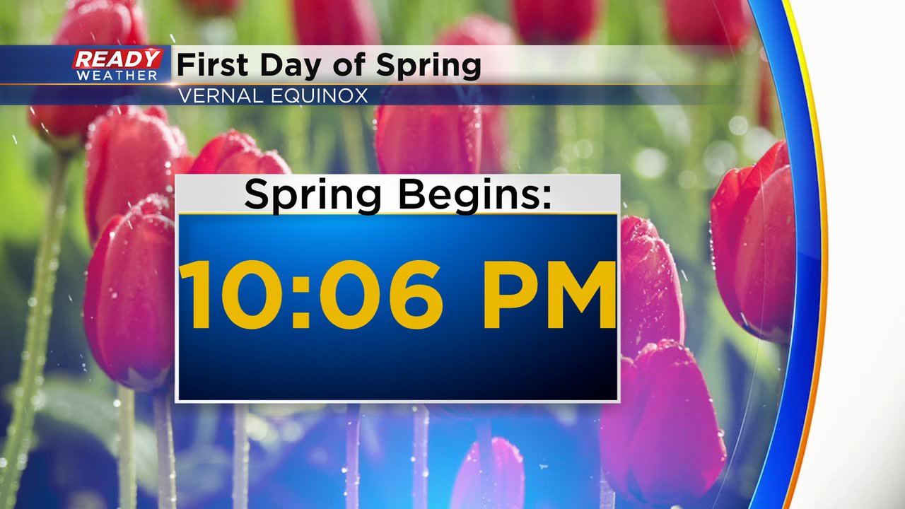
Happy Spring! The vernal equinox happens Tuesday evening at 10:06 p.m.
On this first day of spring the temperatures aren't bad at all with highs right around 50 degrees and above average. But for the first full day of spring on Wednesday the temperature drops to chilly levels in the 30s and stays there through the weekend.
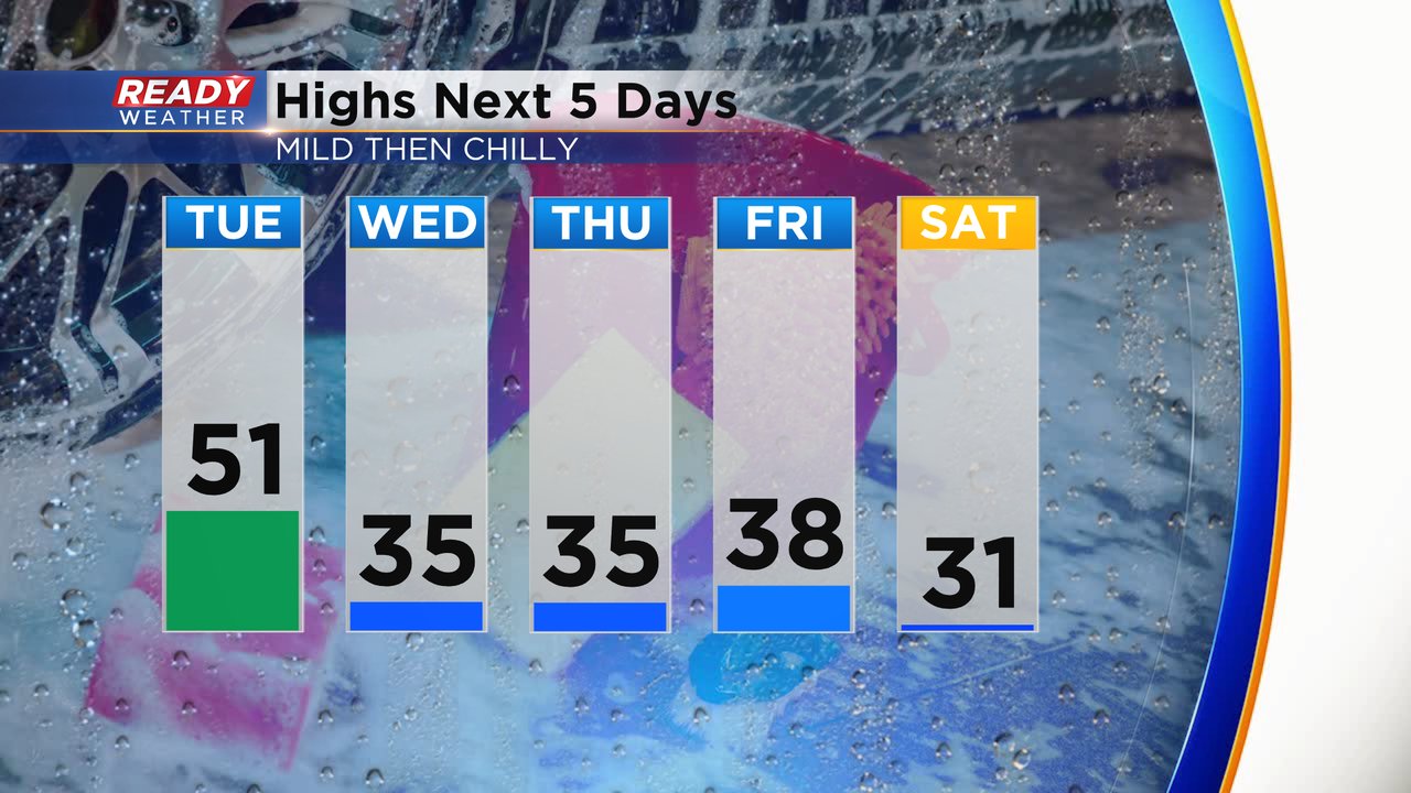
The cool down from Tuesday into Wednesday is the result of a cold front that will roll in Tuesday. That cold front will stay dry but it does come with a good amount of wind with gusts to 35 mph shifting from the southwest to the northwest. Wednesday remains breezy but a lighter wind does return on Thursday.

Even though spring is officially here, snow is still in the forecast. A round of accumulating snow is looking more and more possible for Thursday night and most of the day Friday. A little too early to talk snow totals but more accumulation is expected in our northern counties than southern ones.

Download the CBS 58 Ready Weather app to track the temps and wind to start spring and the snow on the way for Friday.