4:45 pm Update: Scattered storms popping away from the lake


Updated: 4:45 pm Friday, June 11th:
A couple of scattered thunderstorms have popped up this afternoon with a severe storm currently over portions of western Dodge and Jefferson counties. A Severe Thunderstorm Warning for this cell runs through 5:15 pm with quarter sized hail and gusts up to 60 mph possible.
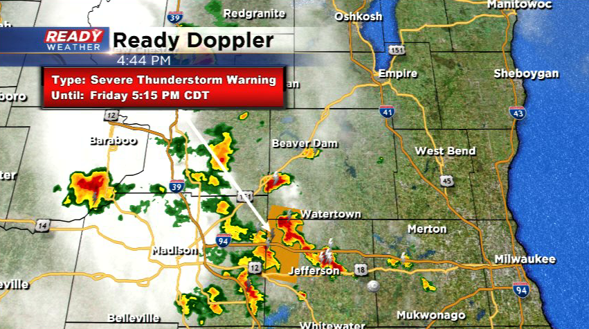
More scattered storms are expected to develop into this evening.
--------------------------------------------------------------------------
Updated 12:45pm Friday, June 11th
We have one sizeable storm in progress at this time. It's located in western Jefferson county and drifting southeast about 25 mph. Head's up for places like Whitewater and other locations in western Walworth county. We've received one report of .88" (nickel size) hail on the west side of Fort Atkinson. So far the storm has stayed under severe limits.
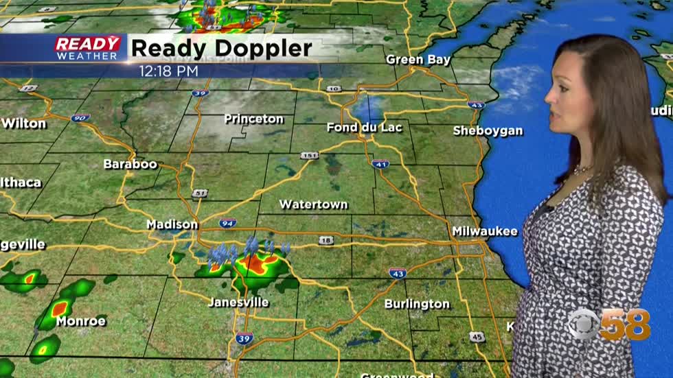
Additionally, another smaller cell is in development just west of Burlington, heading toward places like Lyons and other locations in east-central Walworth county. Keep an eye to the sky for pop up storms which could be strong. Heavy rain is likely, but gusty wind and some hail is also possible. This trend will be with us the remainder of our day, and overnight. Eventually a cold front sweeping through the area will also keep the chance in Saturday, followed by less humid conditions by Sunday.
--------------------------------------------------------------------------
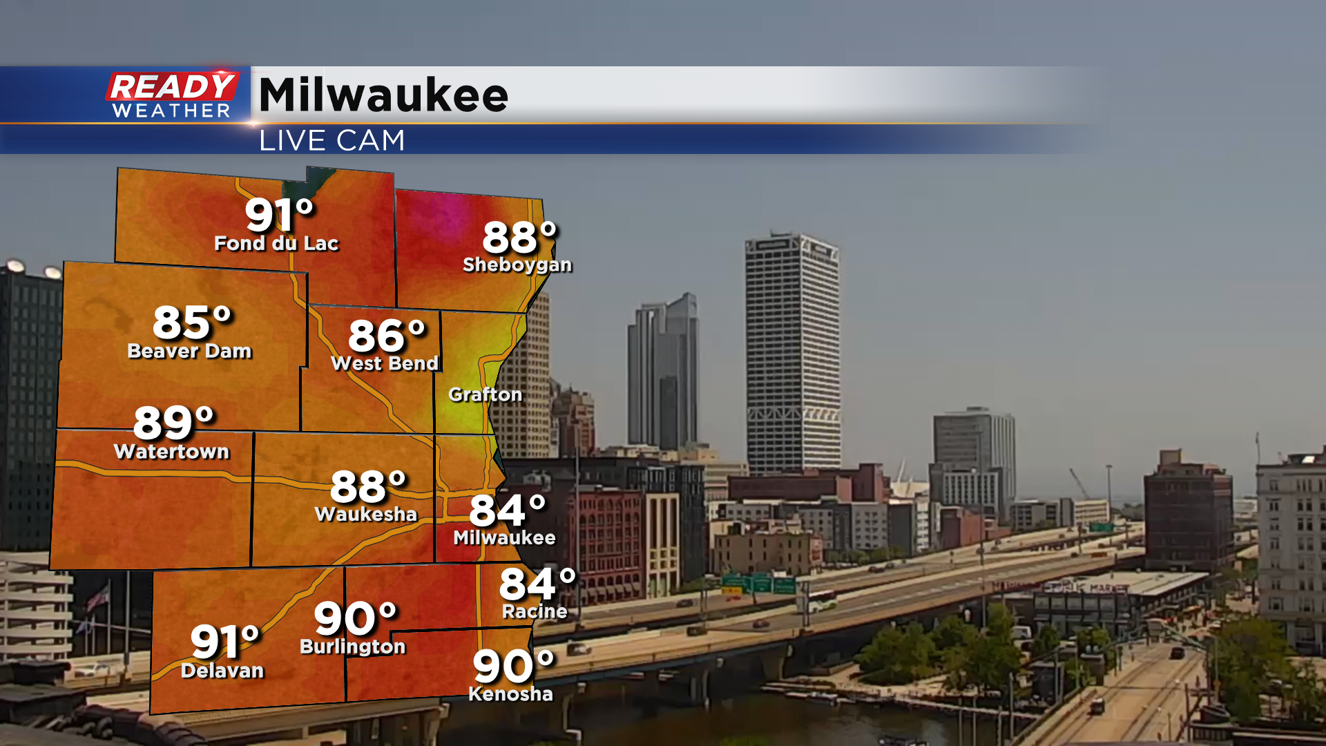
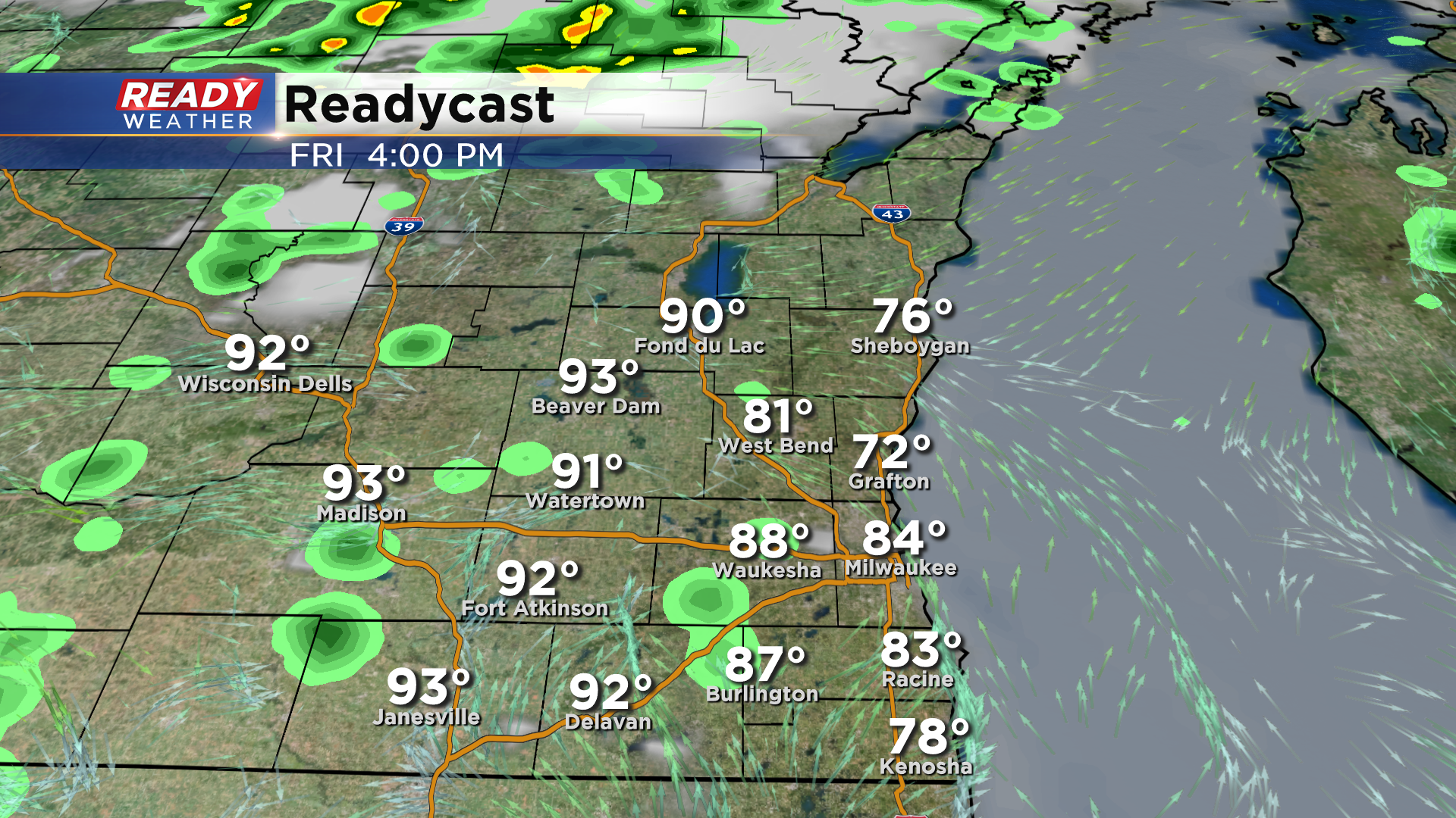
It's been a hot and humid morning with temperatures sitting in the upper 80s to low 90s in most locations as of midday.
While we've had sunny skies through the morning, clouds are starting to pop up around the state along with a few isolated thunderstorms.
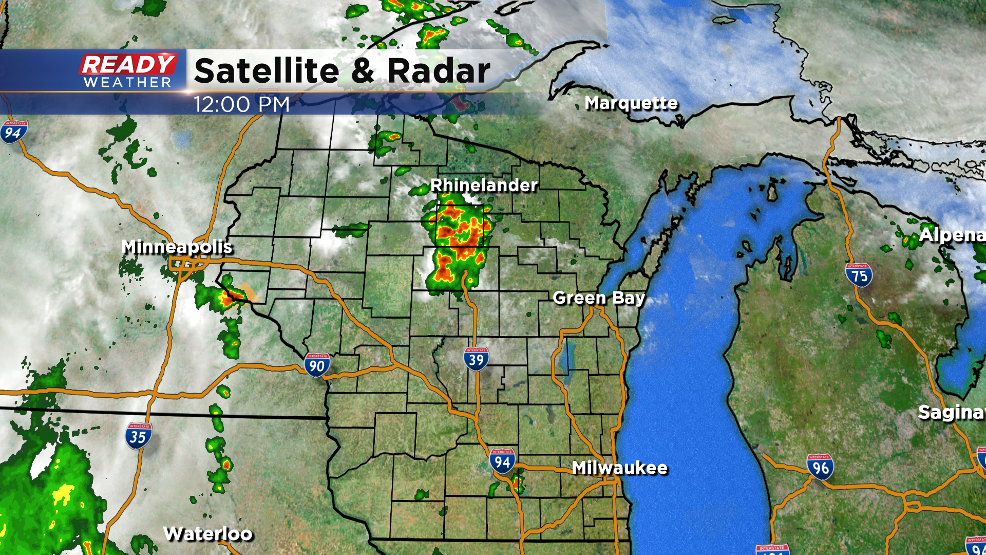
A few isolated pop up storms are possible this afternoon in southeast Wisconsin, but the better chance will be closer to Madison and Janesville and back towards north central Wisconsin.
A better chance for scattered storms in SE Wisconsin arrives between 8-10 pm, continuing into the overnight hours.
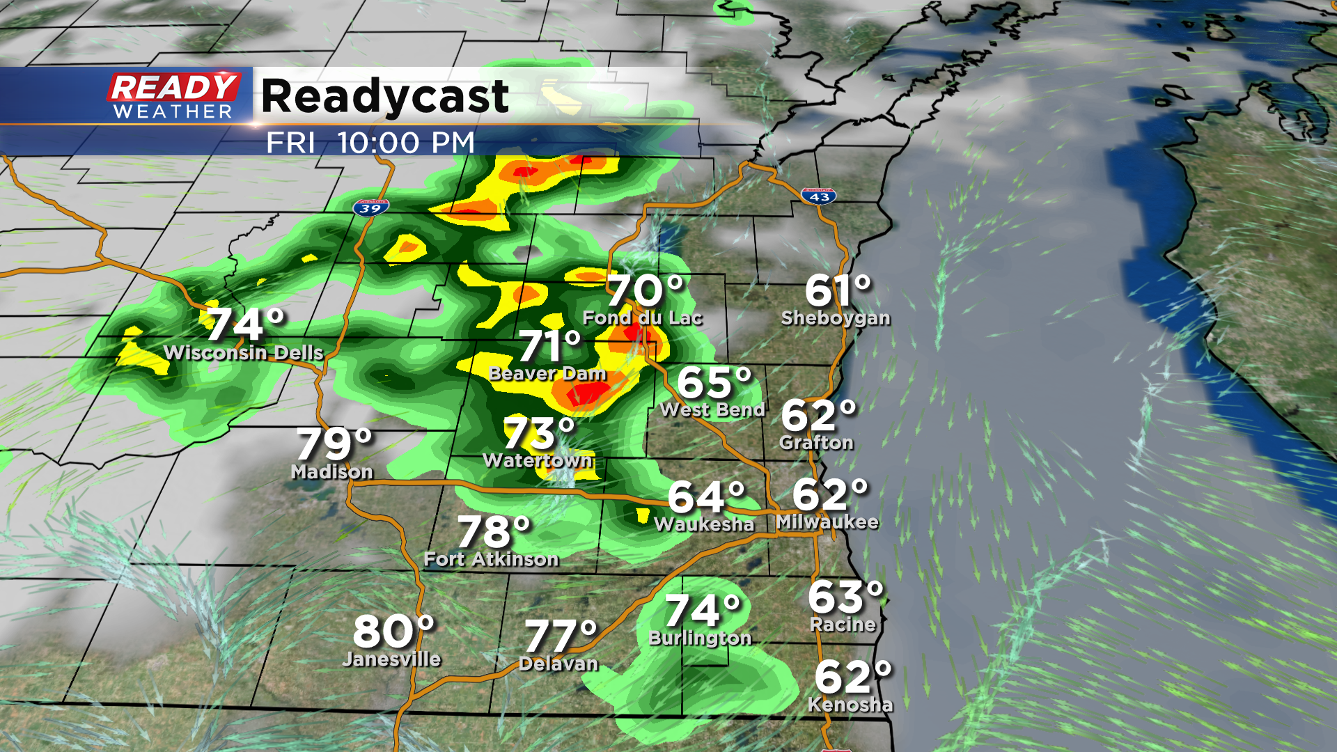
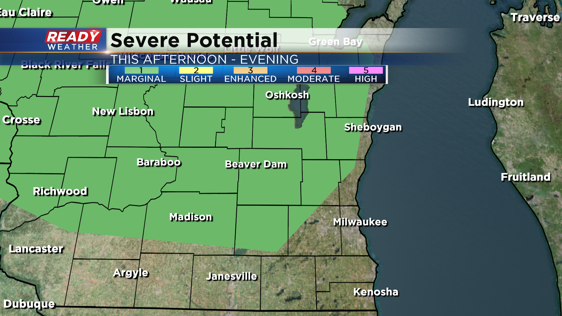
While storms will be weakening after sunset, they could pack some strong wind gusts. Best chance of any strong to severe storms will be northwest of the Milwaukee metro where a Marginal Risk (Level 1 of 5) of severe weather is in place.
A few showers may linger into Saturday morning with more isolated showers and storms popping up in the afternoon as the system pulls away.
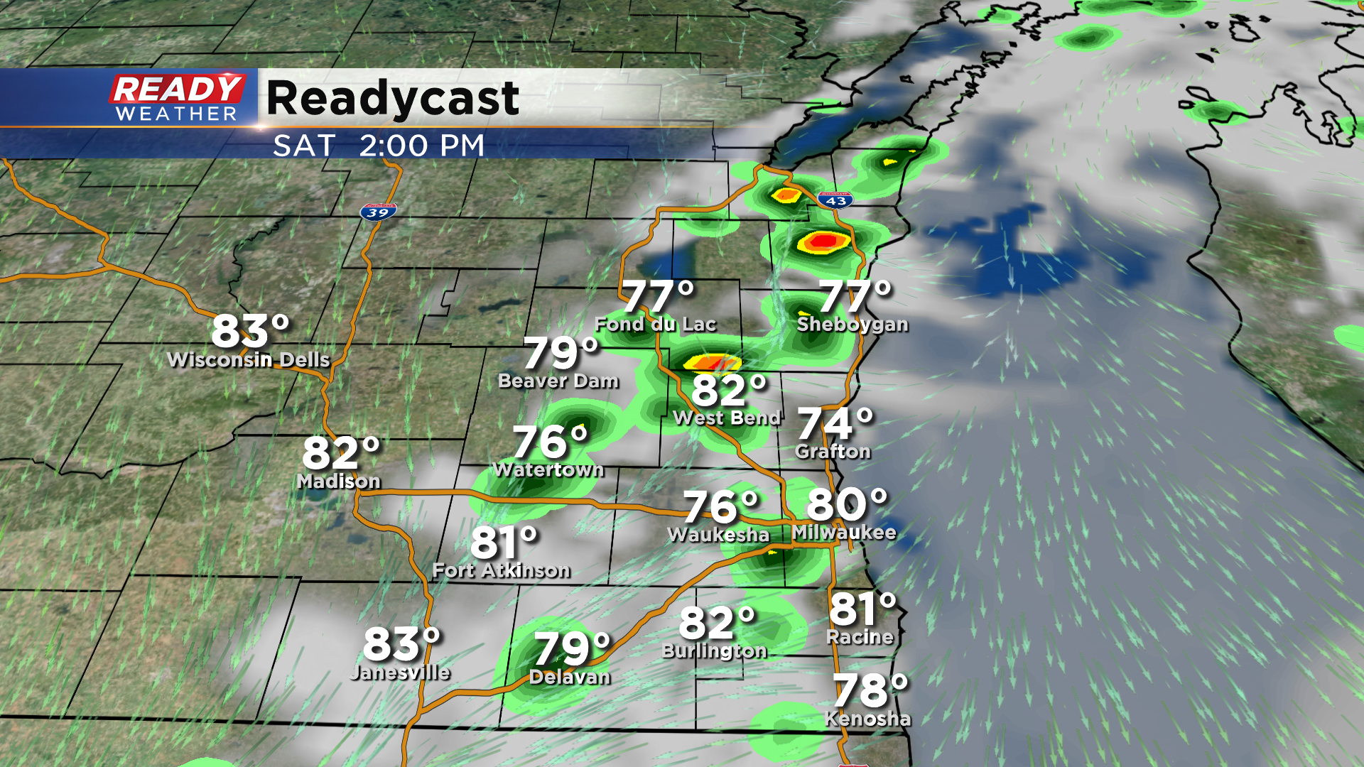
Once these showers push east, less humid air will finally move back in Saturday night with much more comfortable air expected on Sunday. Download the CBS 58 Ready Weather App to track the scattered storms over the next 24 hours.