Early Afternoon Update: Widespread snow becomes patchy by late afternoon


Updated: Jan. 25, 2023 3:00pm:
The forecast remains on track with the widespread snow now becoming patchy around southern Wisconsin.
This patchy snow will continue until Thursday afternoon with an additional 0.5-1.5" expected over the next 24 hours.
--------------------------------------------
Updated: Jan 25, 2023 1:00pm:
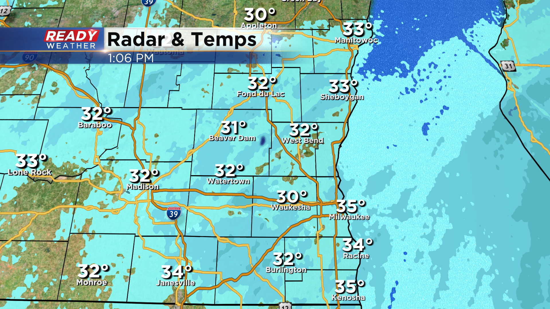
Widespread light snow continues to fall across southeast Wisconsin, but it will become more patchy as we head through the rest of the afternoon. Roads continue to improve as temps have risen into the low to mid 30s, but there are still a handful of slippery stretches on roads that haven't been treated.

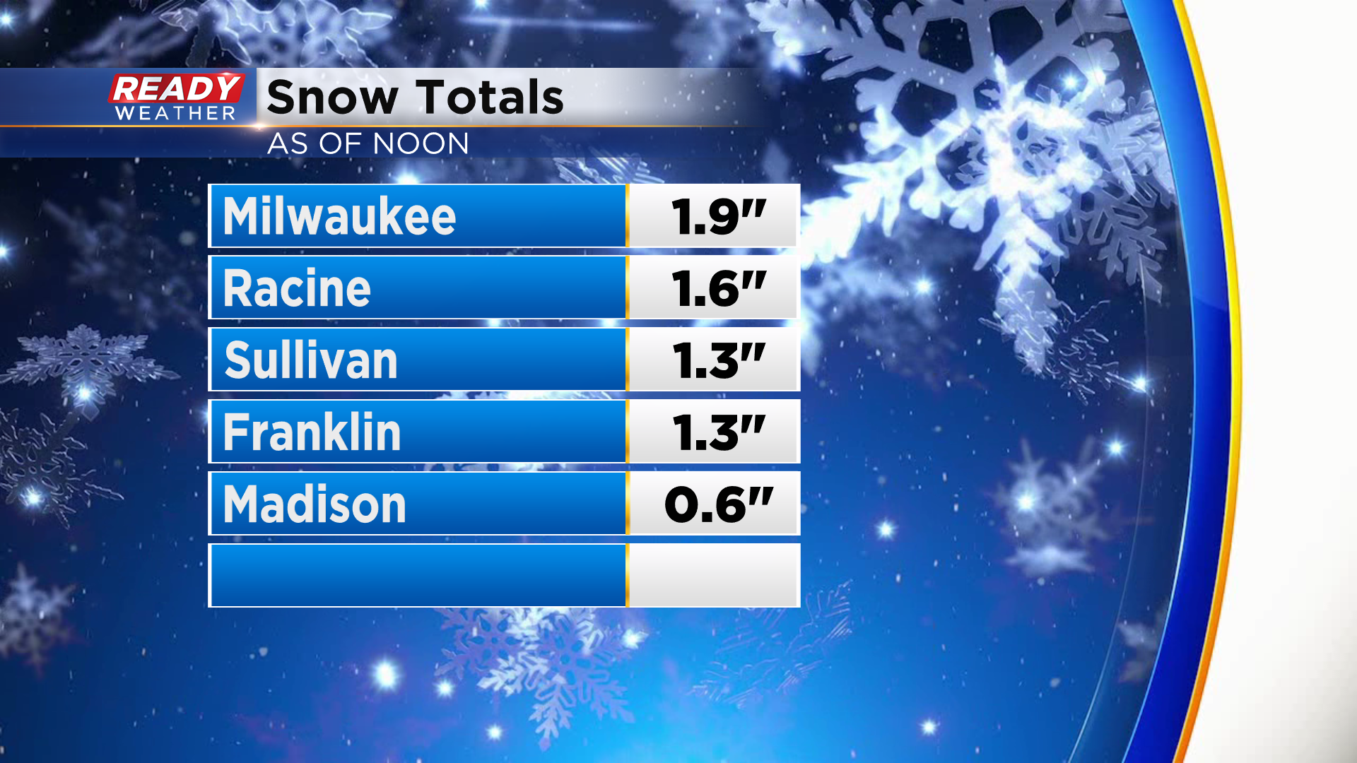
As of noon, Milwaukee has picked up 1.9" of snow, which is the second largest snowfall we've had this winter. An additional inch or so is expected through Thursday morning.
---------------------------------------------------------
Updated: Jan. 25, 2023 10:55am:
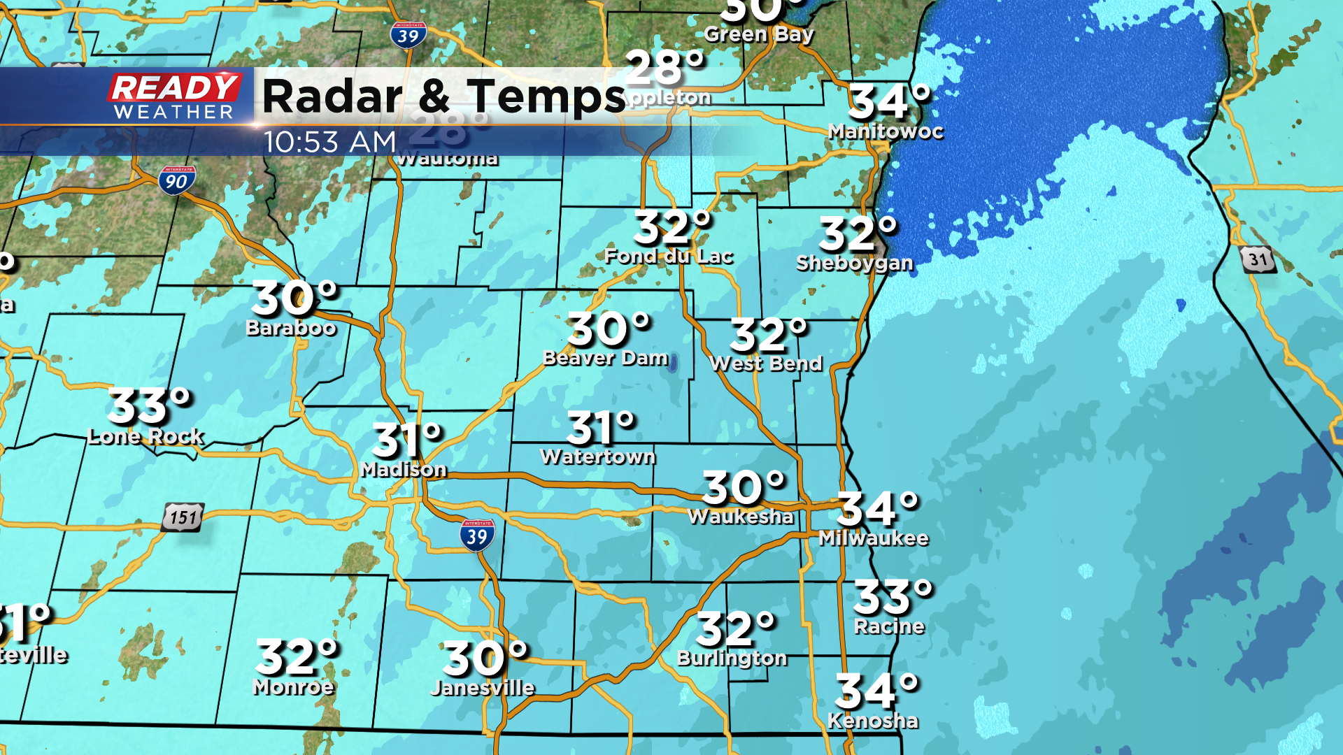
Steady snow continues to fall across southeast Wisconsin late this morning. Temps are sitting above freezing lakeside but are a few degrees below freezing inland, which has created slick and changing road conditions across the region.
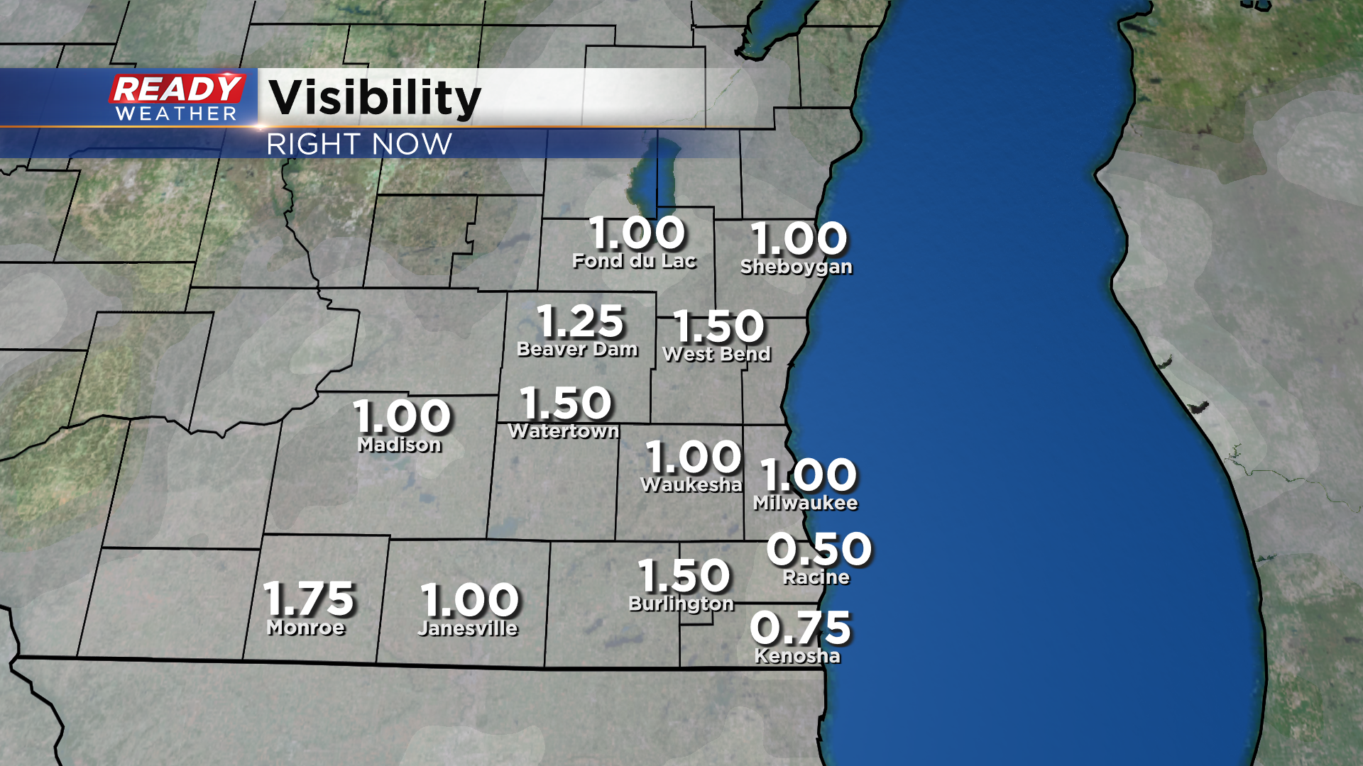
This snow is also reducing visibility to around a mile, so make sure you have your headlights on when driving today!
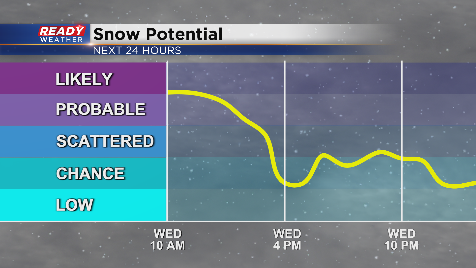
The steady snow will continue through mid afternoon, becoming more patchy in nature late afternoon and evening. Some light snow will linger into Thursday morning but won't add much to snow totals.
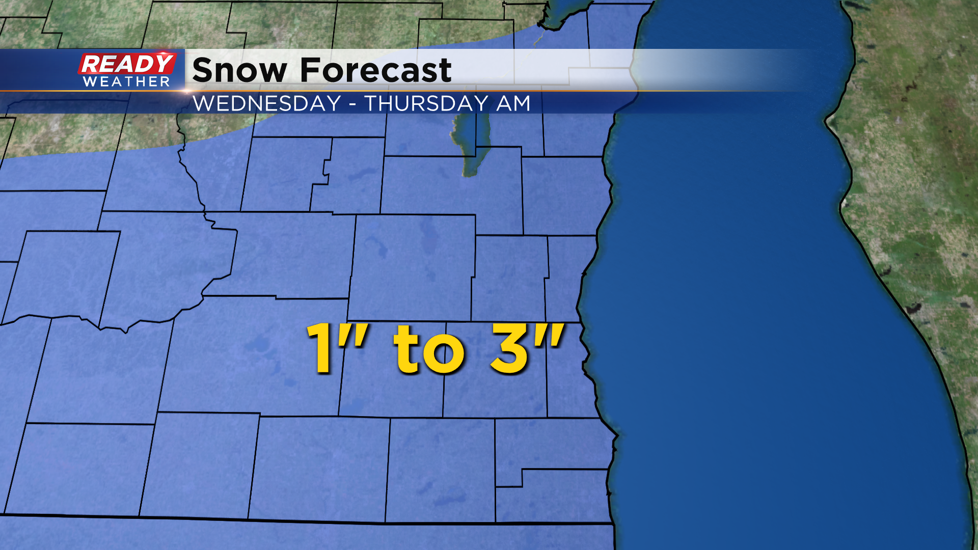
Most of the region picks up 1-3" of snow by the time it's all said and done. Best shot at the highest totals will be lakeside from Milwaukee to Kenosha thanks to some lake enhancement.
--------------------------------------------------------------------
Updated: 9:22 a.m. Jan. 25, 2023
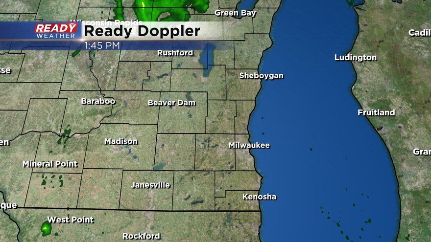
The snow rolled in between 4-9 AM with most of southeast Wisconsin seeing good steady snow right now. That steady snow will last during the rest of the morning and into the early afternoon before becoming a bit more scattered in the late afternoon and evening hours.
Here's an updated radar image that will update with time:
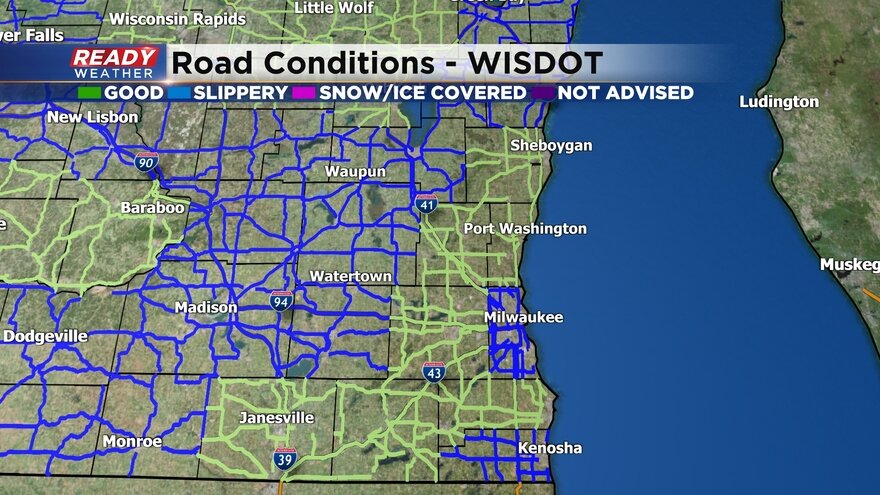
A few dozen crashes were reported on the roads during the Wednesday morning commute and roads will likely stay slick and snow covered most of the day with the steady snow continuing.
See road conditions below:
No changes to the ongoing forecast with 1-3" of snow expected across much of the area.
------
Posted: 5:46 a.m. Jan. 25, 2023
If you are a snow fan, you will love this forecast! You could make an argument for at least a flurry or light snow chance on every day in the 7-day. Light snow rolls into southeast Wisconsin Wednesday morning from 4-9 AM with some slushy accumulation already possible for the morning commute near the IL border. Steady snow looks best from mid-morning through midday and even into the early afternoon. Lingering flurries will continue the rest of Wednesday and Wednesday night.

A winter weather advisory is in effect for Milwaukee, Walworth, Racine and Kenosha Counties until 9 PM for continued light snow showers. Even though everyone in southeast Wisconsin will see accumulating snow, the counties under the advisory have the best chance of 3" and some lake enhancement.

Most of southeast Wisconsin will see a general 1-3" range of snow Wednesday with 1" numbers more likely in northern counties and southern and lakeside areas seeing the best chance for 3".

After Wednesday's snow we have more chances for light snow both Thursday and Friday. Each day could see a new half inch of snow putting our three day totals in the 2-4" range by Saturday morning. Saturday into early Sunday could see a potentially bigger storm.
Download the CBS 58 Ready Weather app to track Wednesday's snow and look ahead to more chances.