Wind chill advisory extended to Wednesday morning as cold air continues


Afternoon Update:
The ongoing forecast is intact. Just a couple other notes for you:

Pay attention to how your body is handling the cold, especially if you continue without power, have poor heating or have to be outside. The worst of this cold stretch will be tonight through Tuesday morning. Signs of hypothermia include shivering, difficulty speaking, sleepiness and confusion as well as stiff muscles.
The cold is here! A wind chill advisory was issued Sunday then extended into Monday morning and now it's been extended once again to 9 AM Wednesday morning.

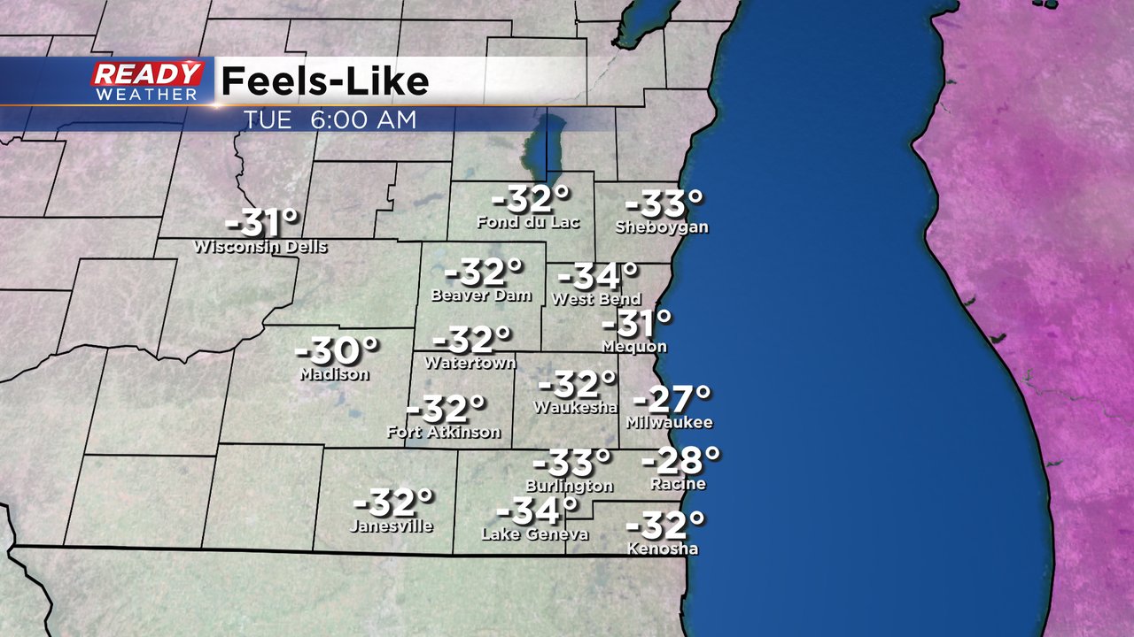
Wind chills will probably be at their coldest levels Tuesday morning where air temps get down as cold as -10 and wind gusts reach 30 mph. That's when the wind chills could get as cold as -35.
The rest of the week will featured cold wind chills as well with wind chills from -30 Monday morning to -15 in the afternoon. Tuesday's afternoon wind chills also don't get warmer than -15. Wednesday will start to improve with morning wind chills to -25 then feeling like 0 in the afternoon.

We may also see wind chill advisories at night through the start of the weekend.
In addition to the cold temps, one of the reasons we are seeing the super cold wind chills is the wind itself. Monday stays breezy with gusts to 20 mph. Tuesday has the strongest wind to 30 mph and the breeze will linger on Wednesday.

Download the CBS 58 Ready Weather app to track the temps and wind chills for your location.